|
Virunga Mountains
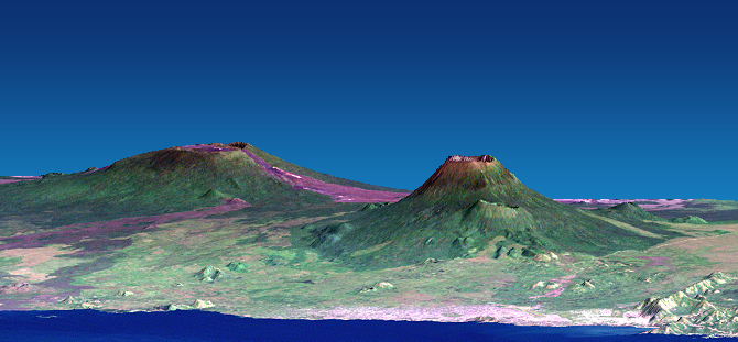
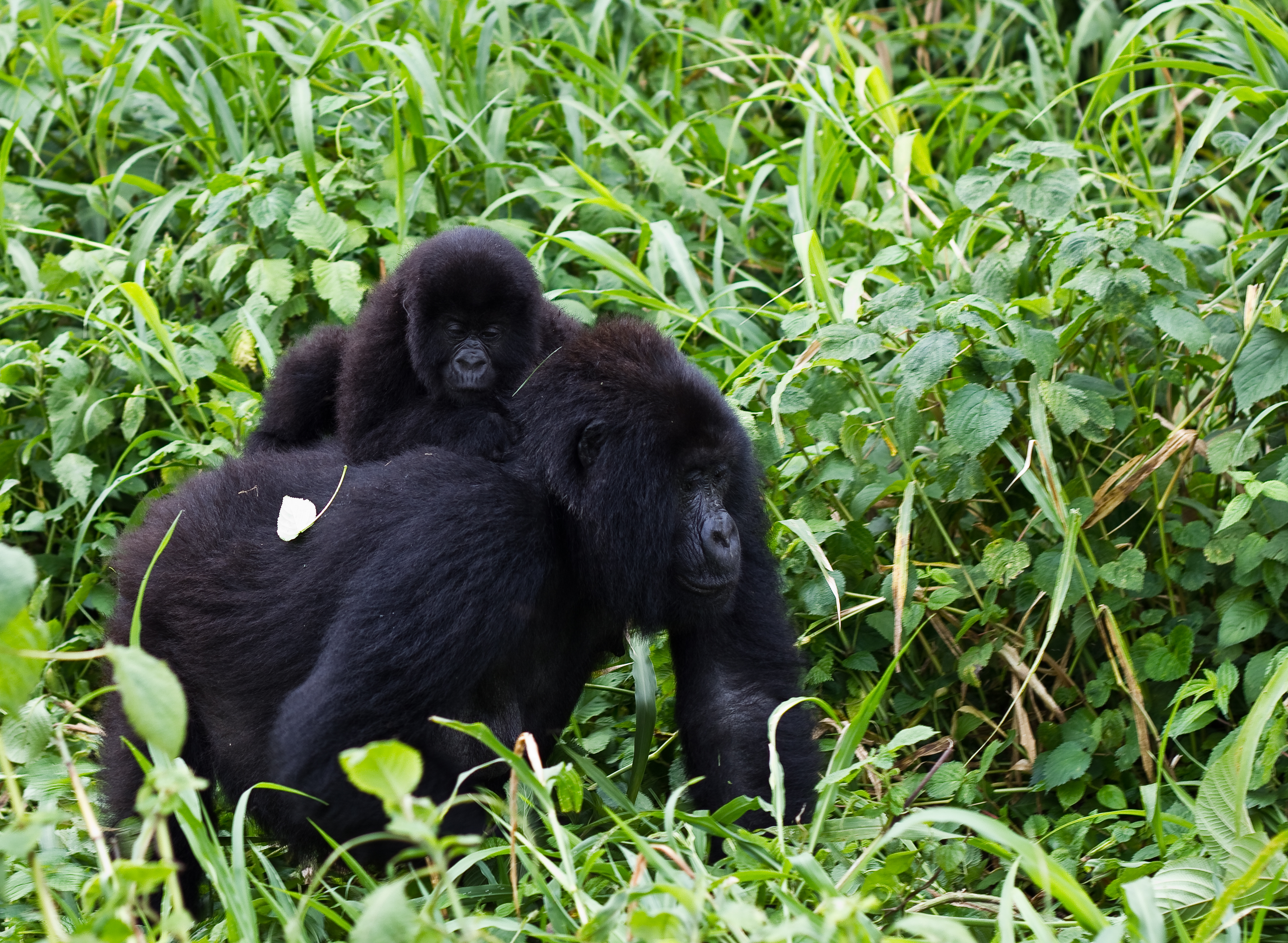
The Virunga Mountains (also known as Mufumbiro) are a chain of volcanoes in East Africa, in the area where Rwanda, the Democratic Republic of the Congo (DRC), and Uganda meet. The mountain range is a branch of the Albertine Rift Mountains, which border the western branch of the East African Rift. They are located between Lake Edward and Lake Kivu. The name "Virunga" is an English version of the Kinyarwanda word ''ibirunga'', which means "volcanoes". The mountain range consists of eight major volcanoes. Most of them are dormant, except Mount Nyiragongo and Mount Nyamuragira , both in the DRC. Recent eruptions occurred in 2006, 2010 and May 2021. Mount Karisimbi is the highest volcano at . The oldest mountain is Mount Sabyinyo, which rises above sea level. The Virunga Mountains are home of the endangered mountain gorilla, listed on the IUCN Red List of Endangered Species due to habitat loss, poaching, disease, and war (Butynski et al. 2003). The Karisoke Research Ce ... [...More Info...] [...Related Items...] OR: [Wikipedia] [Google] [Baidu] |
Mount Mikeno
Mount Mikeno is an extinct volcanic mountain located in the Democratic Republic of the Congo section of the Virunga Mountains along with Mount Nyiragongo, Mount Nyamuragira, Mount Karisimbi, Mount Bisoke and Mount Sabyinyo. At Mount Mikeno is the second highest peak in the Virunga Mountains after Karisimbi, and the 13th highest in Africa. Mikeno means "poor" and is so named for its harsh slopes which preclude human habitation. Mount Mikeno lies completely within Virunga National Park and is known for the critically endangered mountain gorillas The mountain gorilla (''Gorilla beringei beringei'') is one of the two subspecies of the eastern gorilla. It is listed as endangered by the IUCN . There are two populations: One is found in the Virunga volcanic mountains of Central/East Afri ... that live on its slopes."About Vi ... [...More Info...] [...Related Items...] OR: [Wikipedia] [Google] [Baidu] |
Mount Nyiragongo
Mount Nyiragongo ( ) is an active stratovolcano with an elevation of in the Virunga Mountains associated with the Albertine Rift. It is located inside Virunga National Park, in the Democratic Republic of the Congo, about north of the town of Goma and Lake Kivu and just west of the border with Rwanda. The main crater is about wide and usually contains a lava lake. The crater presently has two distinct cooled lava benches within the crater walls – one at about and a lower one at about . Nyiragongo's lava lake has at times been the most voluminous known lava lake in recent history. The depth of the lava lake varies considerably. A maximum elevation of the lava lake was recorded at about prior to the January 1977 eruption – a lake depth of about . Following the January 2002 eruption, the lava lake was recorded at a low of about , or below the rim. The level has gradually risen since then. Nyiragongo and nearby Nyamuragira are together responsible for 40% of Africa's ... [...More Info...] [...Related Items...] OR: [Wikipedia] [Google] [Baidu] |
Virunga National Park
Virunga National Park is a national park in the Albertine Rift Valley in the eastern part of the Democratic Republic of the Congo. It was created in 1925. In elevation, it ranges from in the Semliki River valley to in the Rwenzori Mountains. From north to south it extends approximately , largely along the international borders with Uganda and Rwanda in the east. It covers an area of . Two active volcanoes, Mount Nyiragongo and Nyamuragira, are located in the park. They have significantly shaped the national park's diverse habitats and wildlife. More than 3,000 faunal and floral species have been recorded, of which more than 300 are endemic to the Albertine Rift including eastern gorilla (''Gorilla beringei'') and golden monkey (''Cercopithecus kandti''). The park is also home to Tchegera Island. In 1979, the national park was listed as a UNESCO World Heritage Site because of its rich diversity of habitats, exceptional biodiversity and endemism, and its protection of rare ... [...More Info...] [...Related Items...] OR: [Wikipedia] [Google] [Baidu] |
Mount Gahinga
Mount Gahinga is a dormant/extinct volcano in the Virunga Mountains on the Rwanda-Uganda border. Gahinga lies between Muhabura and Sabyinyo, but is the smallest of these three valcanoes. Mount Gahinga, also known in the local Kinyarwanda/Rufumbira dialect as "a small pile of stones", has a swampy caldera on its peak. The caldera is believed to be about wide. Mgahinga Gorilla National Park got its name from this volcano. Mount Gahinga, whose elevation is , is part of a chain of eight volcanic mountains of the Mufumbiro ranges. The volcano chain spans across Uganda, Rwanda and the Democratic Republic of Congo. The vegetation across the mountain can be described as afro-montane with bamboo composing the main vegetation. Like Muhabura and Sabyinyo, the bamboo forests on Mount Gahinga are a habitat of the endangered mountain gorilla The mountain gorilla (''Gorilla beringei beringei'') is one of the two subspecies of the eastern gorilla. It is listed as endangered by the IUCN . ... [...More Info...] [...Related Items...] OR: [Wikipedia] [Google] [Baidu] |
Mount Muhabura
Mount Muhabura, also known as Mount Muhavura, is an inactive volcano in the Virunga Mountains on the Rwanda-Uganda border. At , Muhabura is the third highest of the eight major mountains of the mountain range, which is part of the Albertine Rift, the western branch of the East African Rift. Its summit contains a small Volcanic crater lake, crater lake. The limited evidence for this volcano suggests that it last erupted some time in the Holocene, but the exact date is not known. The Smithsonian Institution states that a small parasitic crater near Muhabura had been active "recently" without mentioning a date. The name Muhabura means "The Guide" in the local language, Kinyarwanda. Geography Muhabura is the third highest of the 8 volcanoes in the Virunga Mountains chain at an altitude of with a prominence of 1,530 metres. It can be seen from many parts of Uganda and Rwanda because of its height and characteristic slope. It is flanked by the smaller Mount Gahinga to the west, sep ... [...More Info...] [...Related Items...] OR: [Wikipedia] [Google] [Baidu] |
Mount Bisoke
Mount Bisoke (also Visoke) is an active volcano in the Virunga Mountains of the Albertine Rift, the western branch of the East African Rift. It straddles the border of Rwanda and the Democratic Republic of the Congo, but the summit is located in Rwanda. It is located approximately 35 km northeast of the town of Goma and the adjacent Lake Kivu. Geology Bisoke, like all the peaks in the Virunga Mountain Range, is a volcano created by rift action on the forming divergent boundary of the East African Rift which is slowly bisecting the African Plate. Bisoke has two recorded eruptions which happened in 1891 and 1957. The most recent eruption happened 11 km north of the summit, and it formed two small cones on the volcano's north flank. There is evidence that the area where this eruption occurred is still geologically active, suggesting the likelihood of future activity at Bisoke. The volcano has two crater lakes, one being the largest of the range. Geography The mountain i ... [...More Info...] [...Related Items...] OR: [Wikipedia] [Google] [Baidu] |
Gorilla
Gorillas are primarily herbivorous, terrestrial great apes that inhabit the tropical forests of equatorial Africa. The genus ''Gorilla'' is divided into two species: the eastern gorilla and the western gorilla, and either four or five subspecies. The DNA of gorillas is highly similar to that of humans, from 96 to 99% depending on what is included, and they are the next closest living relatives to humans after the chimpanzees. Gorillas are the largest living primates, reaching heights between , weights between , and arm spans up to , depending on species and sex. They tend to live in troops, with the leader being called a silverback. The eastern gorilla is distinguished from the western by darker fur colour and some other minor morphological differences. Gorillas tend to live 35–40 years in the wild. Gorillas' natural habitats cover tropical or subtropical forest in Sub-Saharan Africa. Although their range covers a small percentage of Sub-Saharan Africa, gorillas c ... [...More Info...] [...Related Items...] OR: [Wikipedia] [Google] [Baidu] |
Dian Fossey
Dian Fossey ( ; January 16, 1932 – ) was an American primatologist and conservationist known for undertaking an extensive study of mountain gorilla groups from 1966 until her murder in 1985. She studied them daily in the mountain forests of Rwanda, initially encouraged to work there by paleoanthropologist Louis Leakey. ''Gorillas in the Mist'', a book published two years before her death, is Fossey's account of her scientific study of the gorillas at the Karisoke Research Center and prior career. It was adapted into a 1988 film of the same name.Ware, Susan; Braukman, Stacy (2004). ''Notable American Women: A Biographical Dictionary, Volume 5''. Radcliffe Institute for Advanced Study. pp. 220–1. . Fossey was a leading primatologist, and a member of the "Trimates", a group of female scientists recruited by Leakey to study great apes in their natural environments, along with Jane Goodall who studies chimpanzees, and Birutė Galdikas, who studies orangutans. Fossey spent ... [...More Info...] [...Related Items...] OR: [Wikipedia] [Google] [Baidu] |
Karisoke Research Center
The Karisoke Research Center is a research institute in Rwanda's Volcanoes National Park. It was founded by Dian Fossey on 24 September 1967 to study endangered mountain gorillas. Fossey located the camp in Rwanda's Virunga volcanic mountain range, between Mount Karisimbi and Mount Bisoke, and named it by combining the names of the two mountains. After Fossey's murder in December 1985, she was interred in the grounds of the institute. The camp subsequently continued to function under the auspices of the Dian Fossey Gorilla Fund International. In 2012, Karisoke moved its headquarters to a more modern facility in Musanze. At the time Fossey founded Karisoke, she feared that the mountain gorilla might become extinct by the end of the 20th century, as her mentor, Dr. Louis Leakey, had warned. A census published in 1981 found that the population had fallen to 242 individuals, from a 1960 estimate of 400–500. , 45 years later, some 480 mountain gorillas are known to inhabit the ... [...More Info...] [...Related Items...] OR: [Wikipedia] [Google] [Baidu] |
Poaching
Poaching is the illegal hunting or capturing of wild animals, usually associated with land use rights. Poaching was once performed by impoverished peasants for subsistence purposes and to supplement meager diets. It was set against the hunting privileges of nobility and territorial rulers. Since the 1980s, the term "poaching" has also been used to refer to the illegal harvesting of wild plants. In agricultural terms, the term 'poaching' is also applied to the loss of soils or grass by the damaging action of feet of livestock, which can affect availability of productive land, water pollution through increased runoff and welfare issues for cattle. Stealing livestock, as in cattle raiding, classifies as theft rather than poaching. The United Nations' Sustainable Development Goal 15 enshrines the sustainable use of all wildlife. It targets the taking of action on dealing with poaching and trafficking of protected species of flora and fauna to ensure their availability for present ... [...More Info...] [...Related Items...] OR: [Wikipedia] [Google] [Baidu] |
Habitat Destruction
Habitat destruction (also termed habitat loss or habitat reduction) occurs when a natural habitat is no longer able to support its native species. The organisms once living there have either moved elsewhere, or are dead, leading to a decrease in biodiversity and species numbers. Habitat destruction is in fact the leading cause of biodiversity loss and species extinction worldwide. Humans contribute to habitat destruction through the use of natural resources, agriculture, industrial production and urbanization (urban sprawl). Other activities include mining, logging and trawling. Environmental factors can contribute to habitat destruction more indirectly. Geological processes, climate change, introduction of invasive species, ecosystem nutrient depletion, water and noise pollution are some examples. Loss of habitat can be preceded by an initial habitat fragmentation. Fragmentation and loss of habitat have become one of the most important topics of research in ecology as the ... [...More Info...] [...Related Items...] OR: [Wikipedia] [Google] [Baidu] |
IUCN Red List
The International Union for Conservation of Nature (IUCN) Red List of Threatened Species, also known as the IUCN Red List or Red Data Book, founded in 1964, is an inventory of the global conservation status and extinction risk of biological species. A series of Regional Red Lists, which assess the risk of extinction to species within a political management unit, are also produced by countries and organizations. The goals of the Red List are to provide scientifically based information on the status of species and subspecies at a global level, to draw attention to the magnitude and importance of threatened biodiversity, to influence national and international policy and decision-making, and to provide information to guide actions to conserve biological diversity. Major species assessors include BirdLife International, the Institute of Zoology (the research division of the Zoological Society of London), the World Conservation Monitoring Centre, and many Specialist Groups w ... [...More Info...] [...Related Items...] OR: [Wikipedia] [Google] [Baidu] |


