|
Venice, Florida
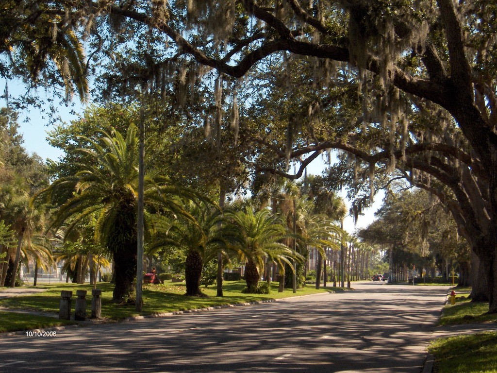
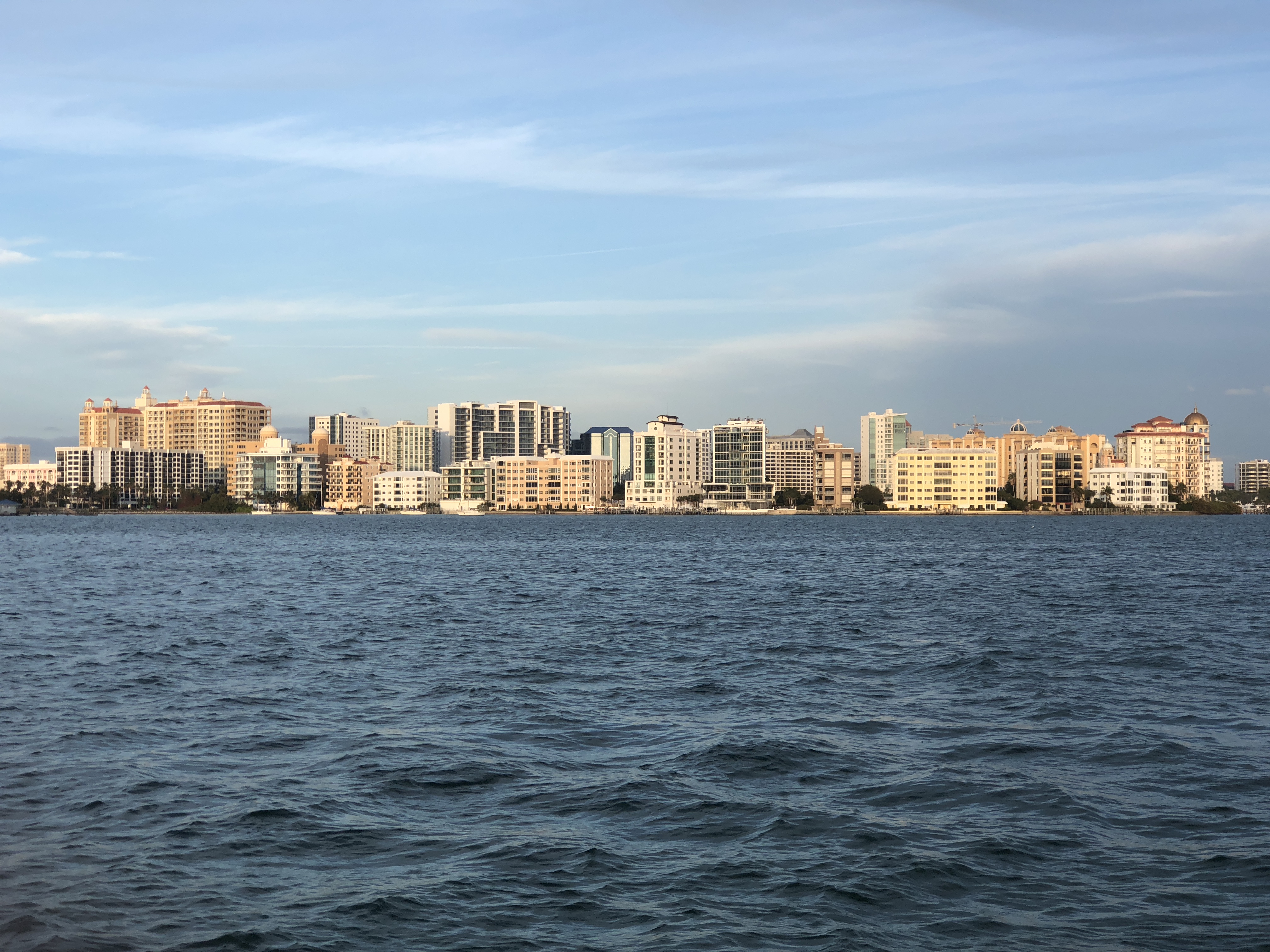
Venice is a city in Sarasota County, Florida, United States. The city includes what locals call "Venice Island", a portion of the mainland that is accessed via bridges over the artificially created Intracoastal Waterway. The city is located in Southwest Florida. As of the 2020 Census, the city had a population of 25,463, up from 20,748 at the 2010 Census. Venice is part of the North Port–Bradenton–Sarasota, Florida Metropolitan Statistical Area. History The area that is now Venice was originally the home of Paleo-Indians, with evidence of their presence dating back to 8200 BCE. As thousands of years passed, and the climate changed and some of the Pleistocene animals that the Indians hunted became extinct, the descendants of the Paleo-Indians found new ways to create stone and bone weapons to cope with their changing environment. These descendants became known as the Archaic peoples. Evidence of their camps along with stone tools were discovered in parts of Venice. Over s ... [...More Info...] [...Related Items...] OR: [Wikipedia] [Google] [Baidu] |
City (Florida)
Local governments in Florida are established by the state government, and are given varying amounts of non-exclusive authority over their jurisdictions. The laws governing the creation of local governments are contained in the Florida Constitution and the Florida Statutes. Local governments are incorporated by special acts of the Florida Legislature. These include four types: counties, municipalities, school districts, and special districts.Dye, T.R., Jewett, A. & MacManus, S.A. (2007) ''Politics in Florida''. Tallahassee: John Scott Dailey Florida Institute of Government. In some cases, municipal and county governments have merged into a consolidated government. However, smaller municipal governments can be created inside of a consolidated municipality/county. In Jacksonville, Florida, Jacksonville, the municipal government has taken over the responsibilities normally given to Duval County, Florida, Duval County, and smaller municipalities exist within it. Both counties and citi ... [...More Info...] [...Related Items...] OR: [Wikipedia] [Google] [Baidu] |
Sarasota Herald-Tribune
The ''Sarasota Herald-Tribune'' is a daily newspaper, located in Sarasota, Florida, United States, founded in 1925 as the ''Sarasota Herald''. History The newspaper was owned by The New York Times Company from 1982 to 2012. It was then owned by Halifax Media Group from 2012 to 2015, when New Media Investment Group acquired Halifax. The ''Herald-Tribune'' was one of the first newspapers in the nation to have an in-house 24-hour cable news channel. SNN was founded in 1995 along with partner Comcast. SNN was sold to private investors in January 2009. The original former headquarters for the newspaper was added to the National Register of Historic Places and still exists, containing the Sarasota Woman's Exchange and several other small businesses; the 1969 replacement building torn down in 2010 to make room for a new Publix. The new headquarters building was designed by Arquitectonica and won the American Institute of Architect's Award of Excellence. In early 2017, the ''Heral ... [...More Info...] [...Related Items...] OR: [Wikipedia] [Google] [Baidu] |
Calusa
The Calusa ( , Calusa: *ka(ra)luś(i)) were a Native American people of Florida's southwest coast. Calusa society developed from that of archaic peoples of the Everglades region. Previous Indigenous cultures had lived in the area for thousands of years. At the time of European contact in the 16th and 17th centuries, the historic Calusa were the people of the Caloosahatchee culture. They developed a complex culture based on estuarine fisheries rather than agriculture. Their principal city of Calos was probably at Mound Key, and their territory reached at least from Charlotte Harbor to Marco Island. Hernando de Escalante Fontaneda, a Spaniard who was held captive by Florida Indians from 1545 until 1566, described the Calusa realm as extending from Tanpa, at the mouth of Charlotte Harbor, down the coast to Muspa, at the southern end of Marco Island, and inland to Guacata on Lake Mayaimi (Lake Okeechobee). They had the highest population density of South Florida; estimates of t ... [...More Info...] [...Related Items...] OR: [Wikipedia] [Google] [Baidu] |
Tocobaga
Tocobaga (occasionally Tocopaca) was the name of a chiefdom of Native Americans, its chief, and its principal town during the 16th century. The chiefdom was centered around the northern end of Old Tampa Bay, the arm of Tampa Bay that extends between the present-day city of Tampa and northern Pinellas County. The exact location of the principal town is believed to be the archeological Safety Harbor site. This is the namesake for the Safety Harbor culture, of which the Tocobaga are the most well-known group. The name "Tocobaga" is often applied to all of the native peoples of the immediate Tampa Bay area during the first Spanish colonial period (1513–1763). While they were culturally very similar, most of the villages on the eastern and southern shores of Tampa Bay were likely affiliated with other chiefdoms, such as the Pohoy, Uzita, and Mocoso. Study of archaeological artifacts has provided insight into the everyday life of the Safety Harbor culture. Little is known about ... [...More Info...] [...Related Items...] OR: [Wikipedia] [Google] [Baidu] |
Mound Builders
Many pre-Columbian cultures in North America were collectively termed "Mound Builders", but the term has no formal meaning. It does not refer to specific people or archaeological culture but refers to the characteristic mound earthworks that indigenous peoples erected for an extended period of more than 5,000 years. The "Mound Builder" cultures span the period of roughly 3500 BCE (the construction of Watson Brake) to the 16th century CE, including the Archaic period ( Horr's Island), Woodland period ( Caloosahatchee, Adena and Hopewell cultures), and Mississippian period. Geographically, the cultures were present in the region of the Great Lakes, the Ohio River Valley, Florida, and the Mississippi River Valley and its tributary waters. Outlying mounds exist in South Carolina at Santee and in North Carolina at Town Creek. The first mound building was an early marker of political and social complexity among the cultures in the Eastern United States. Watson Brake in Louisi ... [...More Info...] [...Related Items...] OR: [Wikipedia] [Google] [Baidu] |
Archaic Period (North America)
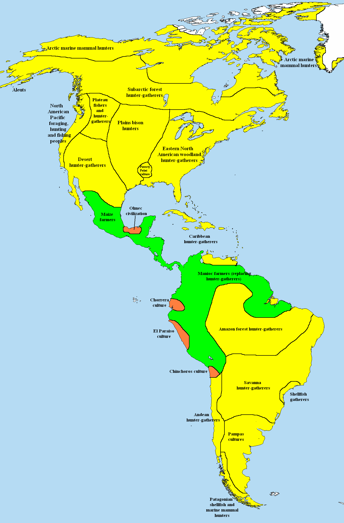
In the classification of the :category:Archaeological cultures of North America, archaeological cultures of North America, the Archaic period in North America, taken to last from around 8000 to 1000 Anno Domini, BC in the sequence of North American pre-Columbian cultural stages, is a period defined by the ''archaic stage'' of cultural development. The Archaic stage is characterized by subsistence economy, subsistence economies supported through the exploitation of Nut (fruit), nuts, seeds, and shellfish. As its ending is defined by the adoption of sedentary farming, this date can vary significantly across the Americas. The rest of the Americas also have an Archaic Period (Americas), Archaic Period. Classifications This classification system was first proposed by Gordon Willey and Philip Phillips (archaeologist), Philip Phillips in the widely accepted 1958 book ''Method and Theory in American Archaeology''. In the organization of the system, the Archaic period followed the Lith ... [...More Info...] [...Related Items...] OR: [Wikipedia] [Google] [Baidu] |
Paleo-Indians
Paleo-Indians were the first peoples who entered and subsequently inhabited the Americas towards the end of the Late Pleistocene period. The prefix ''paleo-'' comes from . The term ''Paleo-Indians'' applies specifically to the lithic period in the Western Hemisphere and is distinct from the term ''Paleolithic''.''Paleolithic'' specifically refers to the period between million years ago and the end of the Pleistocene in the Eastern Hemisphere. It is not used in New World archaeology. Traditional theories suggest that big-animal hunters crossed the Bering Strait from North Asia into the Americas over a land bridge ( Beringia). This bridge existed from 45,000 to 12,000 BCE (47,000–14,000 BP). Small isolated groups of hunter-gatherers migrated alongside herds of large herbivores far into Alaska. From BCE ( BP), ice-free corridors developed along the Pacific coast and valleys of North America. [...More Info...] [...Related Items...] OR: [Wikipedia] [Google] [Baidu] |
Sarasota Metropolitan Area
The Sarasota metropolitan area is a metropolitan area located in Southwest Florida. The metropolitan area is defined by the Office of Management and Budget (OMB) as the North Port–Bradenton–Sarasota Metropolitan Statistical Area, a metropolitan statistical area (MSA) consisting of Manatee County, Florida, Manatee County and Sarasota County, Florida, Sarasota County. The Principal city, principal cities listed by the OMB for the MSA are North Port, Florida, North Port, Bradenton, Florida, Bradenton, Sarasota, Florida, Sarasota, Lakewood Ranch, Florida, Lakewood Ranch, and Venice, Florida, Venice. At the 2020 United States census, 2020 census, the MSA had a population of 833,716. The Census Bureau estimates that its population was 910,108 in 2023. The North Port–Bradenton–Sarasota MSA is a component of the larger North Port–Bradenton Combined Statistical Area, a combined statistical area (CSA) consisting of the North Port–Bradenton–Sarasota MSA, the Punta Gorda, Flori ... [...More Info...] [...Related Items...] OR: [Wikipedia] [Google] [Baidu] |
Southwest Florida
Southwest Florida is the region along the southwest Gulf coast of the U.S. state of Florida. The area is known for its beaches, subtropical landscape, and winter resort economy. Definitions of the region vary, though its boundaries are generally considered to put it south of the Tampa Bay area, west of Lake Okeechobee, and mostly north of the Everglades and to include Manatee, Sarasota, Charlotte, Lee, and Collier counties. For some purposes, the inland counties of DeSoto, Glades, and Hendry, and the thinly populated mainland section of Monroe County, south of Collier, are also included. The region includes four metropolitan areas: the North Port-Bradenton-Sarasota MSA, the Cape Coral-Fort Myers MSA, the Naples-Marco Island MSA, and the Punta Gorda MSA. The most populous county in the region is Lee County (760,822 population), and the region's largest city is Cape Coral with a population of 194,016 as of 2020. History and Development Nomadic Paleo-Indians in ... [...More Info...] [...Related Items...] OR: [Wikipedia] [Google] [Baidu] |
Intracoastal Waterway
The Intracoastal Waterway (ICW) is a Navigability, inland waterway along the Atlantic and Gulf of Mexico coasts of the United States, running from Massachusetts southward along the Atlantic Seaboard and around the southern tip of Florida, then following the Gulf Coast to Brownsville, Texas, Brownsville, Texas. Some sections of the waterway consist of natural inlets, saltwater rivers, bays, and Sound (geography), sounds, while others are artificial Canal, canals. Maintained, improved, and extensively dredged where necessary by the United States Army Corps of Engineers, it provides a navigable route along its length without many of the hazards of travel on the open sea. Context and early history Since the East Coast of the United States, Eastern coastline represented the national border, and commerce of the time was chiefly by water, the fledgling Federal government of the United States, United States government established a degree of national control over it. Inland transporta ... [...More Info...] [...Related Items...] OR: [Wikipedia] [Google] [Baidu] |


