|
Vatovavy
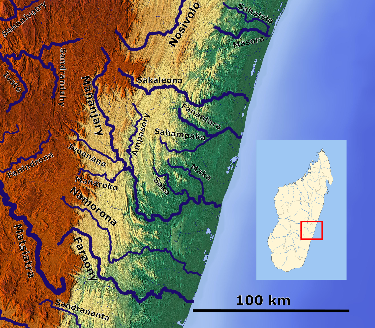
Vatovavy is a region of Madagascar. Its capital is Mananjary, Fianarantsoa, Mananjary. It was created by dividing the former region of Vatovavy-Fitovinany on 16 June 2021. Cyclone Batsirai made landfall at Mananjary in 2022, leaving 90 percent of the city destroyed. Administrative divisions Vatovavy Region is divided into three districts, which are sub-divided into 58 communes. * Ifanadiana District - 14 communes * Mananjary District - 25 communes * Nosy Varika District - 19 communes Transportation *Train - 180 km (from Fianarantsoa) *Car Taxi-Brousse * One airport: Mananjary Airport Bodies of water * the Namorona River * the Mananjary River * the Sakaleona River and the Sakaleona Falls, the highest waterfall in Madagascar (200m) Protected areas *Part of Ranomafana National Park References Vatovavy Regions of Madagascar {{Vatovavy-geo-stub ... [...More Info...] [...Related Items...] OR: [Wikipedia] [Google] [Baidu] |
Ifanadiana District
Ifanadiana is a district of Vatovavy in Madagascar. The district has an area of , and the estimated population in 2020 was 183,553. Communes The district is further divided into 14 communes, which is sub-divided into 195 ''fokontany'' (villages). The postal code is 312. * Ambiabe * Ambohimanga Sud * Ambohimera * Analampasina * Androrangavola * Antaretra * Antsindra * Fasintsara * Ifanadiana * Kelilalina * Maroharatra * Marotoko * Ranomafana * Tsaratanana National Parks *the Ranomafana National Park Ranomafana National Park is a national park in southeastern Madagascar, in the Haute Matsiatra and Vatovavy regions. It was established as Madagascar's fourth national park in 1991 following the rediscovery of the greater bamboo lemur (''Hap ..., one of the most famous national parks of Madagascar. Roads * National road 25 References Districts of Vatovavy {{Madagascar-geo-stub ... [...More Info...] [...Related Items...] OR: [Wikipedia] [Google] [Baidu] |
Sakaleona River
''Sakaleona'' is a river in the regions of Amoron'i Mania and Vatovavy in eastern Madagascar. It flows down from the central highlands to flow into the Indian Ocean near Nosy Varika. See also Sakaleona Falls References Rivers of Amoron'i Mania Rivers of Vatovavy Rivers of Madagascar {{Madagascar-river-stub ... [...More Info...] [...Related Items...] OR: [Wikipedia] [Google] [Baidu] |
Mananjary District
Mananjary is a Districts of Madagascar, district of Vatovavy in Districts of Madagascar, Madagascar. Its capital is the city of Mananjary, Fianarantsoa, Mananjary. Communes The district is further divided into 25 communes: * Ambalahosy Nord * Ambodinonoka, Mananjary, Ambodinonoka * Ambohimiarina II * Ambohinihaonana * Andonabe * Andranambolava * Andranomavo, Majanary, Andranomavo * Anosimparihy * Antsenavolo ** Irondro * Kianjavato * Mahaela * Mahatsara Iefaka * Mahatsara Sud * Mahavoky Nord * Manakana Nord * Mananjary, Fianarantsoa, Mananjary * Marofototra * Marokarima * Marosangy * Morafeno, Mananjary, Morafeno * Namorona * Sandrohy * Tsaravary * Tsiatosika * Vatohandrina * Vohilava, Mananjary, Vohilava References Districts of Vatovavy {{Madagascar-geo-stub ... [...More Info...] [...Related Items...] OR: [Wikipedia] [Google] [Baidu] |
Mananjary, Fianarantsoa
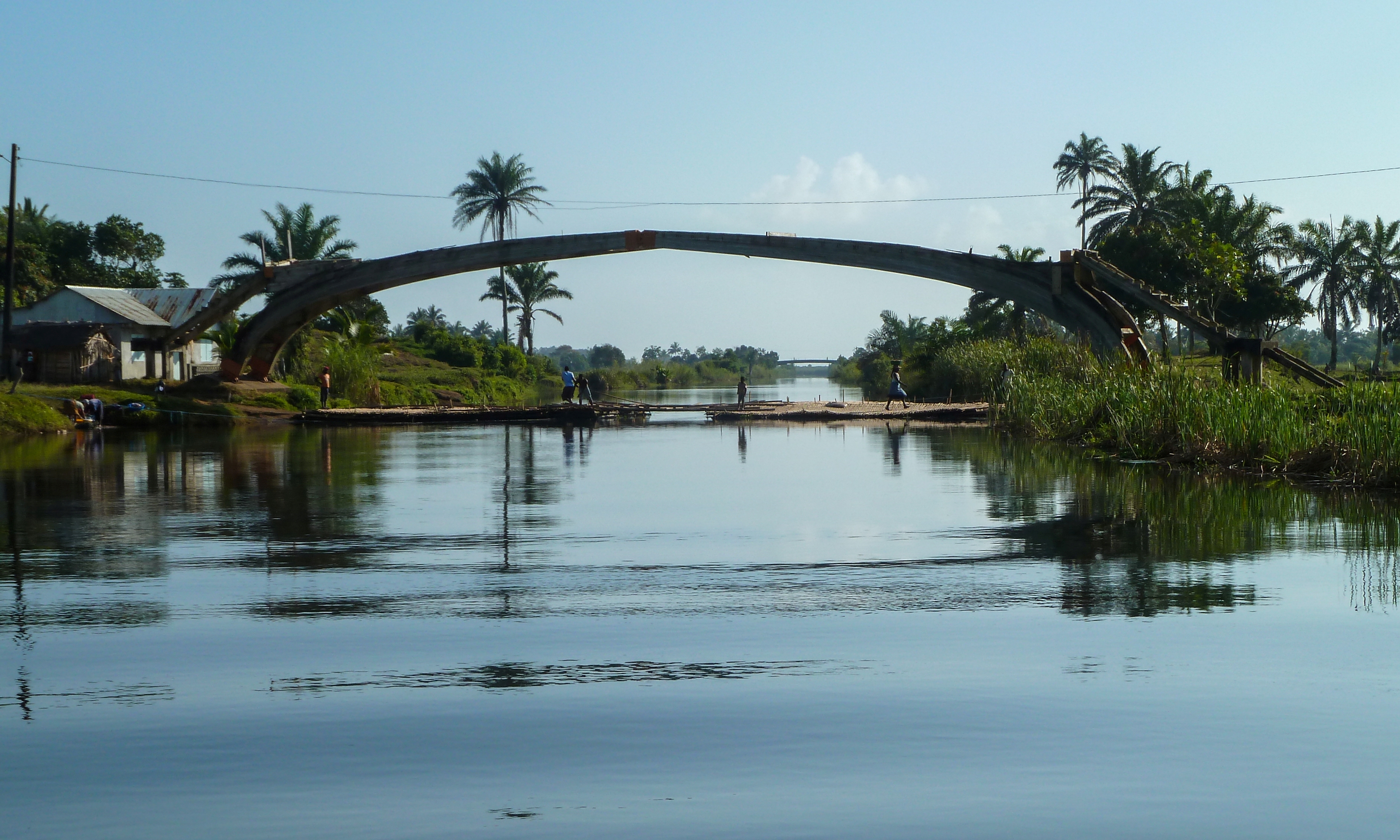
Mananjary is a city on the East coast of Madagascar with a population of 25,222 inhabitants in 2018. It is the chief town of the Mananjary district and the Vatovavy region. It contains a town of the same name, situated on the southern part of the east coast, where the Mananjary River flows into the Indian Ocean. There's a small port and an airport. Mananjary is situated 130 km south of Nosy Varika on the RN 11 and 167 km north of Manakara by the National road 12 and National road 25. The Canal des Pangalanes divides the town into two sections. In 2022 Cyclone Batsirai made landfall at Mananjary, leaving the city 90% destroyed. Economy Agriculture production is focused on vanilla, coffee, and pepper production.Madagascar & Comoros pp. 230-31 ( |
Vatovavy-Fitovinany
Vatovavy-Fitovinany was a region of Madagascar Madagascar, officially the Republic of Madagascar, is an island country that includes the island of Madagascar and numerous smaller peripheral islands. Lying off the southeastern coast of Africa, it is the world's List of islands by area, f ... from 2004 to 2021. Vatovavy-Fitovinany that was split on 16 June 2021 to become the regions Vatovavy and Fitovinany. Administrative divisions Fitovinany Region was divided into six districts, which are sub-divided into 125 communes. Districts * Ifanadiana - 14 communes * Ikongo - 17 communes * Manakara-Atsimo - 42 communes * Mananjary - 25 communes * Nosy Varika - 19 communes * Vohipeno - 17 communes References Former subdivisions of Madagascar Regions of Madagascar {{Madagascar-geo-stub ... [...More Info...] [...Related Items...] OR: [Wikipedia] [Google] [Baidu] |
Nosy Varika District
Nosy Varika is a district of Vatovavy in Madagascar. The district has a population of 270,332 in 2020. Bodies of water * Sakaleona Falls - the highest Waterfall in Madagascar, with 200m height. 18 km from Ampasinambo * Sakaleona River Communes The district is further divided into 19 communes. The postal code for the district is 319. * Ambahy * Ambakobe * Ambodiara * Ambodilafa * Ambodirian I Sahafary * Ampasinambo * Andara * Androrangovola * Angodogodona * Antanambao * Befody Befody is a town and commune in Madagascar. It belongs to the district of Nosy Varika, which is a part of Vatovavy-Fitovinany Region. The population of the commune was estimated to be approximately 12,000 in 2001 commune census. Only primary sch ... * Fanivelona * Fiadanana * Nosy Varika * Sahavato * Soavina Est * Vohilava * Vohindroa * Vohitrandriana References Districts of Vatovavy {{Madagascar-geo-stub ... [...More Info...] [...Related Items...] OR: [Wikipedia] [Google] [Baidu] |
Mananjary Airport
Mananjary Airport is an airport in Mananjary, Vatovavy-Fitovinany Region, Madagascar Madagascar, officially the Republic of Madagascar, is an island country that includes the island of Madagascar and numerous smaller peripheral islands. Lying off the southeastern coast of Africa, it is the world's List of islands by area, f ..., located on the east coast on the island. References Airports in Madagascar Vatovavy-Fitovinany {{Madagascar-airport-stub ... [...More Info...] [...Related Items...] OR: [Wikipedia] [Google] [Baidu] |
Namorona River
Namorona is a river in Vatovavy, eastern Madagascar. It flows down from the central highlands, runs along the Ranomafana National Park, forms the Andriamamovoka Falls, to flow into the Indian Ocean The Indian Ocean is the third-largest of the world's five oceanic divisions, covering or approximately 20% of the water area of Earth#Surface, Earth's surface. It is bounded by Asia to the north, Africa to the west and Australia (continent), .... It empties near Namorona and has a length of . References External links Rivers of Madagascar Rivers of Vatovavy {{Madagascar-river-stub ... [...More Info...] [...Related Items...] OR: [Wikipedia] [Google] [Baidu] |
Mananjary River
The Mananjary River is located in southern Madagascar, in the region of Vatovavy. It drains to the eastern coast, into the Indian Ocean. It serves as the southern edge of the territory known as Betsimisaraka.Helen Chapin Metz Helen Chapin Metz (April 12, 1928 – May 13, 2011) was an American editor and Middle East analyst. Life Helen Chapin was born on April 12, 1928, in Peking, China. She was the daughter of diplomat Selden Chapin and Mary Paul Noyes. Her brother, ..., ed., Madagascar: A Country Study', Library of Congress, 1994., accessed 14 August 2008 Its mouth is situated in the city of Mananjary. References Rivers of Vatovavy {{Madagascar-river-stub ... [...More Info...] [...Related Items...] OR: [Wikipedia] [Google] [Baidu] |
Sakaleona Falls
The Sakaleona Falls are the highest waterfalls of Madagascar, with a height of . They are situated on the Sakaleona River in the Vatovavy region, some from the village of Ampasinambo and about from Nosy Varika. See also * List of waterfalls This list of notable waterfalls of the world is sorted by continent, then country, then province, state or territory. A waterfall is included if it is at least tall and has an existing Wikipedia article, or it is considered historically sig ... References Waterfalls of Madagascar Vatovavy {{Madagascar-geo-stub ... [...More Info...] [...Related Items...] OR: [Wikipedia] [Google] [Baidu] |
Ranomafana National Park
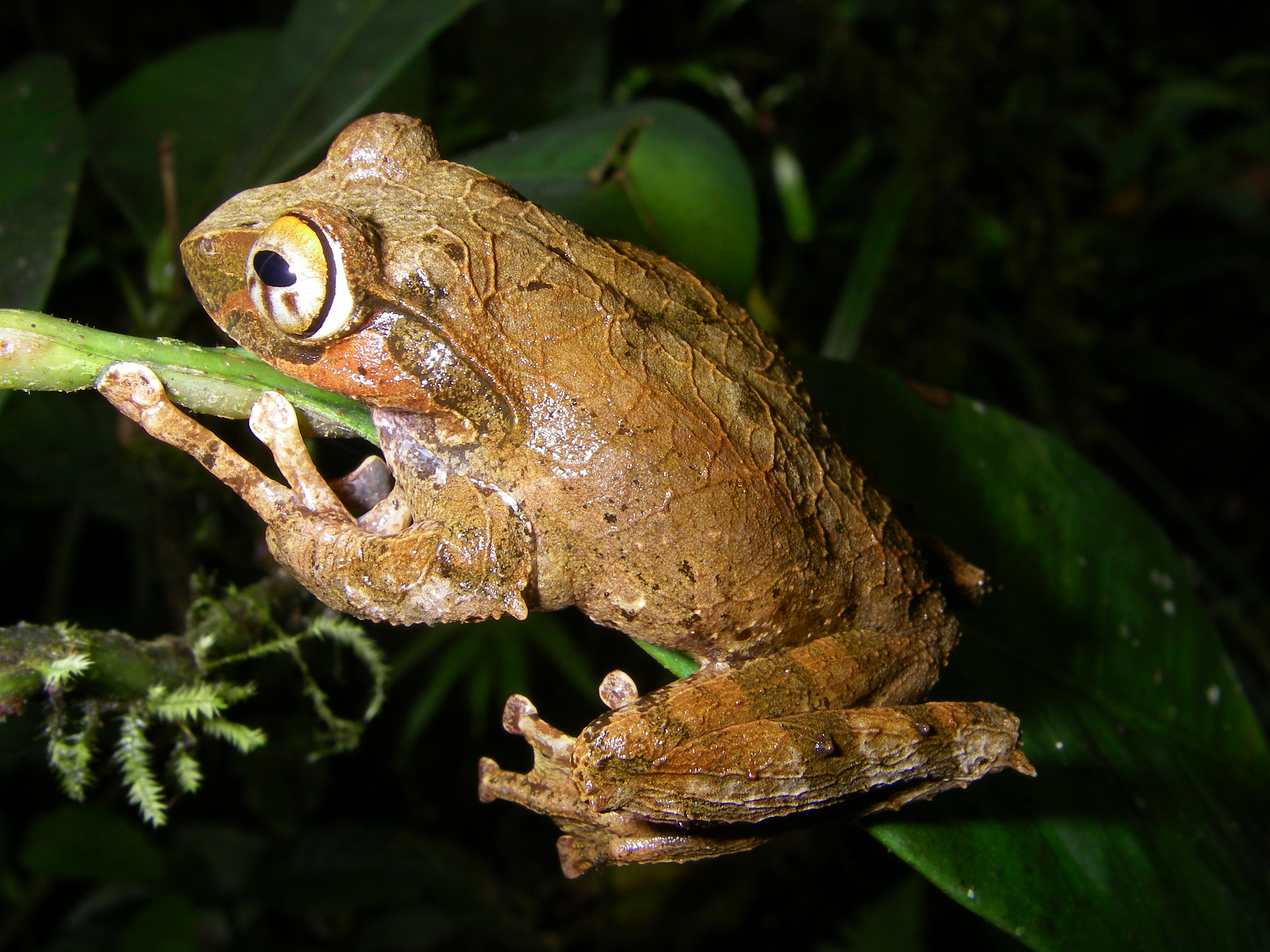
Ranomafana National Park is a national park in southeastern Madagascar, in the Haute Matsiatra and Vatovavy regions. It was established as Madagascar's fourth national park in 1991 following the rediscovery of the greater bamboo lemur (''Hapalemur simus'') and the discovery of the golden bamboo lemur (''Hapalemur aureus'') by the primatologist Dr. Patricia Wright. The park protects more than 41,600 hectares (161 square miles) of tropical rainforest at elevations ranging from 800 to 1,200 m (2,645 to 3,937 ft) and is home to several rare species of plants and animals. It was later integrated into the UNESCO World Heritage Site Rainforests of the Atsinanana. The Centre ValBio research station is adjacent to the park and was created in 2003 by Stony Brook University for biodiversity research, community health and education, environmental arts, and reforestation. The park's name is derived from the Malagasy words ("hot water") due to the hot springs in the nearby town ... [...More Info...] [...Related Items...] OR: [Wikipedia] [Google] [Baidu] |


