|
Turkish Kurdistan
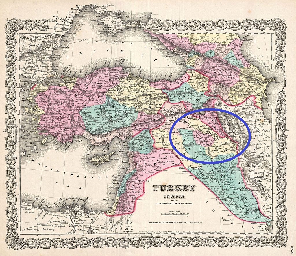
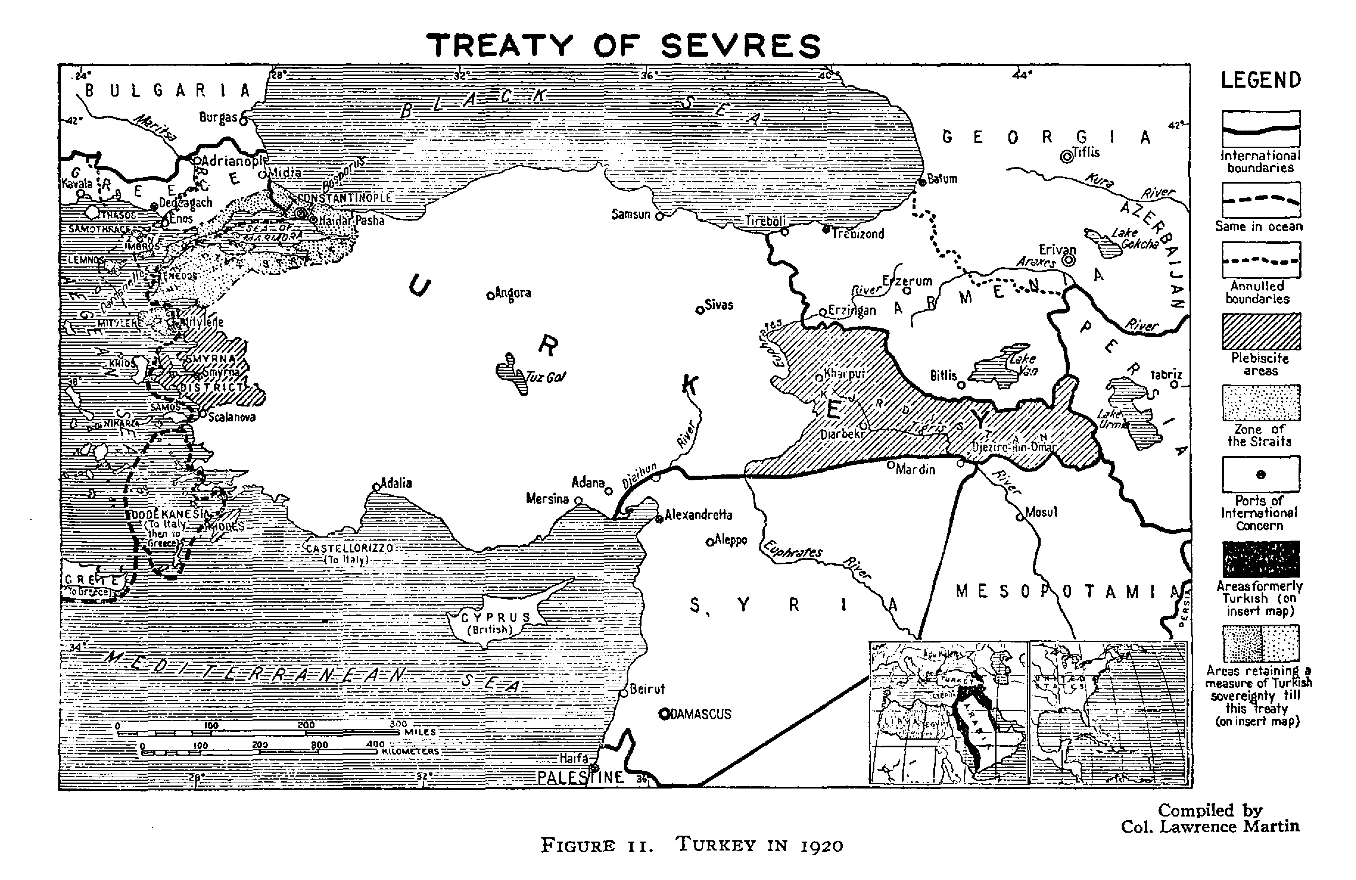
Turkish Kurdistan or Northern Kurdistan () is the southeastern part of Turkey where Kurds form the predominant ethnic group. The Kurdish Institute of Paris estimates that there are 20 million Kurds living in Turkey, the majority of them in the southeast. Southeastern Turkey (Northern Kurdistan) is considered to be one of the four parts of Kurdistan, which also includes parts of northern Syria (Western Kurdistan), northern Iraq ( Southern Kurdistan) and northwestern Iran (Eastern Kurdistan). The term Turkish Kurdistan is often used in the context of Kurdish nationalism, which makes it a controversial term among proponents of Turkish nationalism. The term has different meaning depending on context. Geography The Encyclopaedia of Islam delineates the geography of Turkish Kurdistan as following: Nonetheless, it is emphasized that "the imprecise limits of the frontiers of Kurdistan hardly allow an exact appreciation of the area." The region forms the south-eastern edge of Ana ... [...More Info...] [...Related Items...] OR: [Wikipedia] [Google] [Baidu] |
Kurdistan Of Turkey (CIA)
Kurdistan (, ; ), or Greater Kurdistan, is a roughly defined geo-cultural region in West Asia wherein the Kurds form a prominent majority population and the Kurdish culture, Kurdish languages, languages, and national identity have historically been based. Geographically, Kurdistan roughly encompasses the northwestern Zagros Mountains, Zagros and the eastern Taurus Mountains, Taurus mountain ranges. Kurdistan generally comprises the following four regions: southeastern Turkey (Turkish Kurdistan, Northern Kurdistan), northern Iraq (Iraqi Kurdistan, Southern Kurdistan), northwestern Iran (Iranian Kurdistan, Eastern Kurdistan), and northern Syria (Syrian Kurdistan, Western Kurdistan). Some definitions also include parts of southern South Caucasus, Transcaucasia. Certain Kurdish nationalism, Kurdish nationalist organizations seek to create an independent nation state consisting of some or all of these areas with a Kurdish majority, while others campaign for greater autonomy within ... [...More Info...] [...Related Items...] OR: [Wikipedia] [Google] [Baidu] |
Kars
Kars ( or ; ; ) is a city in northeast Turkey. It is the seat of Kars Province and Kars District.İl Belediyesi , Turkey Civil Administration Departments Inventory. Retrieved 1 March 2023. As of 2022, its population was 91,450. Kars, in classical historiography (Strabo), was in the ancient region known as ''Chorzene'' (), part of the province of Ayrarat in the Kingdom of Armenia (antiquity), Kingdom of Armenia, and later the historic capitals of Armenia, capital of the Bagratid Kingdom of Armenia from 929 to 961. Currently, the mayor of Kars is Ötüken Senger. The city had an Armenians, Armenian ethnic majority until it was re-captured by Turkish National Movement, Turkish nationalist forces in late 1920. Etymology The city's name may derive from the Armenian language, Armenian w ...[...More Info...] [...Related Items...] OR: [Wikipedia] [Google] [Baidu] |
Adıyaman Province
Adıyaman Province (, ) is a Provinces of Turkey, province in the Southeastern Anatolia Region of Turkey. The capital is Adıyaman. Its area is 7,337 km2, and its population is 635,169 (2022). The province is considered part of Turkish Kurdistan and has a Kurds, Kurdish majority. Adıyaman Province was part of the province of Malatya until 1954, when it was made into a province as a reward for voting for the winning Democrat Party (Turkey, historical), Democratic Party in the 1954 Turkish general election, 1954 general election. History Early Armenian rule Armenians, Armenian existence in Adıyaman dates back to the 4th century, where they were known as 'fire worshippers'. Armenians lived in the area when Islam, Muslim Arabs captured the area in 639. The Arabs considered the city as part of Sasanian Armenia, Armenia and experienced immigration from Byzantine Armenia due to Byzantine oppression in 713. The city came under Seljuk Empire, Seljuk rule after the Battle of Man ... [...More Info...] [...Related Items...] OR: [Wikipedia] [Google] [Baidu] |
Ağrı Province
Ağrı Province () is located in eastern Turkey, bordering Iran to the east and the Provinces of Turkey, provinces of Kars Province, Kars to the north, Erzurum Province, Erzurum to the northwest, Muş Province, Muş and Bitlis Province, Bitlis to the southwest, Van Province, Van to the south, and Iğdır Province, Iğdır to the northeast. Its area is 11,099 km2, and its population is 511,238 (2023). The provincial capital is Ağrı, situated on a high plateau. Doğubayazıt was the capital of the province until 1946. The current Wāli#Turkish term, governor is Mustafa Koç. The province is considered part of Western Armenia and was part of the ancient province of Ayrarat of Kingdom of Armenia (antiquity), Kingdom of Armenia. Before the Armenian genocide, modern Ağri Province was part of the Six vilayets, six Armenian vilayets. The majority of the province's population are ethnic Kurds. Districts Ağrı province is divided into eight Districts of Turkey, districts (capit ... [...More Info...] [...Related Items...] OR: [Wikipedia] [Google] [Baidu] |
Muş Province
Muş Province (; ; ) is a Provinces of Turkey, province in the east Anatolia region of Turkey (Türkiye). Its area is 8,718 km2, and its population is 399,202 (2022), down from 453,654 in 2000. The provincial capital is the city of Muş. Another town in Muş province, Malazgirt (''Manzikert''), is famous for the Battle of Manzikert of 1071. History The province is considered a part of historical Western Armenia. Before the Armenian genocide, the area was a part of the six vilayets, Six Armenian Vilayets. The province is considered part of Turkish Kurdistan and has a Kurds, Kurdish majority. Avni Çakır was appointed Governor of Muş, Governor of the province in August 2023. Geology and geomorphology There are a total of 8 mountain ranges, 4 of which are large, in the province. Muş province is surrounded by Otluk Mountains in the middle, Akdoğan Mountains in the north, Bingöl Mountains in the northwest, Şerafettin Mountains in the west, Karaçavuş Mountains in the s ... [...More Info...] [...Related Items...] OR: [Wikipedia] [Google] [Baidu] |
Bingöl Province
Bingöl Province (; ; ; ) is a province of Turkey. The province was known as Çapakçur Province () before 1945 when it was renamed as Bingöl Province. Its area is 8,003 km2, and its population is 282,556 (2022). The province encompasses 11 Belde, municipalities, 325 villages and 693 Hamlet (place), hamlets. The town of Genç, Bingöl, Genç was the scene of origin for the Sheikh Said rebellion in 1925 and most of the region was captured by the rebels during the rebellion. As the current Wāli, Governor of the province, Ahmet Hamdi Usta was appointed by the president in August 2023. Geography The largest lake in Bingöl Province is Lake Bahri. The main mountains in Bingöl province are the Genç Mountains, Akçara Mountains, Şerafettin Mountains and Bingöl Mountains. Demographics Kurds comprise the majority of the province and the province is considered part of Turkish Kurdistan. Its population is majority Sunni Islam, Sunni, conservative and many adhere to the Naqs ... [...More Info...] [...Related Items...] OR: [Wikipedia] [Google] [Baidu] |
Elazığ Province
Elazığ () is a city in the Eastern Anatolia Region, Eastern Anatolia region of Turkey, and the administrative centre of Elazığ Province and Elazığ District. Founded in and around the former city of Harput, it is located in the uppermost Euphrates valley. The plain on which the city extends has an altitude of . Elazığ resembles an inland peninsula surrounded by the natural Lake Hazar and reservoirs of Keban Dam, Karakaya Dam, Kralkızı Dam, Kıralkızı and Özlüce Dam, Özlüce. Its population is 387,072 (2022). History In 1927 the office of the Inspector general, Inspector General was created, which governed with martial law. The province was included in the first Inspectorates-General (Turkey), Inspectorate General (''Umumi Müfettişlik'', UM) over which the Inspector General ruled. The UM spanned over the provinces of Hakkâri Province, Hakkâri, Siirt Province, Siirt, Van Province, Van, Mardin Province, Mardin, Bitlis Province, Bitlis, Şanlıurfa Province, Şanlı ... [...More Info...] [...Related Items...] OR: [Wikipedia] [Google] [Baidu] |
Tunceli Province
Tunceli Province (), formerly Dersim Province (; ; ), is a province in the Eastern Anatolia Region of Turkey. Its central city is Tunceli. The province has a Kurdish majority. Moreover, it is the only province in Turkey with an Alevi majority. The province has eight municipalities, 366 villages and 1,087 hamlets. History Antiquity This region was known as Ishuva in the 2000s BC. As a result of the struggle of the Ishuva Kingdom, which was established by the Hurrians in the region, with the Hittites, the region came under the rule of the Hittites in the 1600s BC. Then, it came under the domination of the Urartians and formed the westernmost part of the country of Urartu. After that, it was ruled by Medes and the Persian Achaemenid Empire, and after that it was ruled by Alexander the Great, king of Macedon. Ottoman Empire rule Although the presence of Ottoman Empire was beginning to be felt in the region after Mehmed II the Conqueror defeated the Aq Qoyunlu in 1473, ... [...More Info...] [...Related Items...] OR: [Wikipedia] [Google] [Baidu] |
Malatya Province
Malatya Province (; ) is a Provinces of Turkey, province and Metropolitan municipalities in Turkey, metropolitan municipality of Turkey. Its area is 12,259 km2, and its population is 812,580 (2022). It is part of a larger mountainous area. The capital of the province is the city of Malatya, which has a population of 485,484 (2022). According to the Encyclopedia of Islam, the province is considered part of Turkish Kurdistan. Districts Malatya province is divided into 13 Districts of Turkey, districts: * Akçadağ * Arapgir * Arguvan * Battalgazi * Darende * Doğanşehir * Doğanyol * Hekimhan * Kale, Malatya, Kale * Kuluncak * Pütürge * Yazıhan * Yeşilyurt, Malatya, Yeşilyurt Demographics According to German geographers Georg Hassel and Adam Christian Gaspari, Malatya was composed of 1200 to 1500 houses in early 19th century, inhabited by Ottomans, Turkmens, Armenians, and Greeks, while the mountainous areas in the sanjak of Malatya were mostly inhabited by Kurds, ... [...More Info...] [...Related Items...] OR: [Wikipedia] [Google] [Baidu] |
Kars Province
Kars Province (; Azerbaijani: Qars Rayonu; ; ) is a province of Turkey, located in the northeastern part of the country. It shares part of its closed border with Armenia. Its area is 10,193 km2, and its population is 274,829 (2022). The provincial capital is the city of Kars. The provinces of Ardahan and Iğdır were part of Kars Province until 1992.Kanun No. 3806 Resmî Gazete, 3 June 1992. History In ancient times, Kars () was part of the province of Ararat in the Kingdom of Armenia. The first known people were the followers of Vanand (Վանանդ), for whom Kars was their main settlement and fortress. In 928, Kars became the capital of[...More Info...] [...Related Items...] OR: [Wikipedia] [Google] [Baidu] |
Erzurum Province
Erzurum Province () is a province and metropolitan municipality in the Eastern Anatolia Region of Turkey. Its area is 25,006 km2, and its population is 749,754 (2022). The capital of the province is the city of Erzurum. It is the fourth largest province in all of Turkey. It is bordered by the provinces of Kars and Ağrı to the east, Muş and Bingöl to the south, Erzincan and Bayburt to the west, Rize and Artvin to the north and Ardahan to the northeast. The governor of the province is Mustafa Çiftçi, appointed in August 2023. The province has a Turkish majority. Geography The surface area of the province of Erzurum is the fourth biggest in Turkey. The majority of the province is elevated. Most plateaus are about above sea level, and the mountainous regions beyond the plateaus are and higher. Depression plains are located between the mountains and plateaus. The southern mountain ranges include the Palandöken Mountains (highest peak Büyük Ejder high) and t ... [...More Info...] [...Related Items...] OR: [Wikipedia] [Google] [Baidu] |
Erzincan Province
Erzincan Province (; ; ) is a Provinces of Turkey, province in the Eastern Anatolia Region of Turkey. In Turkey, its capital is also called Erzincan. Its area is 11,815 km2, and its population is 239,223 (2022). Geography Erzincan is traversed by the northeasterly line of equal latitude and longitude. It lies on the North Anatolian Fault, Northern Anatolian Fault, where it is often the location for earthquakes such as 1939 Erzincan earthquake, on 27 December 1939 and 1992 Erzincan earthquake, 13 March 1992. History In September 1935 the third Inspectorates-General (Turkey), Inspectorate General (''Umumi Müfettişlik,'' UM) was created, into which the Erzincan province was included. Its creation was based on the Law 1164 from June 1927, which was passed in order to Turkification, Turkefy the population. The Erzincan province was included in this area. The third UM span over the provinces of Erzurum Province, Erzurum, Artvin Province, Artvin, Rize Province, Rize, Trabzon ... [...More Info...] [...Related Items...] OR: [Wikipedia] [Google] [Baidu] |


