|
Truckee, California
Truckee is an List of municipalities in California, incorporated town in Nevada County, California, United States. As of the 2010 United States Census, the population was 16,180, reflecting an increase of 2,316 from the 13,864 counted in the 2000 United States Census, 2000 Census. History Name Truckee's existence began in 1863 as Gray's Station, named for Joseph Gray's Roadhouse on the trans-Sierra wagon road.Union Pacific Railroad Historical Society Archives A blacksmith named Samuel S. Coburn was there almost from the beginning, and by 1866 the area was known as Coburn's Station. The Central Pacific Railroad selected Truckee as the name of its railroad station by August 1867, even though the tracks would not reach the station until a year later in 1868. It was renamed Truckee (chief), Truckee after a Northern Paiute, Paiute chief, whose assumed Paiute name was Tru-ki-zo. He was the father of Chief Winnemucca and grandfather of Sarah Winnemucca. The first Europeans who came t ... [...More Info...] [...Related Items...] OR: [Wikipedia] [Google] [Baidu] |
List Of Municipalities In California
California is a U.S. state, state located in the Western United States. It is the List of U.S. states and territories by population, most populous state and the List of U.S. states and territories by area, third largest by area after Alaska and Texas. According to the 2020 United States Census, California has 39,538,223 inhabitants and of land. California has been inhabited by numerous Indigenous peoples of California, Native American peoples for thousands of years. The Spanish colonization of the Americas, Spanish, the Russian colonization of the Americas, Russians, and other Europeans began exploring and colonizing the area in the 16th and 17th centuries, with the Spanish establishing its first California Spanish missions in California, mission at what is now Presidio of San Diego, San Diego in 1769. After the Mexican Cession of 1848, the California Gold Rush brought worldwide attention to the area. The growth of the Cinema of the United States, movie industry in Los Angeles ... [...More Info...] [...Related Items...] OR: [Wikipedia] [Google] [Baidu] |
Sutter's Fort
Sutter's Fort was a 19th-century agricultural and trade colony in the Mexican ''Alta California'' province. Established in 1839, the site of the fort was originally part of a utopian colonial project called New Helvetia (''New Switzerland'') by its builder John Sutter, though construction of the fort proper would not begin until 1841. The fort was the first non-Indigenous community in the California Central Valley, and saw grave mistreatment of Indigenous laborers in plantation or feudal style conditions. The fort is famous for its association with the Donner Party, the California gold rush, and the formation of the city of Sacramento, surrounding the fort. It is notable for its proximity to the end of the California and Siskiyou Trails, which it served as a waystation. In modern times, the adobe structure has been restored to its original condition () and is now administered by California Department of Parks and Recreation. It was designated a National Historic Landmark in ... [...More Info...] [...Related Items...] OR: [Wikipedia] [Google] [Baidu] |
Sierra Nevada (U
The Sierra Nevada ( ) is a mountain range in the Western United States, between the Central Valley (California), Central Valley of California and the Great Basin. The vast majority of the range lies in the state of California, although the Carson Range spur lies primarily in Nevada. The Sierra Nevada is part of the American Cordillera, an almost continuous chain of mountain ranges that forms the western "backbone" of the Americas. The Sierra runs north-south, and its width ranges from to across east–west. Notable features include the General Sherman Tree, the largest tree in the world by volume; Lake Tahoe, the largest alpine lake in North America; Mount Whitney at , the highest point in the contiguous United States; and Yosemite Valley sculpted by glaciers from one-hundred-million-year-old granite, containing List of waterfalls in Yosemite National Park, high waterfalls. The Sierra is home to three national parks, twenty-six wilderness areas, ten national forests, and two ... [...More Info...] [...Related Items...] OR: [Wikipedia] [Google] [Baidu] |
Donner Lake
Donner Lake, formerly known as Truckee Lake, is a freshwater lake in Northeast California on the eastern slope of the Sierra Nevada (U.S.), Sierra Nevada and about northwest of the much larger Lake Tahoe. A moraine serves as a natural dam for the lake. The lake is located in the town of Truckee, California, Truckee, between Interstate 80 to the north and Schallenberger Ridge to the south. The tracks of the Union Pacific Railroad run along Schallenberger Ridge and closely follow the route of the original First Transcontinental Railroad, transcontinental railroad. The historic route of the Lincoln Highway, the first automobile road across America and U.S. Route 40 in California, US 40 follows the northern shoreline, then climbs to Donner Pass from where the entire lake may be viewed. History of the name of the lake The lake was called Datsa’ shut by the Washoe people. In 1844, the Stephens-Townsend-Murphy party was the first wagon train to successfully cross the Sierra Nevada m ... [...More Info...] [...Related Items...] OR: [Wikipedia] [Google] [Baidu] |
Map Of Truckee Lake And Alder Creek
A map is a symbolic depiction of interrelationships, commonly spatial, between things within a space. A map may be annotated with text and graphics. Like any graphic, a map may be fixed to paper or other durable media, or may be displayed on a transitory medium such as a computer screen. Some maps change interactively. Although maps are commonly used to depict geographic elements, they may represent any space, real or fictional. The subject being mapped may be two-dimensional such as Earth's surface, three-dimensional such as Earth's interior, or from an abstract space of any dimension. Maps of geographic territory have a very long tradition and have existed from ancient times. The word "map" comes from the , wherein ''mappa'' meant 'napkin' or 'cloth' and ''mundi'' 'of the world'. Thus, "map" became a shortened term referring to a flat representation of Earth's surface. History Maps have been one of the most important human inventions for millennia, allowing humans t ... [...More Info...] [...Related Items...] OR: [Wikipedia] [Google] [Baidu] |
Donner Pass
Donner Pass is a mountain pass in the northern Sierra Nevada, above Donner Lake and Donner Memorial State Park about west of Truckee, California. Like the Sierra Nevada themselves, the pass has a steep approach from the east and a gradual approach from the west. The pass has been used by the California Trail, First transcontinental railroad, Overland Route, Lincoln Highway and Victory Highway (both later U.S. Route 40 and still later Donner Pass Road), as well as indirectly by Interstate 80. The pass gets its name from the ill-fated Donner Party who overwintered there in 1846. Today the area is home to a thriving recreational community with several alpine lakes and ski resorts ( Donner Ski Ranch, Boreal, and Sugar Bowl). The permanent communities in the area include Kingvale and Soda Springs, as well as the larger community below the pass surrounding Donner Lake. History To reach California from the east, pioneers had to get their wagons over the Sierra Nevada mou ... [...More Info...] [...Related Items...] OR: [Wikipedia] [Google] [Baidu] |
Great Salt Lake Desert
The Great Salt Lake Desert (colloquially referred to as the West Desert) is a large dry lake in northern Utah, United States, between the Great Salt Lake The Great Salt Lake is the largest saltwater lake in the Western Hemisphere and the eighth-largest terminal lake in the world. It lies in the northern part of the U.S. state of Utah and has a substantial impact upon the local climate, partic ... and the Nevada border. It is Great Basin Desert#Subregions, a subregion of the larger Great Basin Desert, and noted for white evaporite Lake Bonneville Halite, salt deposits including the Bonneville Salt Flats. Description Several small mountain ranges occupy the edges of the desert, such as the Cedar Mountains (Tooele County, Utah), Cedar Mountains, Lakeside Mountains, Silver Island Range, Silver Island Mountains, Hogup Mountains, Grassy Mountains, and Newfoundland Mountains. On the western edge of the desert, just across the border in Nevada, stands Pilot Peak (Nevada), Pilot ... [...More Info...] [...Related Items...] OR: [Wikipedia] [Google] [Baidu] |
Oregon Trail
The Oregon Trail was a east–west, large-wheeled wagon route and Westward Expansion Trails, emigrant trail in North America that connected the Missouri River to valleys in Oregon Territory. The eastern part of the Oregon Trail crossed what is now the states of Kansas, Nebraska, and Wyoming. The western half crossed the current states of Idaho and Oregon. The Oregon Trail was laid by fur traders and trappers from about 1811 to 1840 and was initially only passable on foot or horseback. By 1836, when the first migrant wagon train was organized in Independence, Missouri, a wagon trail had been cleared to Fort Hall, Idaho. Wagon trails were cleared increasingly farther west and eventually reached the Willamette Valley in Oregon, at which point what came to be called the Oregon Trail was complete, though further improvements in the forms of bridges, cutoffs, ferries, and roads would make the trip faster and safer. From various starting points in Iowa, Missouri, or Nebraska Territo ... [...More Info...] [...Related Items...] OR: [Wikipedia] [Google] [Baidu] |
Donner Party
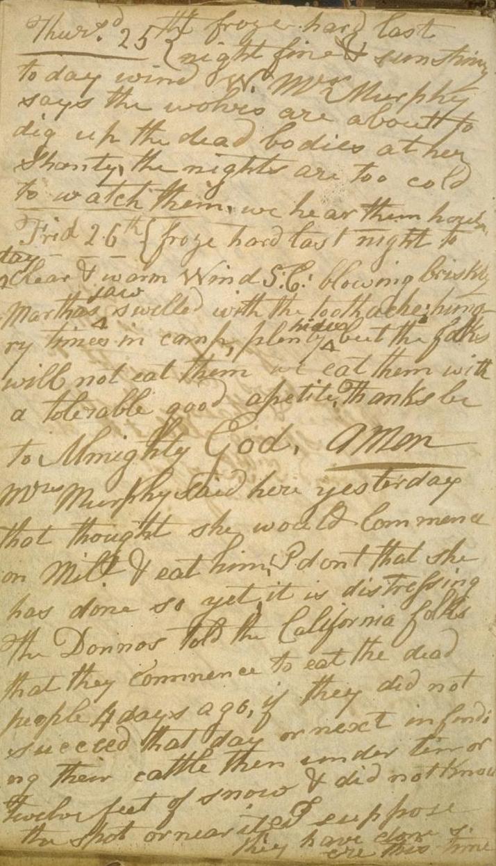
The Donner Party, sometimes called the Donner–Reed Party, was a group of American pioneers who migrated to California interim government, 1846-1850, California in a wagon train from the Midwest. Delayed by a multitude of mishaps, they spent the winter of 1846–1847 snowbound in the Sierra Nevada. Some of the migrants resorted to Human cannibalism, cannibalism to survive, mainly eating the bodies of those who had succumbed to starvation, sickness, or extreme cold, but in one case murdering and eating two Indigenous peoples of California, Native American guides. The Donner Party originated from Springfield, Illinois, and departed Independence, Missouri, on the Oregon Trail in the spring of 1846. The journey west usually took between four and six months, but the Donner Party was slowed after electing to follow a new route called the Hastings Cutoff, which bypassed established trails and instead crossed the Rocky Mountains' Wasatch Range and the Great Salt Lake Desert in present ... [...More Info...] [...Related Items...] OR: [Wikipedia] [Google] [Baidu] |
The Donner Party Monument
''The'' is a grammatical Article (grammar), article in English language, English, denoting nouns that are already or about to be mentioned, under discussion, implied or otherwise presumed familiar to listeners, readers, or speakers. It is the definite article in English. ''The'' is the Most common words in English, most frequently used word in the English language; studies and analyses of texts have found it to account for seven percent of all printed English-language words. It is derived from gendered articles in Old English which combined in Middle English and now has a single form used with nouns of any gender. The word can be used with both singular and plural nouns, and with a noun that starts with any letter. This is different from many other languages, which have different forms of the definite article for different genders or numbers. Pronunciation In most dialects, "the" is pronounced as (with the voiced dental fricative followed by a schwa) when followed by a con ... [...More Info...] [...Related Items...] OR: [Wikipedia] [Google] [Baidu] |


