|
Timbisha
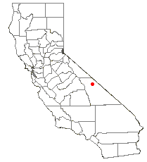
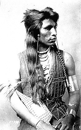
The Timbisha ("rock paint", Timbisha language: Nümü Tümpisattsi) are a Native Americans in the United States, Native American tribe federally recognized tribes, federally recognized as the Death Valley Timbisha Shoshone Band of California. They are known as the Timbisha Shoshone Tribe and are located in south central California, near the Nevada border. As of the 2010 United States Census, 2010 Census the population of the Village was 124. The older members still speak the ancestral language, also called Timbisha language, Timbisha. History The Timbisha have lived in the Death Valley, California, Death Valley region of North America for over a thousand years. They were originally known as Panamints, as was their Uto-Aztecan languages, Uto-Aztecan language. The band traditionally was very small in size, and linguists estimate that fewer than 200 individuals ever spoke Panamint Shoshone. Estimates for the pre-contact populations of most native groups in California have varied sub ... [...More Info...] [...Related Items...] OR: [Wikipedia] [Google] [Baidu] |
Timbisha Language
Timbisha (''Tümpisa'') or Panamint (also called Koso) is the language of the Native Americans in the United States, Native American people who have inhabited the region in and around Death Valley, California, and the southern Owens Valley since late prehistoric times. There are a few elderly individuals who can speak the language in California and Nevada, but none are monolingual, and all use English language, English regularly in their daily lives. Until the late 20th century, the people called themselves and their language "Shoshone." The tribe then achieved federal recognition under the name Timbisha, Death Valley Timbisha Shoshone Band of California. This is an Anglicized spelling of the native name of Death Valley, ''tümpisa'', pronounced , which means "rock paint" and refers to the rich sources of red ochre in the valley. Timbisha is also the language of the so-called "Shoshone" groups at Paiute-Shoshone Indians of the Bishop Community of the Bishop Colony, Bishop, Big Pine ... [...More Info...] [...Related Items...] OR: [Wikipedia] [Google] [Baidu] |
Death Valley
Death Valley is a desert valley in Eastern California, in the northern Mojave Desert, bordering the Great Basin Desert. It is thought to be the Highest temperature recorded on Earth, hottest place on Earth during summer. Death Valley's Badwater Basin is the point of lowest elevation in North America, at below sea level. It is east-southeast of Mount Whitney – the highest point in the contiguous United States, with an elevation of 14,505 feet (4,421 m). On the afternoon of July10, 1913, the National Weather Service, United States Weather Bureau recorded a high temperature of 134 °F (56.7 °C) at Furnace Creek, California, Furnace Creek in Death Valley, which stands as the Highest temperature recorded on Earth, highest ambient air temperature ever recorded on the surface of the Earth. This reading, however, and several others taken in that period are disputed by some modern experts. Lying mostly in Inyo County, California, near the border of California and Nevada, ... [...More Info...] [...Related Items...] OR: [Wikipedia] [Google] [Baidu] |
Federally Recognized Tribes
This is a list of federally recognized tribes in the contiguous United States. There are also federally recognized Alaska Native tribes. , 574 Indian tribes are legally recognized by the Bureau of Indian Affairs (BIA) of the United States.Federal Acknowledgment of the Pamunkey Indian Tribe Of these, 228 are located in Alaska, and 109 are located in California. Of the 574 federally recognized tribes, 346 are located in the contiguous United States. Description [...More Info...] [...Related Items...] OR: [Wikipedia] [Google] [Baidu] |
Death Valley, California
Death Valley is a desert valley in Eastern California, in the northern Mojave Desert, bordering the Great Basin Desert. It is thought to be the hottest place on Earth during summer. Death Valley's Badwater Basin is the point of lowest elevation in North America, at below sea level. It is east-southeast of Mount Whitney – the highest point in the contiguous United States, with an elevation of 14,505 feet (4,421 m). On the afternoon of July10, 1913, the United States Weather Bureau recorded a high temperature of 134 °F (56.7 °C) at Furnace Creek in Death Valley, which stands as the highest ambient air temperature ever recorded on the surface of the Earth. This reading, however, and several others taken in that period are disputed by some modern experts. Lying mostly in Inyo County, California, near the border of California and Nevada, in the Great Basin, east of the Sierra Nevada mountains, Death Valley constitutes much of Death Valley National Park and is ... [...More Info...] [...Related Items...] OR: [Wikipedia] [Google] [Baidu] |
Saline Valley
Saline Valley is a large, deep, and arid graben, about in length, in the northern Mojave Desert of California, a narrow, northwest–southeast-trending tectonic sink defined by fault-block mountains. Most of it became a part of Death Valley National Park when the park was expanded in 1994. This area had previously been administered by the Bureau of Land Management. It is located northwest of Death Valley proper, south of Eureka Valley (Inyo County), Eureka Valley, and east of the Owens Valley. The valley's lowest elevations are about and it lies in the rain shadow of the Sierra Nevada range, plus the Inyo Mountains bordering the valley on the west. Natural features A large dry lake occupies the center of the valley. The west end of the lake supports a salt marsh, which contains a variety of plant and animal life. The marsh is fed by a perennial stream from Hunter Canyon. North of the lake is a large area of low and sweeping sand dunes. There are a number of hot springs in th ... [...More Info...] [...Related Items...] OR: [Wikipedia] [Google] [Baidu] |
Shoshone
The Shoshone or Shoshoni ( or ), also known by the endonym Newe, are an Native Americans in the United States, Indigenous people of the United States with four large cultural/linguistic divisions: * Eastern Shoshone: Wyoming * Northern Shoshone: Southern Idaho * Western Shoshone: California, Nevada, and Northern Utah * Goshute: western Utah, eastern Nevada They traditionally speak the Shoshoni language, part of the Numic languages branch of the large Uto-Aztecan languages, Uto-Aztecan language family. The Shoshone were sometimes called the Snake Indians by neighboring tribes and early American explorers. Their peoples have become members of List of federally recognized tribes, federally recognized tribes throughout their traditional areas of settlement, often co-located with the Northern Paiute people of the Great Basin. Etymology The name "Shoshone" comes from ''Sosoni'', a Shoshoni language, Shoshone word for high-growing grasses. Some neighboring tribes call the Shoshone ... [...More Info...] [...Related Items...] OR: [Wikipedia] [Google] [Baidu] |
Uto-Aztecan Languages
The Uto-Aztecan languages are a family of native American languages, consisting of over thirty languages. Uto-Aztecan languages are found almost entirely in the Western United States and Mexico. The name of the language family reflects the common ancestry of the Ute language of Utah and the Nahuan languages (also known as Aztecan) of Mexico. The Uto-Aztecan language family is one of the largest linguistic families in the Americas in terms of number of speakers, number of languages, and geographic extension. The northernmost Uto-Aztecan language is Shoshoni, which is spoken as far north as Salmon, Idaho, while the southernmost is the Nawat language of El Salvador and Nicaragua. ''Ethnologue'' gives the total number of languages in the family as 61, and the total number of speakers as 1,900,412. Speakers of Nahuatl languages account for over 85% of these. The internal classification of the family often divides it into two branches: a northern branch including all the languages ... [...More Info...] [...Related Items...] OR: [Wikipedia] [Google] [Baidu] |
Chemehuevi
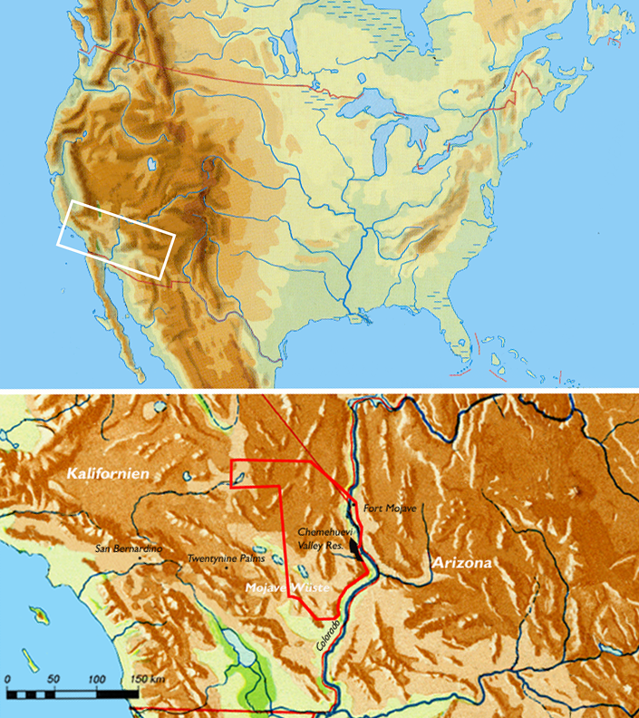
The Chemehuevi ( ) are an indigenous people of the Great Basin. They are the southernmost branch of Southern Paiute. Today, Chemehuevi people are enrolled in the following federally recognized tribes: * Colorado River Indian Tribes * Chemehuevi Indian Tribe of the Chemehuevi Reservation * Morongo Band of Mission Indians * Cabazon Band of Mission Indians * Agua Caliente Band of Cahuilla Indians * Torres-Martinez Desert Cahuilla Indians * Twenty-Nine Palms Band of Mission Indians of California Some Chemehuevi are also part of the Soboba Band of Luiseño Indians, whose members are mostly ''Sovovatum'' or ''Soboba band'' members of Cahuilla and Luiseño people. Name "Chemehuevi" has multiple interpretations. It is considered to either be a Mojave term meaning "those who play with fish;" or a Quechan word meaning "nose-in-the-air-like-a- roadrunner."Pritzker 23 The Chemehuevi call themselves ''Nüwüvi'' ("The People", singular ''Nüwü'') or ''Tantáwats'', meaning " ... [...More Info...] [...Related Items...] OR: [Wikipedia] [Google] [Baidu] |
Comanche
The Comanche (), or Nʉmʉnʉʉ (, 'the people'), are a Tribe (Native American), Native American tribe from the Great Plains, Southern Plains of the present-day United States. Comanche people today belong to the List of federally recognized tribes in the United States, federally recognized Comanche Nation, headquartered in Lawton, Oklahoma. The Comanche language is a Numic languages, Numic language of the Uto-Aztecan languages, Uto-Aztecan family. Originally, it was a Shoshoni language, Shoshoni dialect, but diverged and became a separate language. The Comanche were once part of the Shoshone people of the Great Basin. In the 18th and 19th centuries, Comanche lived in most of present-day northwestern Texas and adjacent areas in eastern New Mexico, southeastern Colorado, southwestern Kansas, and western Oklahoma. Spanish colonists and later Mexicans called their historical territory ''Comancheria, Comanchería''. During the 18th and 19th centuries, Comanche practiced a nomadic h ... [...More Info...] [...Related Items...] OR: [Wikipedia] [Google] [Baidu] |
Native Americans In The United States
Native Americans (also called American Indians, First Americans, or Indigenous Americans) are the Indigenous peoples of the Americas, Indigenous peoples of the United States, particularly of the Contiguous United States, lower 48 states and Alaska. They may also include any Americans whose origins lie in any of the indigenous peoples of North or South America. The United States Census Bureau publishes data about "American Indians and Alaska Natives", whom it defines as anyone "having origins in any of the original peoples of North and South America ... and who maintains tribal affiliation or community attachment". The census does not, however, enumerate "Native Americans" as such, noting that the latter term can encompass a broader set of groups, e.g. Native Hawaiians, which it tabulates separately. The European colonization of the Americas from 1492 resulted in a Population history of Indigenous peoples of the Americas, precipitous decline in the size of the Native American ... [...More Info...] [...Related Items...] OR: [Wikipedia] [Google] [Baidu] |
Belted Range to the northeast and the Death Valley Wilderness to the southwest.
The Belted Range is a mountain range in Nye County, Nevada, United States. The range is approximately 100 miles northwest of Las Vegas and midway between the Basin and Range National Monument Basin and Range National Monument is a national monument of the United States spanning approximately of remote, undeveloped mountains and valleys in Lincoln and Nye counties in southeastern Nevada. References Mountain ranges of Nevada Mountain ranges of Nye County, Nevada[...More Info...] [...Related Items...] OR: [Wikipedia] [Google] [Baidu] |
National Park Service
The National Park Service (NPS) is an List of federal agencies in the United States, agency of the Federal government of the United States, United States federal government, within the US Department of the Interior. The service manages all List of national parks of the United States, national parks; most National monument (United States), national monuments; and other natural, historical, and recreational properties, with various title designations. The United States Congress created the agency on August 25, 1916, through the National Park Service Organic Act. Its headquarters is in Washington, D.C., within the main headquarters of the Department of the Interior. The NPS employs about 20,000 people in units covering over in List of states and territories of the United States, all 50 states, the District of Columbia, and Territories of the United States, US territories. In 2019, the service had more than 279,000 volunteers. The agency is charged with preserving the ecological a ... [...More Info...] [...Related Items...] OR: [Wikipedia] [Google] [Baidu] |


