|
Technical Geography
Technical geography is the branch of geography that involves using, studying, and creating tools to obtain, analyze, interpret, understand, and communicate spatial information. The other branches of geography, most commonly limited to human geography and physical geography, can usually apply the concepts and techniques of technical geography. Nevertheless, the methods and theory are distinct, and a technical geographer may be more concerned with the technological and theoretical concepts than the nature of the data. Further, a technical geographer may explore the relationship between the spatial technology and the end users to improve upon the technology and better understand the impact of the technology on human behavior. Thus, the spatial data types a technical geographer employs may vary widely, including human and physical geography topics, with the common thread being the techniques and philosophies employed. To accomplish this, technical geographers often create their own s ... [...More Info...] [...Related Items...] OR: [Wikipedia] [Google] [Baidu] |
Geography
Geography (from Ancient Greek ; combining 'Earth' and 'write', literally 'Earth writing') is the study of the lands, features, inhabitants, and phenomena of Earth. Geography is an all-encompassing discipline that seeks an understanding of Earth and world, its human and natural complexities—not merely where objects are, but also how they have changed and come to be. While geography is specific to Earth, many concepts can be applied more broadly to other Astronomical object, celestial bodies in the field of planetary science. Geography has been called "a bridge between natural science and social science disciplines." Origins of many of the concepts in geography can be traced to Greek Eratosthenes of Cyrene, who may have coined the term "geographia" (). The first recorded use of the word Geography (Ptolemy), γεωγραφία was as the title of a book by Greek scholar Claudius Ptolemy (100 – 170 AD). This work created the so-called "Ptolemaic tradition" of geography, w ... [...More Info...] [...Related Items...] OR: [Wikipedia] [Google] [Baidu] |
Globes
A globe is a spherical model of Earth, of some other celestial body, or of the celestial sphere. Globes serve purposes similar to maps, but, unlike maps, they do not distort the surface that they portray except to scale it down. A model globe of Earth is called a terrestrial globe. A model globe of the celestial sphere is called a ''celestial globe''. A globe shows details of its subject. A terrestrial globe shows landmasses and water bodies. It might show nations and major cities and the network of latitude and longitude lines. Some have raised relief to show mountains and other large landforms. A celestial globe shows notable stars, and may also show positions of other prominent astronomical objects. Typically, it will also divide the celestial sphere into constellations. The word ''globe'' comes from the Latin word ''globus'', meaning "sphere". Globes have a long history. The first known mention of a globe is from Strabo, describing the Globe of Crates from about 150 ... [...More Info...] [...Related Items...] OR: [Wikipedia] [Google] [Baidu] |
St John's Gate, Clerkenwell
St John's Gate, in Clerkenwell, Middlesex, now within central London, is one of the few tangible remains from Clerkenwell's monastic past. It was built in 1504 by Prior Thomas Docwra as the south entrance to the inner precinct of Clerkenwell Priory, the English headquarters of the Knights of the Order of St John (known as the Knights Hospitaller). The substructure is of brick, while the north and south façades are of stone. After centuries of decay and much rebuilding, very little of the stone facing is original. Heavily restored in the 19th century, the Gate today is in large part a Victorian recreation, the handiwork of a succession of architects— William Pettit Griffith, R. Norman Shaw, and J. Oldrid Scott. History The Priory was established in the 1140s in Clerkenwell as the English headquarters of the Order. The Order was dissolved by King Henry VIII as part of the Dissolution of the Monasteries when its lands and wealth were seized by the Crown. The Order wa ... [...More Info...] [...Related Items...] OR: [Wikipedia] [Google] [Baidu] |
Edward Cave
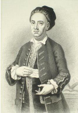
Edward Cave (27 February 1691 – 10 January 1754) was an English printer, editor and publisher. He coined the term "magazine" for a periodical, founding ''The Gentleman's Magazine'' in 1731, and was the first publisher to successfully fashion a wide-ranging publication. Early life The son of a cobbler, Cave was born in Newton near Rugby, Warwickshire, and attended Rugby School, but was expelled after being accused of stealing from the headmaster Henry Holyoake. He worked at a variety of jobs, including timber merchant, reporter and printer. The Gentleman's Magazine Cave conceived the idea of a periodical that would cover every topic the educated public was interested in, from commerce to poetry, and tried to convince several London printers and booksellers to take up the idea. When no one showed any interest, he took on the task himself. The Gentleman's Magazine was launched in 1731 and soon became the most influential and most imitated periodical of its time. It h ... [...More Info...] [...Related Items...] OR: [Wikipedia] [Google] [Baidu] |
World Wide Web
The World Wide Web (WWW or simply the Web) is an information system that enables Content (media), content sharing over the Internet through user-friendly ways meant to appeal to users beyond Information technology, IT specialists and hobbyists. It allows documents and other web resources to be accessed over the Internet according to specific rules of the HTTP, Hypertext Transfer Protocol (HTTP). The Web was invented by English computer scientist Tim Berners-Lee while at CERN in 1989 and opened to the public in 1993. It was conceived as a "universal linked information system". Documents and other media content are made available to the network through web servers and can be accessed by programs such as web browsers. Servers and resources on the World Wide Web are identified and located through character strings called uniform resource locators (URLs). The original and still very common document type is a web page formatted in Hypertext Markup Language (HTML). This markup lang ... [...More Info...] [...Related Items...] OR: [Wikipedia] [Google] [Baidu] |
John Wiley & Sons
John Wiley & Sons, Inc., commonly known as Wiley (), is an American Multinational corporation, multinational Publishing, publishing company that focuses on academic publishing and instructional materials. The company was founded in 1807 and produces books, Academic journal, journals, and encyclopedias, in print and electronically, as well as online products and services, training materials, and educational materials for undergraduate, graduate, and continuing education students. History The company was established in 1807 when Charles Wiley opened a print shop in Manhattan. The company was the publisher of 19th century American literary figures like James Fenimore Cooper, Washington Irving, Herman Melville, and Edgar Allan Poe, as well as of legal, religious, and other non-fiction titles. The firm took its current name in 1865. Wiley later shifted its focus to scientific, Technology, technical, and engineering subject areas, abandoning its literary interests. Wiley's son Joh ... [...More Info...] [...Related Items...] OR: [Wikipedia] [Google] [Baidu] |
Getis–Ord Statistics
Getis–Ord statistics, also known as Gi*, are used in spatial analysis to measure the local and global spatial autocorrelation. Developed by statisticians Arthur Getis and J. Keith Ord they are commonly used for ''Hot Spot Analysis'' to identify where features with high or low values are spatially clustered in a statistically significant way. Getis-Ord statistics are available in a number of software libraries such as CrimeStat, GeoDa, ArcGIS, PySAL and R (programming language), R. Local statistics There are two different versions of the statistic, depending on whether the data point at the target location i is included or not : G_i = \frac : G_i^* = \frac Here x_i is the value observed at the i^ spatial site and w_ is the spatial weight matrix which constrains which sites are connected to one another. For G_i^* the denominator is constant across all observations. A value larger (or smaller) than the mean suggests a hot (or cold) spot corresponding to a high-high (or low-l ... [...More Info...] [...Related Items...] OR: [Wikipedia] [Google] [Baidu] |


