|
Tasman Peninsula
The Tasman Peninsula, officially Turrakana / Tasman Peninsula, is a peninsula located in south-east Tasmania, Australia, approximately by the Arthur Highway, south-east of Hobart. The Tasman Peninsula lies south and west of Forestier Peninsula, to which it connects via an isthmus called Eaglehawk Neck. This in turn is joined to the rest of Tasmania by an isthmus called East Bay Neck, near the town of Dunalley, approximately by road from Hobart. The peninsula is surrounded by water; to the north by Norfolk Bay, to the northwest by Frederick Henry Bay, to the west and south by Storm Bay, and to the east by the Tasman Sea. Description Many smaller towns are also located on the Tasman Peninsula the largest of which are Nubeena and Koonya. Smaller centres include Premaydena, Highcroft and Stormlea. The Conservation Park, located on the main highway at Taranna, is a popular local visitor attraction along with the World Heritage Port Arthur Historic Site and a number of bea ... [...More Info...] [...Related Items...] OR: [Wikipedia] [Google] [Baidu] |
Tasmania
) , nickname = , image_map = Tasmania in Australia.svg , map_caption = Location of Tasmania in AustraliaCoordinates: , subdivision_type = Country , subdivision_name = Australia , established_title = Before federation , established_date = Colony of Tasmania , established_title2 = Federation , established_date2 = 1 January 1901 , named_for = Abel Tasman , demonym = , capital = Hobart , largest_city = capital , coordinates = , admin_center = 29 local government areas , admin_center_type = Administration , leader_title1 = Monarch , leader_name1 = Charles III , leader_title2 = Governor , leader_n ... [...More Info...] [...Related Items...] OR: [Wikipedia] [Google] [Baidu] |
Nubeena, Tasmania
Nubeena is a town and fishing village on the Tasman Peninsula, Tasmania, Australia a township of Tasman Council, and seat of the municipality. At the 2016 census, Nubeena had a population of 481. It is the largest settlement on the peninsula. Media Nubeena is served by 97.7 Tasman FM and Pulse FM Tasman which is run by the JNET Radio Network. Geography The town is halfway along the west coast of Tasman Peninsula, on Parsons Bay, which is a narrow continuation of Wedge Bay. It is north-west of Port Arthur. History Nubeena Post Office opened on 1 December 1886. The first postmaster was Joseph Thornton (1813-1899) who carried the mail between Wedge Bay to Premaydena, then Impression Bay. The town possesses a police station and a branch of the Country Women's Association The Country Women's Association (CWA) is the largest regional and rural advocacy group in Australia. It comprises seven independent State and Territory Associations, who are passionate advocates for ... [...More Info...] [...Related Items...] OR: [Wikipedia] [Google] [Baidu] |
Cape Pillar
Cape Pillar is a rural locality in the local government area (LGA) of Tasman in the South-east LGA region of Tasmania. The locality is about south-east of the town of Nubeena. The 2016 census recorded a population of 4 for the state suburb of Cape Pillar. It is on the Tasman Peninsula in the Tasman National Park, adjacent to Tasman Island. It is notable as a coastal feature of the Dolerite landscape of the area. It has been captured in illustrations as early as 1824 and later. It is the location of a rare casuarina, '' Allocasuarina crassa''. It has been an area where whales have been sighted. It is a reference point on the coast for mapping by Australian navy hydrographic service. History Cape Pillar is a confirmed locality. Geography The waters of the Tasman Sea The Tasman Sea ( Māori: ''Te Tai-o-Rēhua'', ) is a marginal sea of the South Pacific Ocean, situated between Australia and New Zealand. It measures about across and about from north to south. ... [...More Info...] [...Related Items...] OR: [Wikipedia] [Google] [Baidu] |
Cape Raoul
Cape Raoul is a rural locality and a natural feature in the local government area of Tasman in the South-east region of Tasmania. It is located about south of the town of Nubeena. The 2016 census determined a population of nil for the state suburb of Cape Raoul. Cape Raoul is a confirmed suburb/locality. Boundaries and location The shore of the Tasman Sea is the locality's western, southern, and eastern boundaries. The cape is contained within the locality, which is contained within the western section of Tasman National Park. Cape Raoul (the natural feature) is situated at the southernmost part of the Tasman Peninsula, in south eastern Tasmania. It forms the coastline of Raoul Bay, and is part of the dolerite landscape of the Tasman National Park.https://parks.tas.gov.au/explore-our-parks/tasman-national-park Tasman National Park Geography The cape features rock platforms, towering cliffs, columns and off-shore islands. There is a cliff with scenic views of the coastli ... [...More Info...] [...Related Items...] OR: [Wikipedia] [Google] [Baidu] |
Coal Mines Historic Site
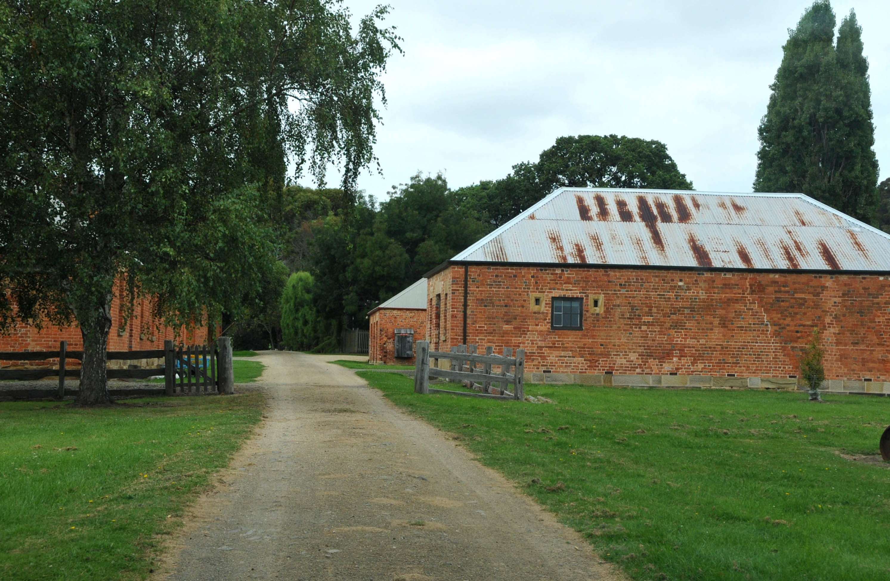
Coal Mines Historic Site was, for a period of 15 years (1833–48), a convict probation stationAustralian Department of Environment, Water, Heritage, and the Arts "Coal Mines Historic Site" webpages 5 August 2010 and the site of Tasmania's (then Van Diemen's Land's) first operational coal mine, "serving as a place of punishment for the 'worst class' of convicts from [...More Info...] [...Related Items...] OR: [Wikipedia] [Google] [Baidu] |
Martin Cash
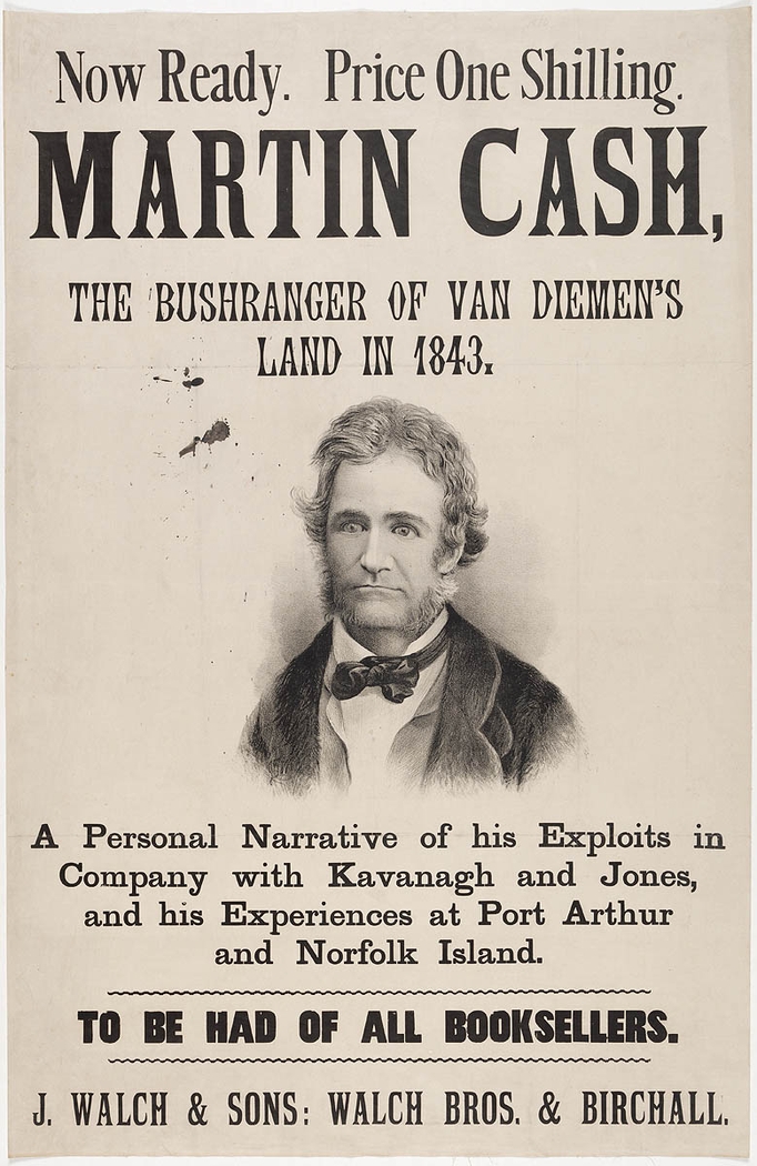
Martin Cash (baptised 10 October 1808 – 26 August 1877) was a notorious Irish-Australian convict bushranger, known for escaping twice from Port Arthur, Van Diemen's Land. His 1870 autobiography, ''The Adventures of Martin Cash'', ghostwritten by James Lester Burke, also a former convict, became a best seller in Australia. Biography Born in Enniscorthy, County Wexford, Ireland, Cash was brought up in a wealthy family and was literate. When he was 18 years old, he became acquainted with a young woman from Enniscorthy who earned a living by making straw hats and bonnets. She and her family borrowed money from him, until his mother stopped him as this extravagance was rapidly draining her resources. Subsequently, he became involved in an event which changed the whole course of his life. His memoirs describe that, in a jealous rage, he shot at a man named Jessop for making advances to the above-mentioned young lady. Cash was sentenced to seven years penal transportation, and ... [...More Info...] [...Related Items...] OR: [Wikipedia] [Google] [Baidu] |
Macquarie Harbour
Macquarie Harbour is a shallow fjord in the West Coast region of Tasmania, Australia. It is approximately , and has an average depth of , with deeper places up to . It is navigable by shallow-draft vessels. The main channel is kept clear by the presence of a rock wall on the outside of the channel's curve. This man-made wall prevents erosion and keeps the channel deep and narrow, rather than allowing the channel to become wide and shallow. A reported Aboriginal name for the harbour is ''Parralaongatek''. The harbour was named in honour of Scottish Major General Lachlan Macquarie, the fifth Colonial Governor of New South Wales. History James Kelly wrote in his narrative ''First Discovery of Port Davey and Macquarie Harbour'' how he sailed from Hobart in a small open five-oared whaleboat to discover Macquarie Harbour on 28 December 1815. However, different accounts of the journey have indicated different methods and dates of the discovery. In the commentary to the ''Historica ... [...More Info...] [...Related Items...] OR: [Wikipedia] [Google] [Baidu] |
Penal Colony
A penal colony or exile colony is a settlement used to exile prisoners and separate them from the general population by placing them in a remote location, often an island or distant colonial territory. Although the term can be used to refer to a correctional facility located in a remote location, it is more commonly used to refer to communities of prisoners overseen by wardens or governors having absolute authority. Historically penal colonies have often been used for penal labour in an economically underdeveloped part of a state's (usually colonial) territories, and on a far larger scale than a prison farm. British Empire With the passage of the Transportation Act 1717, the British government initiated the penal transportation of indentured servants to Britain's colonies in the Americas. British merchants would be in charge of transporting the convicts across the Atlantic, where in the colonies their indentures would be auctioned off to planters. Many of the indentur ... [...More Info...] [...Related Items...] OR: [Wikipedia] [Google] [Baidu] |
Abel Tasman
Abel Janszoon Tasman (; 160310 October 1659) was a Dutch seafarer, explorer, and merchant, best known for his voyages of 1642 and 1644 in the service of the Dutch East India Company (VOC). He was the first known European explorer to reach New Zealand and the islands of Fiji and Van Diemen's Land (now Tasmania). Origins and early life Abel Tasman was born around 1603 in Lutjegast, a small village in the province of Groningen, in the north of the Netherlands. The oldest available source mentioning him is dated 27 December 1631 when, as a seafarer living in Amsterdam, the 28-year-old became engaged to marry 21-year-old Jannetje Tjaers, of Palmstraat in the Jordaan district of the city. Relocation to the Dutch East Indies Employed by the Dutch East India Company (VOC), Tasman sailed from Texel (Netherland) to Batavia, now Jakarta, in 1633 taking the southern Brouwer Route. During this period, Tasman took part in a voyage to Seram Island; the locals had sold spices to ... [...More Info...] [...Related Items...] OR: [Wikipedia] [Google] [Baidu] |
Netherlands
) , anthem = ( en, "William of Nassau") , image_map = , map_caption = , subdivision_type = Sovereign state , subdivision_name = Kingdom of the Netherlands , established_title = Before independence , established_date = Spanish Netherlands , established_title2 = Act of Abjuration , established_date2 = 26 July 1581 , established_title3 = Peace of Münster , established_date3 = 30 January 1648 , established_title4 = Kingdom established , established_date4 = 16 March 1815 , established_title5 = Liberation Day (Netherlands), Liberation Day , established_date5 = 5 May 1945 , established_title6 = Charter for the Kingdom of the Netherlands, Kingdom Charter , established_date6 = 15 December 1954 , established_title7 = Dissolution of the Netherlands Antilles, Caribbean reorganisation , established_date7 = 10 October 2010 , official_languages = Dutch language, Dutch , languages_type = Regional languages , languages_sub = yes , languages = , languages2_type = Reco ... [...More Info...] [...Related Items...] OR: [Wikipedia] [Google] [Baidu] |
Tasmanian Aborigines
The Aboriginal Tasmanians (Palawa kani: ''Palawa'' or ''Pakana'') are the Aboriginal people of the Australian island of Tasmania, located south of the mainland. For much of the 20th century, the Tasmanian Aboriginal people were widely, and erroneously, thought of as being an extinct cultural and ethnic group that had been intentionally exterminated by white settlers. Contemporary figures (2016) for the number of people of Tasmanian Aboriginal descent vary according to the criteria used to determine this identity, ranging from 6,000 to over 23,000. First arriving in Tasmania (then a peninsula of Australia) around 40,000 years ago, the ancestors of the Aboriginal Tasmanians were cut off from the Australian mainland by rising sea levels c. 6000 BC. They were entirely isolated from the outside world for 8,000 years until European contact. Before British colonisation of Tasmania in 1803, there were an estimated 3,000–15,000 Palawa. The Palawa population suffered a drast ... [...More Info...] [...Related Items...] OR: [Wikipedia] [Google] [Baidu] |
Tasman Council
Tasman Council is a local government body in Tasmania, situated in the south-east of the state. Tasman is classified as a rural local government area and has a population of 2,404, the region covers both the Tasman and Forestier peninsulas, with Nubeena the principal town. History and attributes The Tasman municipality was established on 1 January 1907. Tasman is classified as rural, agricultural and medium (RAM) under the Australian Classification of Local Governments. Port Arthur, Nubeena and Koonya are the main towns. The local government area contains the Tasman National Park and a large range of tourism sites including the former penal settlement of Port Arthur, now one of the eleven Australian Convict Sites listed on the World Heritage Register; Eaglehawk Neck and the Tessellated Pavement amongst many others. Localities • Cape Pillar • Cape Raoul • • • • • • • • • Premaydena • • • • • Council Current composition and ... [...More Info...] [...Related Items...] OR: [Wikipedia] [Google] [Baidu] |


.jpg)
