|
Sutton-in-Ashfield
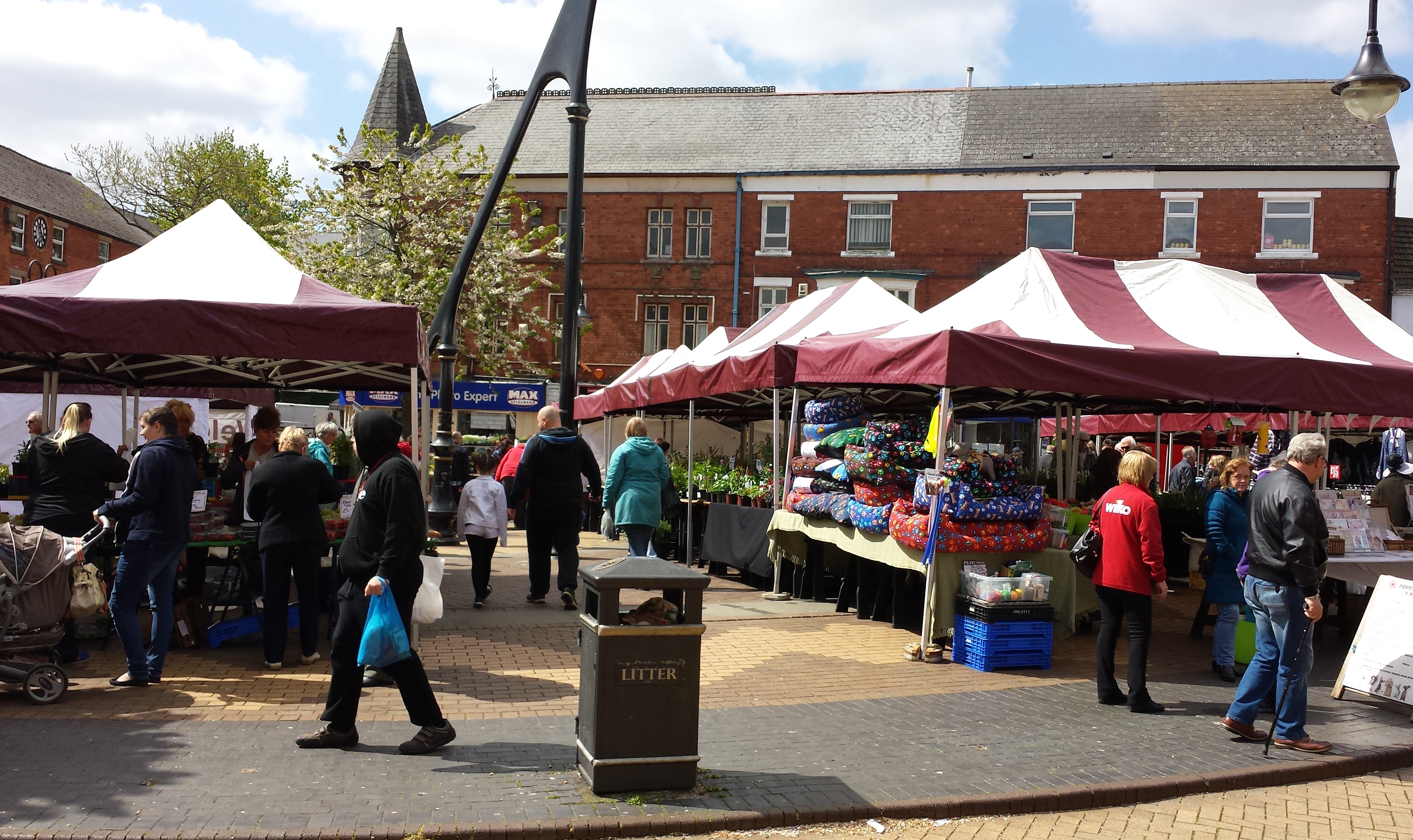
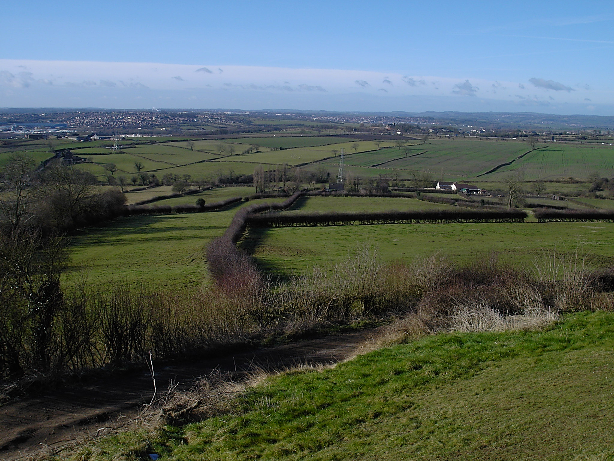
Sutton-in-Ashfield is a market town in Nottinghamshire, England, with a population of 36,404 in 2021. It is the largest town in the district of Ashfield, Nottinghamshire, Ashfield, four miles west of Mansfield, from the Derbyshire border and north of Nottingham. Geography For demographic purposes Sutton-in-Ashfield is included in the Mansfield Urban Area, although it administratively forms part of the separate council district of Ashfield, which is based in Kirkby-in-Ashfield. To the north is Teversal, Skegby and Stanton Hill. History The area was first settled in the Saxon times and the Saxon suffix "ton" means "an enclosure or fenced in clearing". The town appears in the Domesday Book in 1086 as "Sutone". Sutton-in-Ashfield like Mansfield were part the land of Edward the Confessor and later the land of William the Conqueror upon the Norman Conquest in 1066. Edward the Confessor and William the Conqueror were also the lord of the manor house of Sutton in Ashfield. In ... [...More Info...] [...Related Items...] OR: [Wikipedia] [Google] [Baidu] |
Sutton-in-Ashfield Town Hall
The Regency Dance Centre, formerly Sutton-in-Ashfield Town Hall, is a ballroom and former municipal building in Sutton-in-Ashfield, a town in Nottinghamshire, in England. History In 1876, a group of local businessmen decided to form a company, to be known as the "Sutton-in-Ashfield Town Hall Company", to finance and commission a town hall for the town. The site they selected on the northwest side of the Market Place was purchased from the Unwin family of Sutton Hall who were significant landowners in the area as well as proprietors of the local textile mills. The foundation stone for the new building was laid by William Cavendish-Bentinck, 6th Duke of Portland, whose seat was at Welbeck Abbey, on 10 December 1888. It was designed by J. P. Adlington of High Pavement in Sutton-in-Ashfield in the Victorian style, built in red brick for £3,500 and was opened, with a performance of "Messiah" by George Frideric Handel, early the following year. The original design involved a main fr ... [...More Info...] [...Related Items...] OR: [Wikipedia] [Google] [Baidu] |
Church Of St Mary Magdalene, Sutton-in-Ashfield
The Church of St Mary Magdalene, Sutton-in-Ashfield is a parish church in the Church of England in Sutton-in-Ashfield, Nottinghamshire. The church is Grade II* listed by the Department for Digital, Culture, Media and Sport as it is a particularly significant building of more than local interest. History The church is medieval but was rebuilt in 1854 and 1867. It contains a rare 12th century pillar piscina and the remains of the font top from the original Norman church. By American searches, on 5 July 1607, Edward FitzRandolph was baptised at St. Mary's Church Sutton, marrying Elizabeth Blossom in Scituate, Massachusetts - they are Barack Obama's 10x great-grandparents. See also * Grade II* listed buildings in Nottinghamshire *Listed buildings in Sutton-in-Ashfield Sources {{DEFAULTSORT:Sutton-in-Ashfield, St Mary Magdalene Church of England church buildings in Nottinghamshire Grade II* listed churches in Nottinghamshire Anglo-Catholic church buildings in Nottingha ... [...More Info...] [...Related Items...] OR: [Wikipedia] [Google] [Baidu] |
Ashfield, Nottinghamshire
Ashfield () is a Non-metropolitan district, local government district in Nottinghamshire, England. The council is based in Kirkby-in-Ashfield, but the largest town is neighbouring Sutton-in-Ashfield. The district also contains the town of Hucknall and a few villages. The district is mostly urban, with some of its settlements forming parts of both the Nottingham Urban Area, Nottingham and Mansfield Urban Areas. The neighbouring districts are Mansfield District, Mansfield, Newark and Sherwood, Borough of Gedling, Gedling, Nottingham, Borough of Broxtowe, Broxtowe, Amber Valley and Bolsover District, Bolsover. History The district was created on 1 April 1974 under the Local Government Act 1972, covering the whole of two former districts, most of Hucknall Urban District and of parts of a fourth, which were all abolished at the same time: *Basford Rural District (parishes of Annesley, Felley and Selston only) *Hucknall Urban District *Kirkby in Ashfield Urban District *Sutton in Ashfi ... [...More Info...] [...Related Items...] OR: [Wikipedia] [Google] [Baidu] |
Sutton Community Academy
Sutton Community Academy (formerly Sutton Centre Community College) is a coeducational secondary school and sixth form with academy status, located in Sutton-in-Ashfield, Nottinghamshire, England. History Early plans Sutton in Ashfield Urban District councillors in 1966 looked at the possibility of a technical-grammar school between Sutton and Huthwaite. A £264,770 technical grammar school had been planned in 1960, costing £315,000 by 1963. In 1964 the £328,614 technical grammar school was given the go ahead by the county council. The technical grammar school was being planned by 1966. A model was made of the layout of the new technical grammar school in 1968, in the town centre. Two technical grammar schools had been built at Mansfield in 1957 and 1959, one at Eastwood in 1957, one at Hucknall in 1955, and one in Worksop in 1956. In 1967 there was a dispute between the Urban Council and the County Council, as to where to put the school. After 1969, this earlier plan ch ... [...More Info...] [...Related Items...] OR: [Wikipedia] [Google] [Baidu] |
Skegby
Skegby is a village in the Ashfield district of Nottinghamshire, England. It lies on the B6014 road, two miles west of Mansfield and one mile north of Sutton-in-Ashfield, close to Stanton Hill. Skegby sits on both sides of a deep valley near the source of the River Meden. Etymology Skegby took the name of 'Skeggi' which was the name of a Viking settler. His name means the ("bearded one"). The second element of the name is Danish and can mean a farmstead or village. History Skegby is an ancient parish. It covered about 1,433 acres and included the then hamlet of Stanton Hill. In 1931 the parish had a population of 6,519. It was in Skegby Rural District. On 1 April 1935 the parish was abolished and merged with Sutton in Ashfield and became part of Sutton in Ashfield Urban District. Sutton in Ashfield Urban District was in turn abolished in 1974 to become part of the new district of Ashfield. Skegby is mentioned in the Domesday Book in 1086 as the Wapentake of Broxtow. It ... [...More Info...] [...Related Items...] OR: [Wikipedia] [Google] [Baidu] |
Teversal
Teversal is a village in the Ashfield district of Nottinghamshire, England. It lies north of Sutton-in-Ashfield and west of Mansfield. It is close to the boundary with Derbyshire. Former names include ''Tevershalt'', ''Teversholt'', ''Tyversholtee'', ''Teversale'', ''Tevershall'' and ''Teversall''. Teversal Manor is said to have inspired D. H. Lawrence to write his book Lady Chatterley's Lover. Etymology Different conjectures have been devised to the name of Teversal, including that there are two elements to it. The first element referring to tiefrere meaning ‘painter’ used in the sense of ‘sorcerer’. The second element refers to holt, 'wood' and (ge)heald, 'hold, shelter’. History Arthur Mee (1938) described Teversal as ‘crowning a green hilltop, looking out to Hardwick Hall in splendid trees two miles away, it is a charming oasis where we forget the collieries and find treasure wrought by men who knew not coal’. Teversal (called Tevershall) is the site of fi ... [...More Info...] [...Related Items...] OR: [Wikipedia] [Google] [Baidu] |
King's Mill Hospital
King's Mill Hospital is an acute district general hospital serving the population of north Nottinghamshire and parts of Derbyshire and Lincolnshire. It is managed by the Sherwood Forest Hospitals NHS Foundation Trust. The majority of the hospital buildings are inside Ashfield District Council (town planning) area with some peripheral buildings falling under Mansfield District, Mansfield District Council planning controls. History King's Mill was opened as the 30th General Hospital of California, a military hospital, in 1942. The hospital housed 400 injured American personnel as well as German prisoners of war. Part of the site was used to accommodate Mansfield Secondary Technical School, taking students from 1945 housed in the Nissen huts that had been left by the US Army. It was officially opened by Hubert Houldsworth, Sir Hubert Houldsworth, Chairman of the East Midlands Division of the National Coal Board on 22 June 1948. It later moved to new premises, becoming known as She ... [...More Info...] [...Related Items...] OR: [Wikipedia] [Google] [Baidu] |
Stanton Hill
Stanton Hill is a village in the Ashfield district of Nottinghamshire, England. Stanton Hill lies north of Sutton-in-Ashfield, close to the boundary with Derbyshire. History Stanton Hill was built for the colliers after sinking of the collieries and a rapid growing population. The huge increase in population of Skegby – from 805 in 1869 to over 3,000 in 1884 – meant that new housing was required in the immediate area. One hundred and thirty-two houses were initially built on Cooperative Street, Institute Street and Cross Row by the Stanton Ironworks Company, beginning in 1877. However, these street names only developed later, because in 1881 they were all recorded as Stanton Hill. By 1881 Stanton Hill was described as a hamlet within the parish of Skegby. Skegby Colliery, owned by the Dodsley family, was originally located on Wharf Road, which is now in the area known as Stanton Hill, but in the first half of the 19th century was just part of Skegby. It was situated near ... [...More Info...] [...Related Items...] OR: [Wikipedia] [Google] [Baidu] |
Nottinghamshire
Nottinghamshire (; abbreviated ''Notts.'') is a ceremonial county in the East Midlands of England. The county is bordered by South Yorkshire to the north-west, Lincolnshire to the east, Leicestershire to the south, and Derbyshire to the west. The largest settlement is the city of Nottingham (323,632), which is also the county town. The county has an area of and a population of 1,154,195. The latter is concentrated in the Nottingham Urban Area, Nottingham built-up area in the south-west, which extends into Derbyshire and has a population of 729,997. The north-east of the county is more rural, and contains the towns of Worksop (44,733) and Newark-on-Trent (27,700). For Local government in England, local government purposes Nottinghamshire comprises a non-metropolitan county, with seven districts, and the Nottingham Unitary authorities of England, unitary authority area. The East Midlands Combined County Authority includes Nottinghamshire County Council and Nottingham City Council. ... [...More Info...] [...Related Items...] OR: [Wikipedia] [Google] [Baidu] |
Huthwaite
Huthwaite is a village in the Ashfield district, in Nottinghamshire, England, located to the west of Mansfield, close to the Derbyshire boundary. It is in the Huthwaite and Brierley ward of Ashfield District Council. Before 1907 the village was known as Hucknall-under-Huthwaite and also Dirty Hucknall. Governance Hucknall-under-Huthwaite was formerly a township in the parish of Sutton-in-Ashfield, in 1866 Huthwaite became a separate civil parish, from 1894 to 1907 Huthwaite was an urban district under the name "Hucknall under Huthwaite", in 1907 Huthwaite became an urban district under the name "Huthwaite", on 1 April 1935 the district was abolished and merged with Sutton in Ashfield, on 1 April 1935 the parish was abolished and merged with Sutton in Ashfield. In 1931 the parish had a population of 5092. Derivation of name The name Huthwaite is derived from Old English plus Norse elements—hoh is from ''haugr'' an Old Norse word for a hill and thwaite means a clearing—s ... [...More Info...] [...Related Items...] OR: [Wikipedia] [Google] [Baidu] |


