|
Shapinsay
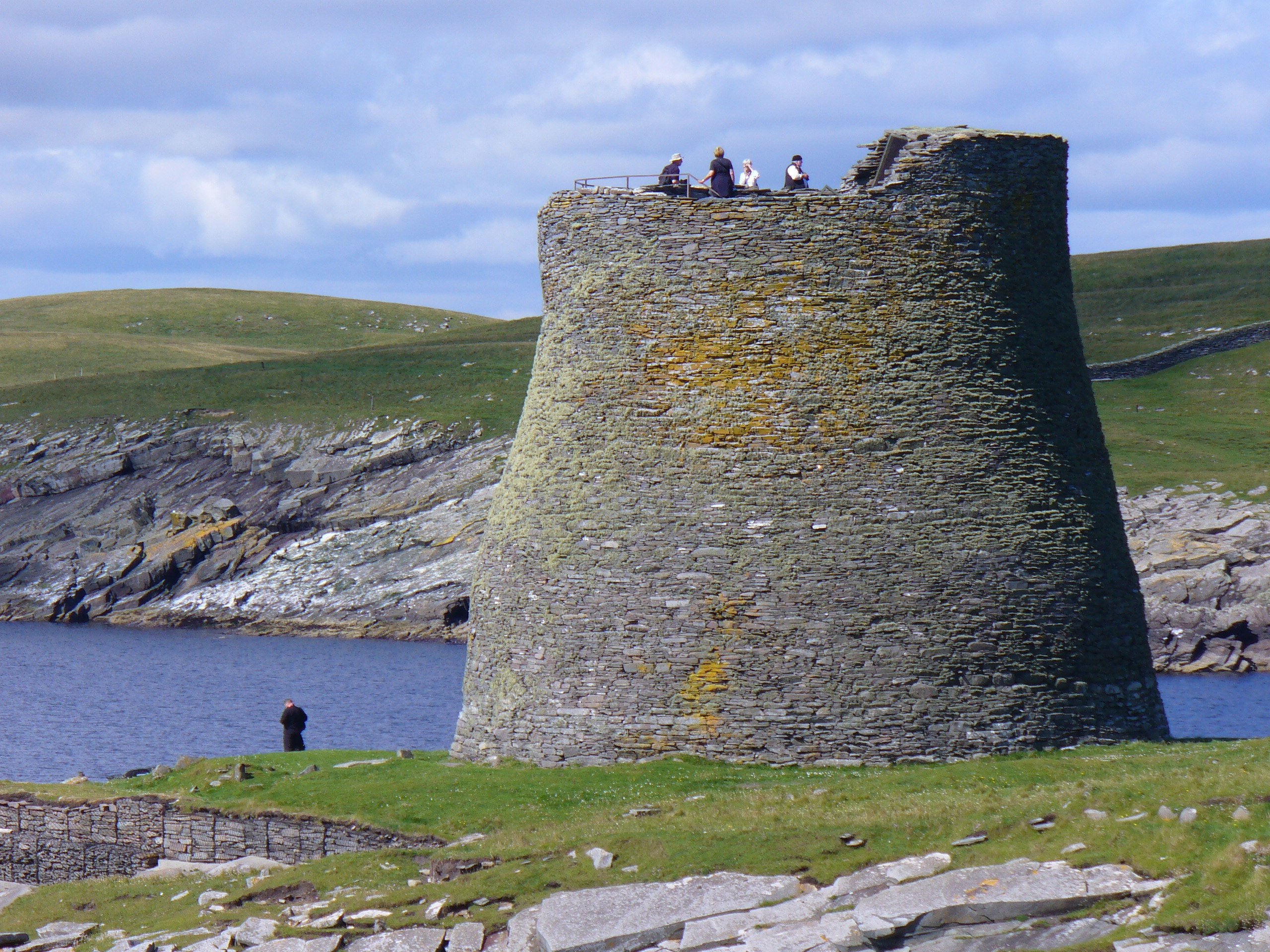
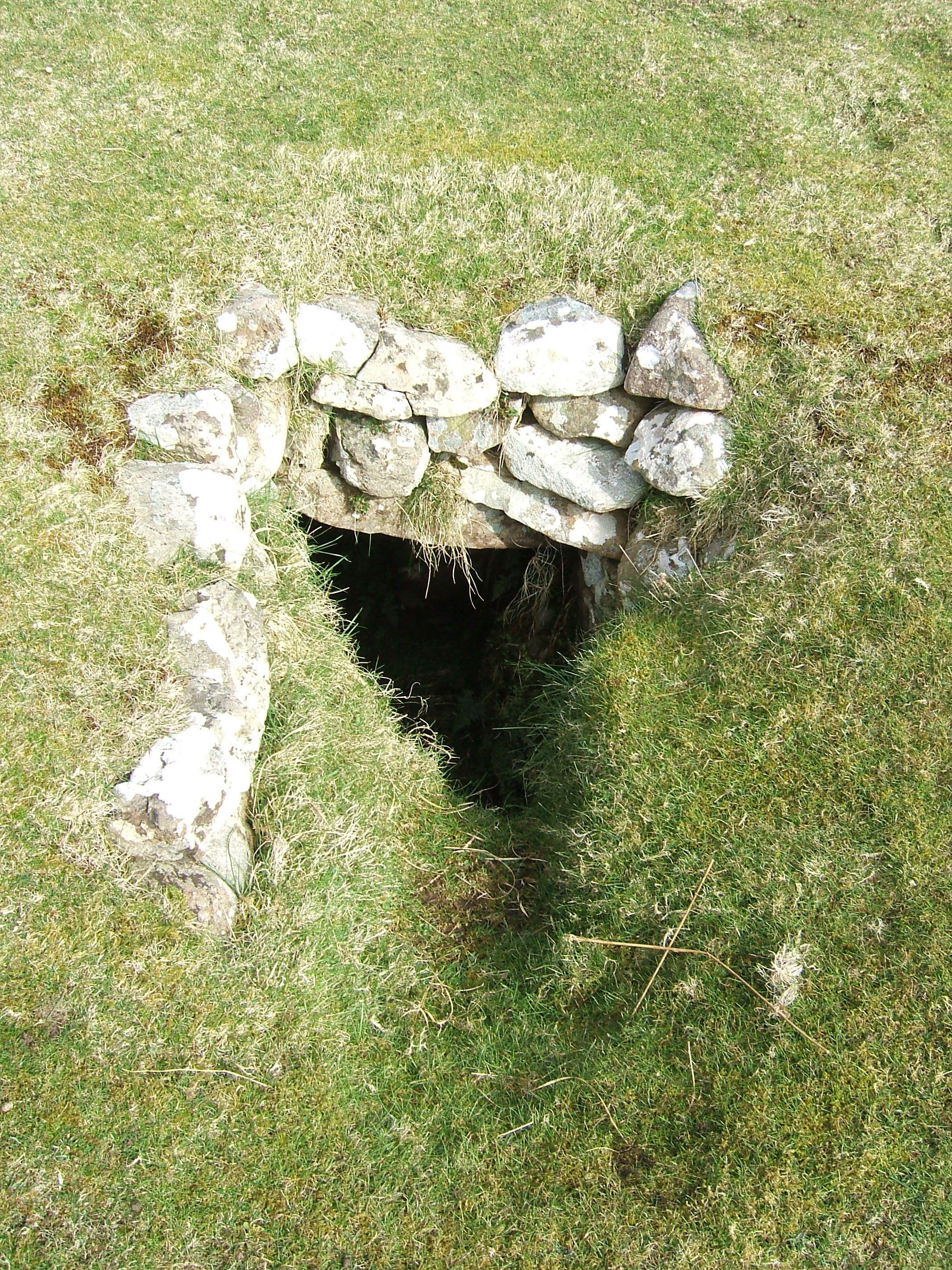
Shapinsay (, ) is one of the Orkney Islands off the north coast of mainland Scotland. With an area of , it is the eighth largest island in the Orkney archipelago. It is low-lying and, with a bedrock formed from Old Red Sandstone overlain by boulder clay, fertile, causing most of the area to be used for farming. Shapinsay has two nature reserves and is notable for its bird life. Balfour Castle, built in the Scottish Baronial style, is one of the island's most prominent features, a reminder of the Balfour family's domination of Shapinsay during the 18th and 19th centuries; the Balfours transformed life on the island by introducing new agricultural techniques. Other landmarks include a standing stone, an Iron Age broch, a souterrain and a salt-water shower. There is one village on the island, Balfour, from which roll-on/roll-off car ferries sail to Kirkwall on the Orkney Mainland. At the 2011 census, Shapinsay had a population of 307. The economy of the island is primarily ba ... [...More Info...] [...Related Items...] OR: [Wikipedia] [Google] [Baidu] |
Balfour, Orkney
Balfour is a village on the island of Shapinsay, Orkney. The village is situated on Elwick Bay, which was used as an anchorage by Haakon IV of Norway before sailing south to eventual defeat at the Battle of Largs in 1263. Today, the village still possesses a harbour, with mock defensive walls constructed at the same time as the castle. David Balfour even added a stone marked with the date 1725, taken from Noltland Castle on the island of Westray, to his defences. A car ferry to Kirkwall, operated by Orkney Ferries, sails from a pier at the harbour. This became a roll-on/roll-off service in 1990. History Originally known as Shoreside, Balfour was built in the 1780s by Thomas Balfour, a former tenant farmer who acquired a private income by marrying the sister of an Earl. With his new-found wealth, Balfour purchased the estate of Sound, whose estate house had been burned down in revenge for the then owner's support of the Jacobite rising of 1745. In 1782, to make way for a new res ... [...More Info...] [...Related Items...] OR: [Wikipedia] [Google] [Baidu] |
Orkney
Orkney (), also known as the Orkney Islands, is an archipelago off the north coast of mainland Scotland. The plural name the Orkneys is also sometimes used, but locals now consider it outdated. Part of the Northern Isles along with Shetland, Orkney is 10 miles (16 km) north of Caithness and has about 70 islands, of which 20 are inhabited.Haswell-Smith (2004) pp. 336–403. The largest island, the Mainland, Orkney, Mainland, has an area of , making it the List of islands of Scotland, sixth-largest Scottish island and the List of islands of the British Isles, tenth-largest island in the British Isles. Orkney's largest settlement, and also its administrative centre, is Kirkwall. Orkney is one of the 32 Subdivisions of Scotland, council areas of Scotland, as well as a Orkney (Scottish Parliament constituency), constituency of the Scottish Parliament, a Lieutenancy areas of Scotland, lieutenancy area, and an counties of Scotland, historic county. The local council is Orkney I ... [...More Info...] [...Related Items...] OR: [Wikipedia] [Google] [Baidu] |
Balfour Castle
Balfour Castle is a historic building on the southwest of Shapinsay, Orkney Islands. Though built around an older structure that dates at least from the 18th century, the present castle was built in 1847, commissioned by Colonel David Balfour, and designed by Edinburgh architect David Bryce. It is a Category A listed building and the landscape and formal gardens are listed in the Inventory of Gardens and Designed Landscapes in Scotland. As of 2021, the castle was operating as a hotel. Prehistory The small island of Shapinsay has been inhabited since prehistoric times, the most notable evidence being the extant Broch of Burroughston, located not far from Balfour Castle to the northeast. C. Michael Hogan. 2007 The Mor Stein standing stone A menhir (; from Brittonic languages: ''maen'' or ''men'', "stone" and ''hir'' or ''hîr'', "long"), standing stone, orthostat, or lith is a large upright rock (geology), stone, emplaced in the ground by humans, typically dating fro ... [...More Info...] [...Related Items...] OR: [Wikipedia] [Google] [Baidu] |
List Of Orkney Islands
This is a list of Orkney islands in Scotland. The Orkney archipelago is located north of mainland Scotland and comprises over 70 islands and skerries, of which 20 are permanently inhabited. In addition to the Orkney Mainland there are three groups of islands. The North and South Isles lie respectively north and south of Mainland. The Pentland Skerries are a group of small islands in the Pentland Firth, a dangerous stretch of water between mainland Scotland and the larger islands of Orkney, through which run the strongest tidal streams in Britain. The Island of Stroma is often mistakenly included with the Orkney Islands, but is part of Caithness. The definition of an island used in this list is that it is 'land that is surrounded by seawater on a daily basis, but not necessarily at all stages of the tide, excluding human devices such as bridges and causeways'. There are four islands joined to the Orkney Mainland by a series of causeways known as the Churchill Barriers. They ... [...More Info...] [...Related Items...] OR: [Wikipedia] [Google] [Baidu] |
Broch
In archaeology, a broch is an British Iron Age, Iron Age drystone hollow-walled structure found in Scotland. Brochs belong to the classification "complex Atlantic roundhouse" devised by Scottish archaeologists in the 1980s. Brochs are roundhouse buildings found throughout Atlantic Scotland. The word broch is derived from the Scots language, Lowland Scots 'brough', meaning fort. In the mid-19th century, Scottish antiquaries called brochs 'burgs', after Old Norse borg, with the same meaning. Brochs are often referred to as Dun (fortification), dùns in the west, and they are the most spectacular of a complex class of buildings found in northern Scotland. There are approximately 571 candidate broch sites throughout the country, according to the Royal Commission on the Ancient and Historical Monuments of Scotland. The origin of brochs is still subject to ongoing research. While most archaeologists believed 80 years ago that brochs were built by immigrants, there is now little do ... [...More Info...] [...Related Items...] OR: [Wikipedia] [Google] [Baidu] |
Mainland, Orkney
The Mainland, also known as Pomona, is the main island of Orkney, Scotland. Both of Orkney's burghs, Kirkwall and Stromness, lie on the island, which is also the heart of Orkney's ferry and air connections. Seventy-five per cent of Orkney's population live on the island, which is more densely populated than the other islands of the archipelago. The lengthy history of the island's occupation has provided numerous important archaeological sites and the sandstone bedrock provides a platform for fertile farmland. There is an abundance of wildlife, especially seabirds. Etymology The name Mainland is a Language change, corruption of the Old Norse . Formerly the island was also known as meaning 'horse island'. The island is sometimes referred to as ''Pomona (mythology), Pomona'' (or ''Pomonia''), a name that stems from a 16th-century mis-translation by George Buchanan.Buchanan, George (1582''Rerum Scoticarum Historia: The First Book''The University of California, Irvine. Revised 8 Marc ... [...More Info...] [...Related Items...] OR: [Wikipedia] [Google] [Baidu] |
Souterrain
''Souterrain'' (from French ', meaning "subterrain", is a name given by archaeologists to a type of underground structure associated mainly with the European Atlantic Iron Age. These structures appear to have been brought northwards from Gaul during the late Iron Age. Regional names include earth houses, fogous and Pict PICT is a graphics file format introduced on the original Apple Macintosh computer as its standard metafile format. It allows the interchange of graphics (both bitmapped and vector), and some limited text support, between Mac applications, an ...ish houses. The term ''souterrain'' has been used as a distinct term from ''fogou'' meaning 'cave'. In Cornwall the regional name of ''fogou'' (Cornish language, Cornish for 'cave') is applied to souterrain structures. The design of underground structures has been shown to differ among regions; for example, in western Cornwall the design and function of the fogou appears to correlate with a larder use. Etymology T ... [...More Info...] [...Related Items...] OR: [Wikipedia] [Google] [Baidu] |
Atlas Maior
The ''Atlas Maior'' is the final version of Joan Blaeu's atlas, published in Amsterdam between 1662 and 1672, in Latin (11 volumes), French (12 volumes), Dutch (9 volumes), German (10 volumes) and Spanish (10 volumes), containing 594 maps and around 3,000 pages of text. It was the largest and most expensive book published in the seventeenth century. Earlier, much smaller versions, titled ''Theatrum Orbis Terrarum, sive, Atlas Novus'', were published from 1634 onwards. Like Abraham Ortelius's ''Theatrum Orbis Terrarum'' (1570), the ''Atlas Maior'' is widely considered a masterpiece of the Golden Age of Dutch/Netherlandish cartography (approximately 1570s–1670s). History Somewhere around 1604 Willem Blaeu settled down in Amsterdam and opened a shop on the Damrak, where he produced and sold scientific instruments, globes and maps. He was also a publisher, editor and engraver. In 1629, Willem Blaeu bought the copperplates of several dozens of maps from Jodocus Hondius II's ... [...More Info...] [...Related Items...] OR: [Wikipedia] [Google] [Baidu] |
Tacitus
Publius Cornelius Tacitus, known simply as Tacitus ( , ; – ), was a Roman historian and politician. Tacitus is widely regarded as one of the greatest Roman historians by modern scholars. Tacitus’ two major historical works, ''Annals'' (Latin: ) and the ''Histories'' (Latin: ), originally formed a continuous narrative of the Roman Empire from the death of Augustus (14 AD) to the end of Domitian’s reign (96 AD). The surviving portions of the Annals focus on the reigns of Tiberius, Claudius, Nero, and those who reigned in the Year of the Four Emperors (69 AD). Tacitus's other writings discuss oratory (in dialogue format, see ), Germania (in ''De origine et situ Germanorum''), and the life of his father-in-law, Agricola (the general responsible for much of the Roman conquest of Britain), mainly focusing on his campaign in Britannia ('' De vita et moribus Iulii Agricolae''). Tacitus's ''Histories'' offers insights into Roman attitudes towards Jews, ... [...More Info...] [...Related Items...] OR: [Wikipedia] [Google] [Baidu] |
Neolithic
The Neolithic or New Stone Age (from Ancient Greek, Greek 'new' and 'stone') is an archaeological period, the final division of the Stone Age in Mesopotamia, Asia, Europe and Africa (c. 10,000 BCE to c. 2,000 BCE). It saw the Neolithic Revolution, a wide-ranging set of developments that appear to have arisen independently in several parts of the world. This "Neolithic package" included the History of agriculture, introduction of farming, domestication of animals, and change from a hunter-gatherer lifestyle to one of sedentism, settlement. The term 'Neolithic' was coined by John Lubbock, 1st Baron Avebury, Sir John Lubbock in 1865 as a refinement of the three-age system. The Neolithic began about 12,000 years ago, when farming appeared in the Epipalaeolithic Near East and Mesopotamia, and later in other parts of the world. It lasted in the Near East until the transitional period of the Chalcolithic (Copper Age) from about 6,500 years ago (4500 BCE), marked by the development ... [...More Info...] [...Related Items...] OR: [Wikipedia] [Google] [Baidu] |


