|
Sangihe Islands
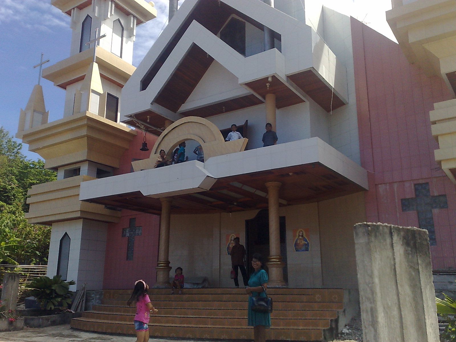
The Sangihe Islands (also spelled "Sangir", "Sanghir" or "Sangi") – – are a group of islands that constitute two regencies within the province of North Sulawesi, in northern Indonesia, the Sangihe Islands Regency. The word Sangihe actually comes from the word Sang Ihe which is means Strong Sailor or Brave Fisherman. ''Kabupaten Kepulauan Sangihe'') and the Sitaro Islands Regency (''Kabupaten Siau Tagulandang Biaro''). They are located northeast of Sulawesi between the Celebes Sea and the Molucca Sea, roughly halfway between Sulawesi and Mindanao, in the Philippines; the Sangihes form the eastern limit of the Celebes Sea. The islands combine to total , with many of the islands being actively volcanic with fertile soil and mountains. The main islands of the group are, north to south, Sangir Besar (or Sangir Island), Siau (or Siao), Tagulandang, and Biaro. The largest island is Sangir Besar and contains an active volcano, Mount Awu (). Tahuna is the chief town ... [...More Info...] [...Related Items...] OR: [Wikipedia] [Google] [Baidu] |
Biaro Island
Biaro Island, an island in the North Sulawesi sea and a part of the Sitaro Islands Regency, is located off the northern extremity of Sulawesi Island, North Sulawesi Province, Indonesia. Sitaro Islands Regency was formed under Law Number 15 Year 2007 from 2 January 2007. Biaro Island is about 90 kilometers away from the coastal of North Sulawesi. Biaro Island is not a resort or tourist island. It had a population of 3,790 at the official estimates for mid 2023.Badan Pusat Statistik, Jakarta, 28 February 2024, ''Kabupaten Kepulauan Siau Tagulandang Biaro Dalam Angka 2024'' (Katalog-BPS 1102001.7109) It is remotely located with more access from Manado (on the mainland of Sulawesi) than from any other island in the regency. There are five villages at the island which are Lamanggo, Dalingsaheng, Karungo, Buang and Tope. [...More Info...] [...Related Items...] OR: [Wikipedia] [Google] [Baidu] |
Mangrove
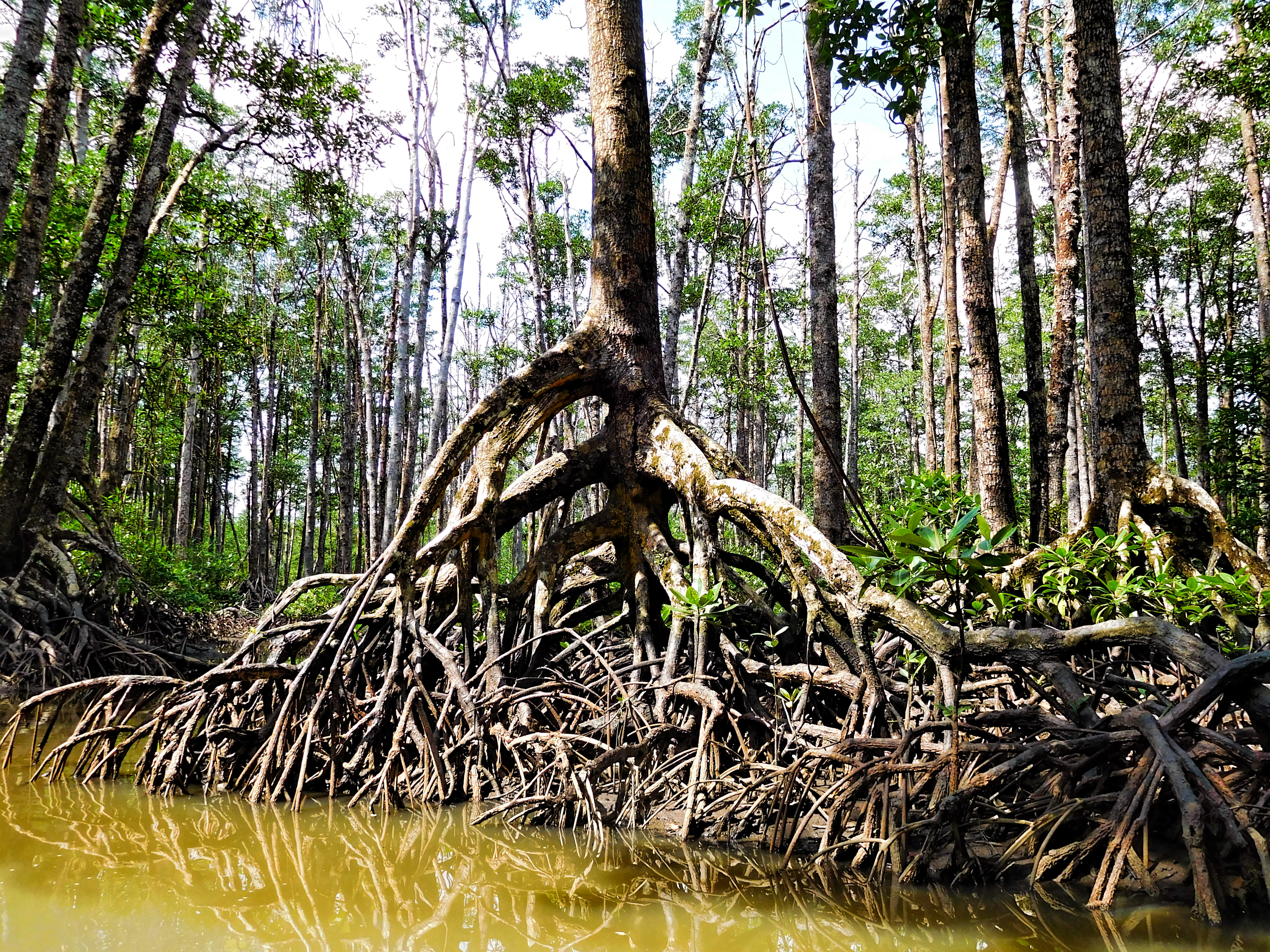
A mangrove is a shrub or tree that grows mainly in coastal saline water, saline or brackish water. Mangroves grow in an equatorial climate, typically along coastlines and tidal rivers. They have particular adaptations to take in extra oxygen and remove salt, allowing them to tolerate conditions that kill most plants. The term is also used for tropical coastal vegetation consisting of such species. Mangroves are taxonomically diverse due to convergent evolution in several plant families. They occur worldwide in the tropics and subtropics and even some temperate coastal areas, mainly between latitudes 30° N and 30° S, with the greatest mangrove area within 5° of the equator. Mangrove plant families first appeared during the Late Cretaceous to Paleocene epochs and became widely distributed in part due to the plate tectonics, movement of tectonic plates. The oldest known fossils of Nypa fruticans, mangrove palm date to 75 million years ago. Mangroves are salt-tolerant ... [...More Info...] [...Related Items...] OR: [Wikipedia] [Google] [Baidu] |
Coral Reef
A coral reef is an underwater ecosystem characterized by reef-building corals. Reefs are formed of colonies of coral polyps held together by calcium carbonate. Most coral reefs are built from stony corals, whose polyps cluster in groups. Coral belongs to the class Anthozoa in the animal phylum Cnidaria, which includes sea anemones and jellyfish. Unlike sea anemones, corals secrete hard carbonate exoskeletons that support and protect the coral. Most reefs grow best in warm, shallow, clear, sunny and agitated water. Coral reefs first appeared 485 million years ago, at the dawn of the Early Ordovician, displacing the microbial and sponge reefs of the Cambrian. Sometimes called ''rainforests of the sea'', shallow coral reefs form some of Earth's most diverse ecosystems. They occupy less than 0.1% of the world's ocean area, about half the area of France, yet they provide a home for at least 25% of all marine species, including fish, mollusks, worms, crustaceans, ... [...More Info...] [...Related Items...] OR: [Wikipedia] [Google] [Baidu] |
Blast Fishing
Blast fishing, fish bombing, dynamite fishing or grenade fishing is a destructive fishing practice using explosives to stun or kill schools of fish for easy collection. This often illegal practice is extremely destructive to the surrounding ecosystem, as the explosion often destroys the underlying habitat (such as coral reefs) that supports the fish. The frequently improvised nature of the explosives used, and undetonated charges, means danger for fishermen and divers as well, with accidents and injuries. Description Although outlawed in some parts of the world, the practice remains widespread in Southeast Asia, as well as in the Aegean Sea and coastal Africa. In the Philippines, where the practice has been well-documented, blast fishing was known prior to World War I, as this activity is mentioned by Ernst Jünger in his book '' Storm of Steel''. One 1999 report estimated that some 70,000 fishermen (12% of the Philippines' total fishermen) engaged in the practice. Extensive ... [...More Info...] [...Related Items...] OR: [Wikipedia] [Google] [Baidu] |
Baselines Of Indonesia
The territorial waters of Indonesia are defined according to the principles set out in Article 46 of the United Nations Convention on the Law of the Sea. Their boundary consists of straight lines ("baselines") linking 195 coordinate points located at the outer edge of the archipelago ("basepoints"). Baselines legislation The current baselines were established by Government Regulation 38 of 2002 which defined by 183 coordinate points as basepoints. The baselines were modified by Government Regulation No 37 of 2008 which changed as well as added basepoints to take into account the International Court of Justice decision on the sovereignty of Sipadan and Ligitan islands and the independence of East Timor. No additional points were established for the area around Sipadan and Ligitan where the baselines was redrawn, while 10 new basepoints were added for the baseline to run around East Timor. Adjustments with two additional points were also made for the southern Java coast. History ... [...More Info...] [...Related Items...] OR: [Wikipedia] [Google] [Baidu] |
Tectonic Plate
Plate tectonics (, ) is the scientific theory that the Earth's lithosphere comprises a number of large tectonic plates, which have been slowly moving since 3–4 billion years ago. The model builds on the concept of , an idea developed during the first decades of the 20th century. Plate tectonics came to be accepted by geoscientists after seafloor spreading was validated in the mid-to-late 1960s. The processes that result in plates and shape Earth's crust are called ''tectonics''. Tectonic plates also occur in other planets and moons. Earth's lithosphere, the rigid outer shell of the planet including the crust and upper mantle, is fractured into seven or eight major plates (depending on how they are defined) and many minor plates or "platelets". Where the plates meet, their relative motion determines the type of plate boundary (or fault): , , or . The relative movement of the plates typically ranges from zero to 10 cm annually. Faults tend to be geologically active, ... [...More Info...] [...Related Items...] OR: [Wikipedia] [Google] [Baidu] |
Austronesian Language
The Austronesian languages ( ) are a language family widely spoken throughout Maritime Southeast Asia, parts of Mainland Southeast Asia, Madagascar, the islands of the Pacific Ocean and Taiwan (by Taiwanese indigenous peoples). They are spoken by about 328 million people (4.4% of the world population). This makes it the fifth-largest language family by number of speakers. Major Austronesian languages include Malay language, Malay (around 250–270 million in Indonesia alone in its own literary standard named "Indonesian language, Indonesian"), Javanese language, Javanese, Sundanese language, Sundanese, Tagalog language, Tagalog (standardized as Filipino language, Filipino), Malagasy language, Malagasy and Cebuano language, Cebuano. According to some estimates, the family contains 1,257 languages, which is the second most of any language family. In 1706, the Dutch scholar Adriaan Reland first observed similarities between the languages spoken in the Malay Archipelago and by people ... [...More Info...] [...Related Items...] OR: [Wikipedia] [Google] [Baidu] |
Sangir Language
Sangir, also known as ''Sangihé'', ''Sangi'', ''Sangil'', or ''Sangih'', is an Austronesian language spoken on the islands linking northern Sulawesi, Indonesia, with Mindanao, Philippines by the Sangir people. It belongs to the Philippine group within the Austronesian language family. Some lexical influence comes from Ternate and Spanish, as well as Dutch and Malay. Many of the Sangirese have migrated to areas outside of the Sangihe archipelago, including mainland Sulawesi, as well as the Philippines, where the language remains vigorous. Sangir is also spoken by Sangirese migrants in North Maluku, Indonesia. Manado Malay Manado Malay, Manadonese or simply the Manado language, is a creole language spoken in Manado, the capital of North Sulawesi province in Indonesia, and the surrounding area. The local name of the language is , and the name Minahasa Malay is also ... is commonly used among the Sangirese, sometimes as a first language. Manado Malay is particularly influentia ... [...More Info...] [...Related Items...] OR: [Wikipedia] [Google] [Baidu] |
Netherlands
, Terminology of the Low Countries, informally Holland, is a country in Northwestern Europe, with Caribbean Netherlands, overseas territories in the Caribbean. It is the largest of the four constituent countries of the Kingdom of the Netherlands. The Netherlands consists of Provinces of the Netherlands, twelve provinces; it borders Germany to the east and Belgium to the south, with a North Sea coastline to the north and west. It shares Maritime boundary, maritime borders with the United Kingdom, Germany, and Belgium. The official language is Dutch language, Dutch, with West Frisian language, West Frisian as a secondary official language in the province of Friesland. Dutch, English_language, English, and Papiamento are official in the Caribbean Netherlands, Caribbean territories. The people who are from the Netherlands is often referred to as Dutch people, Dutch Ethnicity, Ethnicity group, not to be confused by the language. ''Netherlands'' literally means "lower countries" i ... [...More Info...] [...Related Items...] OR: [Wikipedia] [Google] [Baidu] |
Naha Airport (Indonesia)
Naha Airport is an airport serving the locality of Tahuna, on the Sangihe Islands, part of the North Sulawesi province of Indonesia. The airport is previously connected to Manado by daily Wings Air PT Wings Abadi Airlines, operating as Wings Air, is a scheduled commuter passenger low-cost airline based in Jakarta, Indonesia. The airline operates out of Sultan Hasanuddin International Airport in Makassar as well as several other airports aro ... flights. Airlines and destinations References Airports in North Sulawesi {{Indonesia-airport-stub ... [...More Info...] [...Related Items...] OR: [Wikipedia] [Google] [Baidu] |


