|
San Gabriel River (California)
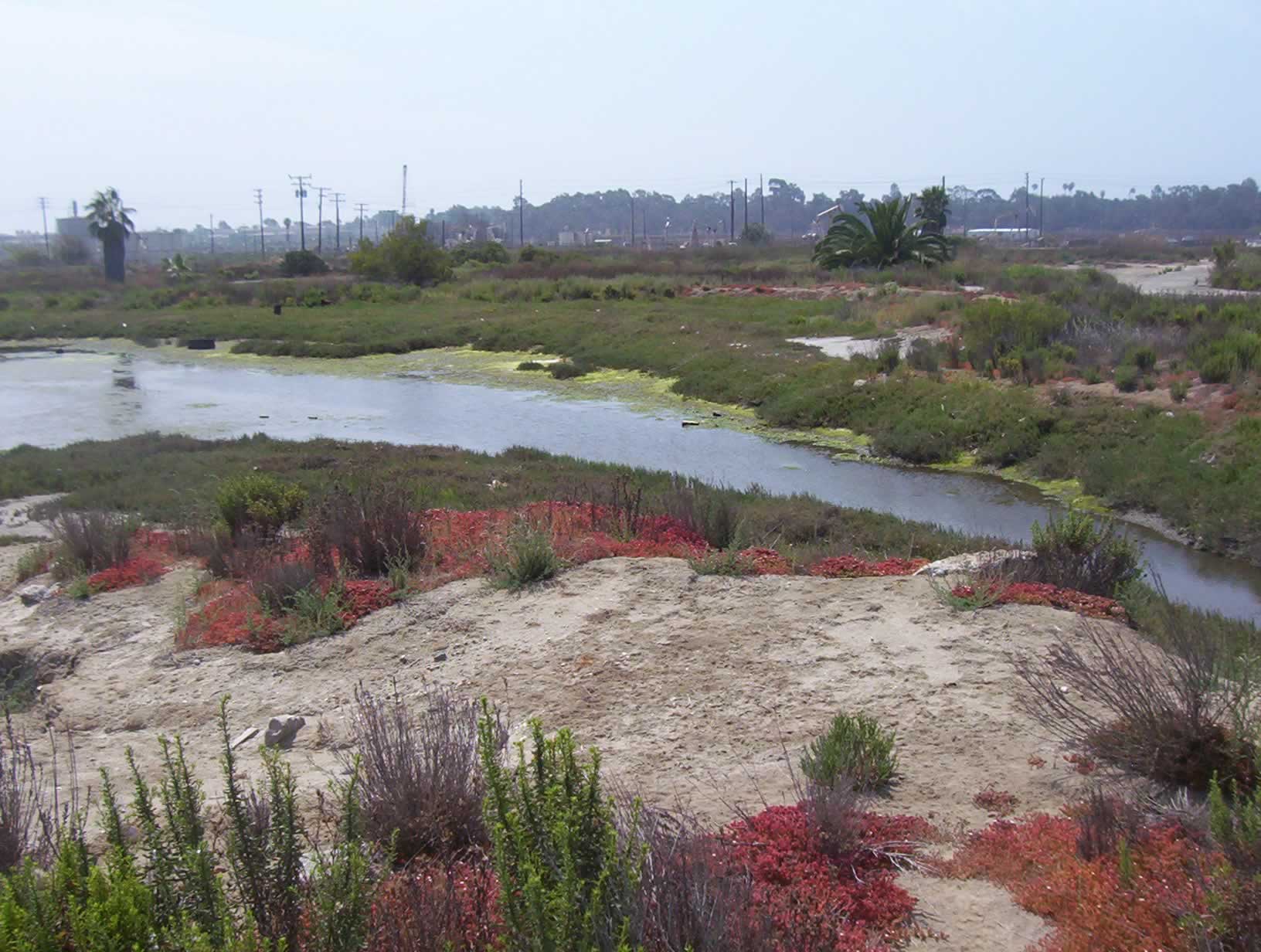
The San Gabriel River is a mostly-Urban stream, urban waterway flowing southward through Los Angeles County, California, Los Angeles and Orange County, California, Orange Counties, California, in the United States. It is the central of three major rivers draining the Greater Los Angeles area, the others being the Los Angeles River and Santa Ana River. The river's Drainage basin, watershed stretches from the rugged San Gabriel Mountains to the heavily-developed San Gabriel Valley and a significant part of the Los Angeles coastal plain, emptying into the Pacific Ocean between the cities of Long Beach, California, Long Beach and Seal Beach, California, Seal Beach. The San Gabriel once ran across a vast Alluvium, alluvial flood plain, its channels shifting with winter floods and forming extensive wetlands along its perennial course, a relatively scarce source of fresh water in this arid region. The Tongva and their ancestors inhabited the San Gabriel River basin for thousands of ... [...More Info...] [...Related Items...] OR: [Wikipedia] [Google] [Baidu] |
South El Monte, California
South El Monte is a city in the San Gabriel Valley, in Los Angeles County, California, United States. At the 2020 United States census, 2020 census, the city had a population of 19,567, down from 20,116 at the 2010 United States Census, 2010 census. Geography According to the United States Census Bureau, the city has a total area of 2.8 square miles (7.4 km), virtually all land. Demographics South El Monte first appeared as a city in the 1960 U.S. Census as part of the Upper San Gabriel Valley census county division. 2020 2010 At the 2010 United States Census, 2010 census South El Monte had a population of 20,116. The population density was . The racial makeup of South El Monte was 10,136 (50.4%) White (3.4% Non-Hispanic White), 107 (0.5%) African American, 250 (1.2%) Native American, 2,211 (11.0%) Asian, 12 (0.1%) Pacific Islander, 6,718 (33.4%) from other races, and 682 (3.4%) from two or more races. Hispanic or Latino of any race were 17,079 persons (84.9%). The ... [...More Info...] [...Related Items...] OR: [Wikipedia] [Google] [Baidu] |
West Fork San Gabriel River
The West Fork is one of two major streams, the other being the East Fork, that combine to form the San Gabriel River in Los Angeles County, California. The West Fork flows for in an easterly direction from its origins at Red Box Gap, in the San Gabriel Mountains, eventually reaching San Gabriel Reservoir where it is bridged by SR 39 just above its mouth. The major tributaries of the West Fork, from upstream to downstream, are Devil Creek, Bear Creek and the North Fork San Gabriel River. A large portion of the watershed is situated in the San Gabriel Wilderness, whose southern boundary is formed by the West Fork. Cogswell Dam impounds the river to create the Cogswell Reservoir, whose primary function is flood and silt control for the San Gabriel Valley.The West Fork of the San Gabriel River is a refuge for Southern California wild rainbow trout. See also *List of rivers of California This is a list of rivers in the U.S. state of California, grouped by region. Major lak ... [...More Info...] [...Related Items...] OR: [Wikipedia] [Google] [Baidu] |
Debris Flow
Debris flows are geological phenomena in which water-laden masses of soil and fragmented Rock (geology), rock flow down mountainsides, funnel into stream channels, entrain objects in their paths, and form thick, muddy deposits on valley floors. They generally have bulk density, bulk densities comparable to those of rock avalanche, rockslides and other types of landslide classification, landslides (roughly 2000 kilograms per cubic meter), but owing to widespread sediment liquefaction caused by high pore pressure, pore-fluid pressures, they can flow almost as fluidly as water. Debris flows descending steep channels commonly attain speeds that surpass 10 m/s (36 km/h), although some large flows can reach speeds that are much greater. Debris flows with volumes ranging up to about 100,000 cubic meters occur frequently in mountainous regions worldwide. The largest prehistoric flows have had volumes exceeding 1 billion cubic meters (i.e., 1 cubic kilometer). As a result o ... [...More Info...] [...Related Items...] OR: [Wikipedia] [Google] [Baidu] |
Spanish Missions In California
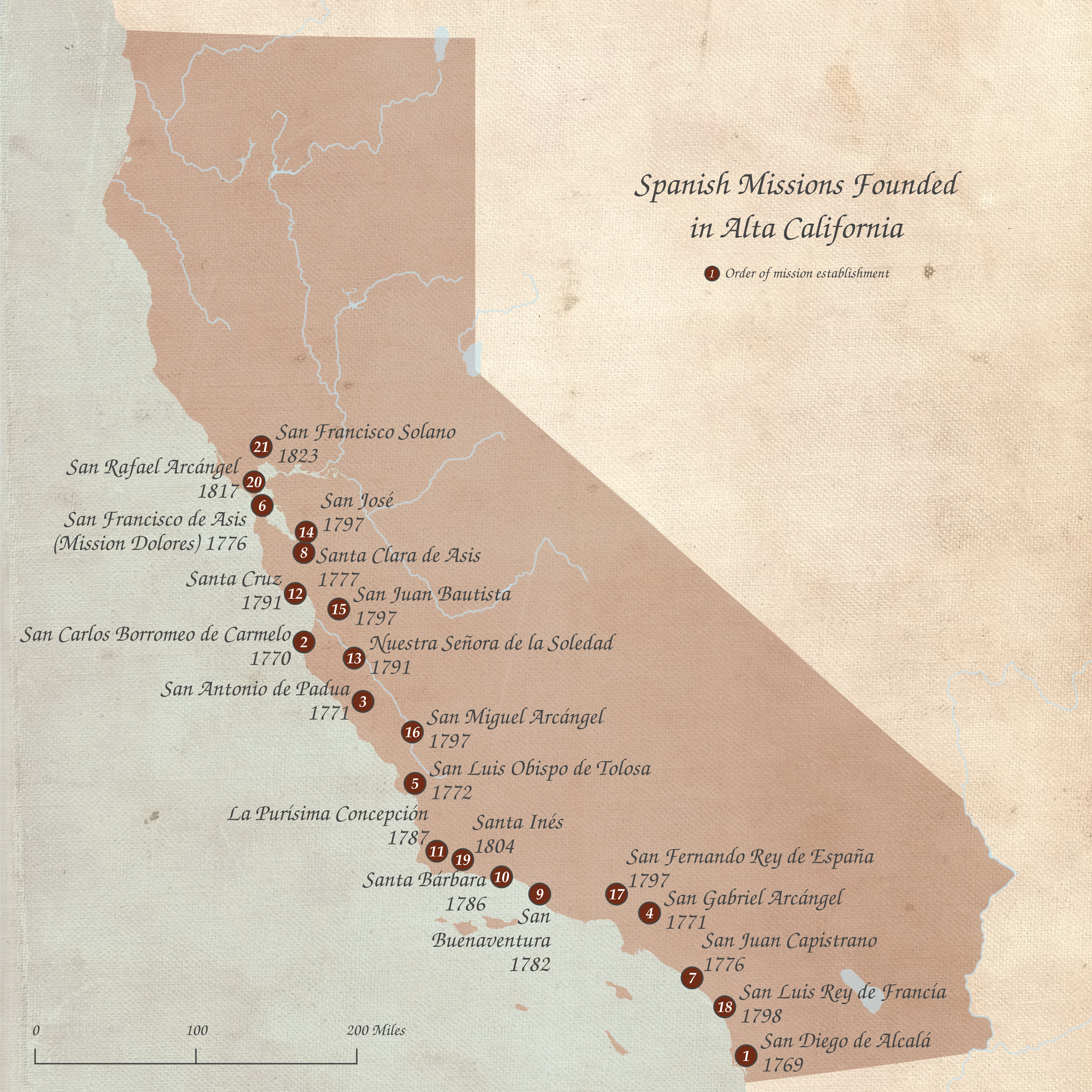
The Spanish missions in California () formed a List of Spanish missions in California, series of 21 religious outposts or missions established between 1769 and 1833 in what is now the U.S. state of California. The missions were established by Catholic priests of the Franciscan order to evangelism, evangelize Indigenous peoples of California, indigenous peoples backed by the military force of the Spanish Empire. The missions were part of the expansion and settlement of New Spain through the formation of Alta California, expanding the empire into the most northern and western parts of Spanish North America. Civilian settlers and soldiers accompanied missionaries and formed settlements like the Pueblo de Los Ángeles. Indigenous peoples of California, Indigenous peoples were forced into settlements called reductions, disrupting their traditional way of life and negatively affecting as many as one thousand villages. European diseases spread in the close quarters of the missions, ca ... [...More Info...] [...Related Items...] OR: [Wikipedia] [Google] [Baidu] |
Mission San Gabriel Arcángel
Mission San Gabriel Arcángel () is a Californian mission and historic landmark in San Gabriel, California. It was founded by the Spanish Empire on the Nativity of Mary September 8, 1771, as the fourth of what would become twenty-one Spanish missions in California. San Gabriel Arcángel was named after the Archangel Gabriel and often referred to as the "Godmother of the Pueblo of Los Angeles." The mission was designed by Antonio Cruzado, who gave the building its capped buttresses and the tall narrow windows, which are unique among the missions of the California chain. It was completed in 1805. A large stone cross stands in the center of the ''Campo Santo'' (cemetery), first consecrated in 1778 and then again on January 29, 1939. It serves as the final resting place for some 6,000 neophytes. According to Spanish legend, the founding expedition was confronted by a large group of native Tongva peoples whose intention was to drive the strangers away. One of the priests laid a pa ... [...More Info...] [...Related Items...] OR: [Wikipedia] [Google] [Baidu] |
Puvunga
Puvunga (alternatively spelled Puvungna or Povuu'nga) is an ancient village and sacred site of the Tongva nation, the Indigenous people of the Los Angeles Basin, and the Acjachemen, the Indigenous people of Orange County. The site is now located within the California State University, Long Beach campus and surrounding areas. The Tongva know Puvunga as the "place of emergence" and it is where they believe "their world and their lives began". Puvunga is an important ceremonial site and is the terminus of an annual pilgrimage for the Tongva, Acjachemen, and Chumash. Before the arrival of European settlers, Puvunga extended far beyond the contemporary site that remains today. Its presence was first uncovered in 1952, and then in 1974, at the designated location, when trenching was done for the Earl Burns Miller Japanese Garden. The site was listed on the National Register of Historic Places in 1974. In 1992, the university challenged its historic designation and threatened to force ... [...More Info...] [...Related Items...] OR: [Wikipedia] [Google] [Baidu] |
Tongva
The Tongva ( ) are an Indigenous peoples of California, Indigenous people of California from the Los Angeles Basin and the Channel Islands of California, Southern Channel Islands, an area covering approximately . In the precolonial era, the people lived in as many as 100 villages and primarily identified by their village rather than by a pan-tribal name. During colonization, the Spanish referred to these people as Gabrieleño and Fernandeño, names derived from the Spanish missions in California, Spanish missions built on their land: Mission San Gabriel Arcángel and Mission San Fernando Rey de España. ''Tongva'' is the most widely circulated endonym among the people, used by Narcisa Higuera in 1905 to refer to inhabitants in the vicinity of Mission San Gabriel. Some people who identify as direct lineal descendants of the people advocate the use of their ancestral name ''Kizh'' as an Endonym and exonym, endonym. The Tongva, along with neighboring groups such as the Chumash peopl ... [...More Info...] [...Related Items...] OR: [Wikipedia] [Google] [Baidu] |
Alluvium
Alluvium (, ) is loose clay, silt, sand, or gravel that has been deposited by running water in a stream bed, on a floodplain, in an alluvial fan or beach, or in similar settings. Alluvium is also sometimes called alluvial deposit. Alluvium is typically geologically young and is not Consolidation (geology), consolidated into solid rock. Sediments deposited underwater, in seas, estuaries, lakes, or ponds, are not described as alluvium. Floodplain alluvium can be highly fertile, and supported some of the earliest human civilizations. Definitions The present Scientific consensus, consensus is that "alluvium" refers to loose sediments of all types deposited by running water in floodplains or in alluvial fans or related landforms. However, the meaning of the term has varied considerably since it was first defined in the French dictionary of Antoine Furetière, posthumously published in 1690. Drawing upon concepts from Roman law, Furetière defined ''alluvion'' (the French term for al ... [...More Info...] [...Related Items...] OR: [Wikipedia] [Google] [Baidu] |
San Gabriel Valley
The San Gabriel Valley (), sometimes referred to by its initials as SGV, is one of the principal valleys of Southern California, with the city of Los Angeles directly bordering it to the west and occupying the vast majority of the southeastern part of Los Angeles County. Surrounding landforms and other features include: * the San Gabriel Mountains to the north; * the San Rafael Hills to the west, with the Los Angeles Basin beyond; * the Crescenta Valley to the northwest; * the Puente Hills to the south, with the coastal plain of Orange County, California, Orange County beyond; * the Chino Hills and San Jose Hills to the east, with the Pomona Valley and Inland Empire (CA), Inland Empire beyond; and * the city limits of Los Angeles bordering its western edge. The San Gabriel Valley derives its name from the San Gabriel River (California), San Gabriel River that flows southward through the center of the valley, which itself was named for the Spanish Mission San Gabriel Arcángel ... [...More Info...] [...Related Items...] OR: [Wikipedia] [Google] [Baidu] |
Drainage Basin
A drainage basin is an area of land in which all flowing surface water converges to a single point, such as a river mouth, or flows into another body of water, such as a lake or ocean. A basin is separated from adjacent basins by a perimeter, the drainage divide, made up of a succession of elevated features, such as ridges and hills. A basin may consist of smaller basins that merge at river confluences, forming a hierarchical pattern. Other terms for a drainage basin are catchment area, catchment basin, drainage area, river basin, water basin, and impluvium. In North America, they are commonly called a watershed, though in other English-speaking places, " watershed" is used only in its original sense, that of the drainage divide line. A drainage basin's boundaries are determined by watershed delineation, a common task in environmental engineering and science. In a closed drainage basin, or endorheic basin, rather than flowing to the ocean, water converges toward the ... [...More Info...] [...Related Items...] OR: [Wikipedia] [Google] [Baidu] |
Santa Ana River
The Santa Ana River is the largest river entirely within Southern California in the United States. It rises in the San Bernardino Mountains and flows for most of its length through San Bernardino County, California, San Bernardino and Riverside County, California, Riverside counties, before cutting through the northern Santa Ana Mountains via Santa Ana Canyon and flowing southwest through urban Orange County, California, Orange County to drain into the Pacific Ocean. The Santa Ana River is long,U.S. Geological Survey. National Hydrography Dataset high-resolution flowline dataThe National Map accessed March 16, 2011 and its drainage basin is in size. The Santa Ana drainage basin has a diversity of terrain, ranging from high peaks of inland mountains in the north and east, to the hot, dry interior and semidesert basins of the Inland Empire, to the flat coastal plain of Orange County. Although it includes areas of alpine climate, alpine and highland forest, the majority of the w ... [...More Info...] [...Related Items...] OR: [Wikipedia] [Google] [Baidu] |


