|
Rhaetian Alps
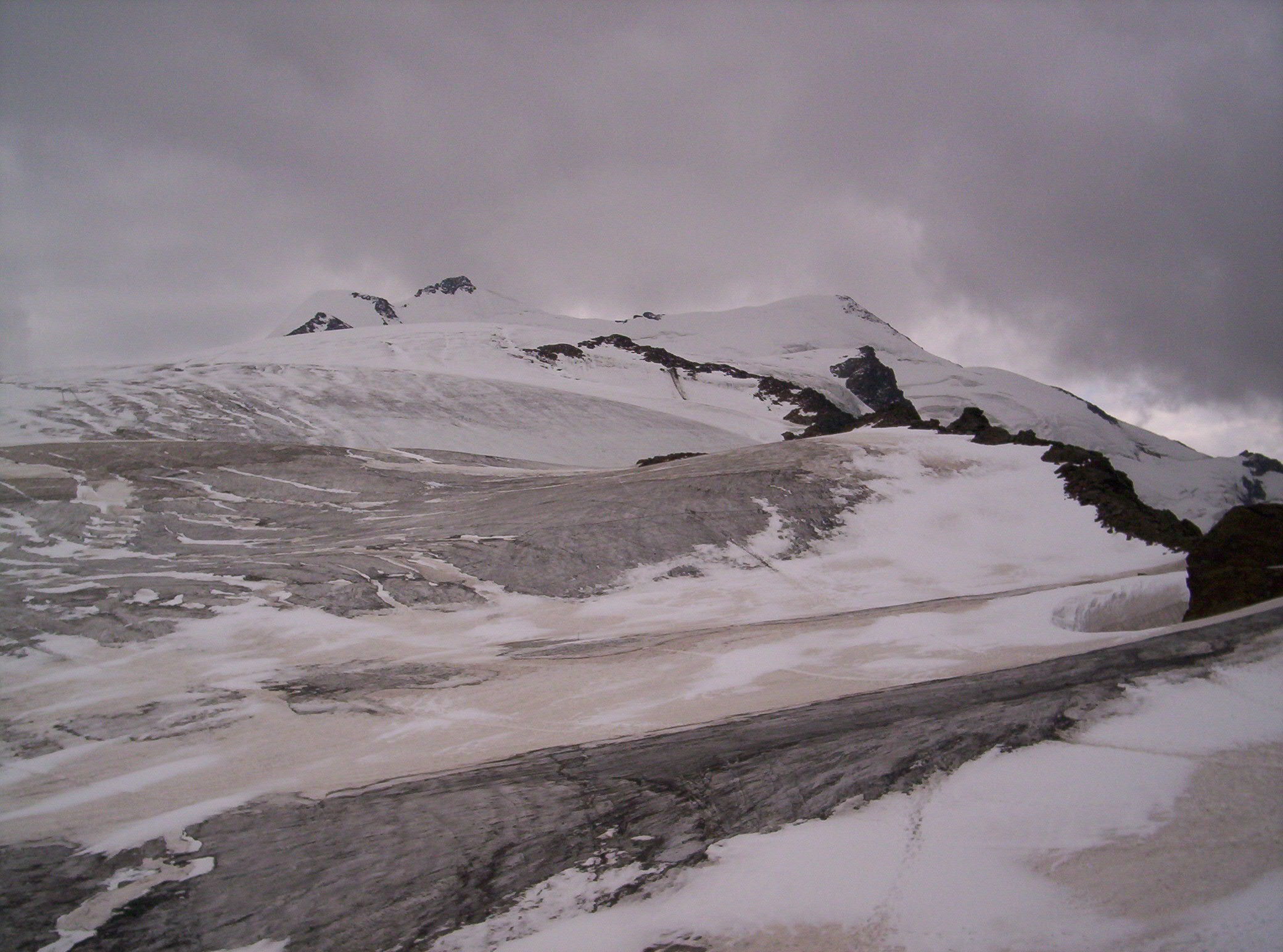
The Rhaetian Alps (; ) are a mountain range of the Eastern Alps. The SOIUSA classification system divides them into the Western Rhaetian Alps, Western, Southern Rhaetian Alps and Eastern Rhaetian Alps, while the Alpine Club classification of the Eastern Alps places most of the Rhaetian subranges within the List of mountain groups in the Alpine Club classification of the Eastern Alps, Western Limestone Alps. They are located along the Italian–Swiss and Austrian–Swiss borders, in the canton of Graubünden in eastern Switzerland; in the state of Tyrol (state), Tyrol in Austria; and in the Italian regions of Trentino-Alto Adige and Lombardy. The name relates to a Roman province and the Rhaetian people subdued under Emperor Augustus in 15 BC. Geography The Rhaetian Alps contain multiple subranges including: #Albula Range (Western) #Bernina Range (Western) #Brenta group (Southern) #Ortler Alps (Southern) #Rätikon (Western) #Silvretta (Western) The Swiss National Park is locate ... [...More Info...] [...Related Items...] OR: [Wikipedia] [Google] [Baidu] |
Mountain Range
A mountain range or hill range is a series of mountains or hills arranged in a line and connected by high ground. A mountain system or mountain belt is a group of mountain ranges with similarity in form, structure, and alignment that have arisen from the same cause, usually an orogeny. Mountain ranges are formed by a variety of geological processes, but most of the significant ones on Earth are the result of plate tectonics. Mountain ranges are also found on many planetary mass objects in the Solar System and are likely a feature of most terrestrial planets. Mountain ranges are usually segmented by highlands or mountain passes and valleys. Individual mountains within the same mountain range do not necessarily have the same geologic structure or petrology. They may be a mix of different orogenic expressions and terranes, for example thrust sheets, uplifted blocks, fold mountains, and volcanic landforms resulting in a variety of rock types. Major ranges Most geolo ... [...More Info...] [...Related Items...] OR: [Wikipedia] [Google] [Baidu] |
Bernina Range
The Bernina Range is a mountain range in the Alps of eastern Switzerland and northern Italy. It is considered to be part of the Rhaetian Alps within the Central Eastern Alps. It is one of the highest ranges of the Alps, covered with many glaciers. Piz Bernina (), its highest peak, is the most easterly List of Alpine Four-thousanders, four-thousand-metre peak in the Alps. The peak in the range which sees the most ascents is Piz Palü. The Bernina Range is separated from the Albula Range in the north-west by the Maloja Pass and the Upper Engadin valley; from the Livigno Range in the east by the Bernina Pass; from the Bergamo Alps in the south by the Adda (river), Adda valley (Valtellina); and from the Bregaglia Range in the south-west by the Muretto Pass. The Bernina Range is drained by the rivers Adda (river), Adda, Inn (river), Inn and Mera (river, Switzerland), Maira (Mera in Italy). The term Bernina Alps can also be used in an extended sense to include both the Bernina and Breg ... [...More Info...] [...Related Items...] OR: [Wikipedia] [Google] [Baidu] |
Triassic
The Triassic ( ; sometimes symbolized 🝈) is a geologic period and system which spans 50.5 million years from the end of the Permian Period 251.902 million years ago ( Mya), to the beginning of the Jurassic Period 201.4 Mya. The Triassic is the first and shortest period of the Mesozoic Era and the seventh period of the Phanerozoic Eon. Both the start and end of the period are marked by major extinction events. The Triassic Period is subdivided into three epochs: Early Triassic, Middle Triassic and Late Triassic. The Triassic began in the wake of the Permian–Triassic extinction event, which left the Earth's biosphere impoverished; it was well into the middle of the Triassic before life recovered its former diversity. Three categories of organisms can be distinguished in the Triassic record: survivors from the extinction event, new groups that flourished briefly, and other new groups that went on to dominate the Mesozoic Era. Reptiles, especially archosaurs, were the ... [...More Info...] [...Related Items...] OR: [Wikipedia] [Google] [Baidu] |
Rhaetian
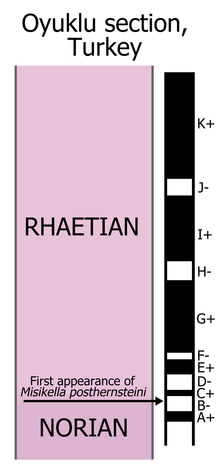
The Rhaetian is the latest age (geology), age of the Triassic period (geology), Period (in geochronology) or the uppermost stage (stratigraphy), stage of the Triassic system (stratigraphy), System (in chronostratigraphy). It was preceded by the Norian and succeeded by the Hettangian (the lowermost stage or earliest age of the Jurassic). The base of the Rhaetian lacks a formal Global Boundary Stratotype Section and Point, GSSP, though candidate sections include Steinbergkogel section, Steinbergkogel in Austria (since 2007) and Pignola-Abriola section, Pignola-Abriola in Italy (since 2016). The end of the Rhaetian (and the base of the overlying Hettangian Stage) is more well-defined. According to the current International Commission on Stratigraphy, ICS (International Commission on Stratigraphy) system, the Rhaetian ended ± 0.2 Ma (million years ago). In 2010, the base of the Rhaetian (i.e. the Norian-Rhaetian boundary) was voted to be defined based on the first appearance of ''Mi ... [...More Info...] [...Related Items...] OR: [Wikipedia] [Google] [Baidu] |
Central Eastern Alps
The Central Eastern Alps (), also referred to as Austrian Central Alps () or just Central Alps, comprise the main chain of the Eastern Alps in Austria and the adjacent regions of Switzerland, Liechtenstein, Italy and Slovenia. South of them is the Southern Limestone Alps. The term "Central Alps" is very common in the Geography of Austria as one of the seven major landscape regions of the country. "Central Eastern Alps" is usually used in connection with the Alpine Club classification of the Eastern Alps (''Alpenvereinseinteilung'', AVE). The Central Alps form the eastern part of the Alpine divide, its central chain of mountains, as well as those ranges that extend or accompany it to the north and south. The highest mountain in the Austrian Central Alps is Grossglockner at . Location The Central Alps have the highest peaks of the Eastern Alps, and are located between the Northern Limestone Alps and the Southern Limestone Alps, from which they differ in geological composi ... [...More Info...] [...Related Items...] OR: [Wikipedia] [Google] [Baidu] |
Southern Limestone Alps
The Southern Limestone Alps (, ), also called the Southern Calcareous Alps, are the mountain range, ranges of the Eastern Alps south of the Central Eastern Alps mainly located in northern Italy and the adjacent lands of Austria and Slovenia. The distinction from the Central Alps, where the higher peaks are located, is based on differences in geological composition. The Southern Limestone Alps extend from the Monte Sobretta, Sobretta-Monte Gavia, Gavia range in Lombardy in the west to the Pohorje in Slovenia in the east. Alpine Club classification Ranges of the Southern Limestone Alps according to the Alpine Club classification of the Eastern Alps, Alpine Club classification (from east to west): * Pohorje (1) * Kamnik–Savinja Alps (2) * Karawanks (3) * Julian Alps (4) * Gailtal Alps (5) * Carnic Alps (6) * Southern Carnic Alps (7) * Dolomites (8) * Fiemme Mountains (9) * Vicentine Alps (10) * Nonsberg Group (11) * Brenta Group (12) * Garda Mountains (13) * Ortler Alps (14) * A ... [...More Info...] [...Related Items...] OR: [Wikipedia] [Google] [Baidu] |
Punta Di Ercavallo
The Punta di Ercavallo (''Ercaàl'' in Lombard) is a mountain of the Rhaetian Alps, with an elevation of . It is located in the Italy, on the border between the Province of Brescia (Lombardy) and the Province of Trento ( Trentino-Alto Adige). Overlooking the Valle di Viso (a branch of the Val Camonica) in Lombardy and the valley of Peio in Trentino, the peak can be reached on foot from Case di Viso, a hamlet of Ponte di Legno Ponte di Legno (Camunian dialect, Camunian: ) is an Italian ''comune'' of 1,729 inhabitants in Val Camonica, province of Brescia, in Lombardy. Geography Situated at the confluence of the two source rivers (Frigidolfo and Narcanello) of the Ogli .... References {{DEFAULTSORT:Punta di Ercavallo Mountains of the Alps Mountains of Lombardy Mountains of Trentino Alpine three-thousanders ... [...More Info...] [...Related Items...] OR: [Wikipedia] [Google] [Baidu] |
Grisons
The Grisons (; ) or Graubünden (),Names include: * ; *Romansh language, Romansh: ** ** ** ** ** **; * ; * ; * . See also list of European regions with alternative names#G, other names. more formally the Canton of the Grisons or the Canton of Graubünden, is one of the twenty-six cantons of Switzerland, cantons of Switzerland. It has eleven districts, and its capital is Chur. The German language, German name of the canton, , translates as the "Grey Leagues", referring to the canton's origin in three local alliances, the Three Leagues. The other native names also refer to the Grey League: in Sutsilvan, in the other forms of Romansh language, Romansh, and in Italian language, Italian. is the Latin name for the area. The Alpine ibex is the canton's heraldic symbol. The largest and easternmost canton of Switzerland, it is also one of the three large southern Alps, Alpine cantons, along with Valais and Ticino. It is the most diverse canton in terms of natural and cultural ge ... [...More Info...] [...Related Items...] OR: [Wikipedia] [Google] [Baidu] |
Piz Bernina
Piz Bernina (Romansh language, Romansh, , ) is the highest mountain in the Eastern Alps, the highest point of the Bernina Range, and the highest peak in the Rhaetian Alps. It rises and is located south of Pontresina in the Bernina Region and near the major Alpine resort of St. Moritz, in the Engadin valley. It is also the most easterly mountain higher than in the Alps, the highest point of the Switzerland, Swiss Cantons of Switzerland, canton of Grisons, and the fifth-most prominent peak in the Alps. Although the summit lies within Switzerland, the massif is on the border with Italy. The "shoulder" () known as La Spedla is the highest point in the Italian Lombardy region. Piz Bernina is entirely surrounded by glaciers, of which the largest is the Morteratsch Glacier. The mountain was named after the Bernina Pass in 1850 by Johann Coaz, who also made the first ascent. The prefix ''Piz'' comes from the Romansh language, Romansch language of the Grisons; any mountain with that na ... [...More Info...] [...Related Items...] OR: [Wikipedia] [Google] [Baidu] |
Swiss National Park
The Swiss National Park (; ; ; ) is located in the Western Rhaetian Alps, in eastern Switzerland. It lies within the Cantons of Switzerland, canton of Graubünden, between Zernez, S-chanf, Scuol, and the Fuorn Pass in the Engadin valley on the border with Italy. Founded in 1914, the Swiss National Park is the oldest national park in the Alps and in Central Europe. It is part of the worldwide World Network of Biosphere Reserves in Europe and North America#Switzerland, UNESCO Biosphere Reserve and has IUCN protected area categories, IUCN category Ia, which is the highest category, signifying a strict nature reserve. Today, the Swiss National Park has an area of 170.3 km2 and is the largest nature reserve in Switzerland. Description The Swiss National Park covers various terrains, from relatively low valleys to high peaks. The highest peak in the National Park is Piz Quattervals, 3165 m.a.s.l, which can be reached by an alpine hike. As of 2022, this is the only National Pa ... [...More Info...] [...Related Items...] OR: [Wikipedia] [Google] [Baidu] |
Silvretta
The Silvretta Alps are a mountain range of the Central Eastern Alps shared by Tirol, Vorarlberg (both in Austria) and Graubünden (Switzerland). The Austrian states of Tirol and Vorarlberg are connected by a pass road ( Silvretta Hochalpenstraße at 2032 m). The majority of the peaks are elevated above three thousand metres and are surrounded by glaciers. Thus, the area is also known as the "Blue Silvretta". Borders According to the Alpine Clubs, the Silvretta Alps are outlined from other groups by the following borders: St. Gallenkirch - Ill river as far as Partenen - Zeinisjoch - Zeinisbach - Paznauntal as far as Ischgl - Fimbertal - Fimber Pass - Val Chöglias - Val Sinestra - Inn River from the mouth of the Branclabach to the mouth of the Susasca - Val Susasca - Flüela Pass - Davos - Wolfgang - Laretbach - Klosters - Schlappinbach - Schlappiner Joch - Valzifensbach - Gargellental - St. Gallenkirch. The Silvretta Alps are surrounded by the Rät ... [...More Info...] [...Related Items...] OR: [Wikipedia] [Google] [Baidu] |


