|
Redbourn
Redbourn is a village and civil parish in Hertfordshire, England. It is located from Harpenden, from St Albans and from Hemel Hempstead. The civil parish had a population of 6,913 according to the 2011 Census. History To the south-west of the village, just beyond the motorway, is the site of an Iron Age hill fort called the ''Aubreys''. Nearby is Aubrey Park, which dates back to the 13th century. To the north of the village is the site of a complex of Roman temples. The village has been continuously settled in since Saxon times at least and is recorded in the Domesday Book. Its parish church, St Mary's, was built in the early 12th century. Some fifty years later, a small priory was founded half a mile away on Redbourn Common, after the abbot of St Albans Abbey decided to consecrate the ground. Some bones had been found on the spot, reputed to be of St Amphibalus, the priest who had converted St Alban to Christianity.Hertfordshire Federation of Women's In ... [...More Info...] [...Related Items...] OR: [Wikipedia] [Google] [Baidu] |
Redbournbury Mill
Redbournbury Mill, is a Grade II* listed flour mill in Redbournbury, Hertfordshire, England, which is thought to have been first built in the early 11th Century. Having operated as a watermill on the River Ver, the mill is now powered by a diesel engine. History The date of inception of Redbournbury Mill is unknown, however, a mill on the same site was mentioned in the Domesday Book of 1086, and it is possible that the existing mill was built on these foundations. Prior to that however, in 1030 the Manor of Redbourn was given to the Abbot of St Albans by Aegelwyne le Swarte and his wife Wynfreda, wealthy Saxon landowners, and possible lords. It is likely that the mill which once stood at the approximate site of Redbournbury would have been within the Manor of Redbourn, and was thus passed on to the St Albans Cathedral, Abbey. The nearby farmhouse was used by the Abbot's Chamberlain (office), Chamberlain, and was referred to as Chamberlain's Mill. The lane that passes the mill c ... [...More Info...] [...Related Items...] OR: [Wikipedia] [Google] [Baidu] |
Aubrey Park, Redbourn
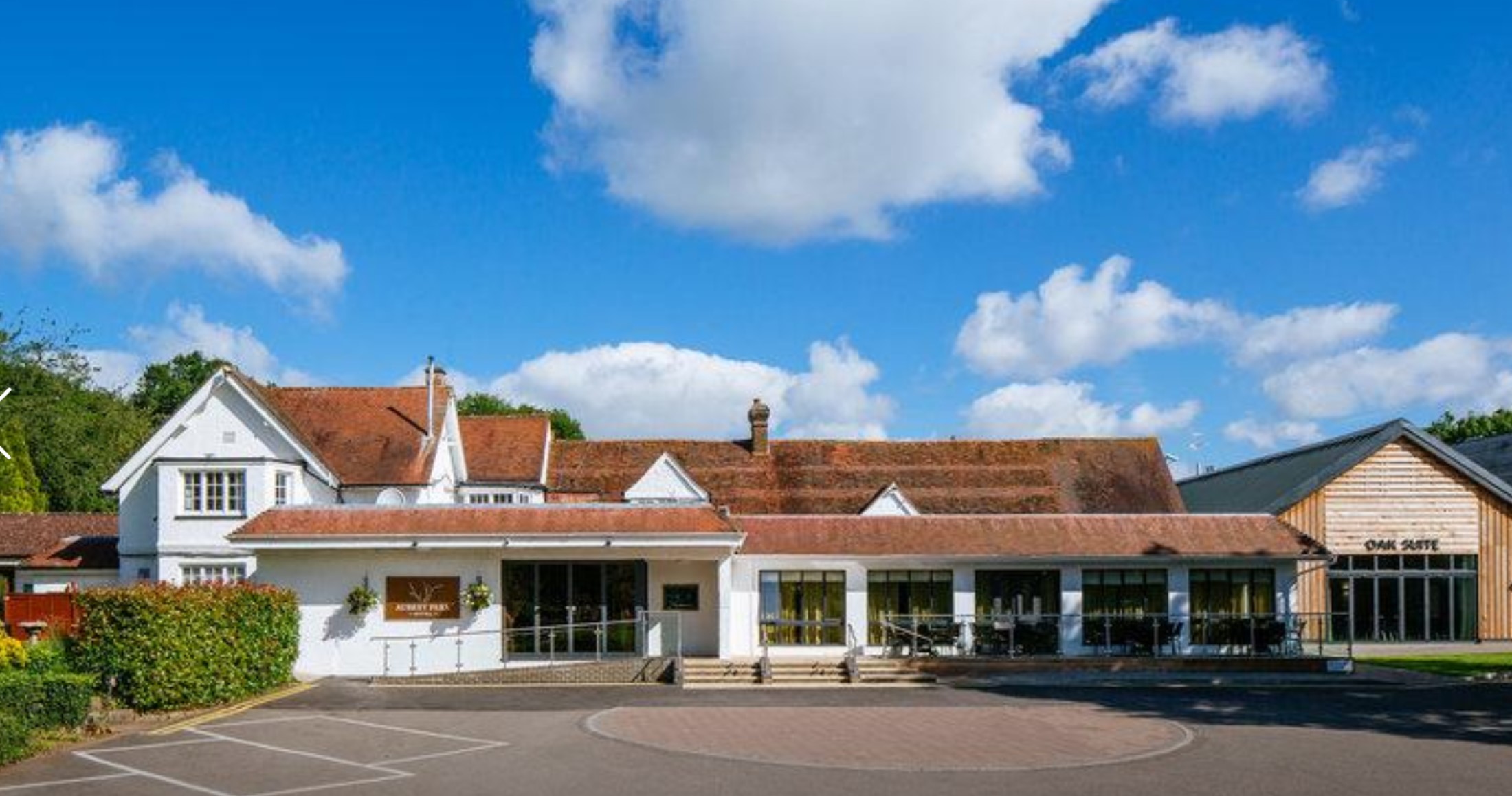
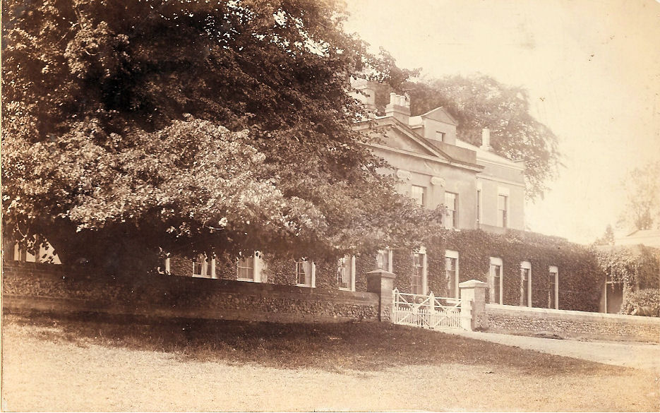
Aubrey Park, Redbourn in Hertfordshire is a building of historical significance and is listed on the English Heritage Register. Parts of the building date back to the 16th and 17th centuries and the site on which it is located may have its origins in the 13th century. Today it is a hotel which provides accommodation, restaurant facilities and caters for special events including weddings. Owners of Aubrey Park Aubrey Park was previously called Foster's Farm and it seems that during the 17th century it was owned by the Carpenter family who were wealthy Redbourn residents possessing large areas of land. Until 1640 they lived at Revel End which is adjacent to Foster's farm. They then built Redbourn House in the early 18th century. The Carpenter family named the eldest son George for five generations and all lived in or around the village. George Carpenter (1713–1782) who was the last of the line had an only child named Mary Elizabeth Carpenter (1783–1811). She was his sole heir. ... [...More Info...] [...Related Items...] OR: [Wikipedia] [Google] [Baidu] |
St Mary's Church, Redbourn
St Mary's Church is an active Grade I listed parish church in the Church of England in Redbourn, Hertfordshire, England. The building is Grade I listed. History The church dates from the 12th century, the oldest parts being the nave and west tower. The north aisle was added around 1140 and the chancel in 1340. The south aisle was built in the mid 14th century, the south chapel and porch between 1444 and 1455. The clerestory was added around 1478. The east window was installed in 1886 in memory of Rev. W. Serocold Wade and was designed by Mayor of London and Munich. Memorials The church contains memorials to *Sir Richard Rede (d. 1576) *Richard Peacock (d. 1512) *Eignon Bignon and his wife (1717) Organ The church contains a pipe organ originally dating from 1888 by Forster and Andrews. This was rebuilt in 1932 by Roy Huntingford and in 1961 by Arnold, Williamson and Hyatt. The last restoration was in 2005 by Vincent Woodstock. A specification of the organ can be found on th ... [...More Info...] [...Related Items...] OR: [Wikipedia] [Google] [Baidu] |
River Ver
The Ver is a long chalk stream in Hertfordshire, England. It is a tributary of the River Colne, Hertfordshire, River Colne. Course The source is in the grounds of Lynch Lodge, Kensworth Lynch on the west side of the A5 trunk road and stays on the west side for some half mile or so. It then crosses through a culvert into Markyate Cell, afterwards crosses under the A5 road (Great Britain), A5 in culvert and runs through Markyate. The river exits above ground at the southern end of Markyate, and on through Flamstead, Redbourn, St Albans and Park Street, Hertfordshire, Park Street, finally joining the River Colne at Bricket Wood. The Ver is a chalk stream, which is partly a seasonal winterbourne (stream), winterbourne north of Redbourn. However, many of its natural features have been compromised as a result of being canalised during the construction of the artificial lakes at Verulamium Park in St Albans in the 1930s following the archaeology, archaeological excavations of Verul ... [...More Info...] [...Related Items...] OR: [Wikipedia] [Google] [Baidu] |
Saint Amphibalus
Amphibalus is a venerated early Christian priest said to have converted Saint Alban to Christianity. He occupied a place in British hagiography almost as revered as Alban himself. According to many hagiographical accounts, including those of Gildas, Bede, Geoffrey of Monmouth, and Matthew of Paris, Amphibalus was a Roman Christian fleeing religious persecution under Emperor Diocletian. Amphibalus was offered shelter by Alban in the Roman city of Verulamium, in modern-day England. Alban was so impressed with the priest's faith and teaching that he began to emulate him in worship, and eventually became a Christian himself. When Roman soldiers came to seize Amphibalus, Alban put on Amphibalus' robes and was punished in his place. According to Matthew Paris, after Alban's martyrdom, the Romans eventually caught and martyred Amphibalus as well. Name and authenticity Gildas (), Bede () and the three texts of Alban's ''Passio,'' going back as far as the 5th century, do not name Amphibal ... [...More Info...] [...Related Items...] OR: [Wikipedia] [Google] [Baidu] |
Richard Reade
Sir Richard Reade (1511–1576) was an English-born judge in sixteenth-century Ireland, who held the office of Lord Chancellor of Ireland. Background and early career He was born at Nether Wallop in Hampshire, second son of Richard Reade (died 1555), Lord of the Manor of Wallop, and his wife Margaret. He was educated at Winchester College and New College, Oxford, where he became a fellow in 1528. He took the degrees of Bachelor of Civil Law at Oxford in 1537 and Doctor of Civil Law at the same university in 1540.Gregg, p. 253 He quickly acquired a reputation as "a man of learning and experience". He was made a Master of Chancery and undertook a crucial trade mission to Flanders.Ball, F. Elrington. ''The Judges in Ireland 1221-1921''. London: John Murray, 1926 He was knighted in 1544. Lord Chancellor of Ireland and later life In 1546 Sir John Alan, the Lord Chancellor of Ireland, was removed from office on a charge of corruption, and Reade was sent to Ireland to replace hi ... [...More Info...] [...Related Items...] OR: [Wikipedia] [Google] [Baidu] |
City Of St Albans
St Albans (), also known as the City and District of St Albans, is a non-metropolitan district with both borough and city status in Hertfordshire, England. Its council is based in St Albans, the largest settlement in the district. The district also includes the town of Harpenden and several villages. The district borders North Hertfordshire, Welwyn Hatfield, Hertsmere, Watford, Three Rivers, Dacorum, and Central Bedfordshire. History The town of St Albans had been an ancient borough since 1553. It was reformed in 1836 to become a municipal borough and additionally gained city status in 1877. The modern St Albans district was created on 1 April 1974 under the Local Government Act 1972, covering the area of three former districts, which were all abolished at the same time: *Harpenden Urban District *St Albans Municipal Borough * St Albans Rural District (except the part within the designated area of Hemel Hempstead New Town, which went to Dacorum.) The new district was nam ... [...More Info...] [...Related Items...] OR: [Wikipedia] [Google] [Baidu] |
Harpenden
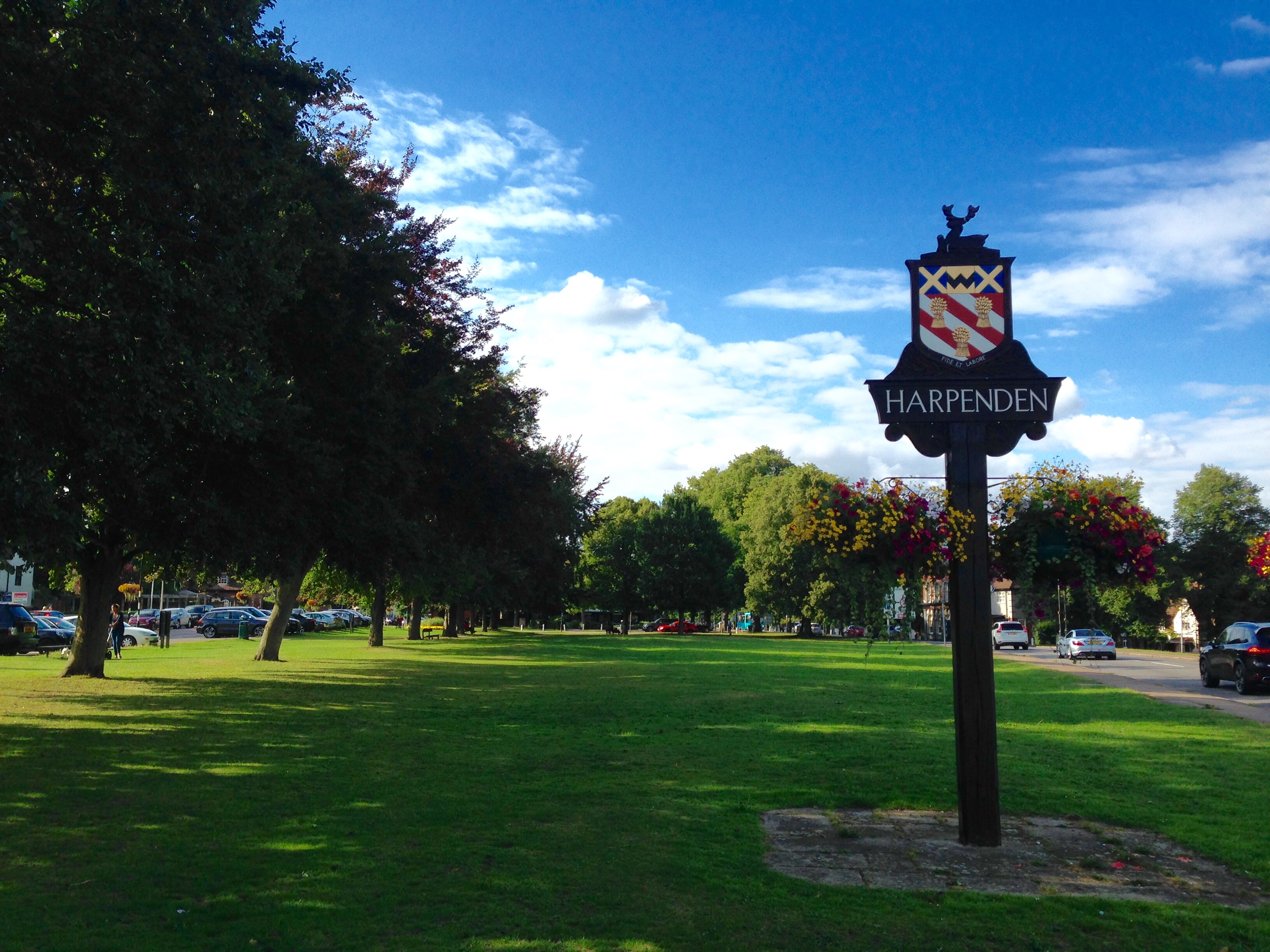
Harpenden () is a town and civil parish in the City and District of St Albans in the county of Hertfordshire, England. The population of the built-up area was 30,674 in the 2021 census, while the population of the civil parish was 31,128. Harpenden is a commuter town, with a direct rail connection to Central London. History There is evidence of pre-Roman Belgae, Belgic farmers in the area. In 1867, several items were found including a bronze escutcheon (heraldry), escutcheon, rams-head shaped mounts, and a bronze bowl. There are Ancient Rome, Roman remains in land around Harpenden, such as the site of a mausoleum in the park at Rothamsted. A tumulus near the river Lea was opened in the 1820s and it contained a stone sarcophagus of Romano-Celtic origin. Five objects dating from around 150 AD, were inside, including a glass jug with a Mediterranean stamp and samian ware dishes used for libations. Up to the 13th century, the area of the parish consisted of woodland with sm ... [...More Info...] [...Related Items...] OR: [Wikipedia] [Google] [Baidu] |
Hemel Hempstead
Hemel Hempstead () is a town in the Dacorum district in Hertfordshire, England. It is located north-west of London; nearby towns and cities include Watford, St Albans and Berkhamsted. The population at the 2021 United Kingdom census, 2021 census was 95,961. Hemel Hempstead has existed since at least the 8th century and was granted its Royal charter, town charter by Henry VIII in 1539. However, it has expanded and developed in recent decades after being designated as a New towns in the United Kingdom, new town after the end of the Second World War. History Origin of the name The Human settlement, settlement was called Henamsted or Hean-Hempsted in Anglo-Saxon times and Hemel-Amstede by the time of William the Conqueror. The name is referred to in the Domesday Book as Hamelamestede, but in later centuries it became Hamelhamsted, and, possibly, Hemlamstede. In Old English, ''-stead'' or ''-stede'' simply meant "place" (reflected in German ''Stadt'' and Dutch ''stede'' or ''sta ... [...More Info...] [...Related Items...] OR: [Wikipedia] [Google] [Baidu] |
St Albans
St Albans () is a cathedral city in Hertfordshire, England, east of Hemel Hempstead and west of Hatfield, Hertfordshire, Hatfield, north-west of London, south-west of Welwyn Garden City and south-east of Luton. St Albans was the first major town on the old Roman Britain, Roman road of Watling Street for travellers heading north and became the city of Verulamium. It is within the London commuter belt and the Greater London Built-up Area. Name St Albans takes its name from the first British saint, Saint Alban, Alban. The most elaborate version of his story, in Bede's ''Ecclesiastical History of the English People'', relates that he lived in Verulamium, sometime during the 3rd or 4th century, when Christians were suffering persecution. Alban met a Christian priest fleeing from his persecutors and sheltered him in his house, where he became so impressed with the priest's piety that he converted to Christianity. When the authorities searched Alban's house, he put on the priest's ... [...More Info...] [...Related Items...] OR: [Wikipedia] [Google] [Baidu] |
Hertfordshire
Hertfordshire ( or ; often abbreviated Herts) is a ceremonial county in the East of England and one of the home counties. It borders Bedfordshire to the north-west, Cambridgeshire to the north-east, Essex to the east, Greater London to the south and Buckinghamshire to the west. The largest settlement is Watford, and the county town is Hertford. The county has an area of and had a population of 1,198,800 at the 2021 census. After Watford (131,325), the largest settlements are Hemel Hempstead (95,985), Stevenage (94,470) and the city of St Albans (75,540). For local government purposes Hertfordshire is a non-metropolitan county with ten districts beneath Hertfordshire County Council. Elevations are higher in the north and west, reaching more than in the Chilterns near Tring. The county centres on the headwaters and upper valleys of the rivers Lea and the Colne; both flow south and each is accompanied by a canal. Hertfordshire's undeveloped land is mainly agricultural ... [...More Info...] [...Related Items...] OR: [Wikipedia] [Google] [Baidu] |
Harpenden And Berkhamsted (UK Parliament Constituency)
Harpenden and Berkhamsted is a constituency of the House of Commons in the UK Parliament. It was established by the 2023 periodic review of Westminster constituencies and was first contested at the 2024 general election. It is represented by Victoria Collins of the Liberal Democrats. Constituency profile This is a generally affluent seat with low deprivation and high incomes, facilitated by two railway lines to Central London. Boundaries The constituency is composed of the following electoral wards: * The Borough of Dacorum wards of Aldbury and Wigginton, Ashridge, Berkhamsted Castle, Berkhamsted East, Berkhamsted West, Northchurch, Tring Central, Tring East, Tring West and Rural, and Watling. * The City of St Albans wards of Harpenden East, Harpenden North & Rural, Harpenden South, Harpenden West, Marshalswick East & Jersey Farm (part), Redbourn, Sandridge & Wheathampstead, and parts of the Marshalswick West, St Stephen and Verulam wards. It covers the following areas: * ... [...More Info...] [...Related Items...] OR: [Wikipedia] [Google] [Baidu] |


