|
Rayalaseema
Rayalaseema (IAST: ''Rāyalasīma'') is a geographic region in the Indian state of Andhra Pradesh. It comprises four southern districts of the State, from prior to the districts reorganisation in 2022, namely Kurnool, Anantapur, Kadapa, and Chittoor. Four new districts were created from these, namely Sri Sathya Sai, Nandyal, Annamayya, and Tirupati. As of 2011 census of India, the western four districts (before the district realignment) of the region had a population of 15,184,908 and cover an area of . Etymology The region was previously called ''Ceded districts'' during the rule of the British Raj. This is with reference to the time when the Nizam of Hyderabad, Ali Khan, ceded the region to the British as a part of subsidiary alliance. Chilukuri Narayana Rao, a Telugu lecturer and activist from Anantapur, deemed the term "ceded" as derogatory and coined the term ''Rayalaseema''. In the Andhra Mahasabha and Ceded Districts Conference held at Nandyala in November 1928 ... [...More Info...] [...Related Items...] OR: [Wikipedia] [Google] [Baidu] |
Andhra Pradesh
Andhra Pradesh (ISO 15919, ISO: , , AP) is a States and union territories of India, state on the East Coast of India, east coast of southern India. It is the List of states and union territories of India by area, seventh-largest state and the List of states and union territories of India by population, tenth-most populous in the country. Telugu language, Telugu is the most widely spoken language in the state, as well as its official language. Amaravati is the state capital, while the largest city is Visakhapatnam. Andhra Pradesh shares borders with Odisha to the northeast, Chhattisgarh to the north, Karnataka to the southwest, Tamil Nadu to the south, Telangana to northwest and the Bay of Bengal to the east. It has the Coastline of Andhra Pradesh, third-longest coastline in India at about . Archaeological evidence indicates that Andhra Pradesh has been continuously inhabited for over 247,000 years, from early archaic Hominini, hominins to Neolithic settlements. The earliest r ... [...More Info...] [...Related Items...] OR: [Wikipedia] [Google] [Baidu] |
Kurnool
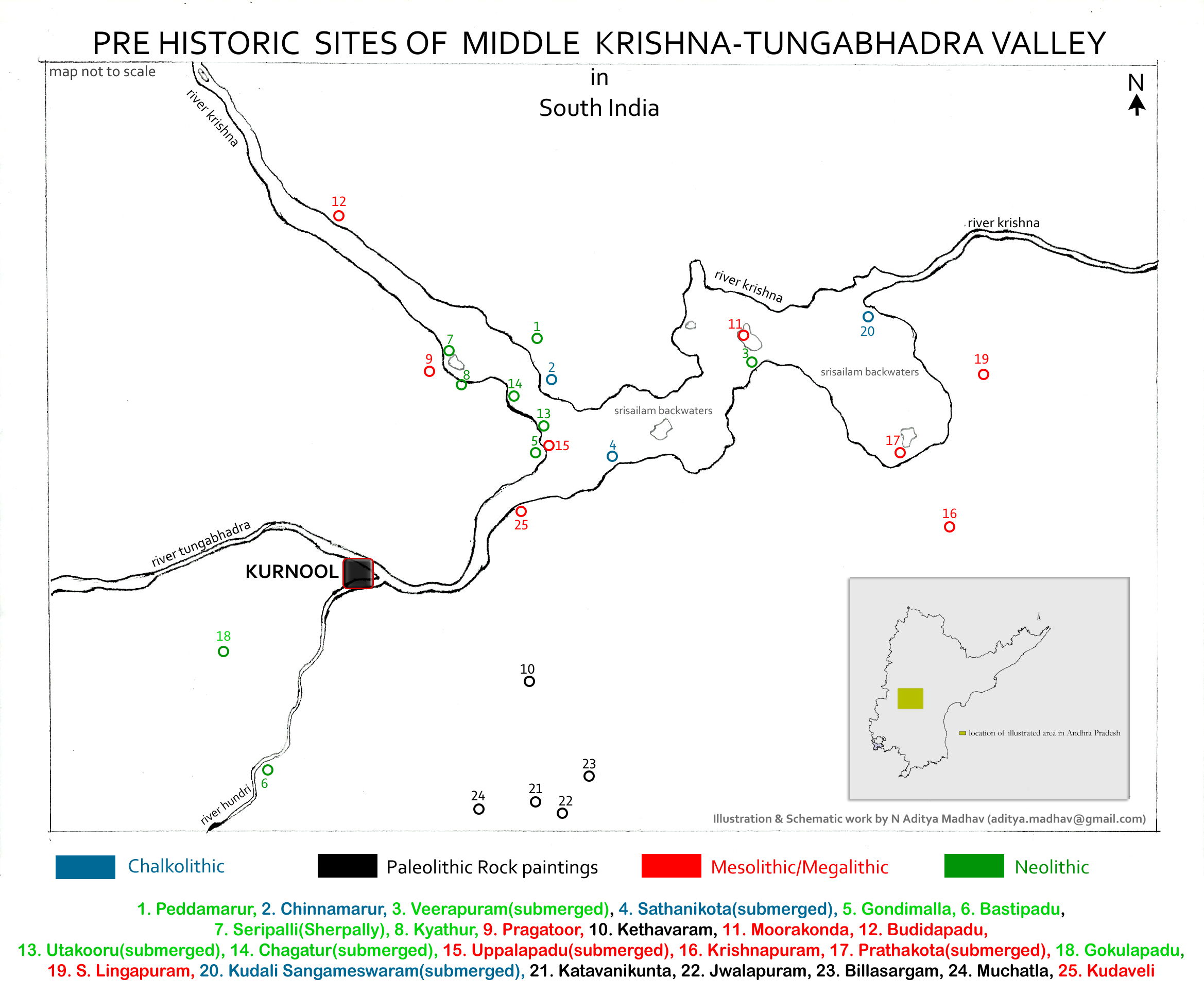
Kurnool is a city in the state of Andhra Pradesh, India. It formerly served as the capital of Andhra State (1953–1956). The city is often referred to as "The Gateway of Rayalaseema". Kurnool is also famous for Diamond hunting as diamonds can be found in the barren land of Kurnool after the top layers of soil are washed away by the monsoon rains. It also serves as the district headquarters of its Kurnool district. census, it is the fifth most populous city in the state with a population of 425,214. It is located on the banks of the Tungabhadra river. Although the area has been inhabited for thousands of years, modern Kurnool was founded in the 16th century CE with the construction of the Konda Reddy Fort. Etymology The original name of Kurnool is found in historical records as ''Kandanavōlu'' or ''Kandanōlu''. It used to be a crossing on the Tungabhadra River, where the bullock cart caravans are believed to have greased their wheels ("''kandana''" being a reference ... [...More Info...] [...Related Items...] OR: [Wikipedia] [Google] [Baidu] |
YSR Kadapa District
YSR Kadapa district is one of the twenty six districts in the Indian state of Andhra Pradesh. In the 2022 reorganisation of Andhra Pradesh districts, the district boundary was largely restricted to the Kadapa parliamentary constituency area. It is one of the eight districts in the Rayalaseema region. Kadapa is the administrative headquarters for this district. Barytes, limestone, asbestos and uranium are major mineral resources of the district. The district is home to many religious and historic places of interest. Kodandarama Temple, Vontimitta, Kodandarama Temple at Vontimetta, Chennakesava temple of Pushpagiri Temple Complex, Pushpagiri, Siddavatam , Siddavatam Fort and Gandikota , Gandikota gorge are some of the famous places. Etymology The old records of the district reveal that Kadapa was previously called ''Gadapa'' which translated in Telugu to ''threshold''. The ancient village of Kadapa with its large tank and temple of Lord Venkateswara at Devuni Kadapa was a conv ... [...More Info...] [...Related Items...] OR: [Wikipedia] [Google] [Baidu] |
Kurnool District
Kurnool district is one of the eight districts in the Rayalaseema region of the Indian state of Andhra Pradesh after the districts are reorganised in April 2022. It is located in the north western part of the state and is bounded by Nandyal district in the east, Anantapur district in the south, Raichur district of Karnataka in the northwest, Bellary district of Karnataka in the west, and Jogulamba Gadwal district of Telangana in the north. It has a population of 2,271,686 based on the 2011 census. The city of Kurnool is the headquarters of the district. Konda Reddy Fort, Mantralayam and Orvakal Rock Garden, Kurnool are tourist places of interest in the district. Etymology The name Kurnool was originally called "Kandenavolu". In the 11th century CE, the Oddera community engaged in construction activity used this place as a halting place for greasing their cartwheels with oil, before crossing the Tungabhadra river. The carts carried loads of stones for temple constructio ... [...More Info...] [...Related Items...] OR: [Wikipedia] [Google] [Baidu] |
Tirupati District
Tirupati district () is one of the eight districts of Rayalaseema region in the Indian state of Andhra Pradesh.The district headquarters is located at Tirupati city. This district is known for its numerous historic temples, including the Hindu shrine of Venkateswara Temple, Tirumala, Tirumala Venkateswara Temple and Srikalahasteeswara temple, Sri Kalahasteeswara temple. The district is also home to Satish Dhawan Space Centre (formerly Sriharikota Range), a rocket launch centre located in Sriharikota. The district is an educational hub and has central and state universities and institutes including IISER TirupatiIIT Tirupati, , IIT Tirupati, Sri Venkateswara University, National Sanskrit University, IIIT Sri City. Sri Venkateswara Institute of Medical sciences (SVIMS), Sri Padmavati Mahila Visvavidyalayam, Sri Venkateswara Vedic University, Sri Venkateswara Veterinary University, Sri Venkateswara Agriculture College, Sri Padmavati Women's Medical College, Sri Venkateswara Ayurved ... [...More Info...] [...Related Items...] OR: [Wikipedia] [Google] [Baidu] |
Anantapuramu District
Anantapur district, officially Ananthapuramu district, is one of the eight districts in the Rayalaseema region of the States and union territories of India, Indian state of Andhra Pradesh. The district headquarters is located in Anantapur city. It is one of the driest places in South India. In the year 2022, as part of re-organisation of districts, Sri Sathya Sai district was carved out. Etymology The name Anantapuramu was named after a reservoir called ''Anantasagaram'', a big tank, which means "Endless Ocean". The villages of Ananthasagaram and Bukkarayasamudram were constructed by Chikkappa Wadeyar, the minister of Bukka Raya I. Some authorities assert that Anaantasagaram was named after ''Ananthamma'', wife of Bukka Raya I, one of the founders of the Vijayanagar empire. , while some contend that it must have been known after Anantarasa Chikkavodeya himself, as Bukka-Raya had no queen by that name. History Gooty Fort, a major fort in the medieval history of the region ... [...More Info...] [...Related Items...] OR: [Wikipedia] [Google] [Baidu] |
Anantapur District
Anantapur district, officially Ananthapuramu district, is one of the eight districts in the Rayalaseema region of the Indian state of Andhra Pradesh. The district headquarters is located in Anantapur city. It is one of the driest places in South India. In the year 2022, as part of re-organisation of districts, Sri Sathya Sai district was carved out. Etymology The name Anantapuramu was named after a reservoir called ''Anantasagaram'', a big tank, which means "Endless Ocean". The villages of Ananthasagaram and Bukkarayasamudram were constructed by Chikkappa Wadeyar, the minister of Bukka Raya I. Some authorities assert that Anaantasagaram was named after ''Ananthamma'', wife of Bukka Raya I, one of the founders of the Vijayanagar empire. , while some contend that it must have been known after Anantarasa Chikkavodeya himself, as Bukka-Raya had no queen by that name. History Gooty Fort, a major fort in the medieval history of the region was a stronghold of the Marathas, ... [...More Info...] [...Related Items...] OR: [Wikipedia] [Google] [Baidu] |
Sri Sathya Sai District
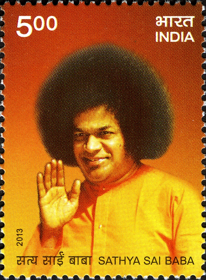
Sri Sathya Sai district is a district in the Indian state of Andhra Pradesh. Its headquarters is at Puttaparthi. It was formed on 4 April 2022 from parts of the erstwhile Anantapur district. Etymology This district is named after Indian Guru Sri Sathya Sai Baba, who contributed to improving the infrastructure of the Rayalaseema region by building schools, university, free healthcare institutions and drinking water projects. History Sri Sathya Sai district was formed on 4 April 2022 from the Dharmavaram revenue division, Dharmavaram, Penukonda revenue division, Penukonda, Kadiri revenue division, Kadiri revenue divisions of erstwhile Anantapur district. A new Puttaparthi revenue division is created as part of the formation. Geography This district is bounded on the North by Anantapur district, on the East by Annamayya district and Kadapa district and on the West and South West by Chitradurga district, Chitradurga, Tumakuru district, Tumakuru, Chikkaballapura district, Chik ... [...More Info...] [...Related Items...] OR: [Wikipedia] [Google] [Baidu] |
Nandyal District
Nandyal district is a district in the Indian state of Andhra Pradesh with Nandyal as its administrative headquarters, it was formed on 4 April 2022 to become one of the resultant 26 districts. It is part of the Rayalaseema region. The district consists of Nandyal revenue division and a newly formed Dhone revenue division and Atmakur revenue division from Kurnool district. Etymology The district derived its name from its headquarters Nandyal. History Belum Caves are geologically and historically important caves in the district. There are indications that Jain and Buddhist monks were occupying these caves centuries ago. Many Buddhists relics were found inside the caves. These relics are now housed in Museum at Anantapur. Archaeological survey of India (ASI) found remnants of vessels and other artifacts of pre-Buddhist era and has dated the remnants of vessels found in the caves to 4500 BC. [...More Info...] [...Related Items...] OR: [Wikipedia] [Google] [Baidu] |
Telugu Language
Telugu (; , ) is a Dravidian languages, Dravidian language native to the Indian states of Andhra Pradesh and Telangana, where it is also the official language. Spoken by about 96 million people (2022), Telugu is the most widely spoken member of the Dravidian language family, and one of the twenty-two Languages with legal status in India, scheduled languages of the Republic of India. It is one of the few languages that has primary official status in more than one States and union territories of India, Indian state, alongside Hindi and Bengali language, Bengali. Telugu is one of the languages designated as a Classical Languages of India, classical language by the Government of India. It is the 14th most spoken native language in the world.Statistics in Modern Standard Telugu is based on the dialect of erstwhile Krishna, Guntur, East Godavari and ... [...More Info...] [...Related Items...] OR: [Wikipedia] [Google] [Baidu] |
Kadapa
Kadapa is a city in the southern part of Andhra Pradesh, India. It is located in the Rayalaseema region, and is the district headquarters of YSR Kadapa district. It is located south of the Penna River. The city is surrounded on three sides by the Nallamala and Palkonda Hills lying on the tectonic landscape between the Eastern and Western ghats. Black and red ferrous soils occupy the region. The city is nicknamed "Gadapa" ('threshold') since it is the gateway from the west to the hills of Tirumala. Kadapa has been under different rulers in its history, including the Cholas, the Vijayanagara Empire and Kingdom of Mysore. Etymology The city's name originated from the Telugu language, Telugu word "Gadapa" meaning threshold or gate. It acquired this name with its relation to the Venkateswara Temple, Tirumala; one had to pass through this city in the olden days to reach Venkateswara Temple, Tirumala. In Telugu, the word Gadapa means a threshold and over time, the name evolved i ... [...More Info...] [...Related Items...] OR: [Wikipedia] [Google] [Baidu] |


