|
Pamba River
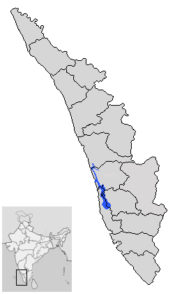
The Pamba River (also called Pampa River) is the longest river in the Indian state of Kerala after Periyar (river), Periyar and Bharathappuzha, and the longest river in the erstwhile former princely state of Travancore. The Sabarimala Temple, dedicated to Ayyappa, Lord Ayyappa, is located on the banks of the river Pamba. The River Pamba enriches the lands of Pathanamthitta District, Pathanamthitta district and the Kuttanad area of Alappuzha District, Alappuzha district and Kottayam Course The Pamba originates at the Pulachimalai Hill in the Peerumedu Plateau in the Western Ghats at an altitude of . Starting from the Idukki district and traversing a distance of through Pathanamthitta and Alappuzha districts, the river joins the Arabian Sea through a number of channels. The basin extends over an area of with the entire catchment area within Kerala state. The basin is bounded on the east by the Western Ghats and on the west by the Arabian Sea. The river shares its northern boun ... [...More Info...] [...Related Items...] OR: [Wikipedia] [Google] [Baidu] |
Vembanad Lake
Vembanad () is the longest lake in India, and the largest in the state of Kerala. The lake has an area of 2,033 square kilometers and a maximum length of 96.5 km. Spanning three districts in the state of Kerala, it is known as Vembanad Lake in Kottayam, Vaikom, Changanassery, Punnamada Lake in Alappuzha, Punnappra, Kuttanadu and Kochi Lake in Kochi. Several groups of small islands including Vypin, Mulavukad, Maradu, Udayamperoor, Vallarpadam, and Willingdon Island are located in the Kochi Lake portion. Kochi Port is built around Willingdon Island and Vallarpadam island. Kuttanad, also known as ''The Rice Bowl of Kerala'', has the lowest altitude in India, and is also one of the few places in world where cultivation takes place below sea level. Kuttanad lies on the southern portion of Vembanad. The Nehru Trophy Boat Race is conducted in a portion of the lake. High levels of pollution have been noticed at certain hotspots of the Vembanad backwaters. The Governmen ... [...More Info...] [...Related Items...] OR: [Wikipedia] [Google] [Baidu] |
Aranmula
Aranmula is a temple town in the state of Kerala, India. It is known as the cultural capital of Pathanamthitta district, located at a distance of around 116 km from Trivandrum, the capital of Kerala, it is situated on the banks of the river Pampa. A centre of pilgrimage from time immemorial and a trade post of eminence, when the river was the chief means of transport, it is near Kozhencherry in Pathanamthitta District. It is easily accessible from Chengannur railway station (10km). It is one of the Fastest Growing Village. Aranmula, along with the majority of Pathanamthitta district, was part of the Central Division (Travancore), Quilon division or Central Travancore division of Travancore. On November 1, 1982, Pathanamthitta district, Pathanamthitta district was established. Tourism Aranmula is famous for the tourist attraction 'Vallam Kali', (Snakeboat regatta). Aranmula is a global heritage site enlisted by the United Nations. It is a sacred site for the Hindus an ... [...More Info...] [...Related Items...] OR: [Wikipedia] [Google] [Baidu] |
Maramon
Maramon is a small village on the Pampa River in Thiruvalla taluk & Thiruvalla Revenue Division of Pathanamthitta district in the state of Kerala, India. The nearest railway station is at chengannur (13 km) & Thiruvalla (16 km) Maramon is about 16 km from the Thiruvalla. The ''T.K.Road'' (Thiruvalla-Kumbazha Road/SH-7) connects the town to other major towns. The nearest airports are Cochin International Airport and Trivandrum International Airport. Maramon Convention Maramon is famous because of the Maramon Convention, the largest Christian gathering in Asia. Maramon is said to be the birthplace of Mar Thoma Syrian Church. Villages The following villages form a part of Maramon:- #Nedumprayar #Chettimukku #Chalaikara #Thottapuzhassery. #Kurianoor Transport The M. K. Road (Mavelikkara-Chengannur -Kozhencherry Road/SH-10) connects the town to other major towns. The T. K. Road (Thiruvalla- -Kumbazha Road/SH-07) connects the town to other major towns. Rail Co ... [...More Info...] [...Related Items...] OR: [Wikipedia] [Google] [Baidu] |
Kozhencherry
Kozhencherry is a census town in Pathanamthitta district of South Central Kerala in Kerala state, India. census, the population was 12,021 of which 5,594 are males while 6,427 are females. Etymology The name ''Kozhencherry'' is believed to have originated from the Malayalam word “Kovilancheri,” which refers to a settlement near a temple in the banks of river. Over time, the name evolved into Kozhencherry. History Kozhencherry is located in central Travancore and at the heart of Pathanamthitta District. It lies along the banks of the sacred Pampa River, which originates from Sabarimala, and is surrounded by hills and lush green valleys. The town's history is deeply intertwined with that of Central Travancore State. Historically, Kozhencherry was one of the five major towns in the former state of Travancore. The land of Kozhencherry is highly fertile, supporting the cultivation of plantations, paddy, tapioca, coconut, rubber, pepper, sugarcane, vegetables, spices, and more. ... [...More Info...] [...Related Items...] OR: [Wikipedia] [Google] [Baidu] |
Keezhukara
Keezhukara, a small village in Pathanamthitta Pathanamthitta (), is a municipality, city in southern Kerala, India, spread over an area of . It is the administrative capital of Pathanamthitta district. The town has a population of 37,538 (as of 2011 census). The Hindu pilgrim centre Sab ... district, is about 135 km from Thiruvanandapuram, capital city of Kerala, India. It is on latitude 9.349 N and longitude 76.705 E. Pampa River is on the north and west. Kozhencherry is in the south and Melukara in the east. The interior is hilly but the riverine land is flat, fertile and arable. The population of Keezhukara in 2008 was 1211 in 292 households.Kozhencherry Panchayat Reports References {{Pathanamthitta district Villages in Pathanamthitta district ... [...More Info...] [...Related Items...] OR: [Wikipedia] [Google] [Baidu] |
Cherukole
Cherukole is a village in Pathanamthitta district in the state of Kerala, India. Demographics India census, Cherukole had a population of 13,048 with 6,200 males and 6,848 females. See also * Ranni * Keekozhur * Pathanamthitta district Pathanamthitta District (), is one of the List of districts of Kerala, 14 districts in the States and union territories of India, Indian state of Kerala. The district headquarters is in the town of Pathanamthitta. There are four municipalitie ... References Villages in Pathanamthitta district {{Pathanamthitta-geo-stub ... [...More Info...] [...Related Items...] OR: [Wikipedia] [Google] [Baidu] |
Ayroor
Ayroor (also spelled Ayiroor) is a village near Thiruvalla, located in the western part of Ranni taluk, in the Pathanamthitta district in Kerala state, India. It is bordered by hills and located near the Western Ghats. Ayroor was previously part of Thiruvalla taluk in Alappuzha district and is considered part of the Edanadu region in Kerala. The Pamba River flows on the southern side of the village. Tourism The Pamba River and the surrounding hills make Ayiroor a picturesque location in central Travancore. Residents of Ayiroor cultivate coconut, rubber, cocoa, tapioca, plantains, cinnamon, pepper, nutmeg, vanilla, rambutan and other crops, making the per capita income of the residents higher than the state average. The nearest airports are the Cochin International Airport, located 127 kilometers away, and Thiruvananthapuram International Airport, 120 kilometers away. One of the highlights of Ayroor is the ''Cherukolpuzha Hindu Parishad'', a religious festival that is held ... [...More Info...] [...Related Items...] OR: [Wikipedia] [Google] [Baidu] |
Ranni, Kerala
Ranni (or Ranny) is a town in the Pathanamthitta district of Kerala, India, and the 16th largest Taluk, ''taluk'' in the state. The town is situated on both sides of the Pamba River, Pamba River. It falls under the Thiruvalla Revenue Division and is located 27 km from Tiruvalla railway station, Thiruvalla railway station and NH 183 in Thiruvalla. Etymology The name ''Ranni'' is derived from a word in Malayalam which means "Queen", or ''Rani''. The town is known as "The Queen of the Eastern Hill Lands" (മലനാടിന്റെ റാണി). History The history of Ranni can be traced back 5000 years to the early settlement of Adi Dravidans around Sabarimala and Nilakkal. An ancient trade route used to pass through Nilackal between Kerala and the Pandya dynasty, Pandian kingdom. The former rulers of Ranni were known as the Ranni Karthas or the Karthkal of Ranni, the "Samanthas" and blood-related family of Thekkamamkoor Raja. In the 18th century, Anizham Thirunal Mart ... [...More Info...] [...Related Items...] OR: [Wikipedia] [Google] [Baidu] |
Vadasserikkara
Vadaserikara is a village in Pathanamthitta district, in the state of Kerala, India. It is one of the 11 villages in Ranni taluk with an area of 6007 hectares. The nearest railway station is Chengannur located at a distance of and sits at the confluence of the Pamba and Kallar River. The village is located on the main trunk road to Sabarimala–the Pathanamthitta-Pampa Highway and is a stopover for pilgrims on the way to Sabarimala, the abode of Lord Ayyappa, a pilgrim centre that attracts millions of Ayyappa devotees. It lies from Kumplampoika and about from Ranni. The Pathanamthitta- Seethathodu road also pass through Vadasserikkara. Marthoma Christians and Orthodox form the majority of the population. The village has seen much growth since the 1990s. One of the biggest bridges in the district is at Benglavkadavu. Demographics India census, Vadaserikara had a population of 22,580 with 11,082 males and 11,498 females. Electricity supply 33kV Substation, Peruna ... [...More Info...] [...Related Items...] OR: [Wikipedia] [Google] [Baidu] |


