|
Nahuel Huapi National Park
Nahuel Huapi National Park () is the oldest National Parks of Argentina, national park in Argentina, established in 1922 as Parque Nacional de Sud and reconfiguered in 1934. It surrounds Nahuel Huapi Lake in the foothills of the Patagonian Andes. The largest of the national parks in the region, it has an area of , or nearly 2 million acres. Its landscapes represent the north Patagonian Andean Zone consisting of three types, namely, the Altoandino (with perpetual snow above an altitude of ), the Bosque Andino Patagónico, Andino-Patagónico (in the lower reaches of the hills) and the Patagonian Desert. It also represents small parts of the Valdivian temperate rain forest, Valdivian Rainforest. The park and the reserve lie at an altitude of , and are designated under International Union for Conservation of Nature, IUCN management categories II (National Park) and IV (Management Reserve). The park is completely protected while the reserve is partially protected. The national park is ... [...More Info...] [...Related Items...] OR: [Wikipedia] [Google] [Baidu] |
Río Negro Province
Río Negro (, ''Black River'') is a province of Argentina, located in northern Patagonia. Neighboring provinces are from the south clockwise Chubut, Neuquén, Mendoza, La Pampa and Buenos Aires. To the east lies the Atlantic Ocean. Its capital is Viedma near the Atlantic outlet of the province's namesake river in the eastern extreme. The largest city is in the Andean foothills Bariloche in the far west. Other important cities include General Roca and Cipolletti. History Ferdinand Magellan was the first European explorer to visit the coasts of the provinces in 1520. Italian priest Nicolás Mascardi founded the Jesuit mission ''Nuestra Señora de Nahuel Huapi'' in 1670 at the shore of the Nahuel Huapi Lake, at the feet of the Andes range. Originally part of the Argentine territory called Patagonia (in 1878 the ''Gobernación de la Patagonia''), in 1884 it was organised into the ''Territorio Nacional del Río Negro'' and General Lorenzo Vintter was appointed as the ... [...More Info...] [...Related Items...] OR: [Wikipedia] [Google] [Baidu] |
Conquest Of Chile
The Conquest of Chile is a period in Chilean history that starts with the arrival of Pedro de Valdivia to Chile in 1541 and ends with the death of Martín García Óñez de Loyola in the Battle of Curalaba in 1598, and the subsequent destruction of the Seven Cities in 1598–1604 in the Araucanía region. This was the period of Spanish conquest of territories, founding of cities, establishment of the Captaincy General of Chile, and defeats ending its further colonial expansion southwards. The initial conflict with the Mapuche extended well beyond the conquest period becoming known as the Arauco War, and the Spanish were never able to reassert control in Araucanía south of the Bío Bío River. Spanish conquerors entering Chile were accompanied by thousands of yanakuna from the already subdued territories of the Inca Empire as well by a few African slaves. In the first years of the period the Spanish in Chile gained a reputation of being poorly dressed among the Spanish in Per ... [...More Info...] [...Related Items...] OR: [Wikipedia] [Google] [Baidu] |
Mapuche
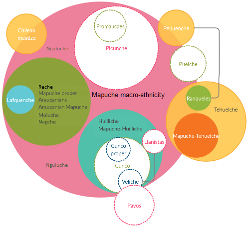
The Mapuche ( , ) also known as Araucanians are a group of Indigenous peoples of the Americas, Indigenous inhabitants of south-central Chile and southwestern Argentina, including parts of Patagonia. The collective term refers to a wide-ranging ethnicity composed of various groups who share a common social, religious, and economic structure, as well as a common linguistic heritage as Mapudungun speakers. Their homelands once extended from Choapa River, Choapa Valley to the Chiloé Archipelago and later spread eastward to Puelmapu, a land comprising part of the Pampas, Argentine pampa and Patagonia. Today the collective group makes up over 80% of the Indigenous peoples in Chile and about 9% of the total Chilean population. The Mapuche are concentrated in the Araucanía (historic region), Araucanía region. Many have migrated from rural areas to the cities of Santiago and Buenos Aires for economic opportunities, more than 92% of the Mapuches are from Chile. The Mapuche traditional e ... [...More Info...] [...Related Items...] OR: [Wikipedia] [Google] [Baidu] |
Exequiel Bustillo
Exequiel Bustillo (1893–1973) was an Argentine lawyer and politician. He was president of the Argentine National Park Service. As director of the National Park Service he enjoyed great autonomy and set out to develop the national parks according to his vision. Several activities contrary to his vision were targeted. He over sighted the eviction of settlers living of husbandry many of whom were Chileans. Under his leadership logging activity was suppressed. In the position he commissioned his brother Alejandro Bustillo among others to design build-up the city of Bariloche as a centre for tourism. In his development plans Bustillo was inspired in Hubert Lyautey's administration of French Morocco The French protectorate in Morocco, also known as French Morocco, was the period of French colonial rule in Morocco that lasted from 1912 to 1956. The protectorate was officially established 30 March 1912, when Sultan Abd al-Hafid signed the .... Especially through his aut ... [...More Info...] [...Related Items...] OR: [Wikipedia] [Google] [Baidu] |
Iguazú National Park
The Iguazú National Park () is a national park of Argentina, located in the Iguazú Department, in the north of the province of Misiones, Argentine Mesopotamia. It has an area of . History The area of the park was inhabited 10,000 years ago by the hunter-gatherers of the ''Eldoradense'' culture. They were displaced around 1,000 Common Era, CE by the Guaraní, who brought new agricultural technologies, and were displaced in turn by the Spanish and Portuguese conquistadores in the 16th century, though their legacy is still alive in this area (the name of the park and the river is Guaraní ''y guasu'', "large water"). The first European to visit the zone was Álvar Núñez Cabeza de Vaca, in 1542; Jesuit missions followed in 1609. The park was created in 1934 to protect one of the greatest natural beauties of Argentina, the Iguazu Falls, surrounded by the subtropical jungle. The Iguazú National Reserve was defined by law 18.801 of 7 October 1970 as constituting the west ... [...More Info...] [...Related Items...] OR: [Wikipedia] [Google] [Baidu] |
Francisco Moreno
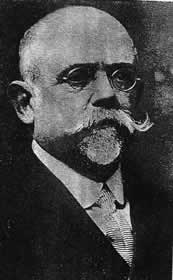
Francisco Pascasio Moreno (May 31, 1852 – November 22, 1919) was a prominent explorer and academic in Argentina, where he is usually referred to as ''Perito'' Moreno (''perito'' means "specialist, expert"). Perito Moreno has been credited as one of the most influential figures in the Argentine incorporation of large parts of Patagonia and its subsequent development. Life and work Moreno was born to Francisco and Juana Thwaites Madero in Buenos Aires. Raised in a traditional patrician family, he studied in local parochial schools. He shared his spare time with his father searching for artifacts and fossils and, at age 14, created a homemade museum of his extensive collections. Following graduation in 1872, he participated in the founding of the Argentine Scientific Society. He embarked on the first of the series of scientific expeditions that made him well known: a survey of Río Negro Territory, largely uncharted country. In January 1876, he reached Lake Nahuel-Huapi in the ... [...More Info...] [...Related Items...] OR: [Wikipedia] [Google] [Baidu] |
Arica
Arica ( ; ) is a commune and a port city with a population of 222,619 in the Arica Province of northern Chile's Arica y Parinacota Region. It is Chile's northernmost city, being located only south of the border with Peru. The city is the capital of both the Arica Province and the Arica and Parinacota Region. Arica is located at the bend of South America's western coast known as the Arica Bend or Arica Elbow. At the location of the city are two valleys that dissect the Atacama Desert converge: Azapa and Lluta. These valleys provide citrus and olives for export. Arica is an important port for a large inland region of South America. The city serves a free port for Bolivia and manages a substantial part of that country's trade. In addition it is the end station of the Bolivian oil pipeline beginning in Oruro. The city's strategic position is enhanced by being next to the Pan-American Highway, being connected to both Tacna in Peru and La Paz in Bolivia by railroad and being ... [...More Info...] [...Related Items...] OR: [Wikipedia] [Google] [Baidu] |
Quinoa
Quinoa (''Chenopodium quinoa''; , from Quechuan languages, Quechua ' or ') is a flowering plant in the Amaranthaceae, amaranth family. It is a herbaceous annual plant grown as a crop primarily for its edible seeds; the seeds are high in protein, dietary fiber, B vitamins and mineral (nutrient), dietary minerals especially potassium and magnesium in amounts greater than in many grains. Quinoa is not a Poaceae, grass but rather a pseudocereal botany, botanically related to spinach and amaranth (''Amaranthus'' spp.), and originated in the Andes, Andean region of northwestern South America. It was first used to feed livestock 5,2007,000 years ago, and for human consumption 3,0004,000 years ago in the Lake Titicaca basin of Peru and Bolivia. The plant thrives at high elevations and produces seeds that are rich in protein. Almost all production in the Andean region is done by small farms and associations. Its cultivation has spread to more than 70 countries, including Kenya, India, ... [...More Info...] [...Related Items...] OR: [Wikipedia] [Google] [Baidu] |
Chiloé Archipelago
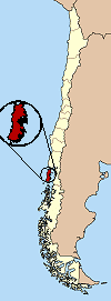
The Chiloé Archipelago (, , ) is a group of islands lying off the coast of Chile, in the Los Lagos Region. It is separated from mainland Chile by the Chacao Channel in the north, the Sea of Chiloé in the east and the Gulf of Corcovado in the southeast. All islands except the Desertores Islands form Chiloé Province. The main island is Chiloé Island. Of roughly rectangular shape, the southwestern half of this island is a wilderness of contiguous forests, wetlands and, in some places, Chilean Coast Range, mountains. The landscape of the northeastern sectors of Chiloé Island and the islands to the east is dominated by rolling hills, with a mosaic of pastures, forests and cultivated fields. The archipelago is known within Chile for its distinctive folklore, chilote mythology, mythology, potatoes of Chiloé, potatoes, cuisine of Chiloé, cuisine and unique Chilotan architecture, architecture. The culture of Chiloé is the result of mixing of Huilliche people, Huilliche, Culture of ... [...More Info...] [...Related Items...] OR: [Wikipedia] [Google] [Baidu] |
Limay River
The Limay River is an important river in the northwestern Argentine Patagonia (the region of Comahue). It originates at the eastern end of the Nahuel Huapi Lake and flows in a meandering path for about , collecting the waters of several tributaries, such as the Traful River, the Pichileufú and the Collón Curá. It then meets the Neuquén River and together they become the Río Negro. At this confluence lies the city of Neuquén. The river serves as natural border between the provinces of Río Negro and Neuquén. Its deep waters are clear, and carry a large flow, on average. Its drainage basin has an area of and includes almost all the rivers and streams of the Atlantic basin in the region, as well as an extensive network of lakes. The waters of the Limay are used to generate hydroelectricity at the five dams built on its course: Alicurá, Piedra del Águila, Pichi Picún Leufú, El Chocón, and Arroyito; together with the Cerros Colorados Complex on the Neuquén ... [...More Info...] [...Related Items...] OR: [Wikipedia] [Google] [Baidu] |
Mamuil Malal Pass
Mamuil Malal Pass (Mapudungun for '' corral of wooden sticks'') is an international mountain pass in the Andes between Chile and Argentina Argentina, officially the Argentine Republic, is a country in the southern half of South America. It covers an area of , making it the List of South American countries by area, second-largest country in South America after Brazil, the fourt .... The pass connects Pucón and Curarrehue in Chile with Junín de los Andes in Argentina. The road passes just north of Lanín Volcano (). During winter the pass may close due to heavy snowfalls. From the Chilean side the pass is accessed through Route 199-CH, branch line which begins at the Panamerican Highway near Freire. References {{Reflist Argentina–Chile border crossings Landforms of Araucanía Region Transport in Araucanía Region Landforms of Neuquén Province Mountain passes of the Andes Mountain passes of Argentina Mountain passes of Chile ... [...More Info...] [...Related Items...] OR: [Wikipedia] [Google] [Baidu] |


