|
Marine Parade
Marine Parade is a planning area and residential estate located on the eastern fringe of the Central Region of Singapore. Straddling the tip of the southeastern coast of Pulau Ujong, Marine Parade serves as a buffer between the Central and East regions of the country. Bordering it are the planning areas of Geylang to the north, Kallang to the northwest, Bedok to the northeast, Marina East to the southwest and the Singapore Straits to the south. Marine Parade is further divided into five subzones, East Coast, Katong, Marine Parade, Marina East (not to be confused with Marina East, the neighbouring planning area) and Mountbatten. Background Marine Parade's early history can be associated with the precinct of Katong. Throughout the early to mid 20th century, the area was a haven for the wealthy Peranakan community of Singapore. Katong witnessed a growth in Straits Chinese culture, developing a distinctive architecture style and even becoming the place of origin for ... [...More Info...] [...Related Items...] OR: [Wikipedia] [Google] [Baidu] |
Goh Pei Ming
Goh Pei Ming (; born ) is a Singaporean politician and former brigadier-general and chief of staff of Singapore Armed Forces. A member of the ruling People's Action Party (PAP), he is a Member of Parliament representing Marine Parade–Braddell Heights Group Representation Constituency (GRC) for the 15th Parliament of Singapore after a walkover was declared for the constituency in the 2025 Singaporean general election. Goh will represent the division of Marine Parade in his constituency. Education Goh received his early education at Fengshan Primary School. He subsequently attended Dunman High School and Victoria Junior College where he was awarded the Wong Hung Khim trophy, VJC's highest award. He was a President Scout. After junior college, he was awarded the Singapore Armed Forces (SAF) Overseas Scholarship and obtained a bachelor’s degree (summa cum laude) in Civil Engineering from Cornell University, followed by a master's degree in Defence Studies from King's Coll ... [...More Info...] [...Related Items...] OR: [Wikipedia] [Google] [Baidu] |
Apartment
An apartment (American English, Canadian English), flat (British English, Indian English, South African English), tenement (Scots English), or unit (Australian English) is a self-contained housing unit (a type of residential real estate) that occupies part of a building, generally on a single story. There are many names for these overall buildings (see below). The housing tenure of apartments also varies considerably, from large-scale public housing, to owner occupancy within what is legally a Condominium (living space), condominium (strata title or commonhold) or leasehold, to tenants renting from a private landlord. Terminology The term ''apartment'' is favoured in North America (although in some Canadian cities, ''flat'' is used for a unit which is part of a house containing two or three units, typically one to a floor). In the UK and Australia, the term ''apartment'' is more usual in professional real estate and architectural circles where otherwise the term ''flat'' is u ... [...More Info...] [...Related Items...] OR: [Wikipedia] [Google] [Baidu] |
Housing And Development Board
The Housing & Development Board (HDB; often referred to as the Housing Board; ; ; ), is a Statutory boards of the Singapore Government, statutory board under the Ministry of National Development (Singapore), Ministry of National Development responsible for the public housing in Singapore. Established in 1960 as a result of efforts in the late 1950s to set up an authority to take over the Singapore Improvement Trust's (SIT) public housing responsibilities, the HDB focused on the construction of emergency housing and the resettlement of kampong residents into public housing in the first few years of its existence. This focus shifted from the late 1960s, with the HDB building flats with improved fittings and offering them for sale. From the 1970s, it initiated efforts to improve community cohesion in its estates and solicit resident feedback. In the 1990s and 2000s, the HDB introduced upgrading and redevelopment schemes for mature estates, as well as new types of housing inte ... [...More Info...] [...Related Items...] OR: [Wikipedia] [Google] [Baidu] |
Peranakan
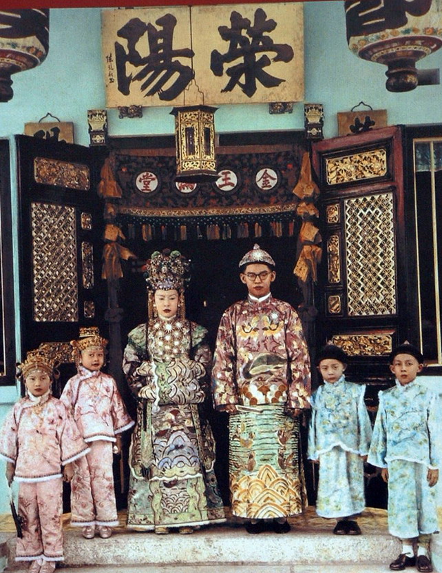
The Peranakan Chinese () are an ethnic group defined by their genealogical descent from the first waves of Southern Chinese settlers to maritime Southeast Asia, known as Nanyang (region), Nanyang (), namely the British Empire, British, Portuguese Empire, Portuguese, and Dutch Empire, Dutch colonial ports in the Malay Peninsula and the List of islands of Indonesia, Indonesian Archipelago, as well as Singapore Island, Singapore. The Peranakan Chinese are often simply referred to as the Peranakans. Peranakan culture, especially in the dominant Peranakan centres of Malacca, Singapore, Penang, Phuket, and Tangerang, is characterized by its unique hybridization of ancient Chinese culture with the local cultures of the Nusantara (archipelago), Nusantara region, the result of a centuries-long history of transculturation and interracial marriage. Immigrants from the southern provinces of China arrived in significant numbers in the region between the 14th and 17th centuries, taking abode ... [...More Info...] [...Related Items...] OR: [Wikipedia] [Google] [Baidu] |
Mountbatten, Singapore
Mountbatten (also known as ''Mountbatten Estate'') is a neighbourhood located in the planning area of Marine Parade, Singapore. History The neighbourhood is named after Lord Louis Mountbatten, the Supreme Allied Commander of the South East Asia Command, Governor General of India and British Military Administrator of Malaya from 1945 to 1946. Layout Mountbatten Road is a major thoroughfare that stretches all the way from the junction with Nicoll Highway, Guillemard Road and Sims Way (where Kallang Airport Way branches out from Sims Way) in Kallang to Haig Road in Katong where it continues eastward as East Coast Road. Points of interest * Chung Cheng High School (Main) * Goodman Arts Centre (former LASALLE College of the Arts) * Katong Community Centre (formally Mountbatten CC) * Katong Shopping Centre * Katong Swimming Complex * Sing Hoe Hotel (formerly Sin Hoe) * Singapore Sindhi Association Transportation Mountbatten is served by Mountbatten MRT station Mountb ... [...More Info...] [...Related Items...] OR: [Wikipedia] [Google] [Baidu] |
Singapore Straits
The Singapore Strait is a , strait between the Strait of Malacca in the west and the South China Sea in the east. Singapore is on the north of the channel, and the Indonesian Riau Islands are on the south. The two countries share a maritime border along the strait. It includes Keppel Harbour and many small islands. The strait provides the deepwater passage to the Port of Singapore, which makes it very busy. Approximately 2,000 merchant ships traverse the waters on a daily basis in 2017. The depth of the Singapore Strait limits the maximum draft of vessels going through the Straits of Malacca, and the Malaccamax ship class. Historical records The 9th century AD Muslim author Ya'qubi referred a ''Bahr Salahit'' or Sea of Salahit (from the Malay ''selat'' meaning strait), one of the Seven Seas to be traversed to reach China. Some have interpreted Sea of Salahit as referring to Singapore, although others generally considered it the Malacca Strait, a point of contact between ... [...More Info...] [...Related Items...] OR: [Wikipedia] [Google] [Baidu] |
Marina East
Marina East is a planning area located in the Central Area of the Central Region of Singapore, covering of reclaimed land. It is the location of NTUC Club's Marina Bay Golf Course (formerly known as the Marina East Course) and the Gardens by the Bay (Bay East Garden).. Marina East is bordered by Marine Parade to the east, Kallang to the north, Marina South and Downtown Core to the west, as well as the Singapore Straits The Singapore Strait is a , strait between the Strait of Malacca in the west and the South China Sea in the east. Singapore is on the north of the channel, and the Indonesian Riau Islands are on the south. The two countries share a maritime ... to the south. Marina East Planning Area should not be confused with the Marina East subzone that is part of the adjacent Marine Parade Planning Area. Notes Marine Parade {{Singapore-geo-stub ... [...More Info...] [...Related Items...] OR: [Wikipedia] [Google] [Baidu] |
Bedok
Bedok ( ) is a Planning areas of Singapore, planning area and New towns of Singapore, residential town located in the geographical region of Tanah Merah, Singapore, Tanah Merah along the south-eastern coast of the East Region, Singapore, East Region of Singapore. Bedok is bounded by five other planning areas: Paya Lebar to the north, Hougang to the northwest, Tampines to the northeast and east, Geylang to the west and Marine Parade to the southwest. It also shares a maritime boundary with the Singapore Strait to the south and southeast. Bedok has a rich history, with evidence of human settlement dating back to the 14th century. The area was originally a fishing village and agriculture centre, but it has transformed into a bustling residential and commercial hub over the years. Today, Bedok is known for its vibrant and diverse community, with a mix of public and private housing options, shopping centers, parks, and a thriving food scene. In addition to its commercial development ... [...More Info...] [...Related Items...] OR: [Wikipedia] [Google] [Baidu] |
Kallang
Kallang ( ) is a Planning Areas of Singapore, planning area and New towns of Singapore, residential zone located in the Central Region, Singapore, Central Region of Singapore. Development of the town is centered around the Kallang River, the longest List of rivers of Singapore, river in Singapore. Kallang Planning Area is bounded by Toa Payoh in the north, Geylang in the east, Marine Parade in the southeast, Marina East in the south, the Downtown Core in the southwest, Rochor, Newton, Singapore, Newton in the west, and Novena, Singapore, Novena in the northwest. Throughout its history, Kallang was home to several national landmarks, some of which were built along the banks of the Kallang Basin, including the Former National Stadium, Singapore, old National Stadium as well as the country's first purpose-built civil List of airports in Singapore, airport, the Kallang Airport. The famous Kallang Roar and Kallang Wave have roots traced to the former National Stadium, which hosted 1 ... [...More Info...] [...Related Items...] OR: [Wikipedia] [Google] [Baidu] |
Geylang
Geylang () is a planning area and township located on the eastern fringe of the Central Region of Singapore, bordering Hougang and Toa Payoh in the north, Marine Parade in the south, Bedok in the east, and Kallang in the west. Geylang is previously known as a red-light district, particularly the areas along Geylang Road. Today only 3-4 units remain for brothels and street walkers are hard to come by. Geylang is also where one of Singapore's oldest Malay settlements, Geylang Serai, is located. During Ramadan, the neighbourhood is famous for its popular and iconic Ramadan lights and bazaars. Etymology The word ''Geylang'' is found early in Singapore's history and also in early topographical maps showing marsh and coconut plantations beside and adjacent to the mouth of the Kallang River, home to the Orang Laut (sea gypsies) called ''orang biduanda kallang'' who inhabited the area at the time of Raffles' arrival in 1819, and after whom the river is named. ''Geylang'' may be ... [...More Info...] [...Related Items...] OR: [Wikipedia] [Google] [Baidu] |


