|
Lasithi
Lasithi () is the easternmost regional unit on the island of Crete, to the east of Heraklion. Its capital is Agios Nikolaos, the other major towns being Ierapetra and Sitia. The mountains include the Dikti in the west and the Thrypti in the east. The Sea of Crete lies to the north and the Libyan Sea to the south. To the east of the village of Elounda lies the island of Spinalonga, formerly a Venetian fortress and a leper colony. On the foot of Mount Dikti lies the Lasithi Plateau, famous for its windmills. Vai is well known for its datepalm forest. Thanks to its beaches and its mild climate year-long, Lasithi attracts many tourists. Mass tourism is served by places like Vai, Agios Nikolaos and the island of Chrissi. More off-beat tourism can be found in villages on the south coast like Myrtos, Makrys Gialos or Makrigialos, Xerokambos and Koutsouras. Lasithi is home to a number of ancient remains. Vasiliki, Fournou Korifi, Pyrgos, Zakros and Gournia are rui ... [...More Info...] [...Related Items...] OR: [Wikipedia] [Google] [Baidu] |
Ierapetra
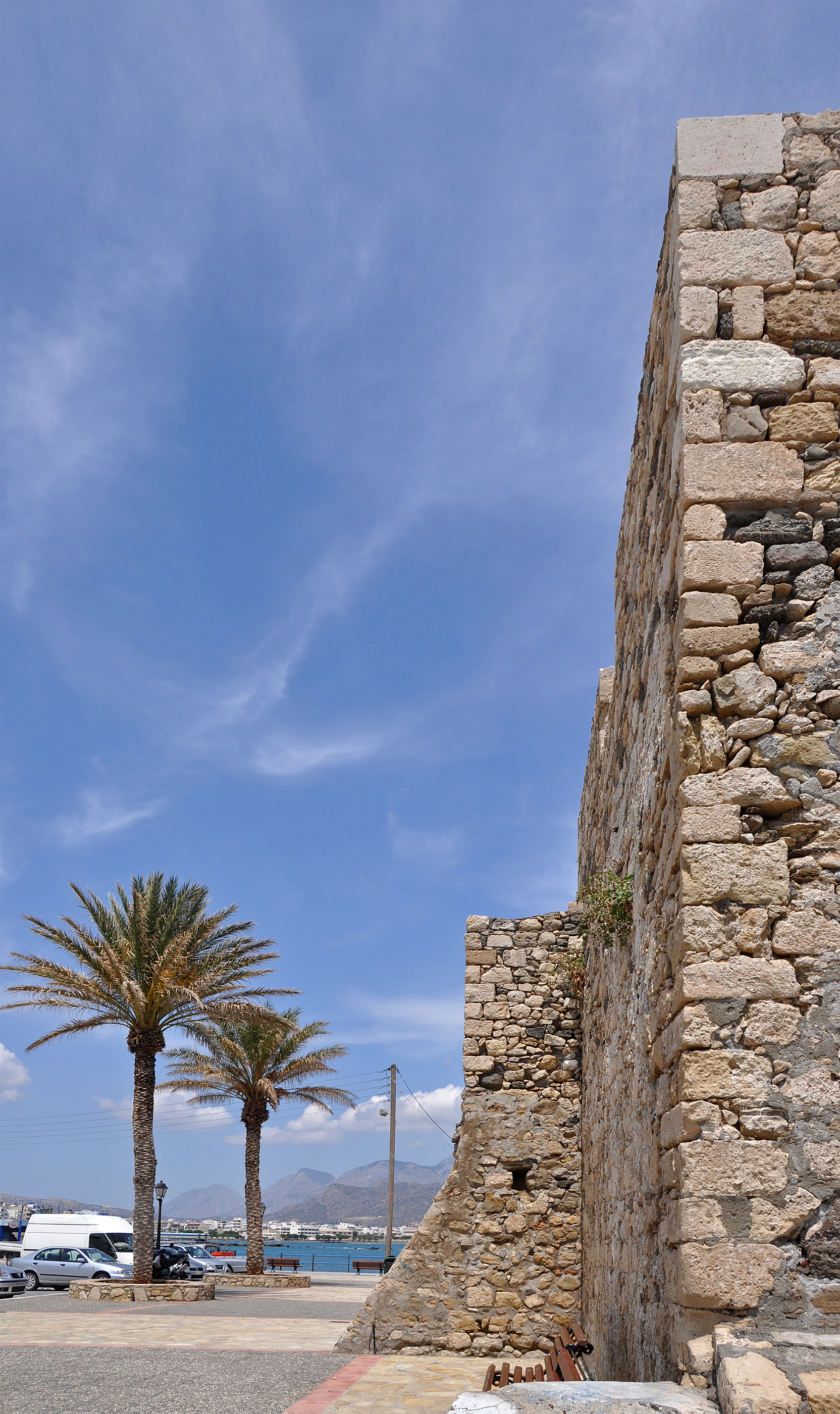
Ierapetra (; ancient name: ) is a Greece, Greek city and municipality located on the southeast coast of Crete. History The town of Ierapetra (in the local dialect: Γεράπετρο ''Gerapetro'') is located on the southeast coast of Crete, situated on the beach of Ierapetra Bay. This town lies south of Agios Nikolaos, Crete, Agios Nikolaos and southwest of Sitia, and is an important regional centre. With 17,710 inhabitants (in 2021), Ierapetra is the most populous town in the regional unit of Lasithi and the fourth most populous town in Crete. Ierapetra is nicknamed "the bride of the Libyan Sea" because of its position as the only town on Crete's southern coast. Antiquity Ierapetra has retained a prominent place in the history of Crete since the Minoan civilization, Minoan period. The Greek and later Ancient Rome, Roman town of Hierapytna was located on the same site as present-day Ierapetra. In the Classical antiquity, Classical Age, Hierapytna became the most substantial Do ... [...More Info...] [...Related Items...] OR: [Wikipedia] [Google] [Baidu] |
Olous
Olous or Olus (, or ''Stadiasmus Maris Magni'' § 350.) was a city of ancient Crete; now sunken, it was situated at the site of present day town of Elounda, Crete, Greece. According to the ''Stadiasmus Maris Magni'', it had a harbour and was located 260 stadia (in the range of approximately ) from Chersonasus and 15 stadia (approximately ) from Camara. History After continuing boundary disputes with the hillfort of Lato, the citizens of Olous eventually entered into a treaty with those of Lato. There was a temple to Britomartis in the city, a wooden statue of whom was erected by Daedalus, the mythical ancestor of the Daedalidae, and father of Cretan art. Her effigy is represented on the coins of Olous. The Ptolemaic naval fleet commander Callicrates was honored by the citizens of Olous and received honorary citizenship. Present conditions Archaeologists discovered ancient texts within the ruins linking the town with the ancient cities of Knossos and the island of Rhodes. [...More Info...] [...Related Items...] OR: [Wikipedia] [Google] [Baidu] |
Sitia
Sitia (Latin language, Latin and Italian language, Italian) or Siteia (, ) is a port town and a municipality in Lasithi, Crete, Greece. The town has 11,166 inhabitants and the municipality has 20,438 (2021). It lies east of Agios Nikolaos, Crete, Agios Nikolaos and northeast of Ierapetra. Sitia's port is on the Sea of Crete, part of the Aegean Sea and is one of the economic centers of the Lasithi region. European route E75 (which ends in Vardø (town), Vardø, Norway) starts in Sitia. The town is served by the Sitia Public Airport. It has not experienced the effects of mass tourism even though there is a long beach along the road leading to Vai (Crete), Vai and several places of historical interest. History The settlement of the town dates to pre-Minoan civilization, Minoan times. Excavations in the Petras neighbourhood have found architectural remains from the end of the Neolithic (3000 BC) and continue through the Bronze Age 3000-1050 BC, including the Minoan palace of Pet ... [...More Info...] [...Related Items...] OR: [Wikipedia] [Google] [Baidu] |
Crete
Crete ( ; , Modern Greek, Modern: , Ancient Greek, Ancient: ) is the largest and most populous of the Greek islands, the List of islands by area, 88th largest island in the world and the List of islands in the Mediterranean#By area, fifth largest island in the Mediterranean Sea, after Sicily, Sardinia, Cyprus, and Corsica. Crete is located about south of the Peloponnese, and about southwest of Anatolia. Crete has an area of and a coastline of 1,046 km (650 mi). It bounds the southern border of the Aegean Sea, with the Sea of Crete (or North Cretan Sea) to the north and the Libyan Sea (or South Cretan Sea) to the south. Crete covers 260 km from west to east but is narrow from north to south, spanning three longitudes but only half a latitude. Crete and a number of islands and islets that surround it constitute the Region of Crete (), which is the southernmost of the 13 Modern regions of Greece, top-level administrative units of Greece, and the fifth most popu ... [...More Info...] [...Related Items...] OR: [Wikipedia] [Google] [Baidu] |
Myrtos
Myrtos is a coastal village and a community in the west of the municipality of Ierapetra, in the Regional Unit (previously called prefecture) of Lasithi on the Greek island of Crete. It is located from Agios Nikolaos and from Ierapetra, on the road to Viannos. A little to the west of the village is the iconic conical Kolektos mountain. Myrtos is situated on the Libyan Sea. The patron saint of the village is Saint Anthony. The population of the community is 518 (2021). The transliteral spelling of this village is often written as Mirtos. Myrtos has a rich history but has only prospered with the advent of tourism. The village has many tavernas and diverse shops for both residents and visitors. More recently there is now a pharmacy and an ATM. There are numerous churches, hotels, apartments and studios. There is a regular bus service between Ierapetra and Myrtos. History The area surrounding Myrtos was already inhabited during the Minoan period, but the current villag ... [...More Info...] [...Related Items...] OR: [Wikipedia] [Google] [Baidu] |
Linear B
Linear B is a syllabary, syllabic script that was used for writing in Mycenaean Greek, the earliest Attested language, attested form of the Greek language. The script predates the Greek alphabet by several centuries, the earliest known examples dating to around 1450 BC. It is adapted from the earlier Linear A, an undeciphered script perhaps used for writing the Minoan language, as is the later Cypriot syllabary, which also recorded Greek. Linear B, found mainly in the Minoan palace, palace archives at Knossos, Kydonia, Pylos, Thebes, Greece, Thebes and Mycenae, disappeared with the fall of Mycenaean Greece, Mycenaean civilization during the Late Bronze Age collapse. The succeeding period, known as the Greek Dark Ages, provides no evidence of the use of writing. Linear B was deciphered in 1952 by English architect and self-taught linguist Michael Ventris based on the research of American classicist Alice Kober. It is the only Bronze Age Aegean script to have been deciphered, w ... [...More Info...] [...Related Items...] OR: [Wikipedia] [Google] [Baidu] |
Dorians
The Dorians (; , , singular , ) were one of the four major ethnic groups into which the Greeks, Hellenes (or Greeks) of Classical Greece divided themselves (along with the Aeolians, Achaeans (tribe), Achaeans, and Ionians). They are almost always referred to as just "the Dorians", as they are called in the earliest literary mention of them in the ''Odyssey'', where they already can be found inhabiting the island of Crete. They were diverse in way of life and social organization, varying from the populous trade center of the city of Ancient Corinth, Corinth, known for its ornate style in art and architecture, to the isolationist, military state of Sparta; and yet, all Hellenes knew which localities were Dorian and which were not. Dorian states at war could more likely, but not always, count on the assistance of other Dorian states. Dorians were distinguished by the Doric Greek dialect and by characteristic social and historical traditions. In the 5th century BC, Dorians and Ion ... [...More Info...] [...Related Items...] OR: [Wikipedia] [Google] [Baidu] |
Itanos
Itanos () is a municipal unit (demotike enoteta) of the municipality (demos) Siteia in the Lasithi regional unit, eastern Crete, Greece. A former municipality itself, it was included in Siteia as part of the 2011 local government reform. The municipal unit has an area of . The population was 2,014 in 2021. The seat of the municipality was in Palaikastro, but now all municipal units are administered from the municipal seat, Siteia. Until 2017 Itanos comprised four local communities (topika koinoteta): Palaikastro, Karydi, Zakros, and Mitato (Μητάτο). Subsequently by Presidential Decree No. 70/207, on recommendation of the Minister of the Interior, and approval by Sitia and Palaikastro, Mitato was abolished, due to its seriously declining population (being a few mountain communities) and its settlements were turned over to Palaikastro. Etymological speculations Unlike most Greek demes (municipalities) Itanos did not have a modern city or town to serve as a namesake to th ... [...More Info...] [...Related Items...] OR: [Wikipedia] [Google] [Baidu] |
Lato
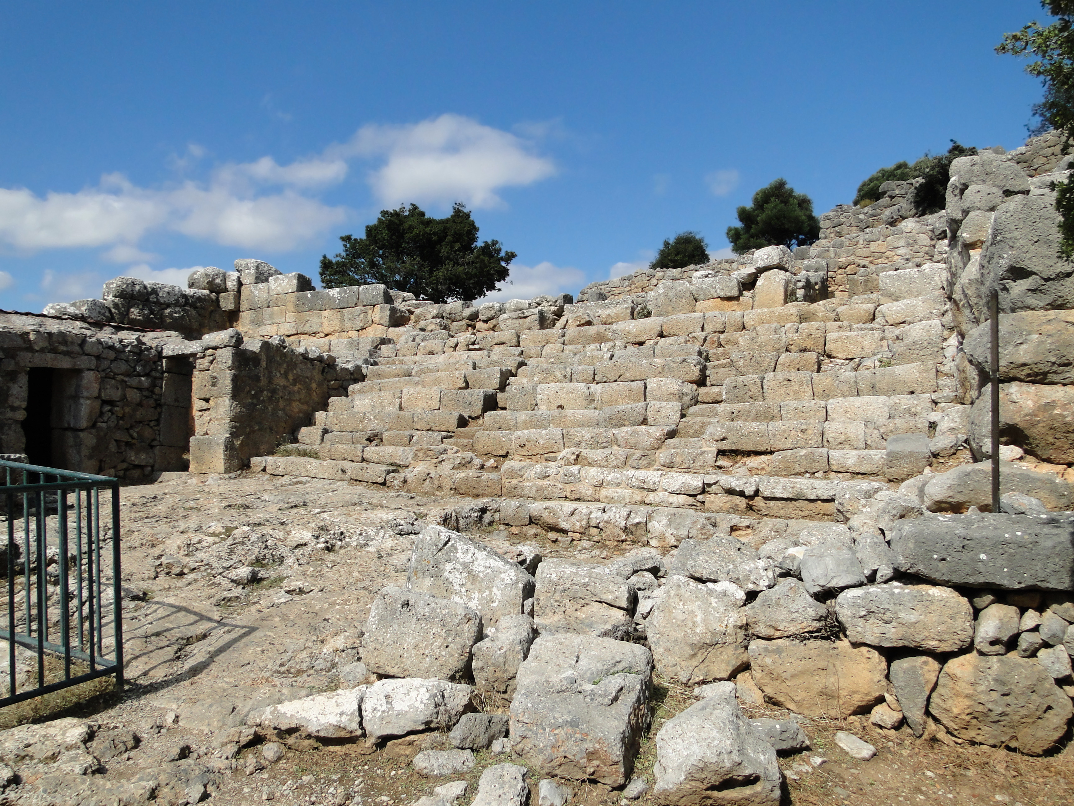
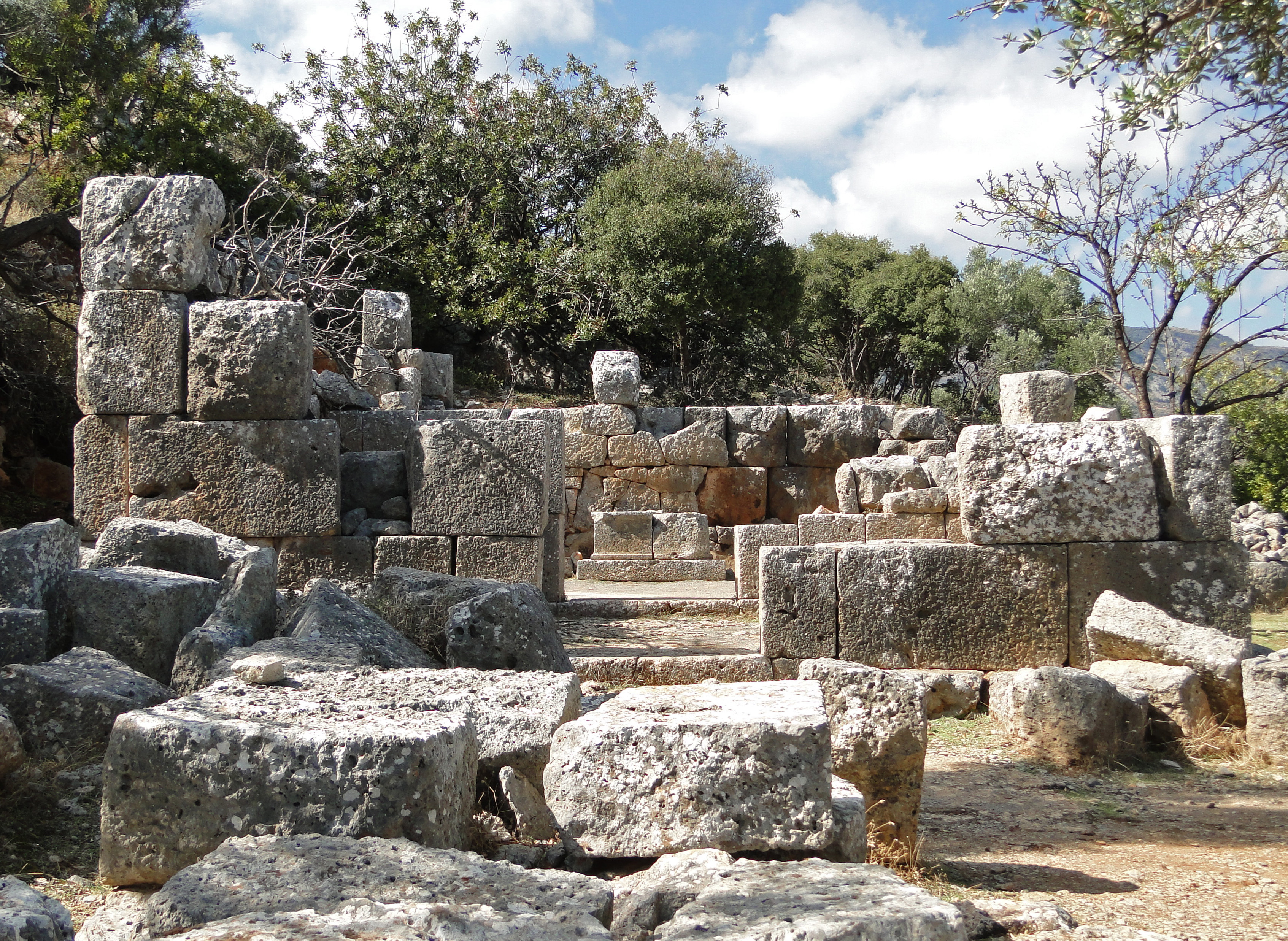
Lato () was an ancient city of Crete, the ruins of which are located approximately 3 km from the village of Kritsa. History The Dorian city-state was built in a defensible position overlooking Mirabello Bay between two peaks, both of which became acropolises to the city. Although the city probably predates the arrival of the Dorians, the ruins date mainly from the Dorian period (5th and 4th centuries BCE). The city was destroyed c. 200 BCE, but its port (Lato Etera or Lato pros Kamara), located near Agios Nikolaos was in use during Roman rule. This has led to the confusion: Stephanus of Byzantium, for example, quoted Xenion, a 3rd-century Cretan historian, repeating the latter's error that Kamara and Lato were one and the same. Modern scholarship distinguishes the two. The city most likely was named after the goddess Leto (of which Lato is the usual Doric form) and may be mentioned in Linear B tablets as RA-TO. [...More Info...] [...Related Items...] OR: [Wikipedia] [Google] [Baidu] |
Minoan Civilization
The Minoan civilization was a Bronze Age culture which was centered on the island of Crete. Known for its monumental architecture and energetic art, it is often regarded as the first civilization in Europe. The ruins of the Minoan palaces at Knossos and Phaistos are popular tourist attractions. The Minoan civilization developed from the local Neolithic culture around 3100BC, with complex urban settlements beginning around 2000BC. After 1450BC, they came under the cultural and perhaps political domination of the mainland Mycenaean Greeks, forming a hybrid culture which lasted until around 1100BC. Minoan art included elaborately decorated pottery, seals, figurines, and colorful frescoes. Typical subjects include nature and ritual. Minoan art is often described as having a fantastical or ecstatic quality, with figures rendered in a manner suggesting motion. Little is known about the structure of Minoan society. Minoan art contains no unambiguous depiction of a monarch, and t ... [...More Info...] [...Related Items...] OR: [Wikipedia] [Google] [Baidu] |
Gournia
Gournia () is the site of a Minoan palace complex in the Lasithi regional unit on the island of Crete, Greece. Its modern name originated from the many stone troughs that are at the site and its original name for the site is unknown. atrous, L. Vance, et al., "Excavations at gournia, 2010–2012", Hesperia: The Journal of the American School of Classical Studies at Athens 84.3, pp. 397-465, 2015 It was first permanently inhabited during the Early Minoan II periods (approximately between 2650-2100 B.C.E) and was occupied until the Late Minoan I period (approximately between 1700-1470 B.C.E.).Buell, D. Matthew, and John C. McEnroe, "Community building/building community at Gournia", Minoan Architecture and Urbanism: New Perspectives on an Ancient Built Environment, pp. 204-227, 2017 ... [...More Info...] [...Related Items...] OR: [Wikipedia] [Google] [Baidu] |
Zakros
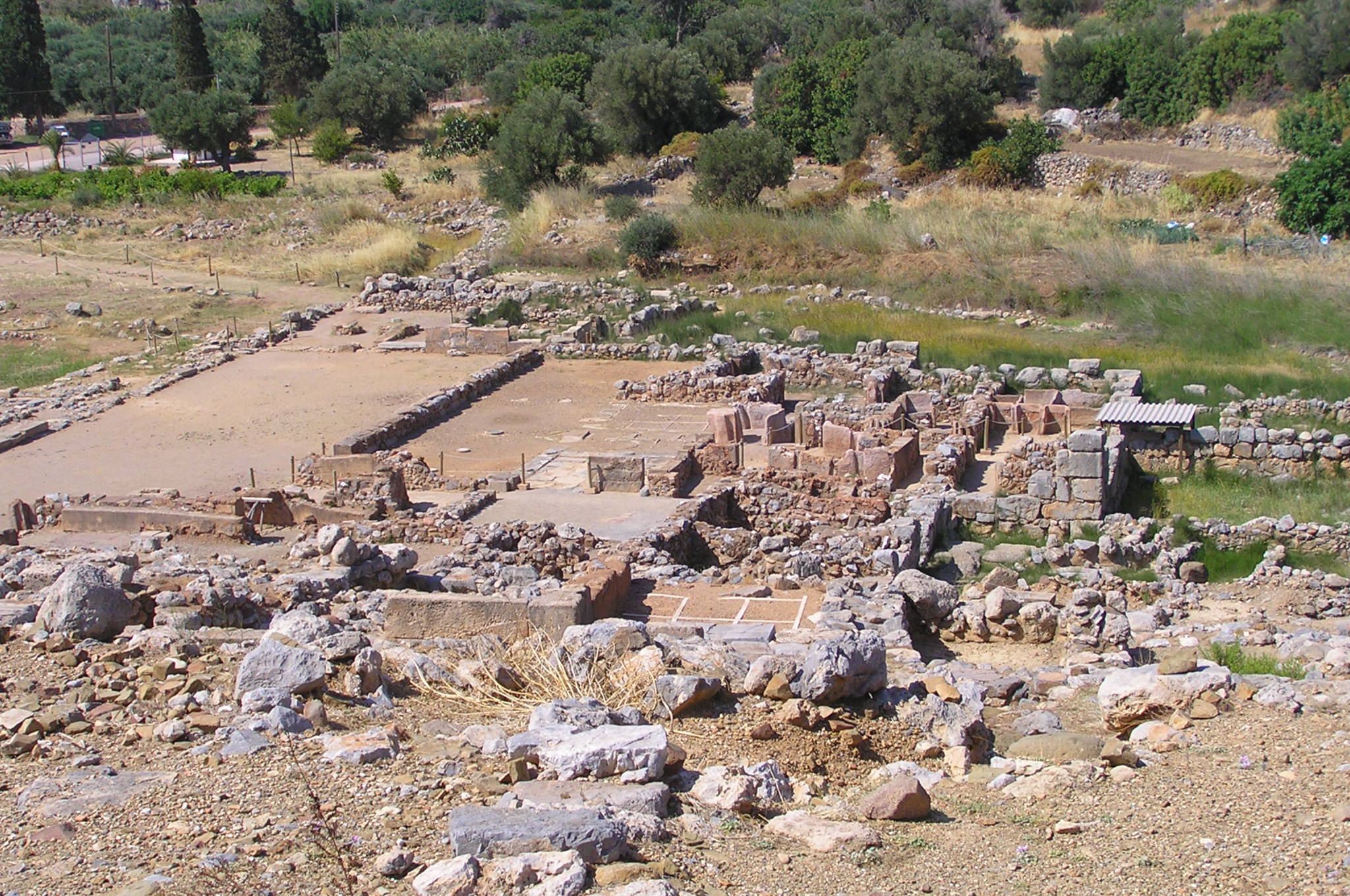
Zakros ( also Zakro or Kato Zakro) is a Minoan archaeological site on the eastern coast of Crete in Lasithi, Greece. It is regarded as one of the six Minoan palaces, and its protected harbor and strategic location made it an important commercial hub for trade to the east. The town was dominated by the Palace of Zakro, originally built around 1900 BC, rebuilt around 1600 BC, and destroyed around 1450 BC along with the other major centers of Minoan civilization. Extensive ruins of the palace remain, and are a popular tourist destination. Zakros is sometimes divided into ''Epano Zakros'' (''Upper Zakros''), the portion higher up on the hillside, and ''Kato Zakros'' (''Lower Zakros''), the part near the sea. A Minoan villa was discovered on the road from Epano Zakos near the gorge. It is dated to the Minoan LM IA period (c. 1700–1625 BC), before the construction of the palace. A pithos found there had a Linear A inscription around its rim recording a large quantity (32 units) of wi ... [...More Info...] [...Related Items...] OR: [Wikipedia] [Google] [Baidu] |


