|
Ice Caps
In glaciology, an ice cap is a mass of ice that covers less than of land Land, also known as dry land, ground, or earth, is the solid terrestrial surface of Earth not submerged by the ocean or another body of water. It makes up 29.2% of Earth's surface and includes all continents and islands. Earth's land sur ... area (usually covering a highland area). Larger ice masses covering more than are termed ice sheets. Description By definition, ice caps are not constrained by topographical features (i.e., they must lie over the top of mountains). By contrast, ice masses of similar size that ''are'' constrained by topographical features are known as ice fields. The ''dome'' of an ice cap is usually centred on the highest point of a massif. Ice flows away from this high point (the ice divide) towards the ice cap's periphery. Ice caps significantly affect the geomorphology of the area they occupy. Plastic moulding, gouging and other glacial erosional features become prese ... [...More Info...] [...Related Items...] OR: [Wikipedia] [Google] [Baidu] |
Firn
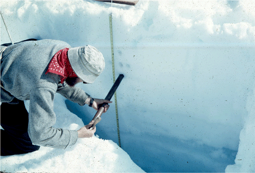
__NOTOC__ Firn (; from Swiss German "last year's", cognate with ''before'') is partially compacted névé, a type of snow that has been left over from past seasons and has been recrystallized into a substance denser than névé. It is ice that is at an intermediate stage between snow and glacial ice. Firn has the appearance of wet sugar, but has a hardness that makes it extremely resistant to shovelling. Its density generally ranges from 0.35 g/cm3 to 0.9 g/cm3, and it can often be found underneath the snow that accumulates at the head of a glacier. Snowflakes are compressed under the weight of the overlying snowpack. Individual crystals near the melting point are semiliquid and slick, allowing them to glide along other crystal planes and to fill in the spaces between them, increasing the ice's density. Where the crystals touch, they bond together, squeezing the air between them to the surface or into bubbles. In the summer months, the crystal metamorphosis can occur ... [...More Info...] [...Related Items...] OR: [Wikipedia] [Google] [Baidu] |
Sea Ice
Sea ice arises as seawater freezes. Because ice is less density, dense than water, it floats on the ocean's surface (as does fresh water ice). Sea ice covers about 7% of the Earth's surface and about 12% of the world's oceans. Much of the world's sea ice is enclosed within the polar ice packs in the Earth's polar regions: the Arctic ice pack of the Arctic Ocean and the Antarctic ice pack of the Southern Ocean. Polar packs undergo a significant yearly cycling in surface extent, a natural process upon which depends the Arctic ecology, including the Arctic sea ice ecology and history, ocean's ecosystems. Due to the action of winds, currents and temperature fluctuations, sea ice is very dynamic, leading to a wide variety of ice types and features. Sea ice may be contrasted with icebergs, which are chunks of ice shelf, ice shelves or glaciers that Ice calving, calve into the ocean. Depending on location, sea ice expanses may also incorporate icebergs. General features and dynamics ... [...More Info...] [...Related Items...] OR: [Wikipedia] [Google] [Baidu] |
List Of Glaciers In Russia
This is a list of glaciers in Russia. It includes glaciers, ice caps and ice domes located in the Russian Federation. List of glaciers and ice caps Ice caps * Academy of Sciences Glacier () – Severnaya Zemlya. Largest single ice formation in Russia * Albanov Glacier () – Severnaya Zemlya * Chernyshev Ice Cap () – Franz Josef Land * De Long East Glacier – Bennett Island. De Long Islands * De Long West Glacier – Bennett Island. De Long Islands * Henrietta Island ice cap – De Long Islands * Jeannette Island ice cap – De Long Islands * Karpinsky Glacier ()Maria Shahgedanova & Mikhail Kuznetsov, ''The Physical Geography of Northern Eurasia'', p. 202 – Severnaya Zemlya * Leningradsky ice cap () – Severnaya Zemlya * Malyy Glacier – Bennett Island. De Long Islands * Pioneer Glacier () – Severnaya Zemlya * Rusanov Glacier ()Mark Nuttall, ''Encyclopedia of the Arctic'', p. 1887 – Severnaya Zemlya * Schmidt Island ice cap – Severnaya Zemlya * Seve ... [...More Info...] [...Related Items...] OR: [Wikipedia] [Google] [Baidu] |
Ice Shelf
An ice shelf is a large platform of glacial ice floating on the ocean, fed by one or multiple tributary glaciers. Ice shelves form along coastlines where the ice thickness is insufficient to displace the more dense surrounding ocean water. The boundary between the ice shelf (floating) and grounded ice (resting on bedrock or sediment) is referred to as the grounding line; the boundary between the ice shelf and the open ocean (often covered by sea ice) is the ice front or calving front. Ice shelves are found in Antarctica and the Arctic (Greenland, Northern Canada, and the Russian Arctic), and can range in thickness from about . The world's largest ice shelves are the Ross Ice Shelf and the Filchner-Ronne Ice Shelf in Antarctica. The movement of ice shelves is principally driven by gravity-induced pressure from the grounded ice. That flow continually moves ice from the grounding line to the seaward front of the shelf. Typically, a shelf front will extend forward for years ... [...More Info...] [...Related Items...] OR: [Wikipedia] [Google] [Baidu] |
Ice Core
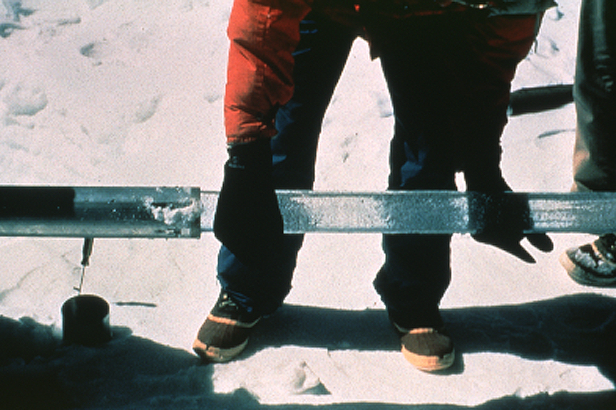
An ice core is a core sample that is typically removed from an ice sheet or a high mountain glacier A glacier (; or ) is a persistent body of dense ice, a form of rock, that is constantly moving downhill under its own weight. A glacier forms where the accumulation of snow exceeds its ablation over many years, often centuries. It acquires .... Since the ice forms from the incremental buildup of annual layers of snow, lower layers are older than upper ones, and an ice core contains ice formed over a range of years. Cores are Ice drilling, drilled with hand Auger (drill), augers (for shallow holes) or powered drills; they can reach depths of over two miles (3.2 km), and contain ice up to 800,000 years old. The physical properties of the ice and of material trapped in it can be used to reconstruct the climate over the age range of the core. The proportions of different oxygen and hydrogen isotopes provide information about Paleothermometer, ancient temperatures, a ... [...More Info...] [...Related Items...] OR: [Wikipedia] [Google] [Baidu] |
Ice Cap Climate
An ice cap climate is a polar climate where no mean monthly temperature exceeds . The climate generally covers areas at high altitudes and Polar regions of Earth, polar regions (60–90° north and south latitude), such as Antarctica and some of the northernmost islands of Canada and Russia. Most of Greenland is under the influence of an ice cap climate, although the coasts are prone to more influence from the sea, providing more Tundra climate, tundra climates. Some regions on the islands of Norway's Svalbard, Svalbard Archipelago facilitate an ice cap climate. Areas with ice cap climates are normally covered by a permanent layer of ice and have no vegetation. There is limited animal life in most ice cap climates, which are usually found near the oceanic margins. Although ice cap climates are inhospitable to human life and no civilian communities lie in such climates, there are some research stations scattered in Antarctica and interior Greenland. Description Under the Köppen cl ... [...More Info...] [...Related Items...] OR: [Wikipedia] [Google] [Baidu] |
Iceberg
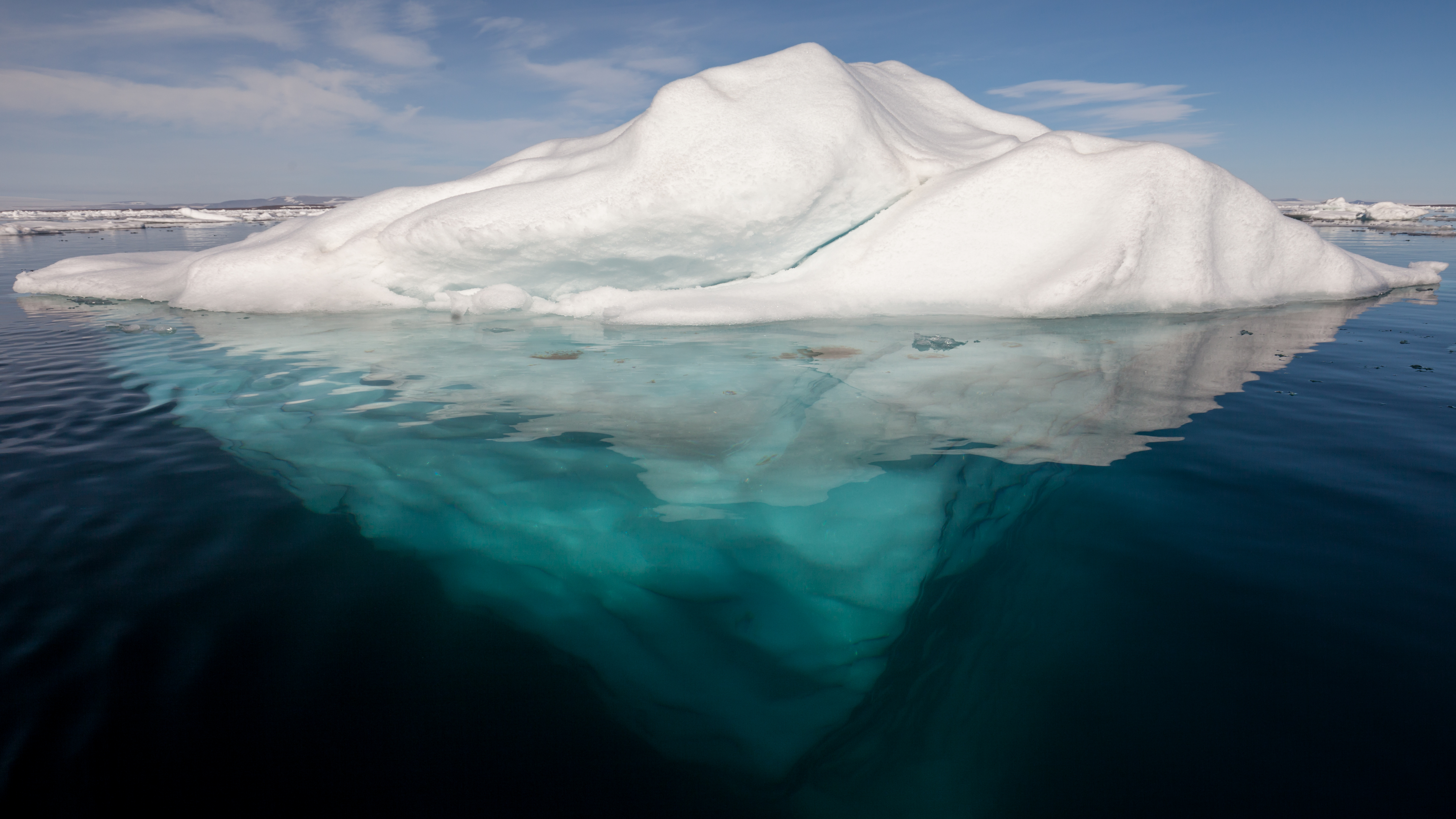
An iceberg is a piece of fresh water ice more than long that has broken off a glacier or an ice shelf and is floating freely in open water. Smaller chunks of floating glacially derived ice are called "growlers" or "bergy bits". Much of an iceberg is below the water's surface, which led to the expression " tip of the iceberg" to illustrate a small part of a larger unseen issue. Icebergs are considered a serious maritime hazard. Icebergs vary considerably in size and shape. Icebergs that calve from glaciers in Greenland are often irregularly shaped while Antarctic ice shelves often produce large tabular (table top) icebergs. The largest iceberg in recent history, named B-15, was measured at nearly in 2000. The largest iceberg on record was an Antarctic tabular iceberg measuring sighted west of Scott Island, in the South Pacific Ocean, by the USS ''Glacier'' on November 12, 1956. This iceberg was larger than Belgium. Etymology The word ''iceberg'' is a partial loan tr ... [...More Info...] [...Related Items...] OR: [Wikipedia] [Google] [Baidu] |
Glacier
A glacier (; or ) is a persistent body of dense ice, a form of rock, that is constantly moving downhill under its own weight. A glacier forms where the accumulation of snow exceeds its ablation over many years, often centuries. It acquires distinguishing features, such as crevasses and seracs, as it slowly flows and deforms under stresses induced by its weight. As it moves, it abrades rock and debris from its substrate to create landforms such as cirques, moraines, or fjords. Although a glacier may flow into a body of water, it forms only on land“Glacier, N., Pronunciation.” Oxford English Dictionary, Oxford UP, June 2024, https://doi.org/10.1093/OED/7553486115. Accessed 25 Jan. 2025. and is distinct from the much thinner sea ice and lake ice that form on the surface of bodies of water. On Earth, 99% of glacial ice is contained within vast ice sheets (also known as "continental glaciers") in the polar regions, but glaciers may be found in mountain ranges on ever ... [...More Info...] [...Related Items...] OR: [Wikipedia] [Google] [Baidu] |
Norwegian Polar Institute
The Norwegian Polar Institute (NPI; ) is Norway's central governmental institution for scientific research, mapping and environmental monitoring in the Arctic and the Antarctic. The NPI is a directorate under Norway's Ministry of Climate and Environment (Norway), Ministry of Climate and Environment. The institute advises Norwegian authorities on matters concerning polar environmental management and is the official environmental management body for Norwegian activities in Antarctica. Activities The institute's activities are focused on environmental research and management in the polar regions. The NPI's researchers investigate biodiversity, climate and environmental toxins in the Arctic and Antarctic, and in this context the institute equips and organizes large-scale expeditions to both polar regions. The institute contributes to national and international climate work, and is an active contact point for the international scientific community. The institute collects and analyses ... [...More Info...] [...Related Items...] OR: [Wikipedia] [Google] [Baidu] |
Svalbard
Svalbard ( , ), previously known as Spitsbergen or Spitzbergen, is a Norway, Norwegian archipelago that lies at the convergence of the Arctic Ocean with the Atlantic Ocean. North of continental Europe, mainland Europe, it lies about midway between the northern coast of Norway and the North Pole. The islands of the group range from 74th parallel north, 74° to 81st parallel north, 81° north latitude, and from 10th meridian east, 10° to 35th meridian east, 35° east longitude. The largest island is Spitsbergen (37,673 km2), followed in size by Nordaustlandet (14,443 km2), (5,073 km2), and Barentsøya (1,288 km2). Bear Island (Norway), Bjørnøya or Bear Island (178 km2) is the most southerly island in the territory, situated some 147 km south of Spitsbergen. Other small islands in the group include Hopen (Svalbard), Hopen to the southeast of Edgeøya, Kongsøya and Svenskøya in the east, and Kvitøya to the northeast. The largest settlement is Longyearbyen, situated in Isfjor ... [...More Info...] [...Related Items...] OR: [Wikipedia] [Google] [Baidu] |
Biscayarfonna
Biscayarfonna (''Biscay glacier'' in Nynorsk) is an ice cap in Spitsbergen, Svalbard. It has an elevation of , and is located on the Haakon VII Land peninsula between Raudfjorden in the west and Breibogen bay in the east. This ice cap is named after Biscay in honour of the Basque Basque may refer to: * Basques, an ethnic group of Spain and France * Basque language, their language Places * Basque Country (greater region), the homeland of the Basque people with parts in both Spain and France * Basque Country (autonomous co ... whalers who hunted at Spitsbergen in the 17th and 18th centuries. See also * List of glaciers in Svalbard References External linksKayaking by Glaciers in Svalbard Glaciers of Spitsbergen {{Spitsbergen-glacier-stub ... [...More Info...] [...Related Items...] OR: [Wikipedia] [Google] [Baidu] |


