|
Geology Of Shropshire
The geology of the county of Shropshire, England is very diverse with a large number of periods being represented at outcrop. The bedrock consists principally of sedimentary rocks of Palaeozoic and Mesozoic age, surrounding restricted areas of Precambrian metasedimentary and metavolcanic rocks. The county hosts in its Quaternary deposits and landforms, a significant record of recent glaciation. The exploitation of the Coal Measures and other Carboniferous age strata in the Ironbridge area made it one of the birthplaces of the Industrial Revolution. There is also a large amount of mineral wealth in the county, including lead and baryte. Quarrying is still active, with limestone for cement manufacture and concrete aggregate, sandstone, greywacke and dolerite for road aggregate, and sand and gravel for aggregate and drainage filters. Groundwater is an equally important economic resource. The Church Stretton Fault is a major structural feature forming a part of the Welsh Border ... [...More Info...] [...Related Items...] OR: [Wikipedia] [Google] [Baidu] |
Church Stretton
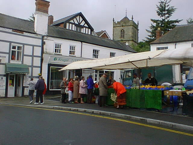
Church Stretton is a market town and civil parish in Shropshire, England, south of Shrewsbury and north of Ludlow. The population in 2011 was 4,671.National Statistics Church Stretton 2011 population area and density The town was nicknamed Little Switzerland (landscape), Little Switzerland in the late Victorian era, Victorian and Edwardian era, Edwardian period for its landscape, and became a health resort. The local geology includes some of the oldest rocks in England and a notable Fault (geology), fault is named after the town. Church Stretton is in the Shropshire Hills AONB, Shropshire Hills Area of Outs ... [...More Info...] [...Related Items...] OR: [Wikipedia] [Google] [Baidu] |
Sedimentary
Sedimentary rocks are types of rock formed by the cementation of sediments—i.e. particles made of minerals (geological detritus) or organic matter (biological detritus)—that have been accumulated or deposited at Earth's surface. Sedimentation is any process that causes these particles to settle in place. Geological detritus originates from weathering and erosion of existing rocks, or from the solidification of molten lava blobs erupted by volcanoes. The geological detritus is transported to the place of deposition by water, wind, ice or mass movement, which are called agents of denudation. Biological detritus is formed by bodies and parts (mainly shells) of dead aquatic organisms, as well as their fecal mass, suspended in water and slowly piling up on the floor of water bodies ( marine snow). Sedimentation may also occur when dissolved minerals precipitate from water solution. The sedimentary rock cover of the continents of the Earth's crust is extensive (73% of the ... [...More Info...] [...Related Items...] OR: [Wikipedia] [Google] [Baidu] |
Telford
Telford () is a town in the Telford and Wrekin borough status in the United Kingdom, borough in Shropshire, England. The wider borough covers the town, its suburbs and surrounding towns and villages. The town is close to the county's eastern boundary, and near the River Severn. The notable hill near the town called The Wrekin is part of the Shropshire Hills, an Area of Outstanding Natural Beauty. To the south of the town is the Ironbridge Gorge, a UNESCO World Heritage Site. Places around the Ironbridge Gorge area, which were developed into the town itself, are internationally recognised as being "The Birthplace of Industry" being to a large extent constructed during the Industrial Revolution on the Shropshire Coalfield. The town is the main administrative centre for Telford and Wrekin Council. The M54 motorway was completed in 1983, improving the town's road links with the West Midlands conurbation, Wolverhampton is south east and Birmingham is in the same direction. In the ... [...More Info...] [...Related Items...] OR: [Wikipedia] [Google] [Baidu] |
The Wrekin
The Wrekin ( ) is a hill in east Shropshire, England. It is located some west of Telford, on the border between the unitary authorities of Shropshire Council, Shropshire and Telford and Wrekin. Rising above the Shropshire Plain to a height of above sea level, it is a prominent and well-known landmark, signalling the entrance to Shropshire for travellers westbound on the M54 motorway. The Wrekin is contained within the northern Salient (geography), salient of the Shropshire Hills AONB. The hill is popular with walkers and tourists and offers good views of Shropshire. It can be seen well into Staffordshire and the Black Country, and even as far as the Beetham Tower, Manchester, Beetham Tower in Manchester, Winter Hill (North West England), Winter Hill in Lancashire and Cleeve Hill, Gloucestershire, Cleeve Hill in Gloucestershire. Name The earliest mention of ''the Wrekin'' occurs in a charter of 855, as entered in a late 11th-century Worcester, England, Worcester cartulary, spe ... [...More Info...] [...Related Items...] OR: [Wikipedia] [Google] [Baidu] |
Quarried
A quarry is a type of open-pit mining, open-pit mine in which dimension stone, rock (geology), rock, construction aggregate, riprap, sand, gravel, or slate is excavated from the ground. The operation of quarries is regulated in some jurisdictions to manage their safety risks and reduce their environmental impact. The word ''quarry'' can also include the underground quarrying for stone, such as Bath stone. History For thousands of years, only hand tools had been used in quarries. In the eighteenth century, the use of drilling and blasting operations was mastered. Types of rock Types of rock extracted from quarries include: *Chalk *China clay *Scoria, Cinder *Clay *Coal *Construction aggregate (sand and gravel) *Coquina *Diabase *Gabbro *Granite *Gritstone *Gypsum *Limestone *Marble *Ores *Phosphate rock *Quartz *Sandstone *Slate *Travertine Methods of quarrying The method of removal of stones from their natural bed by using different operations is called quarryin ... [...More Info...] [...Related Items...] OR: [Wikipedia] [Google] [Baidu] |
Gneiss
Gneiss (pronounced ) is a common and widely distributed type of metamorphic rock. It is formed by high-temperature and high-pressure metamorphic processes acting on formations composed of igneous or sedimentary rocks. This rock is formed under pressures ranging from 2 to 15 kbar, sometimes even more, and temperatures over 300 °C (572 °F). Gneiss nearly always shows a banded texture characterized by alternating darker and lighter colored bands and without a distinct Cleavage (geology), cleavage. Gneisses are common in the ancient crust of Continental Shield, continental shields. Some of the oldest rocks on Earth are gneisses, such as the Acasta Gneiss. Description image:Orthogneiss Geopark.jpg, Orthogneiss from the Czech Republic In traditional English and North American usage, a gneiss is a coarse-grained metamorphic rock showing compositional banding (gneissic banding) but poorly developed schistosity and indistinct Cleavage (geology), cleavage. In other words, it i ... [...More Info...] [...Related Items...] OR: [Wikipedia] [Google] [Baidu] |
Schist
Schist ( ) is a medium-grained metamorphic rock generally derived from fine-grained sedimentary rock, like shale. It shows pronounced ''schistosity'' (named for the rock). This means that the rock is composed of mineral grains easily seen with a low-power hand lens, oriented in such a way that the rock is easily split into thin flakes or plates. This texture (geology), texture reflects a high content of platy minerals, such as mica, talc, chlorite group, chlorite, or graphite. These are often interleaved with more granular minerals, such as feldspar or quartz. Schist typically forms during regional metamorphism accompanying the process of mountain building (orogeny) and usually reflects a medium Metamorphism#Metamorphic grades, grade of metamorphism. Schist can form from many different kinds of rocks, including sedimentary rocks such as mudstones and igneous rocks such as tuffs. Schist metamorphosed from mudstone is particularly common and is often very rich in mica (a ''mica schis ... [...More Info...] [...Related Items...] OR: [Wikipedia] [Google] [Baidu] |
Shrewsbury
Shrewsbury ( , ) is a market town and civil parish in Shropshire (district), Shropshire, England. It is sited on the River Severn, northwest of Wolverhampton, west of Telford, southeast of Wrexham and north of Hereford. At the 2021 United Kingdom census, 2021 census, the parish had a population of 76,782. It is the county town of the ceremonial county of Shropshire. Shrewsbury has Anglo-Saxons, Anglo-Saxon roots and institutions whose foundations, dating from that time, represent a cultural continuity possibly going back as far as the 8th century. The centre has a largely undisturbed medieval street plan and over 660 Listed buildings in Shrewsbury, listed buildings, including several examples of timber framing from the 15th and 16th centuries. Shrewsbury Castle, a red sandstone fortification, and Shrewsbury Abbey, were founded in 1074 and 1083 respectively by the Normans, Norman Earl of Shrewsbury, Roger de Montgomery. The town is the birthplace of Charles Darwin. It has ... [...More Info...] [...Related Items...] OR: [Wikipedia] [Google] [Baidu] |
Pontesbury
Pontesbury ( ) is a village and civil parish in Shropshire, and is approximately eight miles southwest of Shrewsbury. In the 2011 census, the village had a population of 1,873 and the parish had a population of 3,227. The village of Minsterley is just over a mile further southwest. The A488 road runs through the village, on its way from Shrewsbury to Bishop's Castle. The Rea Brook flows close by to the north with the village itself nestling on the northern edge of the Shropshire Hills AONB. Shropshire Council in their 2015 Place Plan detail the development strategy and refer to Pontesbury and neighbouring Minsterley as towns. Local government The village is the seat of an extensive civil parish, with its own parish council grouped into five wards, representing the village and outlying areas such as the villages and hamlets of Pontesford, Plealey, Asterley, Cruckton, Cruckmeole, Arscott, Lea Cross, Malehurst etc., as well as Habberley (which was previously a civil pari ... [...More Info...] [...Related Items...] OR: [Wikipedia] [Google] [Baidu] |
Long Mynd
The Long Mynd is a heath and moorland plateau that forms part of the Shropshire Hills in Shropshire, England. The high ground, which is common land and designated as an Area of Outstanding Natural Beauty, lies between the Stiperstones range to the west and the Stretton Hills and Wenlock Edge to the east. Much of it is owned by the National Trust, and is managed by the Longmynd Commoners. The Long Mynd is approximately long by wide, and is broadly characterised by steep valleys on its eastern flanks, and a long slope to the western side rising in a steep escarpment. In its vicinity are the principal settlements of Church Stretton, Little Stretton and All Stretton, Pulverbatch, Smethcott, Woolstaston, Asterton, Myndtown, Wentnor and Ratlinghope. The highest point on the Long Mynd is Pole Bank (); this and the adjacent hill of Caer Caradoc () are classed as Marilyns. Etymology The name ''Long Mynd'' means "long mountain", the second element being Brittonic in ori ... [...More Info...] [...Related Items...] OR: [Wikipedia] [Google] [Baidu] |
Newport, Shropshire
Newport is a market town and Civil parishes in Shropshire, civil parish in the borough of Telford and Wrekin in Shropshire, England. It lies north-east of Telford, west of Stafford, and is near the Shropshire-Staffordshire border. The 2001 Census in the United Kingdom, census recorded 10,814 people living in the town's parish, which rose to 11,387 by the 2011 census. Toponym The Normans planned a new town called Novus Burgus roughly on the Anglo-Saxons, Anglo-Saxon settlement of Plesc. The first market charter was granted by Henry I of England, Henry I, and over time the name changed from Novus Burgus, to Nova Porta, to Newborough and finally to Newport in about 1220. Location The site was chosen partly because of its location near the Via Devana (Roman Road, which ran from Colchester to Chester), and partly because of the number of fisheries (which are mentioned in the Domesday Survey). The River Meese, which flows from Aqualate Mere, lies to the north of the town. Newpo ... [...More Info...] [...Related Items...] OR: [Wikipedia] [Google] [Baidu] |


