|
Geography Of The Faroe Islands
The Faroe Islands are an island group consisting of eighteen islands between the Norwegian Sea and the North Atlantic, about half-way between Iceland and Norway. Its coordinates are . It is 1,393 square kilometres in area, and includes List of lakes of the Faroe Islands, small lakes and rivers, but no major ones. There are 1,117 kilometres of coastline, and no land boundaries with any other country. The Faroe Islands generally have cool summers and cool to cold winters, with a usually overcast sky and frequent fog and strong winds. Although at a high latitude, due to the Gulf Stream their climate is ameliorated. The islands are rugged and rocky with some low peaks; the coasts are mostly bordered by cliffs. The Faroe Islands are notable for having the highest sea cliffs in Europe, and some of the highest in the world otherwise. The lowest point is at sea level, and the highest is at Slættaratindur, which is 882 metres above sea level. The landscape made roadbuilding difficult, and ... [...More Info...] [...Related Items...] OR: [Wikipedia] [Google] [Baidu] |
Faroe Islands By Sentinel-2
Faroe may refer to: Places * Faroe Islands, an archipelago in the North Atlantic and a part of the Kingdom of Denmark **Faroese people ** Faroese language * Danish ship Færøe, Danish ship ''Færøe'' * Fårö, an island off Gotland, Sweden * Farø, an island south of Zealand, Denmark Arts, entertainment, and media * Faroe, southernmost main island in the Skellige archipelago in The Witcher 3 video game by CD Projekt See also * Pharaoh (other) {{disambiguation ... [...More Info...] [...Related Items...] OR: [Wikipedia] [Google] [Baidu] |
Sumbiarsteinur
Munkurin is the southernmost point of the Faroe Islands. Munkurin is an 11-metre-high rock, also known as Sumbiarsteinur. Munkur means "monk". The rock is one of a group of skerries called Flesjarnar, 5 km south of the island of Suðuroy in the Faroe Islands. The sound between Flesjarnar and Suðuroy is notorious for its strong current. Flesjarnar Flesjarnar are a group of rocks, located 5 km south of Akraberg in Suðuroy. The rocks are: * Sumbiarfles, 4 metres high (nearest to land) * Miðjufles, 4 metres high (the word miðju means in the middle) * Bøllufles, 6 metres high (two rocks) * Stórafles, 7 metres high (Stóra means large) * Munkurin or Sumbiarsteinur, 11 metres high Munkurin The rocks are close together except for Munkurin, which is a little further away, which is possibly why it is called the Monk. Two sources mention another reason for the name Munkurin, referring to before the islet An islet ( ) is generally a small island. Definitions ... [...More Info...] [...Related Items...] OR: [Wikipedia] [Google] [Baidu] |
Convention On The Prevention Of Marine Pollution By Dumping Of Wastes And Other Matter
The Convention on the Prevention of Marine Pollution by Dumping of Wastes and Other Matter 1972, commonly called the "London Convention" or "LC '72" and also abbreviated as Marine Dumping, is an agreement to control pollution of the sea by dumping and to encourage regional agreements supplementary to the convention. It covers the deliberate disposal at sea of wastes or other matter from vessels, aircraft, and platforms. It does not cover discharges from land-based sources such as pipes and outfalls, wastes generated incidental to normal operation of vessels, or placement of materials for purposes other than mere disposal, providing such disposal is not contrary to aims of the convention. It entered into force in 1975. As of September 2016, there were 89 Parties to the convention. Background The convention was called for by the United Nations Conference on the Human Environment (June 1972, Stockholm), the treaty was drafted at the Intergovernmental Conference on the Convention ... [...More Info...] [...Related Items...] OR: [Wikipedia] [Google] [Baidu] |
Natural Gas
Natural gas (also fossil gas, methane gas, and gas) is a naturally occurring compound of gaseous hydrocarbons, primarily methane (95%), small amounts of higher alkanes, and traces of carbon dioxide and nitrogen, hydrogen sulfide and helium. Methane is a colorless and odorless gas, and, after carbon dioxide, is the second-greatest greenhouse gas that contributes to global climate change. Because natural gas is odorless, a commercial odorizer, such as Methanethiol (mercaptan brand), that smells of hydrogen sulfide (rotten eggs) is added to the gas for the ready detection of gas leaks. Natural gas is a fossil fuel that is formed when layers of organic matter (primarily marine microorganisms) are thermally decomposed under oxygen-free conditions, subjected to intense heat and pressure underground over millions of years. The energy that the decayed organisms originally obtained from the sun via photosynthesis is stored as chemical energy within the molecules of methane and other ... [...More Info...] [...Related Items...] OR: [Wikipedia] [Google] [Baidu] |
Petroleum
Petroleum, also known as crude oil or simply oil, is a naturally occurring, yellowish-black liquid chemical mixture found in geological formations, consisting mainly of hydrocarbons. The term ''petroleum'' refers both to naturally occurring unprocessed crude oil, as well as to petroleum products that consist of refining, refined crude oil. Petroleum is a fossil fuel formed over millions of years from anaerobic decay of organic materials from buried prehistoric life, prehistoric organisms, particularly planktons and algae, and 70% of the world's oil deposits were formed during the Mesozoic. Conventional reserves of petroleum are primarily recovered by oil drilling, drilling, which is done after a study of the relevant structural geology, sedimentary basin analysis, analysis of the sedimentary basin, and reservoir characterization, characterization of the petroleum reservoir. There are also unconventional (oil & gas) reservoir, unconventional reserves such as oil sands and oil sh ... [...More Info...] [...Related Items...] OR: [Wikipedia] [Google] [Baidu] |
Wind Power
Wind power is the use of wind energy to generate useful work. Historically, wind power was used by sails, windmills and windpumps, but today it is mostly used to generate electricity. This article deals only with wind power for electricity generation. Today, wind power is generated almost completely using wind turbines, generally grouped into wind farms and connected to the electrical grid. In 2024, wind supplied over 2,494 TWh of electricity, which was 8.1% of world electricity. With about 100 Gigawatt, GW added during 2021, mostly Wind power in China, in China and the Wind power in the United States, United States, global installed wind power capacity exceeded 800 GW. 30 countries generated more than a tenth of their electricity from wind power in 2024 and wind generation has nearly tripled since 2015. To help meet the Paris Agreement goals to Climate change mitigation, limit climate change, analysts say it should expand much faster – by over 1% of electricity generation p ... [...More Info...] [...Related Items...] OR: [Wikipedia] [Google] [Baidu] |
Whales
Whales are a widely distributed and diverse group of fully Aquatic animal, aquatic placental mammal, placental marine mammals. As an informal and Colloquialism, colloquial grouping, they correspond to large members of the infraorder Cetacea, i.e. all cetaceans apart from dolphins and porpoises. Dolphins and porpoises may be considered whales from a formal, Cladistics, cladistic perspective. Whales, dolphins and porpoises belong to the order Cetartiodactyla, which consists of even-toed ungulates. Their closest non-cetacean living relatives are the hippopotamuses, from which they and other cetaceans diverged about 54 million years ago. The two parvorders of whales, baleen whales (Mysticeti) and toothed whales (Odontoceti), are thought to have had their Most recent common ancestor, last common ancestor around 34 million years ago. Mysticetes include four Neontology, extant (living) Family (biology), families: Balaenopteridae (the rorquals), Balaenidae (right whales), Cetotheriid ... [...More Info...] [...Related Items...] OR: [Wikipedia] [Google] [Baidu] |
Fishing
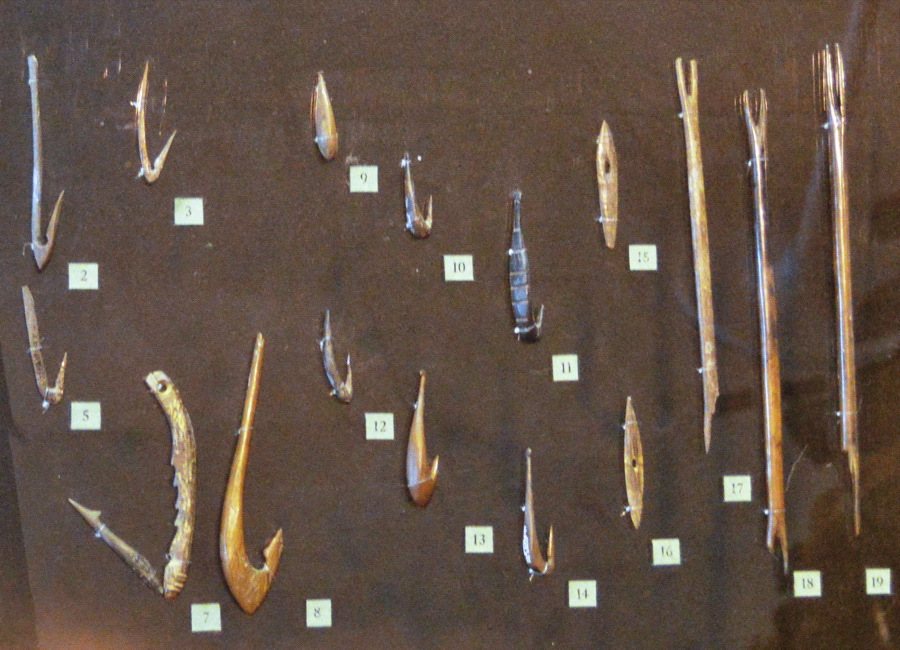
Fishing is the activity of trying to catch fish. Fish are often caught as wildlife from the natural environment (Freshwater ecosystem, freshwater or Marine ecosystem, marine), but may also be caught from Fish stocking, stocked Body of water, bodies of water such as Fish pond, ponds, canals, park wetlands and reservoirs. Fishing techniques include trawling, Longline fishing, longlining, jigging, Fishing techniques#Hand-gathering, hand-gathering, Spearfishing, spearing, Fishing net, netting, angling, Bowfishing, shooting and Fish trap, trapping, as well as Destructive fishing practices, more destructive and often Illegal, unreported and unregulated fishing, illegal techniques such as Electrofishing, electrocution, Blast fishing, blasting and Cyanide fishing, poisoning. The term fishing broadly includes catching aquatic animals other than fish, such as crustaceans (shrimp/lobsters/crabs), shellfish, cephalopods (octopus/squid) and echinoderms (starfish/sea urchins). The term is n ... [...More Info...] [...Related Items...] OR: [Wikipedia] [Google] [Baidu] |
Sea Stacks
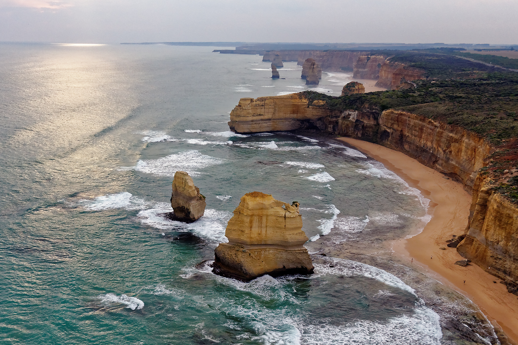
A stack or sea stack is a geological landform consisting of a steep and often vertical column or columns of rock in the sea near a coast, formed by wave erosion. Stacks are formed over time by wind and water, processes of coastal geomorphology. britannica.com They are formed when part of a is by hydraulic action, which is the force of the sea or water crashing against the rock. The force of the water weakens cracks in the headland, causing them to later collapse, ... [...More Info...] [...Related Items...] OR: [Wikipedia] [Google] [Baidu] |
Fjord
In physical geography, a fjord (also spelled fiord in New Zealand English; ) is a long, narrow sea inlet with steep sides or cliffs, created by a glacier. Fjords exist on the coasts of Antarctica, the Arctic, and surrounding landmasses of the northern and southern hemispheres. Norway's coastline is estimated to be long with its nearly 1,200 fjords, but only long excluding the fjords. Formation A true fjord is formed when a glacier cuts a U-shaped valley by ice segregation and abrasion of the surrounding bedrock. According to the standard model, glaciers formed in pre-glacial valleys with a gently sloping valley floor. The work of the glacier then left an overdeepened U-shaped valley that ends abruptly at a valley or trough end. Such valleys are fjords when flooded by the ocean. Thresholds above sea level create freshwater lakes. Glacial melting is accompanied by the rebounding of Earth's crust as the ice load and eroded sediment is removed (also called isostasy or gla ... [...More Info...] [...Related Items...] OR: [Wikipedia] [Google] [Baidu] |
Arctic Climate
The climate of the Arctic is characterized by long, cold winters and short, cool summers. There is a large amount of variability in climate across the Arctic, but all regions experience extremes of solar radiation in both summer and winter. Some parts of the Arctic are covered by ice (sea ice, glacial ice, or snow) year-round, and nearly all parts of the Arctic experience long periods with some form of ice on the surface. The Arctic consists of ocean that is largely surrounded by land. As such, the climate of much of the Arctic is moderated by the ocean water, which can never have a temperature below . In winter, this relatively warm water, even though covered by the polar ice pack, keeps the North Pole from being the coldest place in the Northern Hemisphere, and it is also part of the reason that Antarctica is so much colder than the Arctic. In summer, the presence of the nearby water keeps coastal areas from warming as much as they might otherwise. Overview of the Arctic ... [...More Info...] [...Related Items...] OR: [Wikipedia] [Google] [Baidu] |


