|
Geography Of Veliko Tarnovo
Veliko Tarnovo is located in Central Northern Bulgaria, in the central pre-Balkan and in the catchment area of the Yantra River. Location The main roads pass through the town, connecting the Western Balkans with the Black Sea and Central Europe with the Middle East. Urban area The town is an urban center and forms a metropolitan area with the sedentary town of Debelets, the villages of Ledenik, Belyakovets, Shemshevo, Prisovo and the suburban areas of Kozlodzha, Dervent. Relief The relief of the city is highly have a medium degree of roughness (RR from 5 to 40‰). To the east, the town is surrounded by the Tarnovo Heights, to the west by Kalakaya and Salamatya, to the south by the Debeli Bair, the Big and Small Duvar, Patryal Dyal, to the north by Orlovets and Kartala. The average altitude is 220 meters. Highest points: Garga Bair (373 m.), Kartala (359 m.), The Small Duvar (351 m.), Patryl share (350 m.). There are three caves over 5 meters deep around the city – two in ... [...More Info...] [...Related Items...] OR: [Wikipedia] [Google] [Baidu] |
Veliko Tarnovo
Veliko Tarnovo ( bg, Велико Търново, Veliko Tărnovo, ; "Great Tarnovo") is a town in north central Bulgaria and the administrative centre of Veliko Tarnovo Province. Often referred as the "''City of the Tsars''", Veliko Tarnovo is located on the Yantra River and is famously known as the historical capital of the Second Bulgarian Empire, attracting many tourists with its unique architecture. The old part of the town is situated on three hills, Tsarevets, Trapezitsa, and Sveta Gora, rising amidst the meanders of the Yantra. On Tsarevets are the palaces of the Bulgarian emperors and the Patriarchate, the Patriarchal Cathedral, and also a number of administrative and residential edifices surrounded by thick walls. Trapezitsa is known for its many churches and as the former main residence of the nobility. During the Middle Ages, the town was among the main European centres of culture and gave its name to the architecture of the Tarnovo Artistic School, paintin ... [...More Info...] [...Related Items...] OR: [Wikipedia] [Google] [Baidu] |
Siltstone
Siltstone, also known as aleurolite, is a clastic sedimentary rock that is composed mostly of silt. It is a form of mudrock with a low clay mineral content, which can be distinguished from shale by its lack of fissility.Blatt ''et al.'' 1980, pp.381-382 Although its permeability and porosity is relatively low, siltstone is sometimes a tight gas reservoir rock, an unconventional reservoir for natural gas that requires hydraulic fracturing for economic gas production. Siltstone was prized in ancient Egypt for manufacturing statuary and cosmetic palettes. The siltstone quarried at Wadi Hammamat was a hard, fine-grained siltstone that resisted flaking and was almost ideal for such uses. Description There is not complete agreement on the definition of siltstone. One definition is that siltstone is mudrock ( clastic sedimentary rock containing at least 50% clay and silt) in which at least 2/3 of the clay and silt fraction is composed of silt-sized particles. Silt is defi ... [...More Info...] [...Related Items...] OR: [Wikipedia] [Google] [Baidu] |
Belitsa (river)
BelitsaTown of Belitsa, Municipality Belitsa, District Blagoevgrad at Guide-Bulgaria.com ( bg, Белица ) is a town in southwestern , located in the of the province of . Geography Belitsa is close to |
Dryanovo River
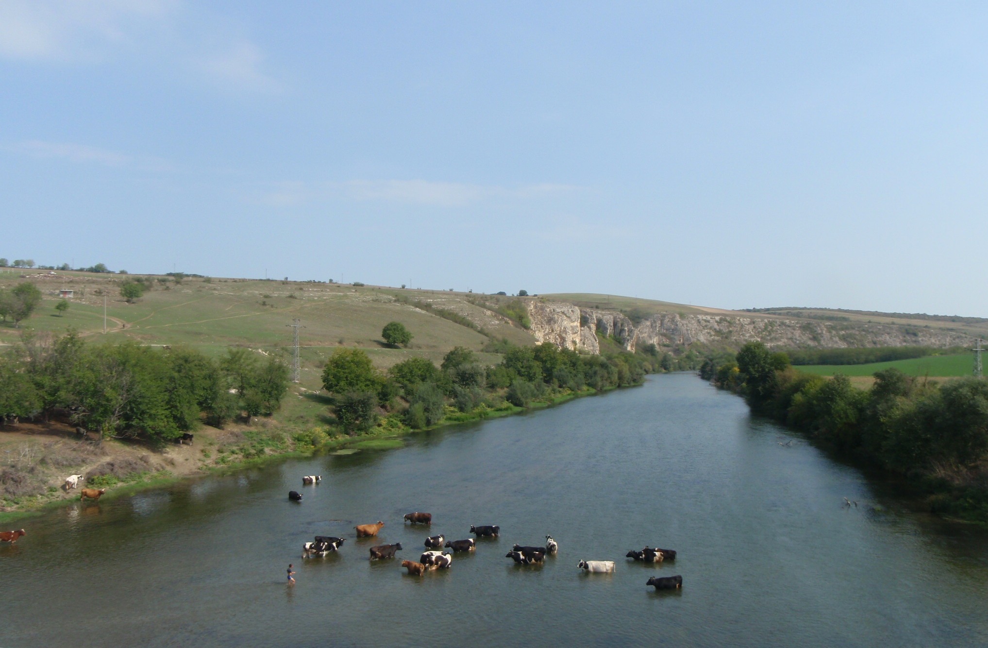
The Dryanovo ( bg, Дряновска река) is a river in Bulgaria, in Gabrovo Province and Veliko Tarnovo Province, a tributary of the Belitsa from the basin of the Yantra, flowing into the Danube). It issues from the mountains close to the town of Tryavna and flows into the Belitsa at the town of Debelets (a kilometer south to the city of Veliko Tarnovo). The river Dryanovo passes through Plachkovtsi, Tryavna, Tsareva Livada, Dryanovo, Ganchovets, Sokolovo and Debelets Debelets ( bg, Дебелец ) is a town in northern Bulgaria, part of Veliko Tarnovo Municipality, Veliko Tarnovo Province Veliko Tarnovo ( bg, Област Велико Търново, Oblast Veliko Tǎrnovo) is a province in the middle of .... Landforms of Veliko Tarnovo Province Landforms of Gabrovo Province Rivers of Bulgaria {{Bulgaria-river-stub ... [...More Info...] [...Related Items...] OR: [Wikipedia] [Google] [Baidu] |
Yantra (river)
The Yantra ( bg, Янтра ) is a river in northern Bulgaria, a right tributary of the Danube. It is long (the third longest Bulgarian tributary of the Danube, after Iskar and Osam), and has a watershed of . Its average discharge at the mouth is . The Yantra has its source from the northern foot of Hadzhi Dimitar Peak in Central Stara Planina, at . In its upper course, it is alternatively known as ''Etar'' (Етър), its older name. The river flows into the Danube close to Svishtov. The river characteristically forms a number of gorges as it flows northward through the foothills of Stara Planina. The most prominent and longest one is , located close to the capital of the Second Bulgarian Empire Veliko Tarnovo. Major cities on the river are Gabrovo, Veliko Tarnovo, Gorna Oryahovitsa, Polski Trambesh, and Byala, close to which is the famous Belenski bridge. Honour Yantra Cove in Livingston Island in the South Shetland Islands, Antarctica Antarctica () is Earth's ... [...More Info...] [...Related Items...] OR: [Wikipedia] [Google] [Baidu] |
Fortress At Veliko Tarnovo
A fortification is a military construction or building designed for the defense of territories in warfare, and is also used to establish rule in a region during peacetime. The term is derived from Latin ''fortis'' ("strong") and ''facere'' ("to make"). From very early history to modern times, defensive walls have often been necessary for cities to survive in an ever-changing world of invasion and conquest. Some settlements in the Indus Valley civilization were the first small cities to be fortified. In ancient Greece, large stone walls had been built in Mycenaean Greece, such as the ancient site of Mycenae (famous for the huge stone blocks of its ' cyclopean' walls). A Greek '' phrourion'' was a fortified collection of buildings used as a military garrison, and is the equivalent of the Roman castellum or English fortress. These constructions mainly served the purpose of a watch tower, to guard certain roads, passes, and borders. Though smaller than a real fortress, the ... [...More Info...] [...Related Items...] OR: [Wikipedia] [Google] [Baidu] |
Bentonite
Bentonite () is an absorbent swelling clay consisting mostly of montmorillonite (a type of smectite) which can either be Na-montmorillonite or Ca-montmorillonite. Na-montmorillonite has a considerably greater swelling capacity than Ca-montmorillonite. Bentonite usually forms from the weathering of volcanic ash in seawater, or by hydrothermal circulation through the porosity of volcanic ash beds, which converts ( devitrification) the volcanic glass (obsidian, rhyolite, dacite) present in the ash into clay minerals. In the mineral alteration process, a large fraction (up to 40-50 wt.%) of amorphous silica is dissolved and leached away, leaving the bentonite deposit in place. Bentonite beds are white or pale blue or green (traces of reduced ) in fresh exposures, turning to a cream color and then yellow, red, or brown (traces of oxidized ) as the exposure is weathered further. As a swelling clay, bentonite has the ability to absorb large quantities of water, whic ... [...More Info...] [...Related Items...] OR: [Wikipedia] [Google] [Baidu] |
Montmorillonite
Montmorillonite is a very soft phyllosilicate group of minerals that form when they precipitate from water solution as microscopic crystals, known as clay. It is named after Montmorillon in France. Montmorillonite, a member of the smectite group, is a 2:1 clay, meaning that it has two tetrahedral sheets of silica sandwiching a central octahedral sheet of alumina. The particles are plate-shaped with an average diameter around 1 μm and a thickness of 0.96 nm; magnification of about 25,000 times, using an electron microscope, is required to "see" individual clay particles. Members of this group include, amongst others, saponite, nontronite, beidellite, and hectorite. Montmorillonite is a subclass of smectite, a 2:1 phyllosilicate mineral characterized as having greater than 50% octahedral charge; its cation exchange capacity is due to isomorphous substitution of Mg for Al in the central alumina plane. The substitution of lower valence cations in such instances leaves the nea ... [...More Info...] [...Related Items...] OR: [Wikipedia] [Google] [Baidu] |
Limestone
Limestone ( calcium carbonate ) is a type of carbonate sedimentary rock which is the main source of the material lime. It is composed mostly of the minerals calcite and aragonite, which are different crystal forms of . Limestone forms when these minerals precipitate out of water containing dissolved calcium. This can take place through both biological and nonbiological processes, though biological processes, such as the accumulation of corals and shells in the sea, have likely been more important for the last 540 million years. Limestone often contains fossils which provide scientists with information on ancient environments and on the evolution of life. About 20% to 25% of sedimentary rock is carbonate rock, and most of this is limestone. The remaining carbonate rock is mostly dolomite, a closely related rock, which contains a high percentage of the mineral dolomite, . ''Magnesian limestone'' is an obsolete and poorly-defined term used variously for dolomite, for lime ... [...More Info...] [...Related Items...] OR: [Wikipedia] [Google] [Baidu] |
Granite
Granite () is a coarse-grained ( phaneritic) intrusive igneous rock composed mostly of quartz, alkali feldspar, and plagioclase. It forms from magma with a high content of silica and alkali metal oxides that slowly cools and solidifies underground. It is common in the continental crust of Earth, where it is found in igneous intrusions. These range in size from dikes only a few centimeters across to batholiths exposed over hundreds of square kilometers. Granite is typical of a larger family of ''granitic rocks'', or '' granitoids'', that are composed mostly of coarse-grained quartz and feldspars in varying proportions. These rocks are classified by the relative percentages of quartz, alkali feldspar, and plagioclase (the QAPF classification), with true granite representing granitic rocks rich in quartz and alkali feldspar. Most granitic rocks also contain mica or amphibole minerals, though a few (known as leucogranites) contain almost no dark minerals. Granite is ... [...More Info...] [...Related Items...] OR: [Wikipedia] [Google] [Baidu] |
Garga Bair
Garga may refer to: People * Garga (sage), ancient Indian sage and the author of a ''Rigveda'' hymn * Bhagwan Das Garga, Indian documentary filmmaker * Garga Haman Adji, Cameroonian politician * Vrddha Garga, ancient Indian astrologer and astronomer Places * Garga, Republic of Buryatia, a rural locality in Russia * Garga, Iran, a village in Iran * Garga, Burkina Faso, a village in Niou Department, Burkina Faso * Garga (river), a river in Italy Other * ''Garga'' (skipper), a genus of butterflies * Garga, a fictional character in the ''Future Card Buddyfight'' collectible card game See also * * Gargah, Iran * Gargi, an ancient Indian philosopher and sage * ''Gargi'' (film), 2022 Indian legal drama film by Gautham Ramachandran *Garga Samhita (other) * Garg (other) * Gargar (other) Gargar may refer to: * Gargar, Armenia * Gərgər, Azerbaijan * Gargar-e Paini, Iran * Gargar, Chaharmahal and Bakhtiari, Iran * Gargar, Lorestan, Iran * Gargar ... [...More Info...] [...Related Items...] OR: [Wikipedia] [Google] [Baidu] |


