|
Geography Of Belgium
Belgium is a federal state located in Western Europe and is divided into three regions: the Flemish Region (Flanders), the Walloon Region (Wallonia), and the Brussels Capital Region (Brussels). Belgium borders the North Sea and shares borders with the countries of France (620 km), the Netherlands (450 km), Germany (162/167 km) and Luxembourg (148 km). General information Total renewable water resources: 20 cu km (2013) Freshwater withdrawal (domestic/industrial/agricultural): ''total:'' 6.22 cu km/yr (12%/88%/1%) ''per capita:'' 589.8 cu m/yr (2007) Natural hazards: flooding is a threat in areas of reclaimed coastal land, protected from the sea by concrete dikes Geography – note: crossroads of Western Europe; majority of West European capitals within 1,000 km of Brussels which is the seat of both the EU and NATO Longest Distances: 280 km SE-NW/ 222 km NE-SW Area Belgium has an area of 30,689 km² (11,849 sq mi), with or 55.1% for th ... [...More Info...] [...Related Items...] OR: [Wikipedia] [Google] [Baidu] |
Europe
Europe is a continent located entirely in the Northern Hemisphere and mostly in the Eastern Hemisphere. It is bordered by the Arctic Ocean to the north, the Atlantic Ocean to the west, the Mediterranean Sea to the south, and Asia to the east. Europe shares the landmass of Eurasia with Asia, and of Afro-Eurasia with both Africa and Asia. Europe is commonly considered to be Boundaries between the continents#Asia and Europe, separated from Asia by the Drainage divide, watershed of the Ural Mountains, the Ural (river), Ural River, the Caspian Sea, the Greater Caucasus, the Black Sea, and the waterway of the Bosporus, Bosporus Strait. "Europe" (pp. 68–69); "Asia" (pp. 90–91): "A commonly accepted division between Asia and Europe ... is formed by the Ural Mountains, Ural River, Caspian Sea, Caucasus Mountains, and the Black Sea with its outlets, the Bosporus and Dardanelles." Europe covers approx. , or 2% of Earth#Surface, Earth's surface (6.8% of Earth's land area), making it ... [...More Info...] [...Related Items...] OR: [Wikipedia] [Google] [Baidu] |
Provinces Of Belgium
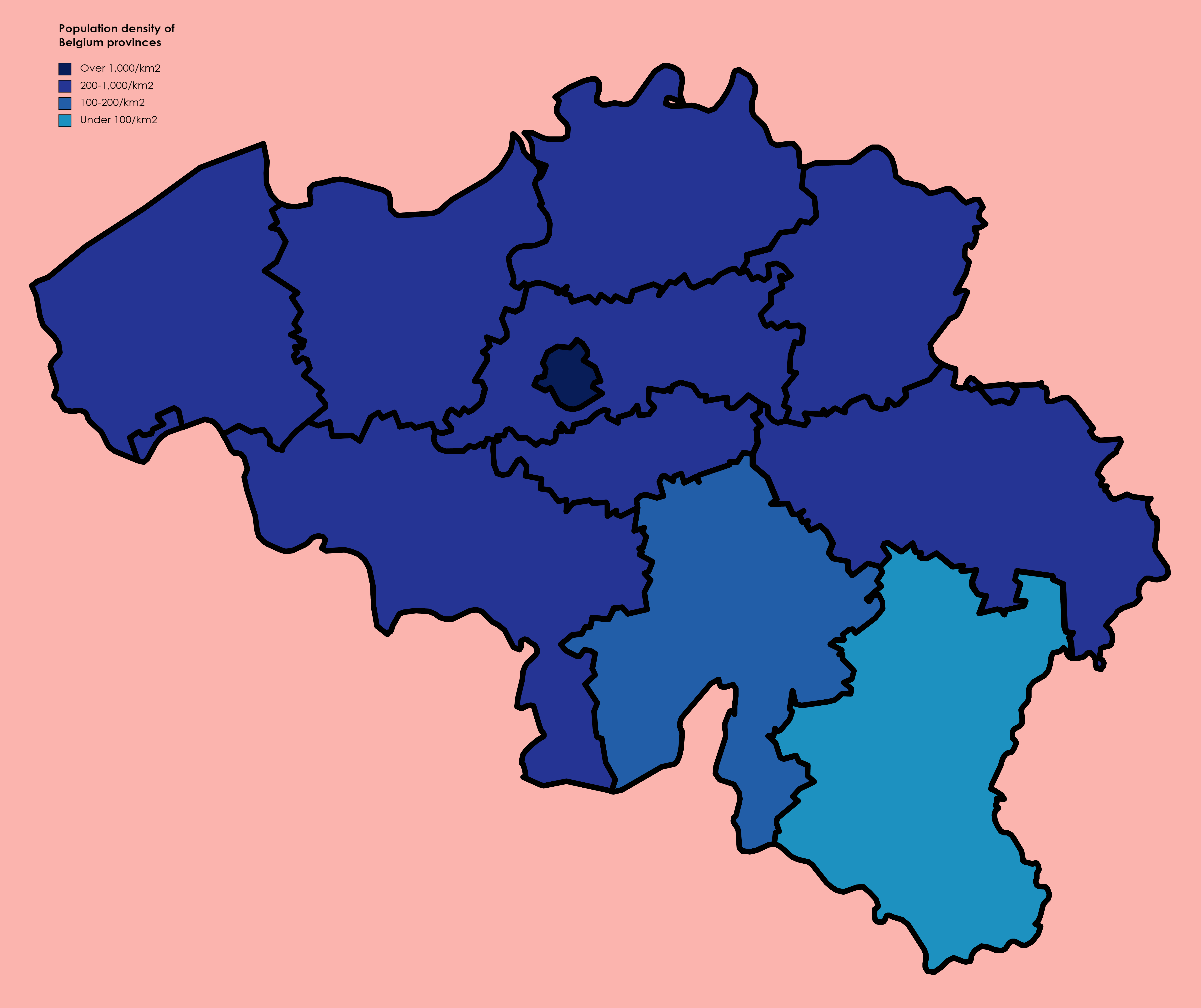
The Kingdom of Belgium is divided into three Communities, regions, and language areas of Belgium, regions. Two of these regions, Flanders and Wallonia, are each subdivided into five provinces. The third region, Brussels, does not belong to any province, nor is it subdivided into provinces. Instead, it has amalgamated both regional and provincial functions into a single "Capital Region" administration. Most of the provinces take their name from earlier duchy, duchies and county, counties of similar location, while their territory is mostly based on the 130 departments of the First French Empire, departments installed during French annexation. At the time of the Independence of Belgium, creation of Belgium in 1830, only nine provinces existed, including the province of Brabant, which held the City of Brussels. In 1995, Brabant was split into three areas: Flemish Brabant, which became a part of the region of Flanders; Walloon Brabant, which became part of the region of Wallonia; an ... [...More Info...] [...Related Items...] OR: [Wikipedia] [Google] [Baidu] |
Ghent–Terneuzen Canal
The Ghent–Terneuzen Canal (Dutch: Kanaal van Gent naar Terneuzen), also known as the "Sea Canal" (Zeekanaal) is a canal linking Ghent in Belgium to the port of Terneuzen on the Westerschelde (Scheldt) Estuary in the Netherlands, thereby providing the former with better access to the sea. History The canal was constructed between 1823 and 1827 on the initiative of the Dutch King: Belgium (as it subsequently became) and the Netherlands had become a united country under the terms agreed at the Congress of Vienna. After Belgium broke away in 1830, traffic to and from Belgium was blocked by the Dutch until 1841. Between 1870 and 1885, the canal was enlarged to a depth of six and a half metres at its centre, and to a width of 17 metres at its base and 68 metres at the surface level: bridges being rebuilt accordingly along the Belgian sector. The famous Cluysen - Ter Donck Regatta was organised here for many decades (1888-1954) and during the 1913 Expo of Ghent the European R ... [...More Info...] [...Related Items...] OR: [Wikipedia] [Google] [Baidu] |
Zelzate
Zelzate () is a municipality located in the Belgian province of East Flanders. The municipality only comprises the town of Zelzate proper. In 2021, Zelzate had a total population of 13,124. The total area is 13.71 km2. Zelzate is divided into two parts by the Ghent–Terneuzen Canal. There is a concrete drawbridge and a tunnel to connect the two sides. Zelzate is known for the nearby polluting industry, which makes it the village with the lowest air quality in the country. Recently ArcelorMittal Ghent (Sidmar) made a major investment which resulted in an emission decrease of 90%. Notable citizens * Eric Verpaele (b. Zelzate, 2 February 1952), writer * Eddy Wally (b. Zelzate, 12 July 1932), singer Sister cities The town is twinned with: *Aubenas (France) * Cesenatico (Italy) *Delfzijl (Netherlands) (Not longer twinned with) * Schwarzenbek (Germany) *Sierre Sierre (; ; ) is the capital municipality of the district of Sierre, located in the canton of Valais, Swi ... [...More Info...] [...Related Items...] OR: [Wikipedia] [Google] [Baidu] |
Brussels-Capital Region
Brussels, officially the Brussels-Capital Region, (All text and all but one graphic show the English name as Brussels-Capital Region.) is a region of Belgium comprising 19 municipalities, including the City of Brussels, which is the capital of Belgium. The Brussels-Capital Region is located in the central portion of the country. It is a part of both the French Community of Belgium and the Flemish Community, and is separate from the Flemish Region (Flanders), within which it forms an enclave, and the Walloon Region (Wallonia), located less than to the south. Brussels grew from a small rural settlement on the river Senne to become an important city-region in Europe. Since the end of the Second World War, it has been a major centre for international politics and home to numerous international organisations, politicians, diplomats and civil servants. Brussels is the '' de facto'' capital of the European Union, as it hosts a number of principal EU institutions, including i ... [...More Info...] [...Related Items...] OR: [Wikipedia] [Google] [Baidu] |
Walloon Brabant
Walloon Brabant ( ; ; ) is a province located in Belgium's French-speaking region of Wallonia. It borders on (clockwise from the North) the province of Flemish Brabant (Flemish Region) and the provinces of Liège, Namur and Hainaut. Walloon Brabant's capital is Wavre; however, the municipality of Braine-l'Alleud is slightly more populous. The provincial population was recorded at about 414,000 as of January 2024, and an area of 1,097 square kilometres (424 sq mi). Etymology Walloon is a Belgian version of an old West Germanic word reconstructed as *walh (“foreigner, stranger, speaker of Celtic or Latin”). Brabant is from Old Dutch *brākbant (attested in Medieval Latin as pāgus brācbatensis, Bracbantum, Bracbantia), from Frankish, a compound of Proto-Germanic *brēk-, *brekaną (“fallow, originally 'to break'”) + *bant-, *bantō, *banti (“district, region”) Like the terms "Belgium" and "Flanders", the terms "Walloon" and "Brabant" are much older than the mode ... [...More Info...] [...Related Items...] OR: [Wikipedia] [Google] [Baidu] |
Flemish Brabant
Flemish Brabant ( ; ) is a province of Flanders, one of the three regions of Belgium. It borders on (clockwise from the North) the Belgian provinces of Antwerp, Limburg, Liège, Walloon Brabant, Hainaut and East Flanders. Flemish Brabant also surrounds the Brussels-Capital Region. Its capital is Leuven. It has an area of which is divided into two administrative districts (''arrondissementen'' in Dutch) containing 65 municipalities. As of January 2024, Flemish Brabant had a population of over 1.19 million. Flemish Brabant was created in 1995 by the splitting of the former province of Brabant into three parts: two new provinces, Flemish Brabant and Walloon Brabant; and the Brussels-Capital Region, which no longer belongs to any province. The split was made to accommodate the eventual division of Belgium in three regions (Flanders, Wallonia and the Brussels-Capital Region). The province is made up of two arrondissements. The Halle-Vilvoorde Arrondissement surrounds Brussels a ... [...More Info...] [...Related Items...] OR: [Wikipedia] [Google] [Baidu] |
Limburg (Belgium)
Limburg (, ; or ; , ), also known as Belgian Limburg, is a province in Belgium. It is the easternmost of the five Dutch language, Dutch-speaking provinces that together form the Flemish Region, Region of Flanders, which is one of the three main Communities, regions and language areas of Belgium, political and cultural sub-divisions of modern-day Belgium. As of January 2024, Limburg had a population of 0.9 million. Limburg is located west of the Meuse (), which separates it from the similarly-named Netherlands, Dutch province of Limburg (Netherlands), Limburg. To the south it shares a border with the French-speaking province of Liège Province, Liège, with which it also has historical ties. To the north and west are the old territories of the Duchy of Brabant. Today these are the Flemish provinces of Flemish Brabant and Antwerp (province), Antwerp to the west, and the Dutch province of North Brabant to the north. Historically Belgian Limburg is roughly equivalent to the Dutch-s ... [...More Info...] [...Related Items...] OR: [Wikipedia] [Google] [Baidu] |
Antwerp Province
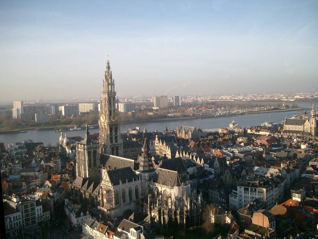
Antwerp Province (; ; ; ), between 1815 and 1830 known as Central Brabant ( , , ), is the northernmost Provinces of Belgium, province both of the Flemish Region, also called Flanders, and of Belgium. It borders on the North Brabant province of the Netherlands to the north and the Belgian provinces of Limburg (Belgium), Limburg, Flemish Brabant and East Flanders. Its capital is Antwerp, which includes the Port of Antwerp, the second-largest Port, seaport in Europe. It has an area of , and with over 1.92 million inhabitants as of January 2024, is the country's most populous province. The province consists of three Arrondissements of Belgium, arrondissements: Antwerp, Mechelen and Turnhout. The eastern part of the province comprises the main part of the Campine region. History During the early Middle Ages the region was part of the Francia, Frankish Empire, which was divided into several ''Pagus, pagi''. The territory of the present-day province belonged to several ''pagi'' of which ... [...More Info...] [...Related Items...] OR: [Wikipedia] [Google] [Baidu] |
East Flanders
East Flanders ( ; ; ; ) is a Provinces of Belgium, province of Belgium. It borders (clockwise from the North) the Netherlands, Dutch province of Zeeland and the Belgian provinces of Antwerp (province), Antwerp, Flemish Brabant, Hainaut (province), Hainaut and West Flanders. It has an area of , divided into six administrative districts containing 60 municipalities, and a population of over 1.57 million as of January 2024. The capital is Ghent, home to the Ghent University and the Port of Ghent. History During the short-lived Napoleonic Empire, most of the area of the modern province was part of the Escaut (department), Department of Escaut, named after the River Scheldt. Following the defeat of Napoleon, the entity was Geographical renaming, renamed after its geographical location in the eastern part of the historic County of Flanders (now in the western portion of the current Flemish Region). The provincial flag has a black lion with red tongue and claws, on a background of h ... [...More Info...] [...Related Items...] OR: [Wikipedia] [Google] [Baidu] |
West Flanders
West Flanders is the westernmost province of the Flemish Region, in Belgium. It is the only coastal Belgian province, facing the North Sea to the northwest. It has land borders with the Dutch province of Zeeland to the northeast, the Flemish province of East Flanders to the east, the Walloon province of Hainaut in the south and the French department of Nord to the west. Its capital is Bruges (''Brugge''). Other important cities are Kortrijk in the south and Ostend (''Oostende'') on the coast, Roeselare and Ypres (''Ieper''). The province has an area of which is divided into eight administrative districts (''arrondissementen'') containing 64 municipalities. As of January 2024, West Flanders has a population of over 1.22 million. The North Sea coast of Belgium, an important tourism destination, lies in West Flanders. A tram line runs the length of the coast, from De Panne on the French border to Knokke-Heist on the Dutch border. West Flanders has two seaports, the ... [...More Info...] [...Related Items...] OR: [Wikipedia] [Google] [Baidu] |
Namur Province
Namur (; ; ) is a Provinces of Belgium, province of Wallonia, one of the three regions of Belgium. It borders (clockwise from the West) on the Walloon provinces of Hainaut Province, Hainaut, Walloon Brabant, Liège Province, Liège and Luxembourg (Belgium), Luxembourg in Belgium, and the France, French department of Ardennes (department), Ardennes. Its capital and largest city is the city of Namur. As of January 2024, the province of Namur has a population of about 0.5 million. Subdivisions It has an area of and is divided into three Arrondissements of Belgium, administrative districts (''arrondissements'' in French language, French) containing a total of 38 municipalities (''communes'' in French language, French). Economy The Gross domestic product (GDP) of the province was 13.5 billion € in 2018, accounting for 2.9% of Belgium's economic output. GDP per capita adjusted for purchasing power was 24,000 € or 80% of the EU27 average in the same year. GDP per person emplo ... [...More Info...] [...Related Items...] OR: [Wikipedia] [Google] [Baidu] |


