|
European Route E85
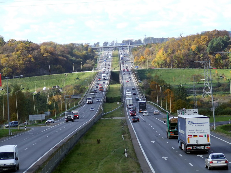
European route E85 is part of the International E-road network, which is a series of main roads in Europe. The E 85 starts from Klaipėda, Lithuania and ends at Alexandroupolis, Greece. The E 85 is long. The definition of its route by UNECE is: Klaipéda - Kaunas - Vilnius - Lida - Slonim - Kobrin - Luck - Černovcy - Siret - Suceava - Săbăoani - Roman - Bačau - Mărăsesti - TisiŃa - Buzău - Urziceni - Bucuresti - Giurgiu - Ruse - Bjala - Veliko Tarnovo - Stara Zagora - Haskovo - Svilengrad - Ormenio - Kastanies - Didymoteicho - Alexandropouli. Route Lithuania *: Klaipėda () - Kryžkalnis () - Kaunas ( ) - Vilnius ( ) *: Vilnius ( ) *: Vilnius () - Šalčininkai Belarus *: Beiniakoni - Lida - Slonim - Ivatsevichy () *: Ivatsevichy (Start of Concurrency with ) - Kobryn (End of Concurrency with ) Ukraine *: Domanove - Kovel () - Dubno () - Ternopil () - Chernivtsi - Porubne Romania *: Siret - Suceava () - Săbăoani () - Roman - Bacău () - Ti� ... [...More Info...] [...Related Items...] OR: [Wikipedia] [Google] [Baidu] |
Kaunas
Kaunas (; ) is the second-largest city in Lithuania after Vilnius, the fourth largest List of cities in the Baltic states by population, city in the Baltic States and an important centre of Lithuanian economic, academic, and cultural life. Kaunas was the largest city and the centre of a in the Duchy of Trakai of the Grand Duchy of Lithuania and Trakai Voivodeship, Trakai Palatinate since 1413. In the Russian Empire, it was the capital of the Kovno Governorate, Kaunas Governorate from 1843 to 1915. During the interwar period, it served as the temporary capital of Lithuania, when Vilnius was Polish–Lithuanian War, seized and controlled by Second Polish Republic, Poland between 1920 and 1939. During that period Kaunas was celebrated for its rich cultural and academic life, fashion, construction of countless Art Deco and Lithuanian National Revival architectural-style buildings as well as popular furniture, interior design of the time, and a widespread café culture. The city in ... [...More Info...] [...Related Items...] OR: [Wikipedia] [Google] [Baidu] |
Chernivtsi
Chernivtsi (, ; , ;, , see also #Names, other names) is a city in southwestern Ukraine on the upper course of the Prut River. Formerly the capital of the historic region of Bukovina, which is now divided between Romania and Ukraine, Chernivtsi serves as the administrative center for the Chernivtsi urban hromada, the Chernivtsi Raion, and the Chernivtsi Oblast, oblast itself. The Chernivtsi population is and the latest Ukrainian Census (2001), census in 2001 was 240,600. The first document that refers to this city dates back to 1408, when Chernivtsi was a town in the region of Moldavia, formerly as a defensive fortification, and became the center of Bukovina in 1488. In 1538, Chernivtsi was under the control of the Principality of Moldavia under Crown of the Kingdom of Poland, Polish suzerainty, later under Ottoman Empire suzerainty, and the Moldavian control lasted for two centuries until 1774, when Archduchy of Austria, Austria took control of Bukovina in the aftermath of t ... [...More Info...] [...Related Items...] OR: [Wikipedia] [Google] [Baidu] |
Ternopil
Ternopil, known until 1944 mostly as Tarnopol, is a city in western Ukraine, located on the banks of the Seret River. Ternopil is one of the major cities of Western Ukraine and the historical regions of Galicia and Podolia. The population of Ternopil was estimated at The city is the administrative center of Ternopil Oblast (region), as well as of surrounding Ternopil Raion (district) within the oblast. It hosts the administration of Ternopil urban hromada, one of the hromadas of Ukraine. History The city was founded in 1540 by Polish commander and Hetman Jan Amor Tarnowski. Its Polish name, ''Tarnopol'', means 'Tarnowski's city' and stems from a combination of the founder's family name and the Greek term ''polis''. The city served as a military stronghold and castle protecting the eastern borders of Polish Kingdom from Tatar raids. On 15 April 1540, the King of Poland, Sigismund I the Old, in Kraków gave Tarnowski permission to establish Tarnopol, near Sopilc ... [...More Info...] [...Related Items...] OR: [Wikipedia] [Google] [Baidu] |
Dubno
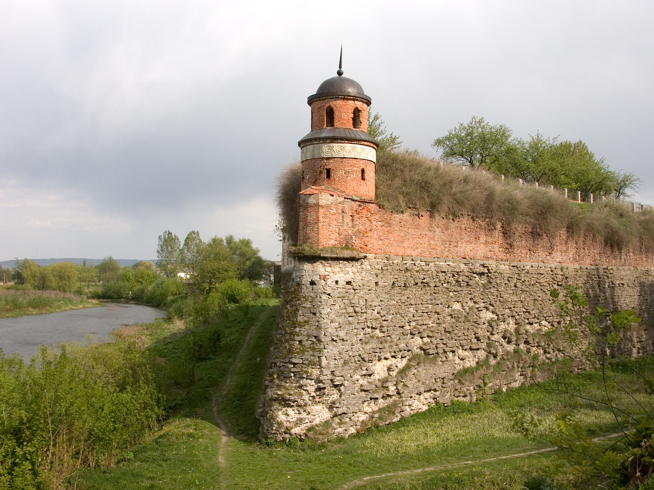
Dubno (, ) is a List of cities in Ukraine, city and List of hromadas of Ukraine, municipality located on the Ikva River in Rivne Oblast (oblast, province) of western Ukraine. It serves as the capital city, administrative center of Dubno Raion (raion, district). The city is located on intersection of two major European routes, E40 and E85. The city is estimated to have a population of . It is located within the historic region of Volhynia. In Soviet times it was home to the Cold War facility Dubno (air base), Dubno air base. The city is also famous for its Dubno Castle, castle. History Middle Ages First mentioned in a chronicle of 1100, when it was in possession of Yaroslav the Wise's grandson David of Brest , Dubno was even a seat of local princes for a short period of time. In 1240 the town was raided by the Mongol Empire, Mongols. In the early 14th century the region was the subject of Kingdom of Poland (1025-1385), Polish-Grand Duchy of Lithuania, Lithuanian rivalry, as ... [...More Info...] [...Related Items...] OR: [Wikipedia] [Google] [Baidu] |
Kovel
Kovel (, ; ; ) is a city in Volyn Oblast, northwestern Ukraine. It serves as the administrative center of Kovel Raion within the oblast. Population: Kovel gives its name to one of the oldest runic inscriptions which were lost during World War II. The Kovel spearhead, unearthed near the town in 1858, contained text in Gothic. History The name Kovel comes from a Slavonic word for blacksmith hence the horseshoe on the town's coat of arms. The rune-inscribed Spearhead of Kovel was found near Kovel in 1858. It dates to the early 3rd century, when Gothic tribes lived in the area. Kovel (Kowel) was first mentioned in 1310. It received its town charter from the Polish King Sigismund I the Old in 1518. In 1547 the owner of Kowel became Bona Sforza, Polish queen. Since 1564 the starost of Kowel was Andrei Kurbski (d. 1584). From 1566 to 1795 it was part of the Volhynian Voivodeship. Kowel was a royal city of Poland. In 1792 the 3rd Polish Vanguard Regiment was garrisoned in Kowel ... [...More Info...] [...Related Items...] OR: [Wikipedia] [Google] [Baidu] |
Domanove (border Checkpoint)
Domanove () is a border crossing between Belarus and Ukraine, just north of village of Domanove, Ratne Raion, Volyn Oblast. Overview The checkpoint/crossing is situated on the (). Named after village of Domanove that is located nearby. Across the border on the Belarusian side is a border checkpoint Makrany. The type of crossing is automobile, status - international. The types of transportation for automobile crossings are passenger and freight. The port of entry is part of the Domanove customs post of Yahodyn customs. See also * State border of Ukraine The state border of Ukraine (; abbreviated as DerzhKordon) is the internationally recognized boundary of Ukraine, encompassing its land, maritime territory, and airspace. The border is jointly secured by the State Border Guard Service of Ukraine ... References External links State Border Guard of Ukraine website Belarus–Ukraine border crossings Geography of Volyn Oblast {{Volyn-geo-stub ... [...More Info...] [...Related Items...] OR: [Wikipedia] [Google] [Baidu] |
Kobryn
Kobryn or Kobrin is a town in Brest Region, Belarus. It serves as the administrative center of Kobryn District. It is located in the southwestern corner of Belarus, where the Mukhavets river and Dnieper–Bug Canal meet. The town lies about east of the city of Brest, Belarus, Brest. As of 2025, it has a population of 52,432. History In the early times, it was inhabited by the ancient Balts, Baltic Yotvingian tribe. At various times, the city belonged to Kingdom of Galicia–Volhynia, the Grand Duchy of Lithuania, the Polish–Lithuanian Commonwealth, the Russian Empire, the Second Polish Republic, the Byelorussian Soviet Socialist Republic, Byelorussian SSR, and the Belarus, Republic of Belarus. Middle Ages and early modern era In the 10th century, the area became part of the emerging Civitas Schinesghe, Polish state under first ruler Mieszko I of Poland. Later, the area was part of the Kievan Rus' and the Kingdom of Galicia–Volhynia. Kobryn was first mentioned in 1287. I ... [...More Info...] [...Related Items...] OR: [Wikipedia] [Google] [Baidu] |
Ivatsevichy
Ivatsevichy (; ; ) is a town in Brest Region, Belarus. It serves as the administrative center of Ivatsevichy District. As of 2025, it has a population of 22,264. History Within the Grand Duchy of Lithuania, Ivatsevitshy was part of Nowogródek Voivodeship. In 1795, the town was acquired by the Russian Empire in the course of the Third Partition of Poland From 1921 until 1939, Ivatsevichy (''Iwacewicze'') was a provincial town in the Second Polish Republic, the seat of Kosów county with a population of around 1,500. It belonged to Polesie Voivodeship region of eastern Kresy, with a notable Jewish population. During World War II, Ivatsevichy was occupied by the Red Army and, on 14 November 1939, incorporated into the Byelorussian SSR. The number of Jews in Ivatsevichy greatly increased due to influx of refugees from the Nazi-occupied western part of Poland. Ivatsevichy was occupied by Nazi Germany from 24 June 1941 until 12 July 1944 and administered as a part of the ''Gen ... [...More Info...] [...Related Items...] OR: [Wikipedia] [Google] [Baidu] |
Slonim
Slonim is a town in Grodno Region, in western Belarus. It serves as the administrative center of Slonim District. It is located at the junction of the Shchara and Isa (river), Isa rivers, southeast of Grodno. As of 2025, it has a population of 48,402. Etymology and historical names Slonim has been known by several versions of its name as spoken by speakers of various languages: Сло́нім (Belarusian language, Belarusian), Słonim (Polish language , Polish), Сло́ним (Russian language , Russian). Slonim was first mentioned by scribes in chronicles in 1252 as ''Uslonim'' and in 1255 as ''Vslonim''. According to one account (which is also considered by some to be an official one), the name of the city originates from the Slavic word ''zaslona'' (a screen), implying that the city once functioned as an outpost at the southern border of the Grand Duchy of Lithuania. Another version, proposed by Jazep Stabroŭski, states that "Slonim" derives from 'Užslenimas', which in Li ... [...More Info...] [...Related Items...] OR: [Wikipedia] [Google] [Baidu] |
Lida
Lida is a city in Grodno Region, western Belarus, located west of Minsk. It serves as the administrative center of Lida District. As of 2025, it has a population of 103,262. Etymology The name ''Lida'' arises from its Lithuanian name ''Lyda'', which derives from ''lydimas'', meaning "slash-and-burn" agricultural method or a plot of land prepared in this way. Names in other languages are spelled as and . History Early history There are passing mentions of Lida in chronicles from 1180. Until the early 14th century, the settlement at Lida was a wooden fortress in Lithuania proper. In 1323, the Grand Duke of Lithuania Gediminas built a brick fortress there. The generally considered founding year of Lida is 1380. The fortress withstood Crusader attacks from Prussia in 1392 and 1394 but was burned to the ground in 1710. Following the death of Gediminas, when Lithuania was divided into principalities, Lida became the capital of one of them, the seat of Algirdas. Lida was ... [...More Info...] [...Related Items...] OR: [Wikipedia] [Google] [Baidu] |


