|
Electoral Wards Of Belfast
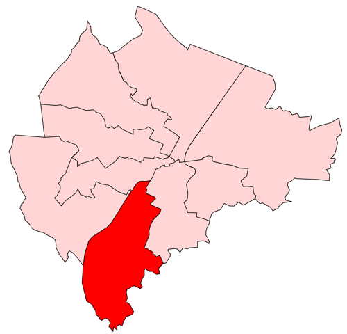
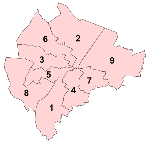
The electoral wards of Belfast are Subdivisions of Belfast, subdivisions of the city, used primarily for statistics and elections. Belfast had 51 wards from May 1973, which were revised in May 1985 and again in May 1993. The number of wards was increased to 60 with the reform of local government in Northern Ireland, 2014 changes in local government. Wards are the smallest administrative unit in Northern Ireland and are set by the Local Government Boundaries Commissioner and reviewed every 8–12 years. Wards are used to create constituencies for Local government in Northern Ireland, local government authorities, the Northern Ireland Assembly and the House of Commons of the United Kingdom. In elections to Belfast City Council, the 60 wards are split into ten District Electoral Areas, each of which contains between five and seven wards, with the number of Members of Belfast City Council, councillors it elects equal to the number of wards it contains. The constituencies for elections ... [...More Info...] [...Related Items...] OR: [Wikipedia] [Google] [Baidu] |
Subdivisions Of Belfast
The subdivisions of Belfast are a series of divisions of Belfast, Northern Ireland that are used for a variety of cultural, electoral, planning and residential purposes. The city is traditionally divided into four main areas based on the cardinal points of a compass, each of which form the basis of constituencies for general elections: North Belfast, East Belfast, South Belfast, and West Belfast. These four areas meet at Belfast City Centre. The second traditional divide is that formed by the River Lagan, with the northern bank of the River being part of County Antrim, while the southern bank is part of County Down. The city's subdivisions reflect the divided nature of Northern Ireland as a whole, with areas tending to be highly segregated, especially in working-class neighbourhoods. Walls known as peace lines, originally erected by the British Army after August 1969, divide fourteen inner city neighbourhoods. Townlands The townlands of Belfast are the oldest survivin ... [...More Info...] [...Related Items...] OR: [Wikipedia] [Google] [Baidu] |
UK Parliament
The Parliament of the United Kingdom of Great Britain and Northern Ireland is the supreme legislative body of the United Kingdom, and may also legislate for the Crown Dependencies and the British Overseas Territories. It meets at the Palace of Westminster in London. Parliament possesses legislative supremacy and thereby holds ultimate power over all other political bodies in the United Kingdom and the Overseas Territories. While Parliament is bicameral, it has three parts: the sovereign, the House of Lords, and the House of Commons. The three parts acting together to legislate may be described as the King-in-Parliament. The Crown normally acts on the advice of the prime minister, and the powers of the House of Lords are limited to only delaying legislation. The House of Commons is the elected lower chamber of Parliament, with elections to 650 single-member constituencies held at least every five years under the first-past-the-post system. By constitutional convention, ... [...More Info...] [...Related Items...] OR: [Wikipedia] [Google] [Baidu] |
Belfast West (UK Parliament Constituency)
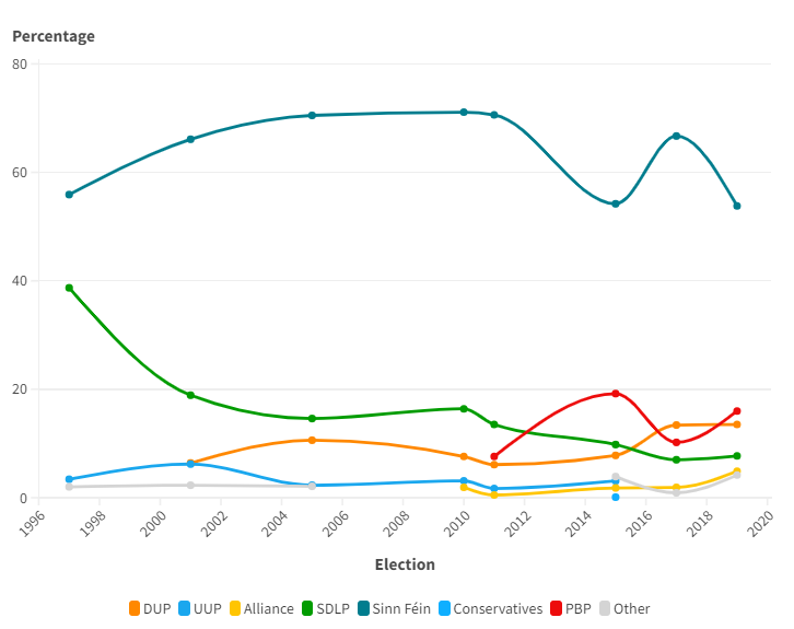
Belfast West is a parliamentary constituency (seat) in the House of Commons of the UK Parliament. The current MP is Paul Maskey of Sinn Fein. In 2017, it ranked the most secure of Northern Ireland's 18 seats by percentage and/or numerical tally of its winning majority, followed by North Down and by North Antrim respectively. Boundaries 1885–1918: In the Borough of Belfast, Smithfield ward, that part of St. Anne's ward bounded on the north-west by a line drawn along the centre of Carrick Hill, that part of St. George's ward lying to the north of a line drawn along the centre of Grosvenor Street and west of a line drawn along the centre of Durham Street, and the townlands of Ballymagarry and Ballymurphy in the parish of Shankill. 1922–1974: The County Borough of Belfast wards of Court, Falls, St. Anne's, St. George's, Smithfield, and Woodvale. The boundaries of these wards can be seen iSchedule 9 of the Report of the Boundary Commission (Ireland) on the Representation ... [...More Info...] [...Related Items...] OR: [Wikipedia] [Google] [Baidu] |
Belfast West (Assembly Constituency)
Belfast West is a constituency in the Northern Ireland Assembly. It was first used for a Northern Ireland-only election in 1973, which elected the Northern Ireland Assembly, 1973, then Northern Ireland Assembly. It usually shares boundaries with the Belfast West (UK Parliament constituency), Belfast West UK Parliament constituency. However, the boundaries of the two constituencies were slightly different from 1973 to 1974, 1983 to 1986 and 2010 to 2011 (because the Assembly boundaries had not caught up with Parliamentary boundary changes) and from 1996 to 1997, when members of the Northern Ireland Forum had been elected from the newly drawn Parliamentary constituencies but the 51st Parliament of the United Kingdom, elected in 1992 under the 1983–95 constituency boundaries, was still in session. Members were then elected from the constituency to the Northern Ireland Constitutional Convention, 1975 Constitutional Convention, the Northern Ireland Assembly, 1982, 1982 Assembly, the ... [...More Info...] [...Related Items...] OR: [Wikipedia] [Google] [Baidu] |
Court (District Electoral Area)
Court is one of the ten district electoral areas (DEA) in Belfast, Northern Ireland. Located in the north and west of the city, the district elects six members to Belfast City Council and contains the wards of Ballygomartin, Clonard, Falls, Forth River, Shankill, and Woodvale. Court is split between the Belfast North and Belfast West constituencies for the Northern Ireland Assembly and UK Parliament. History The DEA was created for the 1985 local elections. It initially contained six wards, three of which came from the abolished Area E, with the remainder from Area G. From the 1993 through 2011 local elections, it contained five wards, namely Crumlin, Glencairn, Highfield, Shankill and Woodvale, following the abolition of the Saint Anne's ward. For the 2014 local elections, the Crumlin ward was abolished, the Glencairn ward was replaced by Forth River ward and the Highfield ward was replaced by Ballygomartin ward. These four wards were joined by the Falls and Clonard wards, ... [...More Info...] [...Related Items...] OR: [Wikipedia] [Google] [Baidu] |
Court DEA
A court is an institution, often a government entity, with the authority to adjudicate legal disputes between parties and administer justice in civil, criminal, and administrative matters in accordance with the rule of law. Courts generally consist of judges or other judicial officers, and are usually established and dissolved through legislation enacted by a legislature. Courts may also be established by constitution or an equivalent constituting instrument. The practical authority given to the court is known as its jurisdiction, which describes the court's power to decide certain kinds of questions, or petitions put to it. There are various kinds of courts, including trial courts, appellate courts, administrative courts, international courts, and tribunals. Description A court is any person or institution, often as a government institution, with the authority to adjudicate legal disputes between parties and carry out the administration of justice in civil, criminal, a ... [...More Info...] [...Related Items...] OR: [Wikipedia] [Google] [Baidu] |
Belfast North (UK Parliament Constituency)
Belfast North is a United Kingdom constituencies, parliamentary constituency in the United Kingdom House of Commons. The current MP is John Finucane (Sinn Féin). Boundaries 1885–1918: In the Borough of Belfast, that part of Dock ward bounded on the south-east by a line drawn along the centre of North Queen Street, on the north-east by a line drawn along the centre of New Lodge Road, on the south-west by a line drawn along the centre of Limestone Road and York Road, and on the east by a line drawn along the centre of Carrickfergus Road, and that part of St. Anne's ward not in the constituency of Belfast West (UK Parliament constituency), Belfast West, and the townlands of Ballygomartin, Ballysillan Lower, Greencastle, Legoniel, Lowwood, Old Park and Skegoneill in the parish of Shankill, along with that part of the townland of Ballyaghagan within the parliamentary borough. 1922–1974: The County Borough of Belfast wards of Clifton, Duncairn, and Shankill. 1974–1983: The ... [...More Info...] [...Related Items...] OR: [Wikipedia] [Google] [Baidu] |
Belfast North (Assembly Constituency)
Belfast North is a constituency in the Northern Ireland Assembly. It was first used for a Northern Ireland-only election in 1973, which elected the then Northern Ireland Assembly. It usually shares boundaries with the Belfast North UK Parliament constituency. However, the boundaries of the two constituencies were slightly different from 1973 to 1974, 1983 to 1986 and 2010 to 2011 (because the Assembly boundaries had not caught up with Parliamentary boundary changes) and from 1996 to 1997, when members of the Northern Ireland Forum had been elected from the newly drawn Parliamentary constituencies but the 51st Parliament of the United Kingdom, elected in 1992 under the 1983–95 constituency boundaries, was still in session. Members were then elected from the constituency to the 1975 Constitutional Convention, the 1982 Assembly, the 1996 Forum and then to the current Assembly from 1998. For further details of the history and boundaries of the constituency, see Belfast North ... [...More Info...] [...Related Items...] OR: [Wikipedia] [Google] [Baidu] |
Castle (District Electoral Area)
Castle is one of the ten district electoral areas in Belfast, Northern Ireland. Located in the north of the city, the district elects six members to Belfast City Council and contains the wards of Bellevue, Cavehill, Chichester Park, Duncairn, Fortwilliam and Innisfayle. Castle, along with Oldpark district and parts of the Court district and Newtownabbey Borough Council, forms the Belfast North constituency for the Northern Ireland Assembly and UK Parliament. The district is bounded to the east by the Victoria Channel, to the north by Newtownabbey Borough Council and Belfast Lough, to the south by North Street and to the west by the Cavehill Road. The district takes its name from the current Belfast Castle, which is located on Cave Hill in the north of the district, while the southern section of the district is part of the city centre and forms one of Belfast's main cultural areas, known as the Cathedral Quarter. The east of the area also contains the Port of Belfast. Castl ... [...More Info...] [...Related Items...] OR: [Wikipedia] [Google] [Baidu] |
Castle DEA
A castle is a type of fortification, fortified structure built during the Middle Ages predominantly by the nobility or royalty and by Military order (monastic society), military orders. Scholars usually consider a ''castle'' to be the private fortified house, fortified residence of a lord or noble. This is distinct from a mansion, palace, and villa, whose main purpose was exclusively for ''pleasance'' and are not primarily fortresses but may be fortified. Use of the term has varied over time and, sometimes, has also been applied to structures such as hill forts and 19th- and 20th-century homes built to resemble castles. Over the Middle Ages, when genuine castles were built, they took on a great many forms with many different features, although some, such as curtain wall (fortification), curtain walls, arrowslits, and portcullises, were commonplace. European-style castles originated in the 9th and 10th centuries after the fall of the Carolingian Empire, which resulted ... [...More Info...] [...Related Items...] OR: [Wikipedia] [Google] [Baidu] |
