|
Cremorne, Hamilton
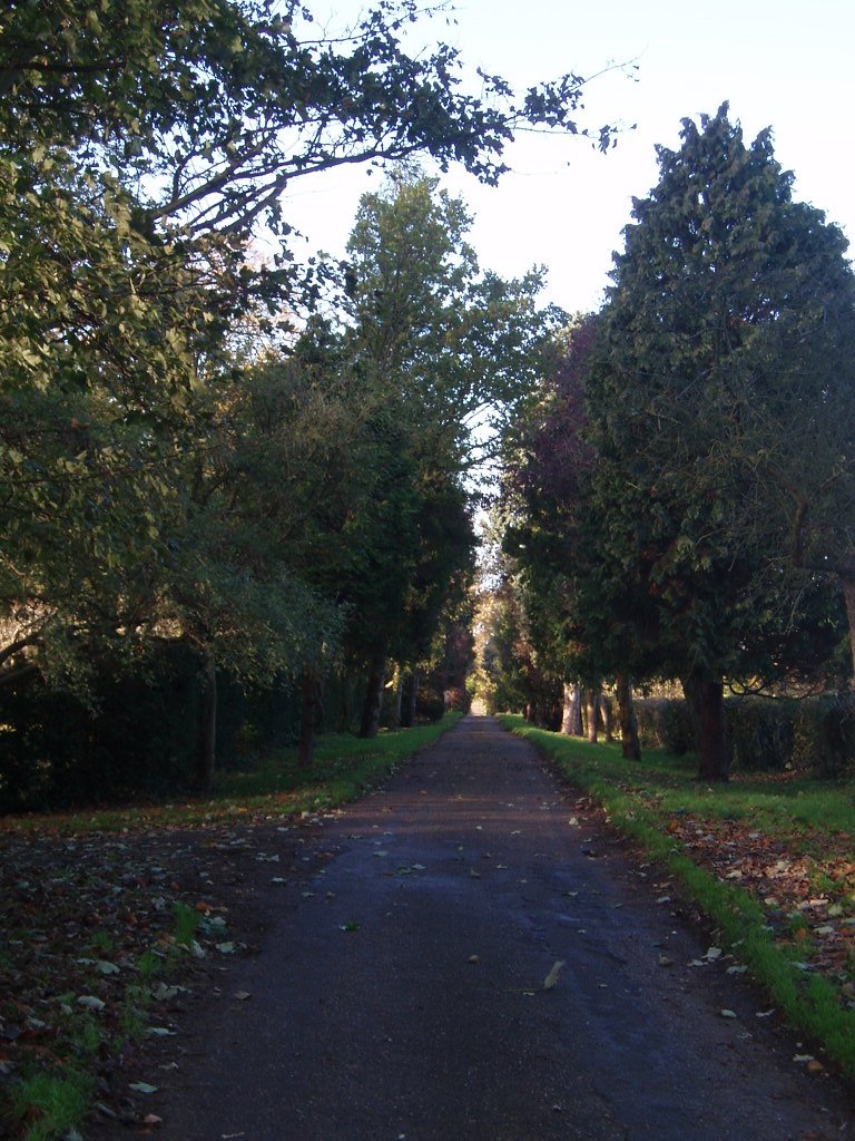
Cremorne is a heritage-listed villa at 34 Mullens Street, Hamilton, City of Brisbane, Queensland, Australia. It was designed by Eaton & Bates and built from 1905 to 1906. It was added to the Queensland Heritage Register on 21 October 1992. History Cremorne is a substantial, single-storeyed, high-set timber residence erected for Brisbane publican James Denis O'Connor. It was designed by the firm of Eaton & Bates, Sydney-trained architects who built up a substantial Queensland practice from -. JD O'Connor, born in Ireland , had emigrated to South Australia in 1878, and was in business in Adelaide before moving north to Queensland, reputedly for health reasons, in 1889. His brother, Denis O'Connor, was already a well-known Brisbane publican, connected from at least 1884 with a number of Brisbane hotels, including the Globe Hotel, Dunmore Arms Hotel, O'Connor's Family Hotel (at Stones Corner), Oriental House (later the Wickham) from 1890, and later with the Prince Conso ... [...More Info...] [...Related Items...] OR: [Wikipedia] [Google] [Baidu] |
Hamilton, Queensland
Hamilton is an affluent riverside mixed-use suburb in the north-east of the City of Brisbane, Queensland, Australia. Hamilton is located along the north bank of the Brisbane River. In the , Hamilton had a population of 6,995 people. In 2013, the suburb had the highest mean taxable income of any in Queensland. Geography The suburb is bounded by the Brisbane River to the south and this section of the river is known as Hamilton Reach (). Kingsford Smith Drive enters the suburb at its south-west corner (from Albion) and runs along the river for approx before heading north-east away from the river and exiting the suburb to the north-east (to Eagle Farm). Historically Kingsford Smith Drive divided the suburb into a hilly residential area to the north and west of the road and a flat industrial area to the south and east which featured wharves used for the transport of goods (and for a time Brisbane's main port facility). However, the need to accommodate larger vessels has led t ... [...More Info...] [...Related Items...] OR: [Wikipedia] [Google] [Baidu] |
South Brisbane, Queensland
South Brisbane is an inner southern suburb in the City of Brisbane, Queensland, Australia. In the , South Brisbane had a population of 7,196 people. Geography The suburb is on the southern bank of the Brisbane River, bounded to the north-west, north, and east by the median of the river. The river to the east of the suburb is the South Brisbane Reach.(). The suburb is directly connected to the central business district across the river by the following bridges (upstream to downstream): * Go Between Bridge (toll road, ) * William Jolly Bridge (road, ) * Merivale Bridge (rail, ) * Kurilpa Bridge (pedestrian/cycling, ) * Victoria Bridge (road, ) * Goodwill Bridge (pedestrian/cycling, ). Modern public transport services include suburban train stations at South Brisbane and South Bank, and South East Busway stations at Cultural Centre, South Bank, and Mater Hill. CityCat ferry services link South Brisbane to other riverside suburbs. History Pre-colonial times South Bris ... [...More Info...] [...Related Items...] OR: [Wikipedia] [Google] [Baidu] |
Driveway
A driveway (also called ''drive'' in UK English) is a type of private road for local access to one or a small group of structures, and is owned and maintained by an individual or group. Driveways rarely have traffic lights, but some that bear heavy traffic, especially those leading to commercial businesses and parks, do. Driveways may be decorative in ways that public roads cannot, because of their lighter traffic and the willingness of owners to invest in their construction. Driveways are not resurfaced, snow blown or otherwise maintained by governments. They are generally designed to conform to the architecture of connected houses or other buildings. Some of the materials that can be used for driveways include concrete, decorative brick, cobblestone, block paving, asphalt, gravel, decomposed granite, and surrounded with grass or other ground-cover plants. Driveways are commonly used as paths to private garages, carports, or houses. On large estates, a driveway may be ... [...More Info...] [...Related Items...] OR: [Wikipedia] [Google] [Baidu] |
Kingsford Smith Drive, Brisbane
Kingsford Smith Drive is a major road in Brisbane. The road was named after the aviator Charles Kingsford Smith. It connects the suburb of Pinkenba to the Brisbane central business district at the Breakfast Creek. Kingsford Smith Drive is one of the busiest roads in Brisbane, carrying an average of 61,773 vehicles per day between July and December 2014. History The first road along the northern bank of the Brisbane River was constructed in 1829/1830. Convict labour was used to connect the main settlement to the women's gaol at Eagle Farm. In 1882, the road was still no better than a rough bush track. The road was then known as Hamilton Road in one part and Eagle Farm Road in another part. In 1938, it was renamed Bailey Memorial Avenue in honour of John Frederick Bailey, Queensland Botanist and curator of the Botanic Gardens. However, this name was not used in practice and, in 1953, the road was again renamed after Charles Kingsford Smith although the idea of renaming it had ... [...More Info...] [...Related Items...] OR: [Wikipedia] [Google] [Baidu] |
Brisbane River
The Brisbane River is the longest river in South East Queensland, Australia, and flows through the city of Brisbane, before emptying into Moreton Bay on the Coral Sea. John Oxley, the first European to explore the river, named it after the Governor of New South Wales, Sir Thomas Brisbane in 1823. The penal colony of Moreton Bay later adopted the same name, eventually becoming the present city of Brisbane. The river is a tidal estuary and the water is brackish from its mouth through the majority of the Brisbane metropolitan area westward to the Mount Crosby Weir. The river is wide and navigable throughout the Brisbane metropolitan area. The river travels from Mount Stanley. The river is dammed by the Wivenhoe Dam, forming Lake Wivenhoe, the main water supply for Brisbane. The waterway is a habitat for the rare Queensland lungfish, Brisbane River cod (extinct), and bull sharks. Early travellers along the waterway admired the natural beauty, abundant fish and rich ve ... [...More Info...] [...Related Items...] OR: [Wikipedia] [Google] [Baidu] |
Toowoomba
Toowoomba ( , nicknamed 'The Garden City' and 'T-Bar') is a city in the Toowoomba Region of the Darling Downs, Queensland, Australia. It is west of Queensland's capital city Brisbane by road. The urban population of Toowoomba as of the 2021 Census was 142,163, having grown at an average annual rate of 1.45% over the previous two decades. Toowoomba is the second-most-populous inland city in the country after the national capital of Canberra and hence the largest city on the Darling Downs, and it is among the largest regional centres in Queensland. It is also referred to as the capital of the Darling Downs. The Toowoomba region is the home of two main Aboriginal language groups, the Giabal whose lands extend south of the city and Jarowair whose lands extend north of the city. The Jarowair lands include the site of one of Australia's most important sacred Bora ceremonial ground, the ‘Gummingurru stone arrangement’ dated to c.4000 BC. The site marked one of the major rout ... [...More Info...] [...Related Items...] OR: [Wikipedia] [Google] [Baidu] |
Maryborough, Queensland
Maryborough ( ) is a city and a suburb in the Fraser Coast Region, Queensland, Australia. At the 2021 Census, Maryborough had a population of 15,287. Geography Maryborough is located on the Mary River in Queensland, Australia, approximately north of the state capital, Brisbane. The city is served by the Bruce Highway. It is closely tied to its neighbour city Hervey Bay which is approximately northeast. Together they form part of the area known as the Fraser Coast. The neighbourhood of Baddow is within the west of the suburb near the Mary River. It takes its name from Baddow House, a historic property in the area (). Baddow railway station () and Baddow Island () in the Mary River also take their names from the house. History Original inhabitants, language and culture Evidence of human inhabitation of the Maryborough region stretches back to at least 6,000 years ago. The Gubbi Gubbi (Kabi Kabi) and Batjala (Butchulla) people were the original inhabitants of ... [...More Info...] [...Related Items...] OR: [Wikipedia] [Google] [Baidu] |
Gladstone, Queensland
Gladstone () is a coastal city in the Gladstone Region, Queensland, Australia. Gladstone has an urban population of 34,703, and together with Boyne Island and Tannum Sands, had an estimated population of 50,317 at August 2021. This urban area covers . It is by road north-west of the state capital, Brisbane, and south-east of Rockhampton. Situated between the Calliope and Boyne Rivers, Gladstone is home to Queensland's largest multi-commodity shipping port, the Port of Gladstone. Gladstone is the largest town within the Gladstone Region and the headquarters of Gladstone Regional Council is located in Gladstone. The Gladstone Region was formed in 2008 through the amalgamation of three former local government areas.. hich areas? History Before European settlement, the Gladstone region was home of the Gooreng Gooreng, Toolooa (or Tulua), Meerooni and Baiali (or Byellee) Aboriginal tribes. In May 1770, , under the command of James Cook, sailed by the entrance to Gla ... [...More Info...] [...Related Items...] OR: [Wikipedia] [Google] [Baidu] |
Clermont, Queensland
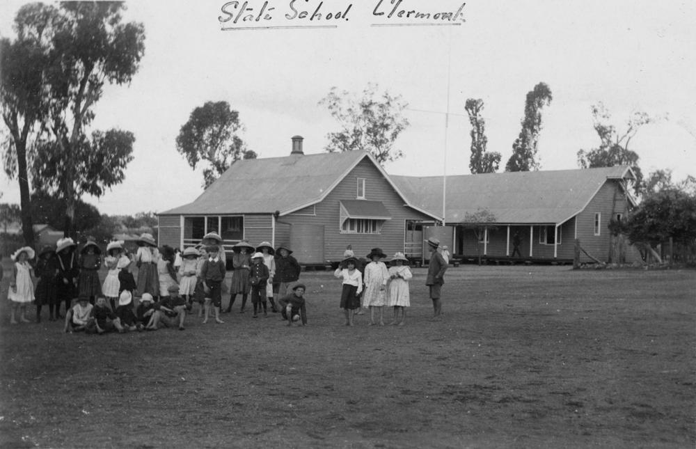
Clermont is a rural town and locality in the Isaac Region, Queensland, Australia. At the , the locality of Clermont had a population of 2952 people. Clermont is a major hub for the large coal mines in the region as well as serving agricultural properties. Geography Clermont is south-west of Mackay, at the junction of the Gregory and Peak Downs highways. The historic towns of North Copperfield () and South Copperfield (), often referred to collectively as Copperfield are along Christoe Street approximately south-west of the Clermont town centre. The Gregory Highway runs through the eastern end, and the Peak Downs Highway enters from the east. The Clermont Connection Road links the Gregory Highway to the CBD, and the Clermont-Alpha Road starts in the CBD and exits to the south-west. History '' Gangalu (Gangulu, Kangulu, Kanolu, Kaangooloo, Khangulu)'' is an Australian Aboriginal language spoken on Gangula country. The Gangula language region includes the towns of Clermo ... [...More Info...] [...Related Items...] OR: [Wikipedia] [Google] [Baidu] |
Longreach, Queensland
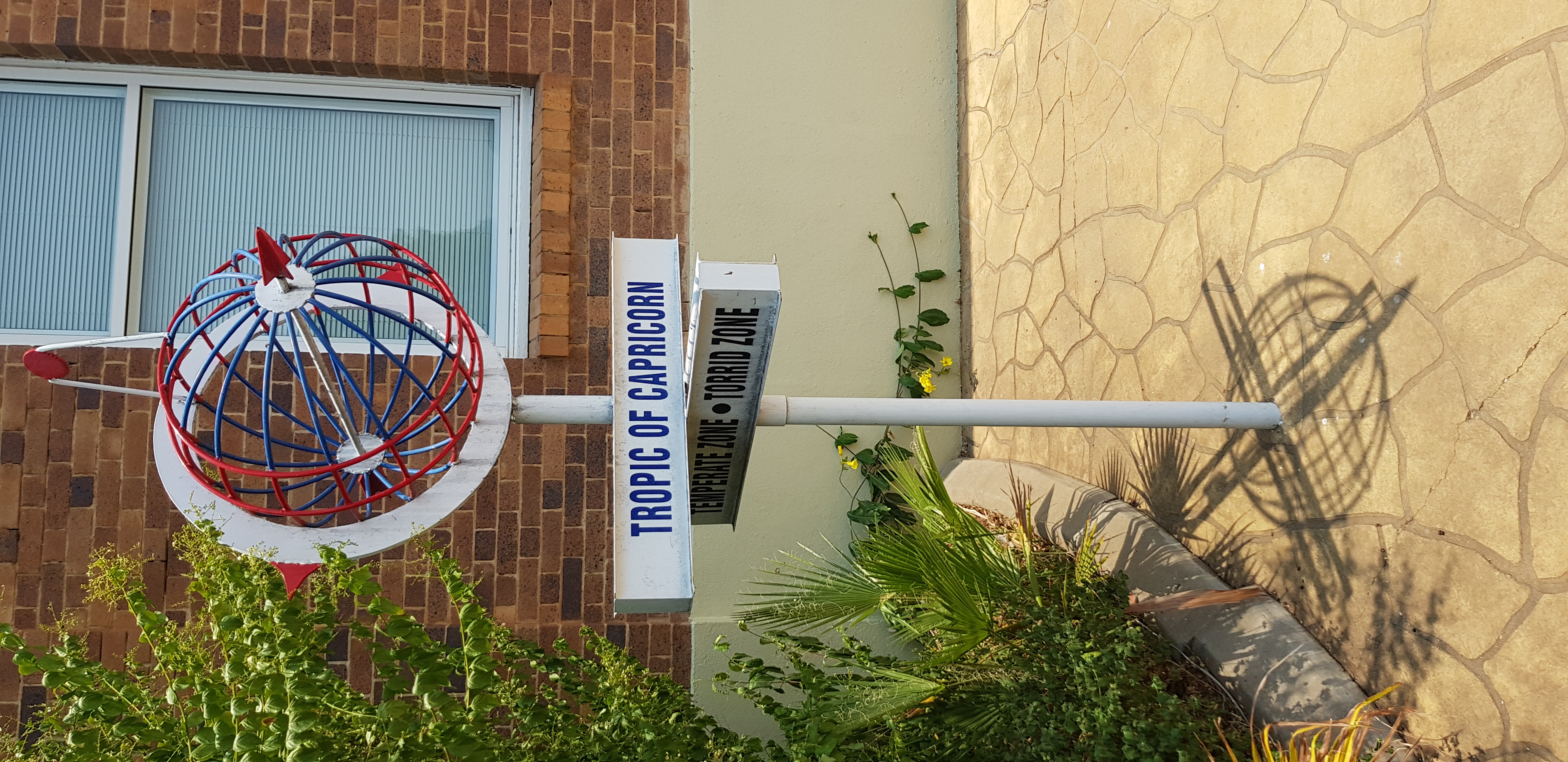
Longreach is a town and a locality in the Longreach Region, Queensland, Australia. It is the administrative centre of the Longreach Regional Council, which was established in 2008 as a merger of the former Longreach, Ilfracombe, and Isisford shires. Longreach is a well known tourist destination due to its aviation history and importance. In the , the locality of Longreach had a population of 3,124 people. Geography Longreach is in Central West Queensland, approximately from the coast, west of Rockhampton. The town is on the Tropic of Capricorn in the south-east of the locality. The town is named after the ‘long reach’ of the Thomson River on which it is situated. Lochern National Park is in the south-western part of the locality (formerly in Vergemont). The main industries of the area are cattle, sheep, and, more recently, tourism. The Landsborough Highway enters the locality from the south-east ( Ilfracombe), passes through the town and then exits to the nort ... [...More Info...] [...Related Items...] OR: [Wikipedia] [Google] [Baidu] |
Mount Morgan, Queensland
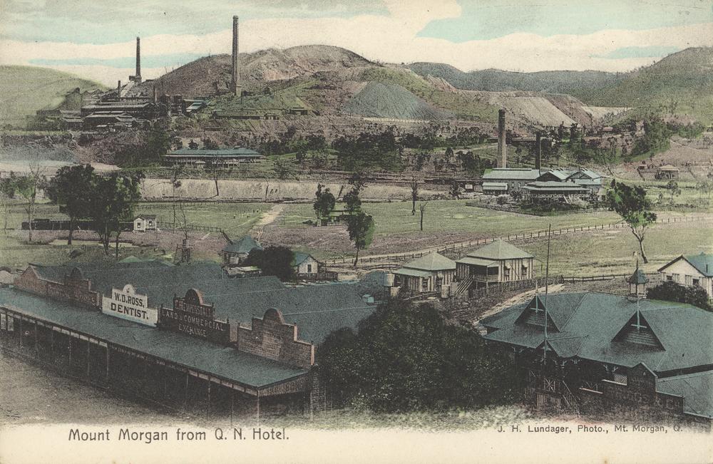
Mount Morgan is a rural town and locality in the Rockhampton Region, Queensland, Australia. In the the locality of Mount Morgan had a population of 1,963 people. The town was the administrative centre of the Mount Morgan Shire until March 2008, when it was amalgamated with neighbouring local government areas to form the Rockhampton Region. Geography The town of Mount Morgan is situated on the Dee River, south of the city of Rockhampton, and is north of the state capital, Brisbane. The Burnett Highway passes through the town. There are a number of neighbourhoods within the locality: * Gordon Vale () * Kenbula (), located around the former Kenbula railway station * Talban (), located around the former Talban railway station The names ''Kenbula'' and ''Talban'' were both assigned by the Queensland Railway Department on 18 November 1911. Both are Aboriginal names, ''Kenbula'' meaning '' ironbark tree'' and ''Talban'' meaning '' stone curlew''. History Prior to European ... [...More Info...] [...Related Items...] OR: [Wikipedia] [Google] [Baidu] |
.jpg)


.jpg)


