|
Cheam
Cheam () is a suburb of London, England, southwest of Charing Cross. It is divided into North Cheam, Cheam Village and South Cheam. Cheam Village contains the listed buildings Lumley Chapel and the 16th-century Whitehall. It is adjacent to two large parks, Nonsuch Park and Cheam Park. Nonsuch Park contains the listed Nonsuch Mansion. Parts of Cheam Park and Cheam Village are in a conservation area. Cheam is bordered by Worcester Park to the northwest, Morden to the northeast, Sutton to the east, Epsom, Ewell and Stoneleigh to the west and Banstead and Belmont to the south. History The Roman road of Stane Street forms part of the boundary of Cheam. The modern London Road at North Cheam follows the course of the Roman road through the area. It is designated A24. The village lay within the Anglo-Saxon administrative division of Wallington hundred. Cheam is mentioned in the Charters of Chertsey Abbey in 727, which mentions Cheam being given to the monastery of Chertsey in 67 ... [...More Info...] [...Related Items...] OR: [Wikipedia] [Google] [Baidu] |
Sutton And Cheam (UK Parliament Constituency)
Sutton and Cheam is a constituency in Greater London represented in the House of Commons of the UK Parliament since 2024 by Luke Taylor, a Liberal Democrat. Political history The area's voters produced a 32.6% swing to the Liberal Party in the 1972 by-election. In the nine prior elections it only returned Conservative MPs and the Liberal candidate polled third behind Labour six times and none stood three times. The seat is a marginal seat which has since 1970 frequently flipped between electing Conservative and Liberal/Liberal Democrat candidates. During the Conservative Government 1979–1990, the seat was won by a sufficient majority to be branded a Conservative safe seat. It was regained by the Liberal Democrats in the 1997 general election and subsequently held in the 2001, 2005 and 2010 general elections. In the 2015 general election the seat was regained by the Conservatives. In June 2016, an estimated 51.28% of local adults voting in the EU membership referendu ... [...More Info...] [...Related Items...] OR: [Wikipedia] [Google] [Baidu] |
Sutton, London
Sutton is a town in the London Borough of Sutton in South London, England. It is the administrative headquarters of the Outer London borough, on the lower slopes of the North Downs. It is south-southwest of Charing Cross, one of the fourteen metropolitan centres in the London Plan. An ancient parish originally in the county of Surrey, Sutton is recorded in the ''Domesday Book'' of 1086 as having two churches and about 30 houses. Its location on the London to Brighton turnpike from 1755 led to the opening of Coaching inn, coaching inns, spurring its growth as a village. When it was connected to central London by rail in 1847, it began to grow into a town, and it expanded further in the 20th century. It became a Municipal Borough of Sutton and Cheam, municipal borough with Cheam in 1934, and became part of Greater London in 1965. Sutton has the largest library in the borough, several works of List of public art in Sutton, public art and four Conservation areas in Sutton, London ... [...More Info...] [...Related Items...] OR: [Wikipedia] [Google] [Baidu] |
Lumley Chapel
The Lumley Chapel is a redundant Anglican church in the suburban village of Cheam, in the London Borough of Sutton, England. It is recorded in the National Heritage List for England as a designated Grade II* listed building, and is under the care of the Churches Conservation Trust. The chapel is located in the churchyard of St Dunstan's Church in Church Road, off Malden Road, the A2043. History The Archbishop of Canterbury acquired the manor of Cheam in 1018, and it is thought that the church was founded soon after this date. It was dedicated to Saint Dunstan, an earlier Archbishop of Canterbury. A south aisle was added to the church in the 12th century. In 1580 John Lumley, 1st Baron Lumley inherited the nearby Nonsuch Palace through his marriage to Jane Fitzalan, daughter of Henry FitzAlan, 19th Earl of Arundel. During the 1590s Lumley converted the church into a memorial chapel for himself and his two wives.Dunk 1954.Llewellyn and Gapper 2010.Simon 2010. In the ... [...More Info...] [...Related Items...] OR: [Wikipedia] [Google] [Baidu] |
Worcester Park
Worcester Park is a suburban town in South London, England. It lies in the London boroughs of Sutton and Kingston, and partly in the Surrey borough of Epsom and Ewell. The area is southwest of Charing Cross. The suburb's population was 16,031 at the time of the 2001 census. The suburb comprises the Worcester Park ward, an electoral area of the London Borough of Sutton with a population in of , as well as the Cuddington ward, an electoral area of Epsom and Ewell, which had a population of 5,791 at the time of the 2001 census. The Worcester Park post town, which is coterminous with the KT4 postcode district, covers all of the suburb and also extends into Old Malden. Other neighbouring localites include Kingston, Sutton, New Malden, Motspur Park, Lower Morden, Stoneleigh, Tolworth and West Ewell. Worcester Park railway station (London Zone 4, South Western Railway), runs trains into London Waterloo and many residents commute into central London. Many maps and po ... [...More Info...] [...Related Items...] OR: [Wikipedia] [Google] [Baidu] |
Whitehall, Cheam
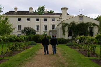
Whitehall is a timber-framed historic house museum in the centre of Cheam Village, London Borough of Sutton, Sutton, Greater London. It is thought to have been a wattle and daub yeoman farmer's house originally, built around 1500. It is Listed building#England and Wales, Grade II* listed on Historic England's National Heritage List for England, National Heritage List. Features The house contains details from the Georgian era, Georgian, Victorian era, Victorian and Edwardian eras. The rooms include the hall, the parlour (thought to have once been the original kitchen), the lower kitchen, the porch room, the Roy Smith art gallery (once a wash room or scullery), the Harriet Killick dressing room and the bedroom. One room has a display about Nonsuch Palace, built nearby by Henry VIII and pulled down in the 1680s. In the garden there is a medieval well which served an earlier building on the site. History It is said once to have been called "The Council House," owing to its use by ... [...More Info...] [...Related Items...] OR: [Wikipedia] [Google] [Baidu] |
Stoneleigh, Surrey
Stoneleigh is a suburban area southwest of London, situated in the north of the Epsom and Ewell borough in the county of Surrey, England. It is situated approximately from centre of London, central London. In the 2011 United Kingdom census, 2011 Census, the population was 8,741. The area was formerly part of the Great Park and Little Park of Nonsuch in the Tudor era. Nonsuch Park today is situated on the site of the Little Park in the east of the suburb, extending into East Ewell and Cheam. The construction of the Stoneleigh railway station, railway station, in 1932, was responsible for initiating the development of most of Stoneleigh, which was largely completed by the onset of World War II in late 1939. History Early history The Roman road Stane Street (Chichester), Stane Street passed through the eastern area of what is now Stoneleigh (along the modern day London Road/A24 road (England), A24) on its way from London to Chichester via the nearby spring at Ewell. Between t ... [...More Info...] [...Related Items...] OR: [Wikipedia] [Google] [Baidu] |
Ewell
Ewell ( , ) is a town in Surrey, England, south of Centre of London, central London and northeast of Epsom. At the 2011 United Kingdom census, 2011 Census, it had a population of 34,872. The majority (73%) was in the NRS social grade, ABC1 social class, except the Ruxley Ward that is C2DE. Ewell was founded as a spring line settlement, where the permeable chalk of the North Downs meets the impermeable London Clay, and the Hogsmill River (a tributary of the River Thames) still rises at a spring (hydrology), spring close to Bourne Hall in the village centre. Recorded in Domesday Book as ''Etwelle'', the settlement was granted a market charter to hold a market in 1618. The town is contiguous with the Greater London Urban Area, Greater London suburbs. History The name ''Ewell'' derives from Old English ''æwell'', which means ''river source'' or spring (hydrosphere), spring. The second half of the name of the village of Temple Ewell in Kent has the same meaning. Bronze Age re ... [...More Info...] [...Related Items...] OR: [Wikipedia] [Google] [Baidu] |
A24 Road (Great Britain)
The A24 is a major road in England that runs for from Clapham in south-west London to Worthing on the English Channel in West Sussex via the suburbs of south-west London, as well as through the counties of Surrey and West Sussex. Route Between Clapham and Dorking, the A24 closely follows the route of the old Roman road Stane Street. The Morden branch of the Northern line runs under the road from Clapham via Colliers Wood to Morden. Cycle Superhighway 7 also runs along the road from Clapham to Colliers Wood. Greater London Lambeth & Wandsworth The A24 starts at a junction with the A3 at the northeastern corner of Clapham Common, near Clapham Common tube station in the London Borough of Lambeth. South of Clapham Common station, the London Underground Northern line runs beneath the A24, following its route southbound. The A24 runs along the eastern perimeter of the Common, before meeting the South Circular near Clapham South tube station. Along this stretch of road, Cycle ... [...More Info...] [...Related Items...] OR: [Wikipedia] [Google] [Baidu] |
Belmont, Sutton
Belmont is a village in the London Borough of Sutton, in South London, England. It is located off the A217 road and near to Banstead Downs in Surrey. It is a suburban development situated 10.8 miles (17.4 km) south-southwest of Charing Cross. History Belmont did not exist until the late 19th century.Sparkes, Roland (2009) ''Belmont: A Century Ago''. Belmont railway station opened in May 1865 and was originally called 'California Station', named after the California Arms public house on the opposite side of Brighton Road which was built by John Gibbons in approximately 1858. The station was renamed 'Belmont' in 1875, and the name was attached to the village that emerged subsequently. The original pub was heavily damaged by German bombing in the Second World War. The new building, built on the site in 1955, was known as "The California" later changed to 'The Belmont', but in 2014, under new management, reverted to its original name of 'The California'. St. John's Church (C o ... [...More Info...] [...Related Items...] OR: [Wikipedia] [Google] [Baidu] |
Morden
Morden is a district and town in South London, England, now within the London Borough of Merton, in the ceremonial county of Greater London. It adjoins Merton Park and Wimbledon, London, Wimbledon to the north, Mitcham to the east, Sutton, London, Sutton to the south and Worcester Park to the west, and is around south-southwest of Charing Cross. Prior to the creation of Greater London in 1965, for local government purposes, Morden was in the Administrative counties of England, administrative and Historic counties of England, historic county of Surrey. At the 2011 United Kingdom census, 2011 census, Morden had a population of 48,233, including the wards of Cannon Hill, Lower Morden, Merton Park, Ravensbury and St Helier. The district of Morden includes the town itself Lower Morden, Morden Park, St Helier, London, St Helier ( partly ), Cannon Hill, Merton, Cannon Hill and Merton Park. Morden Hall Park, a National Trust park on the banks of the River Wandle adjacent to the town c ... [...More Info...] [...Related Items...] OR: [Wikipedia] [Google] [Baidu] |
Domesday Croydon Cheam
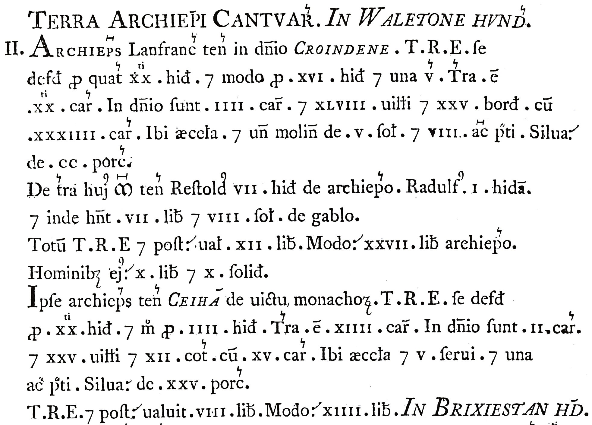
Domesday Book ( ; the Middle English spelling of "Doomsday Book") is a manuscript record of the Great Survey of much of England and parts of Wales completed in 1086 at the behest of William the Conqueror. The manuscript was originally known by the Latin name , meaning "Book of Winchester", where it was originally kept in the royal treasury. The ''Anglo-Saxon Chronicle'' states that in 1085 the king sent his agents to survey every shire in England, to list his holdings and dues owed to him. Written in Medieval Latin, it was highly abbreviated and included some vernacular native terms without Latin equivalents. The survey's main purpose was to record the annual value of every piece of landed property to its lord, and the resources in land, labour force, and livestock from which the value derived. The name "Domesday Book" came into use in the 12th century. Richard FitzNeal wrote in the ( 1179) that the book was so called because its decisions were unalterable, like those of the ... [...More Info...] [...Related Items...] OR: [Wikipedia] [Google] [Baidu] |
Epsom
Epsom is a town in the borough of Epsom and Ewell in Surrey, England, about south of central London. The town is first recorded as ''Ebesham'' in the 10th century and its name probably derives from that of a Anglo-Saxon settlement of Britain, Saxon landowner. The earliest evidence of human activity is from the mid-Bronze Age Britain, Bronze Age, but the modern settlement probably grew up in the area surrounding St Martin's Church in the 6th or 7th centuries and the street pattern is thought to have become established in the England in the Middle Ages, Middle Ages. Today the High Street is dominated by the clock tower, which was erected in 1847–8. Like other nearby settlements, Epsom is located on the spring line settlement, spring line where the permeable chalk of the North Downs meets the impermeable London Clay. Several tributaries of the Hogsmill River rise in the town and in the 17th and early 18th centuries, the spring on Epsom Common was believed to have healing quali ... [...More Info...] [...Related Items...] OR: [Wikipedia] [Google] [Baidu] |


