|
Carl Lotave
Carl Lotave (February 29, 1872 – December 27, 1924) was a painter of portraits, illustrator, and sculptor. He painted portraits of notable leaders of World War I and is best known for his two portraits of President Abraham Lincoln. Lotave was an art instructor at Bethany College (Kansas), Bethany College in Kansas. Early life and education Carl Theofil Gustafson-Lotave was born February 29, 1872, in Jönköping, Sweden. He was the son of the mechanic Carl Gustaf Gustafsson and Carolina Westergren. After completing schooling at Jönköping School of Education in 1889, he went to Stockholm in 1891. He studied art under the Swedish artist Anders Zorn and Richard Bergh at the Artists' Association's newly opened school. Lotave met Birger Sandzén when they studied under Zorn. He then studied at Paris at the Académie Colarossi. Career He established himself in Europe as a portrait painter and then he went to the United States in 1897 to teach at Bethany College (Kansas), Bethany Co ... [...More Info...] [...Related Items...] OR: [Wikipedia] [Google] [Baidu] |
Chief Ignacio
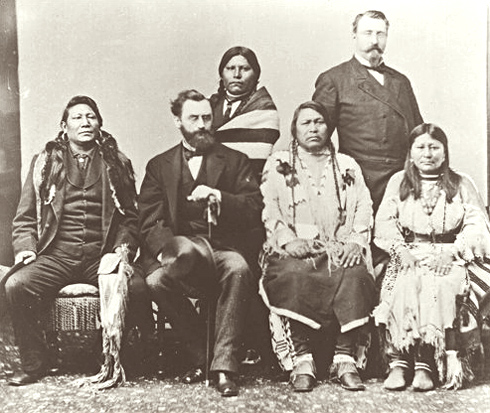
Chief Ignacio (c. 1828–1913) was a chief of the Weeminuche band of the Ute tribe of American Indians, also called the Southern Utes, located in present-day Colorado north of the San Juan River. He led the band through many difficult years in the late nineteenth century, when they were being encroached on by European-American settlers. In January 1880, Chief Ignacio was part of the Ute delegation that traveled to Washington, DC to testify before the US Congress about the 1879 Meeker Massacre and the Ute uprising among the northern Utes on the White River. Although the Weeminuche had not participated in that violence, white settlers wanted to push all the Utes away from their areas. The Utes tried to negotiate for peace, but later that year Congress passed legislation forcing the Utes into reservations. Unlike the Northern and Central bands of Utes, who were forced to reservations in Utah, the Weeminuche and two other Southern bands managed to stay in Colorado. Together w ... [...More Info...] [...Related Items...] OR: [Wikipedia] [Google] [Baidu] |
Joseph Joffre
Joseph Jacques Césaire Joffre , (; 12 January 1852 – 3 January 1931) was a French general who served as Commander-in-Chief of French forces on the Western Front (World War I), Western Front from the start of World War I until the end of 1916. He is best known for regrouping the retreating allied armies to defeat the Germans at the strategically decisive First Battle of the Marne in September 1914. His political position waned after unsuccessful offensives in 1915, the Battle of Verdun, German attack on Verdun in 1916, and the disappointing results of the Battle of the Somme, Anglo-French offensive on the Somme in 1916. At the end of 1916 he was promoted to Marshal of France, the first such elevation under the Third Republic of France, Third Republic, and moved to an advisory role, from which he quickly resigned. Later in the war he led an important mission to the United States. Early career Joffre was born in Rivesaltes, Pyrénées-Orientales, into a family of vineyard o ... [...More Info...] [...Related Items...] OR: [Wikipedia] [Google] [Baidu] |
Charles Bent
Charles Bent (November 11, 1799 – January 19, 1847) was an American businessman and politician who served as the first civilian United States governor of the New Mexico Territory, newly invaded and occupied by the United States during the Mexican-American War by the Military Governor, Stephen Watts Kearny, in September 1846 until his assassination. Bent had been working as a fur trader in the region since 1828, with his younger brother, William, and later partner Ceran St. Vrain. Though his office was in Santa Fe, Bent maintained his residence and a trading post in Taos, New Mexico Territory, in present-day New Mexico. On January 19, 1847, Bent was scalped and killed by Pueblo warriors, during the Taos Revolt. Early life Charles Louis Bent was born in Charleston, Virginia, the oldest of the ten children of Judge Silas Bent, and his wife Martha Kerr. The other children were: Juliannah, Joh, Lucy, Dorcas, William, Mary, George, Robert, Edward, and Silas. Career U ... [...More Info...] [...Related Items...] OR: [Wikipedia] [Google] [Baidu] |
Diego De Vargas
Diego de Vargas Zapata y Luján Ponce de León y Contreras (1643–1704), commonly known as Don Diego de Vargas, was a Spanish Governor of the New Spain territory of Santa Fe de Nuevo México (currently covering the modern US states of New Mexico and Arizona). He was the title-holder in 1690–1695, and effective governor in 1692–1696 and 1703–1704. He is known for leading the reconquest of the territory in 1692 following the Pueblo Revolt of 1680. This reconquest is commemorated annually during the Fiestas de Santa Fe in the city of Santa Fe. Pueblo revolt and reconquest On 10 August 1680, Pueblo people from various pueblos in northern New Mexico staged an uprising against Spanish colonists.Warren A. Beck, New Mexico; a History of Four Centuries, University of Oklahoma Press, 1962 They laid siege to the city of Santa Fe, forcing the colonists to retreat on 20 August. The Spanish colonists fled south to El Paso del Norte (now Ciudad Juárez, Mexico), where they remai ... [...More Info...] [...Related Items...] OR: [Wikipedia] [Google] [Baidu] |
Santa Fe Trail
The Santa Fe Trail was a 19th-century route through central North America that connected Franklin, Missouri, with Santa Fe, New Mexico. Pioneered in 1821 by William Becknell, who departed from the Boonslick region along the Missouri River, the trail served as a vital commercial highway until 1880, when the railroad arrived in Santa Fe. Santa Fe was near the end of El Camino Real de Tierra Adentro which carried trade from Mexico City. The trail was later incorporated into parts of the National Old Trails Road and U.S. Route 66. The route skirted the northern edge and crossed the north-western corner of Comancheria, the territory of the Comanche. Realizing the value, they demanded compensation for granting passage to the trail. American traders envisioned them as another market. Comanche raiding farther south in Mexico isolated New Mexico, making it more dependent on the American trade. They raided to gain a steady supply of horses to sell. By the 1840s, trail traffic through the ... [...More Info...] [...Related Items...] OR: [Wikipedia] [Google] [Baidu] |
Bandelier National Monument
Bandelier National Monument is a United States National Monument near Los Alamos in Sandoval and Los Alamos counties, New Mexico. The monument preserves the homes and territory of the Ancestral Puebloans of a later era in the Southwest. Most of the pueblo structures date to two eras, dating between AD 1150 and 1600. The monument is of the Pajarito Plateau, on the slopes of the Jemez volcanic field in the Jemez Mountains. Over 70% of the monument is wilderness, with over one mile of elevation change, from about along the Rio Grande to over at the peak of Cerro Grande on the rim of the Valles Caldera, providing for a wide range of life zones and wildlife habitats. of road and more than of hiking trails are built. The monument protects Ancestral Pueblo archeological sites, a diverse and scenic landscape, and the country's largest National Park Service Civilian Conservation Corps National Landmark District. Two-thirds of the park, , is designated as the Bandelier Wilde ... [...More Info...] [...Related Items...] OR: [Wikipedia] [Google] [Baidu] |
Puye Cliff Dwellings
The Puye Cliff Dwellings are the ruins of an abandoned pueblo, located in Santa Clara Canyon on Santa Clara Pueblo Reservation land near Española, New Mexico. Established in the late 1200s or early 1300s and abandoned by about 1600, this is among the largest of the prehistoric Indian settlements on the Pajarito Plateau, showing a variety of architectural forms and building techniques. The site was declared a National Historic Landmark in 1966. The name Puye (Tewa language: ''pu'', “cottontail rabbits,” and ''ye'', "to assemble"), possibly a place for hunting rabbits. Ancient pueblo dwellings The Puye Cliffs complex includes two levels of cliff-dwellings and both surface and cave dwellings. The two levels of cliff dwellings, the mesa top and reconstructed 'Community House' are accessed by paths and about twelve stairways and ladders cut into the side of the cliff. One level of cliff dwellings is over long and the second is about long. The ruins are within the northe ... [...More Info...] [...Related Items...] OR: [Wikipedia] [Google] [Baidu] |
Ancestral Puebloans
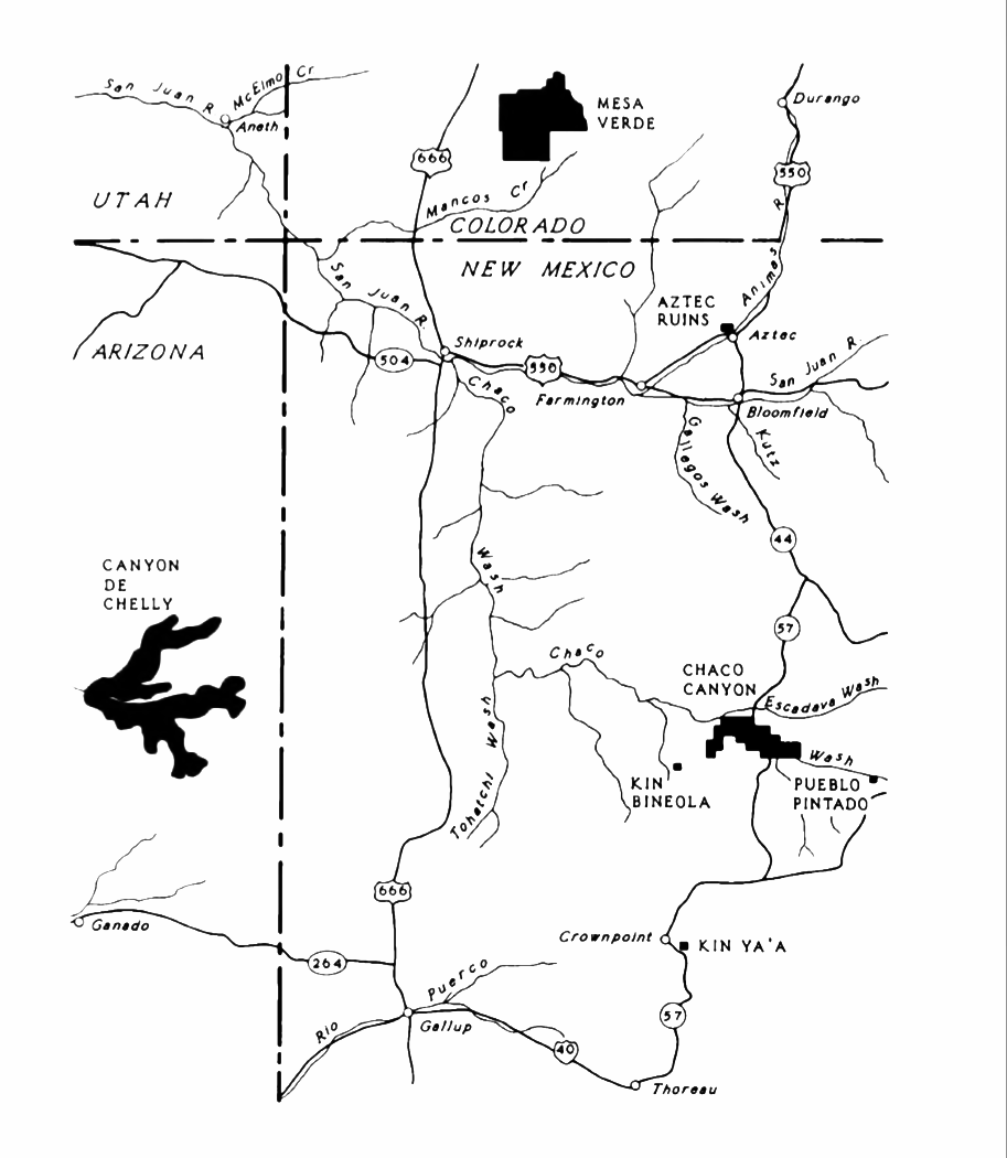
The Ancestral Puebloans, also known as Ancestral Pueblo peoples or the Basketmaker-Pueblo culture, were an ancient Native American culture of Pueblo peoples spanning the present-day Four Corners region of the United States, comprising southeastern Utah, northeastern Arizona, northwestern New Mexico, and southwestern Colorado. They are believed to have developed, at least in part, from the Oshara tradition, which developed from the Picosa culture. The Ancestral Puebloans lived in a range of structures that included small family pit houses, larger structures to house clans, grand pueblos, and cliff-sited dwellings for defense. They had a complex network linking hundreds of communities and population centers across the Colorado Plateau. They held a distinct knowledge of celestial sciences that found form in their architecture. The kiva, a congregational space that was used mostly for ceremonies, was an integral part of the community structure. Archaeologists continue to d ... [...More Info...] [...Related Items...] OR: [Wikipedia] [Google] [Baidu] |
Palace Of The Governors
The Palace of the Governors () is an adobe structure built in the Territorial Style of Pueblo architecture on Palace Avenue in Santa Fe, New Mexico. Located within the Santa Fe Historic District along the Santa Fe Plaza between Lincoln and Washington avenues, it served as the seat of government for New Mexico for centuries, having been established as the capitol building of '' Nuevo México'' in 1610. It was New Mexico's seat of government until 1901. History In 1610, Pedro de Peralta, the newly appointed governor of ''Santa Fe de Nuevo México'' covering most of the modern American Southwest, began construction on the Palace of the Governors, though some recent historical research has suggested that construction began midway through his term in 1618. In the following years, the Palace changed hands as the territory of New Mexico did, seeing the Pueblo Revolt of 1680, the Spanish return from 1693 to 1694, Mexican independence in 1821, American territorial status in 1848, and U ... [...More Info...] [...Related Items...] OR: [Wikipedia] [Google] [Baidu] |
Miguel Antonio Otero (born 1859)
Miguel Antonio Otero II (October 17, 1859 – August 7, 1944) was an American politician, businessman, and author who served as the 16th Governor of New Mexico Territory from 1897 to 1906. He was the son of Miguel Antonio Otero, a prominent businessman and New Mexico politician. Early life Miguel Antonio Otero had an adventurous boyhood as his father, a businessman and railroad baron, moved the family from town to town across Kansas, Colorado, and New Mexico. The family established a permanent home in Las Vegas, New Mexico about 1879. He attended St. Louis University and the University of Notre Dame with his older brother Page, but preferred socializing to studying. He returned to Las Vegas in 1880 to work in his father's bank. Career Politics While working as a banker, land broker, and livestock broker in Las Vegas, Otero began his career in politics. In a few years, he served as clerk for the City of Las Vegas, probate clerk of San Miguel County, county clerk, and re ... [...More Info...] [...Related Items...] OR: [Wikipedia] [Google] [Baidu] |
Hopi Dance Ceremony, Carl Lotave
The Hopi are Native Americans who primarily live in northeastern Arizona. The majority are enrolled in the Hopi Tribe of Arizona and live on the Hopi Reservation in northeastern Arizona; however, some Hopi people are enrolled in the Colorado River Indian Tribes of the Colorado River Indian Reservation at the border of Arizona and California. The 2010 U.S. census states that about 19,338 US citizens self-identify as being Hopi. The Hopi language belongs to the Uto-Aztecan language family. The primary meaning of the word ''Hopi'' is "behaving one, one who is mannered, civilized, peaceable, polite, who adheres to the Hopi Way." Some sources contrast this to other warring tribes that subsist on plunder.Connelly, John C., "Hopi Social Organization." In Alfonso Ortiz, vol. ed., ''Southwest'', vol. 9, in William C. Sturtevant, ed., ''Handbook of North American Indians'', Washington, D.C.: Smithsonian Institution, 1979: 539–53, p. 551 ''Hopi'' is a concept deeply rooted in the cult ... [...More Info...] [...Related Items...] OR: [Wikipedia] [Google] [Baidu] |


