|
Brewood
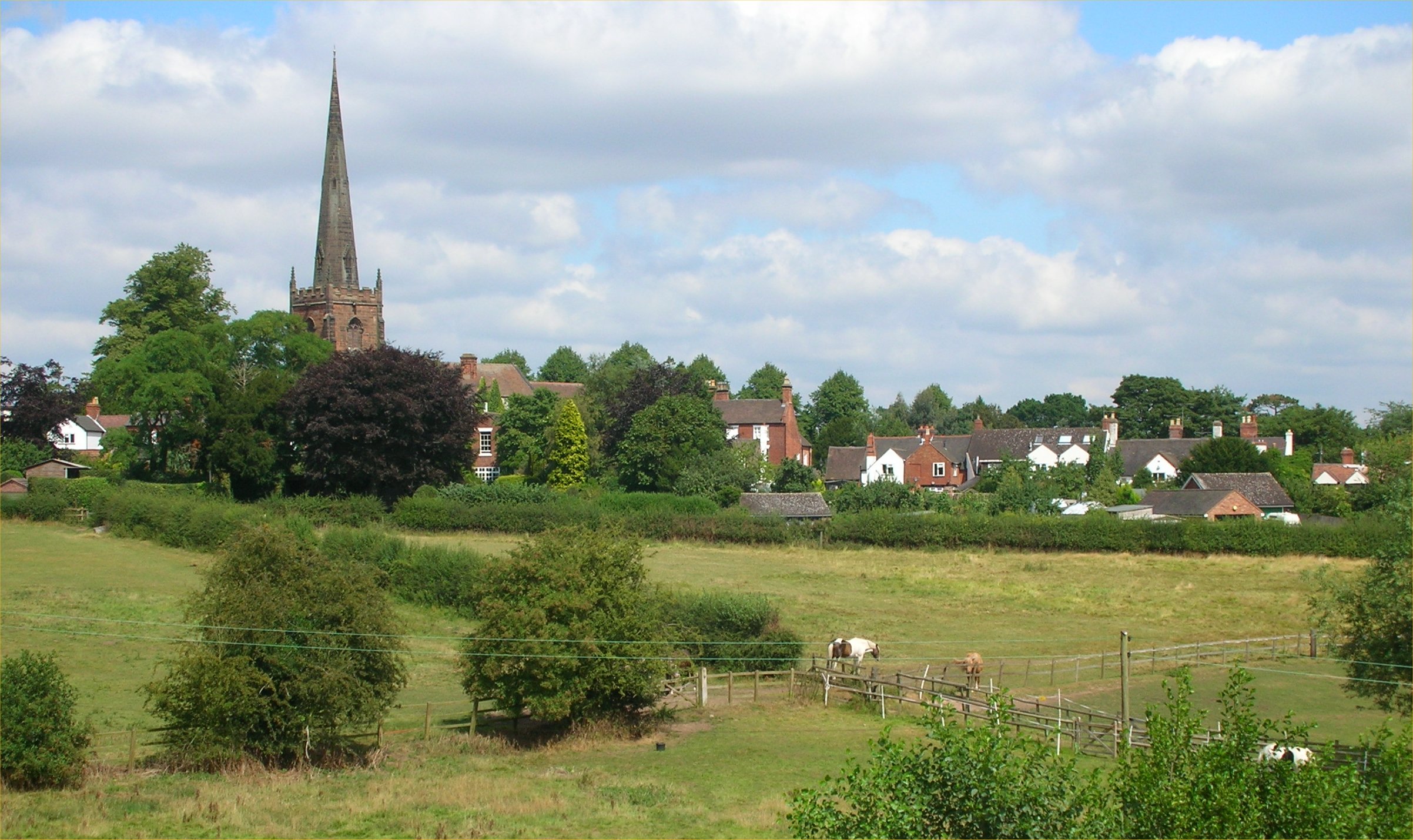
Brewood is an ancient market town in the civil parish of Brewood and Coven, in the South Staffordshire district, in the county of Staffordshire, England. Brewood lies near the River Penk, north of Wolverhampton and south of Stafford. Brewood is about east of the county border with Shropshire. Etymology The Domesday Book of 1086 documented the town as 'Breude'. The name is probably a compound made up of a Celts, Celtic, British language (Celtic), Brythonic word, and an Anglo Saxon, Old English language, Old English word. The first element is the British word 'briga', which appears in modern Welsh as 'bre'. This is the most common of a number of Celtic place-name elements that signify a hill. It appears in various combinations, but sometimes on its own (as in Bray). Margaret Gelling, a specialist in West Midland toponyms, suggested that it was often misunderstood by the Anglo-Saxons as a name rather than as a common noun. Therefore, Anglo-Saxons would have thought that the ... [...More Info...] [...Related Items...] OR: [Wikipedia] [Google] [Baidu] |
Brewood CE Church
Brewood is an ancient market town in the civil parish of Brewood and Coven, in the South Staffordshire district, in the county of Staffordshire, England. Brewood lies near the River Penk, north of Wolverhampton and south of Stafford. Brewood is about east of the county border with Shropshire. Etymology The Domesday Book of 1086 documented the town as 'Breude'. The name is probably a compound made up of a Celtic, Brythonic word, and an Anglo Saxon, Old English word. The first element is the British word 'briga', which appears in modern Welsh as 'bre'. This is the most common of a number of Celtic place-name elements that signify a hill. It appears in various combinations, but sometimes on its own (as in Bray). Margaret Gelling, a specialist in West Midland toponyms, suggested that it was often misunderstood by the Anglo-Saxons as a name rather than as a common noun. Therefore, Anglo-Saxons would have thought that they had come upon a place that was called, by the native ... [...More Info...] [...Related Items...] OR: [Wikipedia] [Google] [Baidu] |
Speedwell Castle
Speedwell Castle is a mid-18th-century house at the centre of Brewood, in Staffordshire, England. Nikolaus Pevsner described it as a "peach" and a "delectable folly", and it stands beside the village market place, at the head of a T-junction on Bargate Street, facing onto Stafford Street. The house is an interesting combination of " Gothick" and Classical architecture: the symmetrical brick façade has two canted bays, each of three storeys, either side of a pillared entrance with ogee portico and octagonal-panelled door. There are five windows around each bay on each floor, and a single window on the two floors above the entrance, with decorative plasterwork arranged in tiers of round-headed arches with keystones and ogee arches rising to pinnacles surmounted by acorns. The glazing is arranged in a delicate tracery, originally of hexagons (although the glazing bars are not original on the ground and first floors). The façade is finished by a modillion cornice and parapet, con ... [...More Info...] [...Related Items...] OR: [Wikipedia] [Google] [Baidu] |
South Staffordshire
South Staffordshire is a local government district in Staffordshire, England. Its council is based in Codsall. Other notable settlements include Brewood, Cheslyn Hay, Coven, Essington, Featherstone, Four Ashes, Great Wyrley, Huntington, Kinver, Landywood, Penkridge, Perton, Wedges Mills, Weston-under-Lizard and Wombourne. The district covers a largely rural area lying immediately to the west and north-west of the West Midlands conurbation. The neighbouring districts are Stafford, Cannock Chase, Walsall, Wolverhampton, Dudley, Bromsgrove, Wyre Forest, Shropshire and Telford and Wrekin. History The district was formed on 1 April 1974 under the Local Government Act 1972. The new district covered two former districts, which were both abolished at the same time: * Cannock Rural District * Seisdon Rural District The new district was named South Staffordshire, reflecting its position within the wider county. Governance South Staffordshire District Council, which styles ... [...More Info...] [...Related Items...] OR: [Wikipedia] [Google] [Baidu] |
Stone, Great Wyrley And Penkridge (UK Parliament Constituency)
Stone, Great Wyrley and Penkridge is a List of UK Parliament constituencies, constituency of the House of Commons of the United Kingdom, House of Commons in the Parliament of the United Kingdom, UK Parliament. Further to the completion of the 2023 Periodic Review of Westminster constituencies, it was first contested at the 2024 United Kingdom general election, 2024 general election and is represented by Gavin Williamson, Sir Gavin Williamson of the Conservative Party (UK), Conservative Party. Boundaries Taking into account a local government boundary review in South Staffordshire which came into effect in May 2023, the constituency comprises the following from the 2024 general election: * The District of South Staffordshire wards of: Brewood, Coven & Blymhill; Cheslyn Hay Village; Essington; Featherstone, Shareshill & Saredon; Great Wyrley Landywood; Great Wyrley Town; Huntington & Hatherton; Lapley, Stretton & Wheaton Aston; Penkridge North & Acton Trussell; Penkridge South & ... [...More Info...] [...Related Items...] OR: [Wikipedia] [Google] [Baidu] |
River Penk
The River Penk is a small river flowing through Staffordshire, England. Its course is mainly within South Staffordshire, and it drains most of the northern part of that district, together with some adjoining areas of Cannock Chase, Stafford, Wolverhampton, and Shropshire. It flows into the River Sow, which is a tributary of the River Trent, so its waters flow ultimately into the North Sea via the Humber Estuary. Etymology The name "Penk" is actually a back-formation from the toponym Penkridge. This was understood to mean "ridge by the Penk"; hence the river was assumed to be the Penk. In reality the settlement name is from Celtic roots: ''pen crug'', signifying the crest of a hill, or a main mound or tumulus. From this was derived the name of a Roman fort in the area, ''Pennocrucium'', from which the present town takes its name. Margaret Gelling has proposed a precise location for the mound, now destroyed by ploughing, that gave both the town and the river the names. Cou ... [...More Info...] [...Related Items...] OR: [Wikipedia] [Google] [Baidu] |
Wolverhampton
Wolverhampton ( ) is a city and metropolitan borough in the West Midlands (county), West Midlands of England. Located around 12 miles (20 km) north of Birmingham, it forms the northwestern part of the West Midlands conurbation, with the towns of Walsall to the east and Dudley to the south. The population in 2021 was 263,700, making it the third largest city in the West Midlands after Birmingham and Coventry. Historic counties of England, Historically in Staffordshire, Wolverhampton grew as a market town specialising in the wool trade. During the Industrial Revolution, it became a major centre for coal mining, steel production, lock making, and automotive manufacturing; the economy of the city is still based on engineering, including a large aerospace industry, as well as the Tertiary sector of the economy, service sector. The city is also home to the University of Wolverhampton. A town for most of its history, it gained city status in the United Kingdom, city status in 2000. The ... [...More Info...] [...Related Items...] OR: [Wikipedia] [Google] [Baidu] |
Stafford
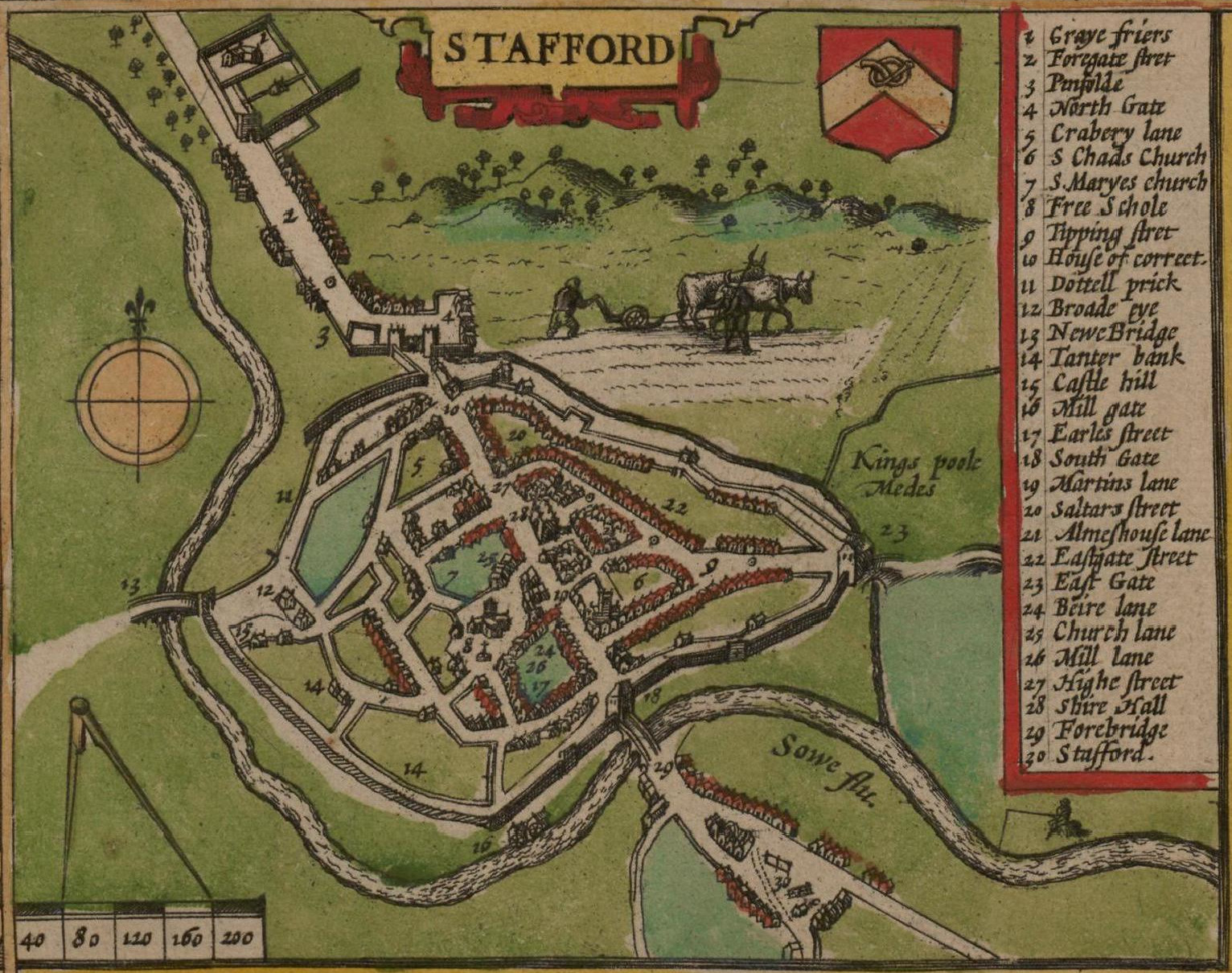
Stafford () is a market town and the county town of Staffordshire, England. It is located about south of Stoke-on-Trent, north of Wolverhampton, and northwest of Birmingham. The town had a population of 71,673 at the 2021–2022 United Kingdom censuses, 2021 census, and is the main settlement within the larger Borough of Stafford, which had a population of 136,837 in 2021. Stafford has Anglo-Saxons, Anglo-Saxon roots, being founded in 913, when Æthelflæd, List of monarchs of Mercia, Lady of the Mercians founded a defensive burh, it became the county town of Staffordshire soon after. Stafford became an important market town in the Middle Ages, and later grew into an important industrial town due to the proliferation of shoemaking, engineering and electrical industries. History Ancient Prehistoric finds suggest scattered settlements in the area, whilst south-west of the town lies an British Iron Age, Iron Age hill fort at Berry Ring. There is also evidence of Roman Brit ... [...More Info...] [...Related Items...] OR: [Wikipedia] [Google] [Baidu] |
Staffordshire
Staffordshire (; postal abbreviation ''Staffs''.) is a Ceremonial counties of England, ceremonial county in the West Midlands (region), West Midlands of England. It borders Cheshire to the north-west, Derbyshire and Leicestershire to the east, Warwickshire to the south-east, the West Midlands (county), West Midlands county and Worcestershire to the south, and Shropshire to the west. The largest settlement is the city of Stoke-on-Trent. The county has an area of and a population of 1,131,052. Stoke-on-Trent is located in the north and is immediately adjacent to the town of Newcastle-under-Lyme. Stafford is in the centre of the county, Burton upon Trent in the east, and the city of Lichfield and Tamworth, Staffordshire, Tamworth in the south-east. For local government purposes Staffordshire comprises a non-metropolitan county, with nine districts, and the Unitary authorities of England, unitary authority area of Stoke-on-Trent. The county Historic counties of England, historical ... [...More Info...] [...Related Items...] OR: [Wikipedia] [Google] [Baidu] |
Penkridge
Penkridge ( ) is a village and civil parish in South Staffordshire, South Staffordshire District in Staffordshire, England. It is to the south of Stafford, north of Wolverhampton, west of Cannock, east of Telford and south-east of Newport, Shropshire, Newport. The wealthiest establishment in Penkridge in the Middle Ages, its collegiate church building survived the Chantry#Abolition of Chantries Acts, 1545 and 1547, abolition of the chantries and is the tallest structure in the village centre. The parish is crossed towards its eastern border by the M6 motorway and a separate junction north of the M6 Toll between the West Midlands (county), West Midlands and Stoke-on-Trent. Penkridge has a Penkridge railway station, railway station on the West Coast Main Line railway next to the listed building, Grade I listed medieval church. Penkridge Viaduct and the Staffordshire and Worcestershire Canal are to either side of Market Street and the Old Market Square and are among its landmarks. ... [...More Info...] [...Related Items...] OR: [Wikipedia] [Google] [Baidu] |
Anglo-Saxon
The Anglo-Saxons, in some contexts simply called Saxons or the English, were a Cultural identity, cultural group who spoke Old English and inhabited much of what is now England and south-eastern Scotland in the Early Middle Ages. They traced their origins to Germanic peoples, Germanic settlers who became one of the most important cultural groups in Britain by the 5th century. The Anglo-Saxon period in Britain is considered to have started by about 450 and ended in 1066, with the Norman conquest of England, Norman Conquest. Although the details of Anglo-Saxon settlement of Britain, their early settlement and History of Anglo-Saxon England, political development are not clear, by the 8th century an Anglo-Saxon cultural identity which was generally called had developed out of the interaction of these settlers with the existing Romano-British culture. By 1066, most of the people of what is now England spoke Old English, and were considered English. Viking and Norman invasions chang ... [...More Info...] [...Related Items...] OR: [Wikipedia] [Google] [Baidu] |


