|
Big Sur
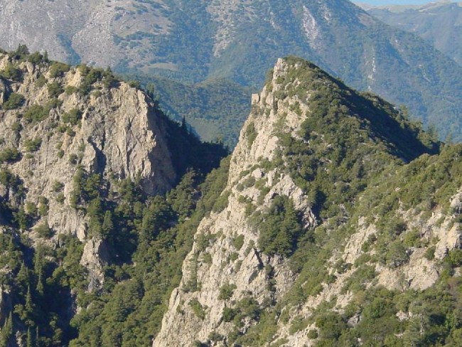
Big Sur () is a rugged and mountainous section of the Central Coast (California), Central Coast of the U.S. state of California, between Carmel Highlands and San Simeon, where the Santa Lucia Range, Santa Lucia Mountains rise abruptly from the Pacific Ocean. It is frequently praised for its dramatic scenery. Big Sur has been called the "longest and most scenic stretch of undeveloped coastline in the contiguous United States", a sublime "national treasure that demands extraordinary procedures to protect it from development", and "one of the most beautiful coastlines anywhere in the world, an isolated stretch of road, mythic in reputation". The views, Sequoioideae, redwood forests, hiking, beaches, and other recreational opportunities have made Big Sur a popular destination for visitors from across the world. With 4.5 to 7 million visitors annually, it is among the top tourist destinations in the United States, comparable to Yosemite National Park, but with considerably fewer ser ... [...More Info...] [...Related Items...] OR: [Wikipedia] [Google] [Baidu] |
California State Route 1 (Big Sur)
Big Sur Coast Highway is a section of California State Route 1 through the Big Sur region of California that is widely considered to be one of the most scenic driving routes in the United States, if not the world. It is both a National Scenic Byway and a State Scenic Highway System (California), California Scenic Highway, and was described by Australian painter Francis McComas (painter), Francis McComas as the "greatest meeting of land and water in the world". The winding, narrow road, often cut into the face of towering seaside cliffs, is a "symbolic image" of Big Sur. ''Condé Nast Traveler'' named State Route 1 through Big Sur one of the top ten world-famous streets, comparable to Broadway (Manhattan), Broadway in New York City and the Champs-Élysées in Paris. The road itself is a destination for visitors. The Big Sur portion of Highway 1 is generally considered to include the segment adjoining the Unincorporated area#United States, unincorporated region of Big Sur betwe ... [...More Info...] [...Related Items...] OR: [Wikipedia] [Google] [Baidu] |
Little Sur River
The Little Sur River is a long river on the Central Coast of California. The river and its main tributary, the a long South Fork, drain a watershed of about of the Big Sur area, a thinly settled region of the Central California coast where the Santa Lucia Mountains rise abruptly from the Pacific Ocean. The South Fork and the North Fork both have their headwaters in the Ventana Wilderness, straddling Mount Pico Blanco. Portions west of the national forest and Old Coast Road lie within the El Sur Ranch. Some portions of the North Fork are on land owned by Graniterock, Granite Rock Company of Watsonville, California, Watsonville, California, which has owned the mineral rights to on Mount Pico Blanco since 1963. The North and South forks converge about from the coast where the river enters the Pacific Ocean. The river's steep canyons and high chaparral-covered ridges are host to a number of rare species including the Santa Lucia Fir, Pedicularis dudleyi, Dudley's lousewort, an ... [...More Info...] [...Related Items...] OR: [Wikipedia] [Google] [Baidu] |
San Simeon
San Simeon ( Spanish: ''San Simeón'', meaning "St. Simon") is an unincorporated community on the Pacific coast of San Luis Obispo County, California, United States. Its position along State Route 1 is about halfway between Los Angeles and San Francisco, each of those cities being roughly away. A key feature of the area is Hearst Castle, a hilltop mansion built for William Randolph Hearst in the early 20th century that is now a tourist attraction. The area is also home to a large northern elephant seal rookery, known as the Piedras Blancas rookery, located north of San Simeon on Highway 1. History Humans first settled the local area at least 11,000 years ago. Prehistorically, the local area was inhabited by the Chumash people, including a large village south of San Simeon at Morro Creek. In 1542 the coastal exploration of Juan Cabrillo discovered the bay and named it the Bay of Sardines. The first European land exploration of Alta California, the Spanish Portolà ... [...More Info...] [...Related Items...] OR: [Wikipedia] [Google] [Baidu] |
List Of Regions Of The United States
This is a list of some of the ways ''regions'' are defined in the United States. Many regions are defined in law or regulations by the federal government; others by shared culture and history, and others by economic factors. Interstate regions Census Bureau-designated regions and divisions Since 1950, the United States Census Bureau defines four statistical regions, with nine divisions. The Census Bureau region definition is "widely used[...] for data collection and analysis","The National Energy Modeling System: An Overview 2003" (Report #: DOE/EIA-0581, October 2009). United States Department of Energy, Energy Information Administration. and is the most commonly used classification system. Puerto Rico and other US territories are not part of any census region or census division. Federal Reserve Banks The Federal Reserve Act, Federal Reserve Act of 1913 divided the country into twelve districts with a central Federal Reserve Bank in each district. These twelve Federal Res ... [...More Info...] [...Related Items...] OR: [Wikipedia] [Google] [Baidu] |
Carmel River (California)
The Carmel River ( Rumsen: ''tirus ua čorx'') is a U.S. Geological Survey. National Hydrography Dataset high-resolution flowline dataThe National Map, accessed March 20, 2021 river on the Central Coast of California in Monterey County that originates in the Ventana Wilderness of the Santa Lucia Mountains. The river flows northwest through Carmel Valley with its mouth at the Pacific Ocean south of Carmel-by-the-Sea, at Carmel Bay. The Carmel River is considered the northern boundary of Big Sur, the other boundaries being San Carpóforo Creek and the Pacific coastline. History Before European first contact, the Indigenous peoples of the Carmel River watershed were the Rumsen Ohlone people in the lower watershed, and the Esselen people of the upper watershed. Both peoples were taken into the Carmel Mission. The mouth of Carmel Valley where the Carmel River runs into Carmel Bay was first seen by Spanish explorer Sebastián Vizcaíno shortly before he landed in Monterey B ... [...More Info...] [...Related Items...] OR: [Wikipedia] [Google] [Baidu] |
Slates Hot Springs
Slates Hot Springs (also known as Big Sur Hot Springs, Slate's Hot Springs, Slate's Springs, and Slate's Hot Sulphur Springs) is the site of a hot spring in the Big Sur region of Monterey County, California. It is located north-northwest of Lopez Point, at an elevation of 118 feet (36 m). Thomas B. Slate filed a land patent for the site and adjacent land on September 9, 1882. He built a home on the site of the springs in 1868 and developed the springs for tourists. He claimed that the waters cured him of arthritis and it attracted others seeking a cure for their physical ailments. He sold the property to Salinas physician Dr. Henry Cloyd Murphy in 1910, whose family owned it until 1967, when Michael Murphy (author), Michael Murphy and Dick Price bought it from the estate of Michael's grandmother, Vinnie McDonald Murphy. They incorporated the business as Esalen Institute. History Native people The Esselen people, Esselen people resided along the upper Carmel River (Californi ... [...More Info...] [...Related Items...] OR: [Wikipedia] [Google] [Baidu] |
Big Sur River
The Big Sur River is a U.S. Geological Survey. National Hydrography Dataset high-resolution flowline dataThe National Map, accessed March 15, 2011 river on the Central Coast (California), Central Coast of California. The river drains a portion of the Big Sur area, a thinly settled region of the Central California coast where the Santa Lucia Mountains rise abruptly from the Pacific Ocean. The upper river and watershed lies within the Ventana Wilderness and encompasses the headwaters downstream to the area known as the Gorge. The lower river flows roughly northwest through Pfeiffer Big Sur State Park, the Big Sur village, several private camp grounds and Andrew Molera State Park where it flows through a lagoon and sandbar into the Pacific Ocean at the Monterey Bay National Marine Sanctuary. Major Tributaries of the river include, in order: Redwood Creek (Monterey County), Redwood Creek, Lion Creek, Logwood Creek, Terrace Creek, Ventana Creek, Post Creek, Pfeiffer-Redwood Creek, Juan ... [...More Info...] [...Related Items...] OR: [Wikipedia] [Google] [Baidu] |
Carmel, California
Carmel-by-the-Sea (), commonly known simply as Carmel, is a city in Monterey County, California, located on the Central Coast of California. As of the 2020 United States census, 2020 census, the city had a population of 3,220, down from 3,722 at the 2010 United States Census, 2010 census. Situated on the Monterey Peninsula, Carmel is a tourist destination, known for its natural scenery and artistic history. The Spanish Empire, Spanish founded a settlement in 1797, when Mission San Carlos Borromeo de Carmelo was relocated by Junípero Serra, St. Junípero Serra from Monterey. Mission Carmel served as the headquarters of the Spanish missions in California, Californian mission system, until the Mexican secularization act of 1833, when the area was divided into ranchos of California, rancho grants. The settlement was largely abandoned by the Conquest of California, U.S. Conquest of California in 1848 and stayed undeveloped until Santiago J. Duckworth set out to build a summer colony ... [...More Info...] [...Related Items...] OR: [Wikipedia] [Google] [Baidu] |
Big Sur And Los Padres National Forest
Big or BIG may refer to: * Big, of great size or degree Film and television * ''Big'' (film), a 1988 fantasy-comedy film starring Tom Hanks * ''Big'', a 2023 Taiwanese children's film starring Van Fan and Chie Tanaka * ''Big!'', a Discovery Channel television show * ''Richard Hammond's Big'', a television show presented by Richard Hammond * ''Big'' (TV series), a 2012 South Korean TV series * "Big" (''My Hero''), a 2003 television episode * ''Banana Island Ghost'', a 2017 fantasy action comedy film Music * '' Big: the musical'', a 1996 musical based on the film * Big Records, a record label * ''Big!'' (Betty Who album) * ''Big'' (album), a 2007 album by Macy Gray * "Big" (Brassmunk song) * "Big" (Dead Letter Circus song) * "Big" (Fontaines D.C. song) * "Big" (Juice Wrld song) * "Big" (Sneaky Sound System song) * "Big" (Rita Ora and Imanbek song) * "Big" (Young M.A song) * "Big", a 1990 song by New Fast Automatic Daffodils * "Big", a 2021 song by Jade Eagleson from ... [...More Info...] [...Related Items...] OR: [Wikipedia] [Google] [Baidu] |
Fort Hunter Liggett
Fort Hunter Liggett is a United States Army post in Jolon, California, in southern Monterey County, California. The fort, named in 1941 after General Hunter Liggett, is primarily used as a training facility, where activities such as field maneuvers and live fire exercises are performed. It is roughly 25 miles northwest of Camp Roberts, California. Geography The Salinas Valley is the fort's northern border, the Santa Lucia Mountains bound it on the east, Los Padres National Forest on the west and the Monterey and San Luis Obispo County line on the south. The fort originally comprised , but even at its present size of , it is the largest United States Army Reserve post. Some of the land, , was given to Mission San Antonio de Padua, bringing its size to . Additionally, land has been traded between the United States Forest Service, which owns the adjacent Los Padres National Forest, and the Army. Junipero Serra Peak is to the north and Bald Mountain to the south. The fort also co ... [...More Info...] [...Related Items...] OR: [Wikipedia] [Google] [Baidu] |
Silver Peak Wilderness
The Silver Peak Wilderness is located in the southwestern corner of Monterey County in the Santa Lucia Mountains along the Central Coast of California. It southern boundary largely follows the Monterey County/San Luis Obispo County line. Its eastern boundary is defined by Ft. Hunter Liggett, while on the west it follows closely along Highway 1 and the Big Sur coastline. It is one of ten wilderness areas within the Los Padres National Forest and managed by the US Forest Service. The wilderness was created by the U.S. Congress as part of the Los Padres Condor Range and River Protection Act of 1992 (Public Law 102-301) which set aside approximately . The same legislation also established the Chumash, Garcia, Machesna Mountain, Matilija, and Sespe Wilderness areas. On December 19, 2002 the Big Sur Wilderness and Conservation Act of 2002 added to the existing wilderness. The Wilderness is in two separate units, divided by the Willow Creek drainage and the fire roads to Alder ... [...More Info...] [...Related Items...] OR: [Wikipedia] [Google] [Baidu] |
Ventana Wilderness
The Ventana Wilderness of Los Padres National Forest is a federally designated wilderness area located in the Santa Lucia Range along the Central Coast (California), Central Coast of California. This wilderness was established in 1969 when the Ventana Wilderness Act redesignated the 55,800-acre (22,600 ha) Ventana Primitive Area as the Ventana Wilderness and added land, totalling . In 1978, the Endangered American Wilderness Act of 1978, Endangered American Wilderness Act added , increasing the total wilderness area to about . The California Wilderness Act of 1984 added about . The Los Padres Condor Range and River Protection Act of 1992 created the approximately 14,500-acre (5,900 ha) Silver Peak Wilderness and added about to the Ventana Wilderness in addition to designating the Big Sur River as a National Wild and Scenic Rivers System, Wild and Scenic River. The Big Sur Wilderness and Conservation Act of 2002 expanded the wilderness for the fifth time, adding nearly , ... [...More Info...] [...Related Items...] OR: [Wikipedia] [Google] [Baidu] |


