|
Austria–Germany Border
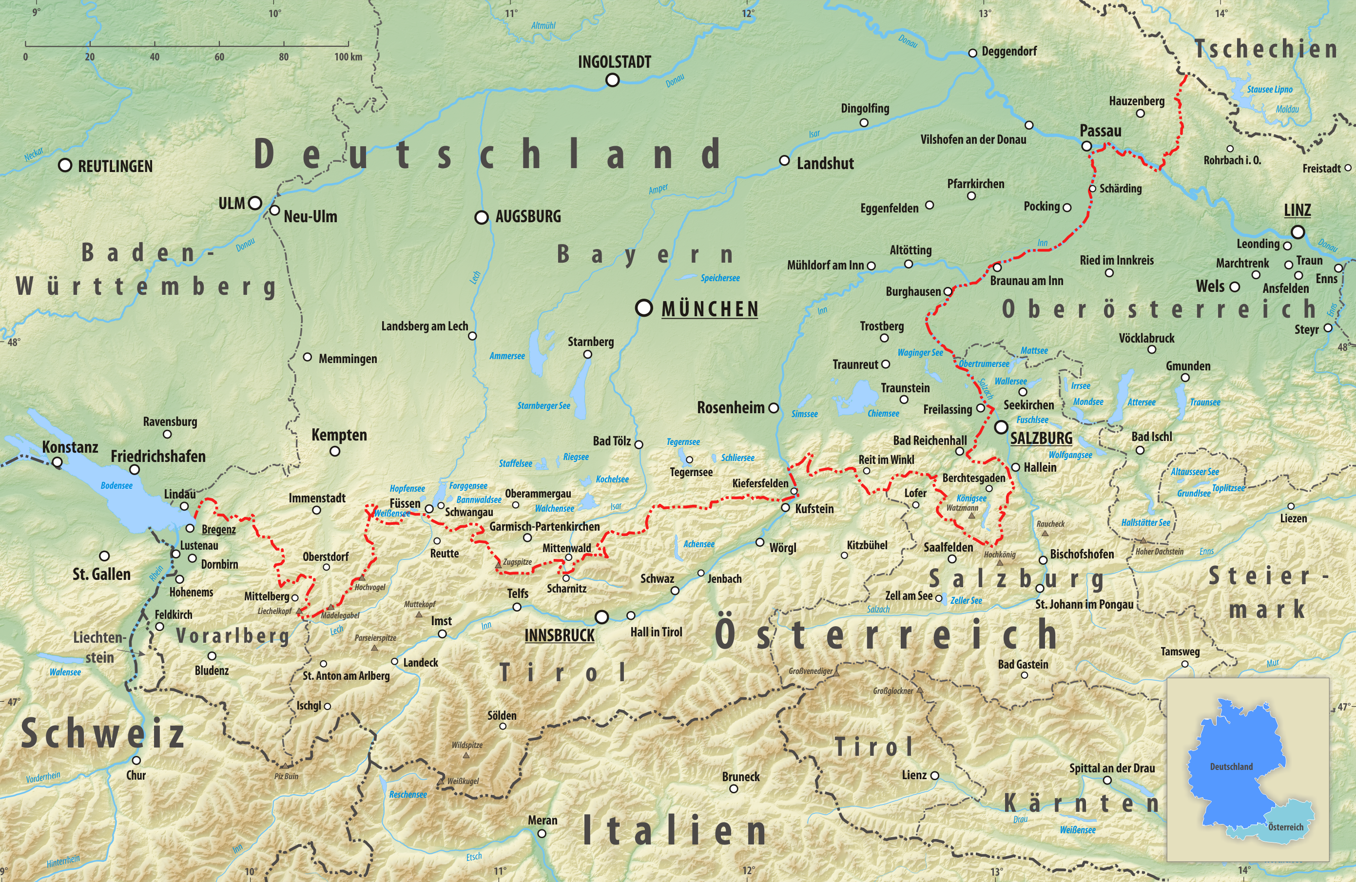
The border between the modern states of Austria and Germany () has a length of , or respectively. It is the longest international border of Austria and the tied longest border of Germany with another country (the other one being the border with the Czech Republic, with the same length of ). Course Within its western part, the border runs roughly from east to west, but from a point south of Salzburg to its eastern end, located at the tripoint of Germany, Austria and the Czech Republic, it runs in a mainly northeastward direction. The western end is located at the border tripoint of Germany, Austria and Switzerland within the '' Obersee'' part of Lake Constance (), although the exact course of the international borders within Lake Constance have never been defined. The border is long, but a straight line between the endpoints is long. Jungholz and Kleinwalsertal are two Austrian pene-exclaves; they can only be reached by road through German territory. Besides Lake Constanc ... [...More Info...] [...Related Items...] OR: [Wikipedia] [Google] [Baidu] |
Jungholz
Jungholz () is a village in the district of Reutte in the Austrian state of Tyrol that is only accessible via Germany. The lack of a road connection to anywhere else in Austria led to Jungholz being included in the German customs area before Austria joined the EU in 1995. It also used the instead of the Austrian schilling as currency until 2002, when the euro took over. Letters to Jungholz can be addressed with either a German or an Austrian postal code. Quadripoint Jungholz forms a pene-exclave of Austria that is connected to the rest of Austria by a single point, which is the summit of the mountain '' Sorgschrofen'' (). As well as housing border post number 110 on the normal international border between Tyrol and Bavaria, a second border starts and, having gone round Jungholz, ends there. There are thus borders extending in four directions from the summit, called a quadripoint. Two Austrian (Tyrolean, Reutte) and two German (Bavarian, Oberallgäu) municipalities meet at that po ... [...More Info...] [...Related Items...] OR: [Wikipedia] [Google] [Baidu] |
Leiblach
The Leiblach is a tributary of Lake Constance ('' Obersee'') and the Rhine, respectively. It forms the Austria–Germany border near the lake. Geography The Leiblach source is near the German municipality of Heimenkirch, flowing to the southwest. Near the Austrian town of Hohenweiler, the river joins a small tributary, the . This tributary forms a part of the Austrian-German border, and below the confluence the border continues to follow the Leiblach until it eventually empties into Lake Constance between the German town of Lindau and the Austrian village of Lochau. See also * List of rivers of Austria *List of rivers of Germany **List of rivers of Bavaria A list of rivers of Bavaria, Germany: A * Aalbach * Abens * Ach * Afferbach * Affinger Bach * Ailsbach * Aisch * Aiterach * Alpbach *Alster * Altmühl * Alz * Amper * Anlauter * Arbach * Arbachgraben * Aschaff * Aschbach * Attel * Aubach, tributa ... References Rivers of Bavaria Rivers of Vorarlberg Austria–Ger ... [...More Info...] [...Related Items...] OR: [Wikipedia] [Google] [Baidu] |
Tyrol (state)
Tyrol ( ; ; ) is an Austrian Provinces of Austria, federal state. It comprises the Austrian part of the historical County of Tyrol, Princely County of Tyrol. It is a constituent part of the present-day Euroregion Tyrol–South Tyrol–Trentino (together with South Tyrol and Trentino in Italy). The capital of Tyrol is Innsbruck. Geography Tyrol is separated into two parts, divided by a strip of Salzburg (federal state), Salzburg State. The two constituent parts of Tyrol are the northern and larger North Tyrol () and the southeastern and smaller East Tyrol ('). Salzburg State lies to the east of North Tyrol, while on the south Tyrol has a border to the Italy, Italian province of South Tyrol, which was part of the Austro-Hungarian Empire before the First World War. With a land area of , Tyrol is the third-largest federal state in Austria. North Tyrol shares its borders with the federal states Salzburg in the east and Vorarlberg in the west. In the north, it adjoins the Germany ... [...More Info...] [...Related Items...] OR: [Wikipedia] [Google] [Baidu] |
Vorarlberg
Vorarlberg ( ; ; , , or ) is the westernmost States of Austria, state () of Austria. It has the second-smallest geographical area after Vienna and, although it also has the second-smallest population, it is the state with the second-highest population density (also after Vienna). It borders three countries: Germany (Bavaria and Baden-Württemberg via Lake Constance), Switzerland (Grisons and Canton of St. Gallen, St. Gallen), and Liechtenstein. The only Austrian state that shares a border with Vorarlberg is Tyrol (state), Tyrol, to the east. The capital of Vorarlberg is Bregenz (29,698 inhabitants), although Dornbirn (49,845 inhabitants) and Feldkirch, Vorarlberg, Feldkirch (34,192 inhabitants) have List of cities and towns in Austria, larger populations. Vorarlberg is also the only state in Austria where the local dialect is not Austro-Bavarian dialects, Austro-Bavarian, but rather an Alemannic dialects, Alemannic dialect; it therefore has much more in common culturally with (hi ... [...More Info...] [...Related Items...] OR: [Wikipedia] [Google] [Baidu] |
States Of Austria
Austria is a federal republic consisting of nine federal states. The European Commission calls them provinces. Austrian federal states can pass laws that stay within the limits of the constitution, and each federal state has representatives in the main Austrian parliament. Geography The majority of the land area in the federal states of Upper Austria, Lower Austria, Vienna, and Burgenland is situated in the Danube valley and thus consists almost completely of accessible and easily arable terrain. Austria's most densely populated federal state is Vienna, the heart of what is Austria's only metropolitan area. Lower Austria ranks only fourth in population density even though it contains Vienna's suburbs; this is due to large areas of land being predominantly agricultural. The alpine federal state Tyrol, the less alpine but geographically more remote federal state Carinthia, and the non-alpine but near-exclusively agricultural federal state Burgenland are Austria's least densely ... [...More Info...] [...Related Items...] OR: [Wikipedia] [Google] [Baidu] |
Kufstein
Kufstein (; ) is a town in the Austrian state of Tyrol, the administrative seat of Kufstein District. With a population of about 20,000 it is the second largest Tyrolean town after the state capital Innsbruck. The greatest landmark is Kufstein Fortress, first mentioned in the 13th century. The town was the place of origin of the Austrian noble family Kuefstein. Geography It is located in the Tyrolean Unterland region on the river Inn, at the confluence with its Weißache and Kaiserbach tributaries, near the border with Bavaria, Germany. The municipal area stretches along the Lower Inn Valley between the Brandenberg Alps in the northwest and the Kaiser Mountains in the southeast. The remote Kaisertal until recently was the last settled valley in Austria without transport connections, prior to the completion of a tunnel road from Kufstein to neighbouring Ebbs in 2008. North of the town, the Inn river leaves the Northern Limestone Alps and enters the Bavarian Alpine Forelan ... [...More Info...] [...Related Items...] OR: [Wikipedia] [Google] [Baidu] |
Berchtesgaden Alps
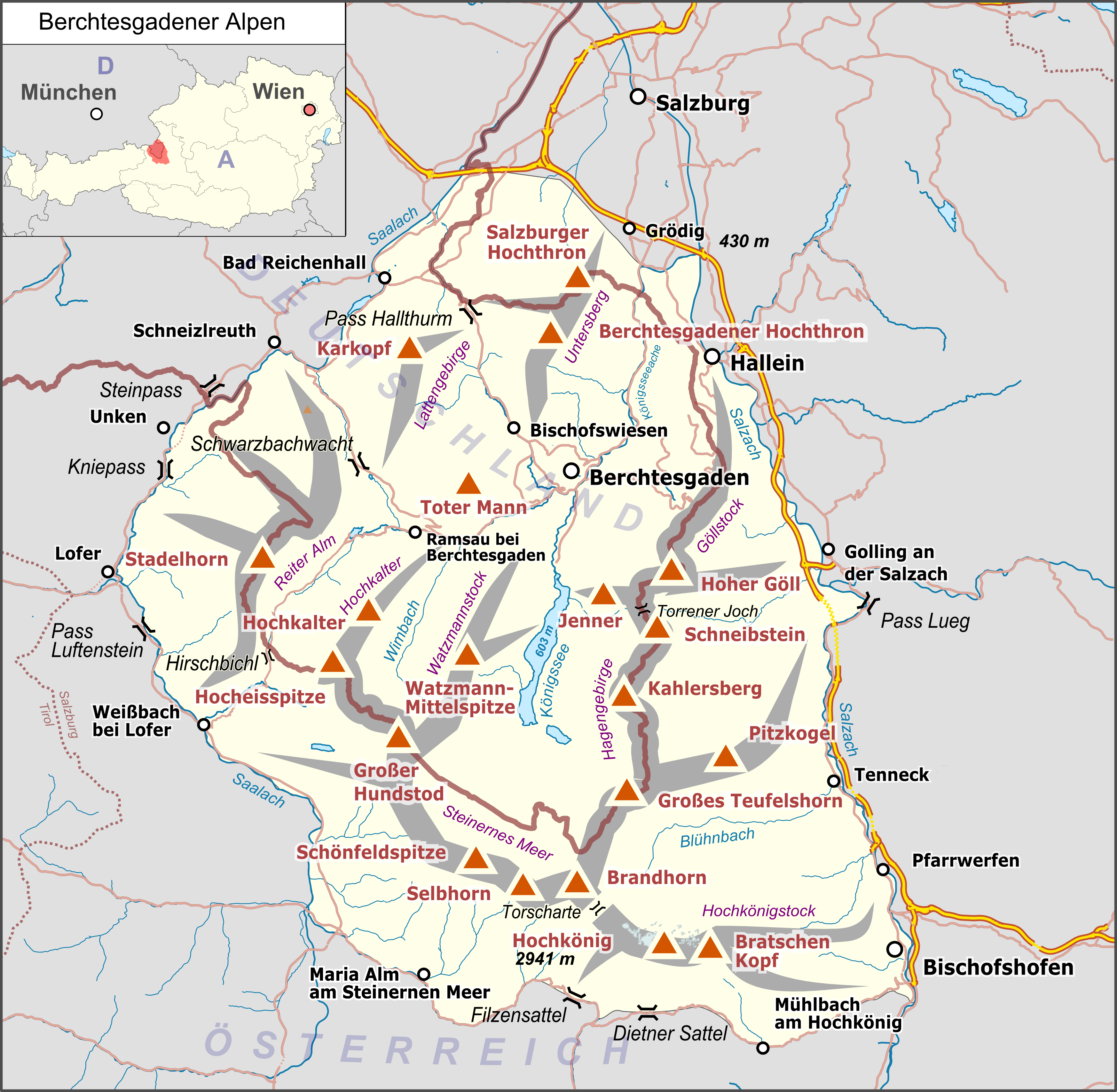
The Berchtesgaden Alps (, ) are a mountain range of the Northern Limestone Alps, named after the market town of Berchtesgaden located in the centre. It is crossed by the Austria–Germany border: the central part belongs to the Berchtesgadener Land district of southeastern Bavaria, Germany, while the adjacent area in the north, east and south is part of the Austrian state of Salzburg (state), Salzburg (''Salzburger Land''). Geography Mountains and lakes While the highest mountain of the Berchtesgaden Alps is the Hochkönig () located in the Austrian part, the best known peak is the Watzmann massif, the third-highest mountain of Germany at . The range also comprises the Obersalzberg slope east of Berchtesgaden, known for the former Berghof (residence), Berghof residence of Adolf Hitler. The picturesque heart is formed by the glacial Königssee lake with the famous St. Bartholomew's Church, Berchtesgaden, St. Bartholomew's pilgrimage church and the smaller Obersee (Königssee), O ... [...More Info...] [...Related Items...] OR: [Wikipedia] [Google] [Baidu] |
Chiemgau Alps
The Chiemgau Alps () are a mountain range in the Northern Limestone Alps and belong to the Eastern Alps. They are crossed by the Austria–Germany border: their major part is situated in Bavaria, Germany, and only a small section is within the states of Salzburg and Tirol in Austria. They reach their highest elevation () in the Sonntagshorn, a peak straddling the German-Austrian border. Geography The Chiemgau Alps stretch from the Inn River in the West to the Salzach River in the East and cover a distance of in strike direction; their maximum width in North-South direction amounts to about . They are surrounded by the following mountain ranges: * Bavarian Prealps in the West * Kaisergebirge in the Southwest * Leoganger Steinberge in the South * Loferer Steinberge in the Southeast * Berchtesgaden Alps in the Southeast and East Their northern edge often drops off quite drastically to the foothills. Major peaks * Sonntagshorn - 1,961 m * Steinplatte - 1,869 ... [...More Info...] [...Related Items...] OR: [Wikipedia] [Google] [Baidu] |
Kaiser Mountains
The Kaiser Mountains (, meaning ''Emperor Mountains'') are a mountain range in the Northern Limestone Alps and Eastern Alps. Its main ridges – are the Zahmer Kaiser and south of it the Wilder Kaiser. The mountains are situated in the Austrian province of Tyrol between the towns of Kufstein and St. Johann in Tirol. The Kaiser Mountains offer some of the loveliest scenery in all the Northern Limestone Alps. Reynolds, Kev (2005). ''Walking in the Alps'', 2nd ed., Cicerone, Singapore, p. 430, . Divisions The Kaiser Mountains are divided into the Wilder Kaiser or Wild Kaiser chain of mountains, formed predominantly of bare limestone rock, and the Zahmer Kaiser ("Tame Kaiser"), whose southern side is mainly covered by mountain pine. These two mountain ridges are linked by the 1,580-metre-high Stripsenjoch pass, but are separated in the west by the valley of Kaisertal and in the east by the Kaiserbach valley. In total the Kaiser extends for about in an east-west direction and ... [...More Info...] [...Related Items...] OR: [Wikipedia] [Google] [Baidu] |
Bavarian Prealps
The Bavarian Prealps () are a mountain range within the Northern Limestone Alps along the Austria–Germany border. They include the Bavarian Prealp region between the river Loisach to the west and the river Inn River, Inn to the east; the range is about long and wide. The term is not defined politically, but alpine-geographically because, although the range is mostly located in Bavaria, southeast Germany, small areas of the Bavarian Prealps lie in the states of Austria, state of Tyrol (state), Tyrol (e.g. the Hinteres Sonnwendjoch south of the Rotwand (Bavaria), Rotwand), Austria. The term is not to be confused with the Bavarian Alps or the Bavarian Alpine Foreland. These terms include the whole of the alpine region (together with parts of the Wetterstein, the Karwendel, etc.) and the whole Alpine Foreland on Bavarian state territory. Except in the Ester Mountains in the extreme west, the summits of the Bavarian Prealps are all below 2000 metres in height and only a few have pro ... [...More Info...] [...Related Items...] OR: [Wikipedia] [Google] [Baidu] |
Karwendel
The Karwendel is the largest mountain range of the Northern Limestone Alps. It is located on the Austria–Germany border. The major part belongs to the Austrian federal state of Tyrol (state), Tyrol, while the adjacent area in the north is part of Bavaria, Germany. Four mountain chain, chains stretch from west to east; in addition, there are a number of fringe ranges and an extensive promontory (''Vorkarwendel'') in the north. Geography The term Karwendel describes the part of the Alps between the Isar river and the Seefeld Saddle mountain pass in the west and Achen Lake in the east. In the north it stretches to the Bavarian Prealps. In the south the Lower Inn Valley with the city of Innsbruck separates the Karwendel from the Central Eastern Alps. Other major settlements include Seefeld in Tirol and Mittenwald in the west, as well as Eben am Achensee in the east. Neighbouring ranges are the Wetterstein and Mieming Range, Mieming Mountains in the west and the Brandenberg Alps in ... [...More Info...] [...Related Items...] OR: [Wikipedia] [Google] [Baidu] |
Wetterstein
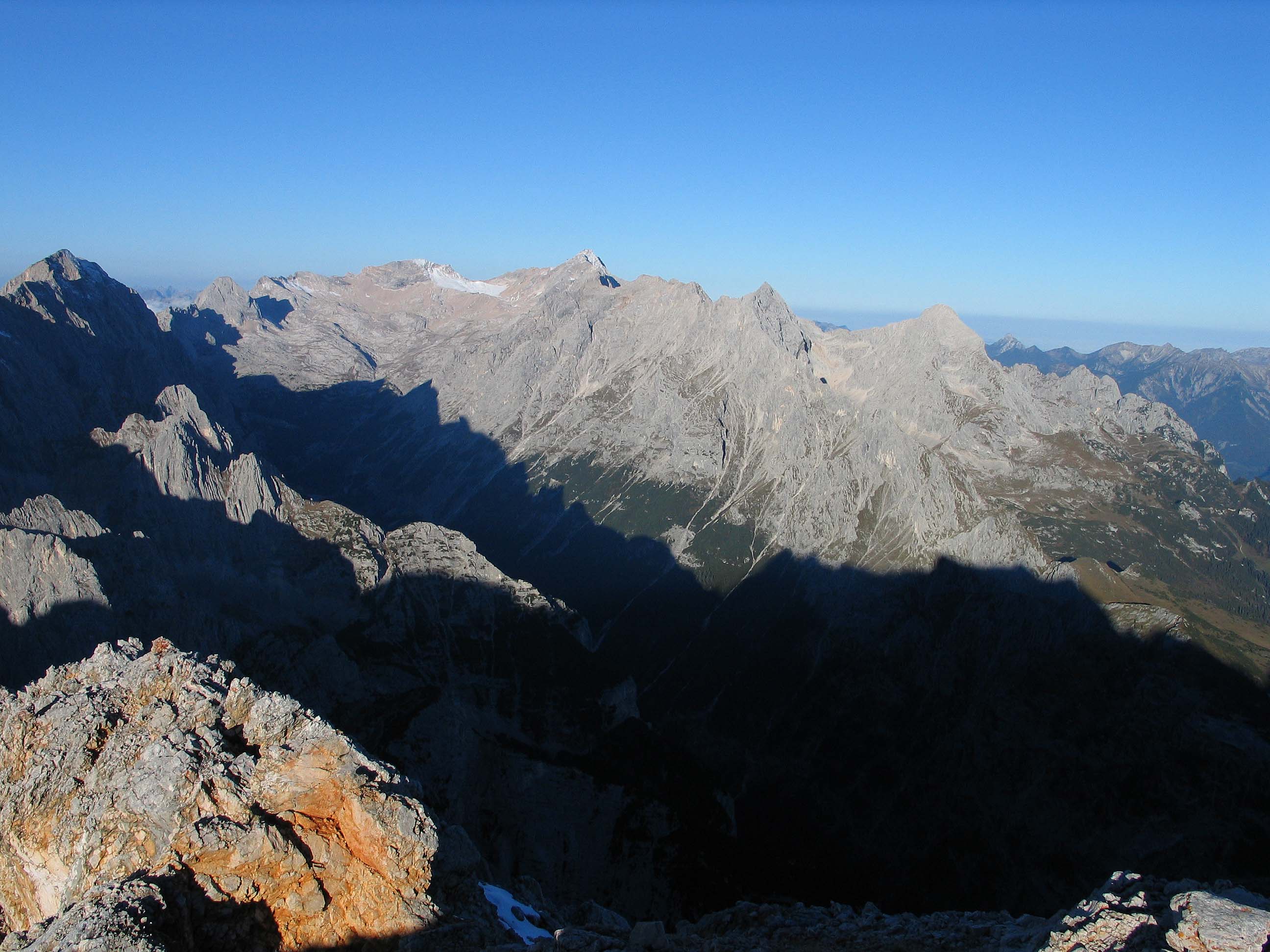
The Wetterstein mountains (), colloquially called Wetterstein, is a mountain group in the Northern Limestone Alps within the Eastern Alps, crossing the Austria–Germany border. It is a comparatively compact range located between Garmisch-Partenkirchen, Mittenwald, Seefeld in Tirol and Ehrwald along the border between Germany (Bavaria) and Austria (Tyrol). Zugspitze, the highest peak is at the same time the highest mountain in Germany. The Wetterstein mountains are an ideal region for mountaineers and climbers. Mountain walkers sometimes need to allow for significant differences in elevation. The proximity of the range to the south German centres of population, the scenic landscape and its good network of cable cars and lifts mean that the mountains are heavily frequented by tourists for most of the year. There are, however, places in the Wetterstein that are rarely or never visited by people. Neighbouring ranges The Wetterstein borders on the following other ... [...More Info...] [...Related Items...] OR: [Wikipedia] [Google] [Baidu] |


