|
Auckland
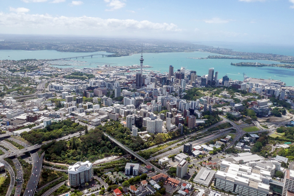
Auckland ( ; ) is a large metropolitan city in the North Island of New Zealand. It has an urban population of about It is located in the greater Auckland Region, the area governed by Auckland Council, which includes outlying rural areas and the islands of the Hauraki Gulf, and which has a total population of as of It is the List of cities in New Zealand, most populous city of New Zealand and the List of cities in Oceania by population, fifth-largest city in Oceania. The city lies between the Hauraki Gulf to the east, the Hunua Ranges to the south-east, the Manukau Harbour to the south-west, and the Waitākere Ranges and smaller ranges to the west and north-west. The surrounding hills are covered in rainforest and the landscape is dotted with 53 volcanic centres that make up the Auckland Volcanic Field. The central part of the urban area occupies a narrow isthmus between the Manukau Harbour on the Tasman Sea and the Waitematā Harbour on the Pacific Ocean. Auckland is one of ... [...More Info...] [...Related Items...] OR: [Wikipedia] [Google] [Baidu] |
Auckland War Memorial Museum
The Auckland War Memorial Museum (), also known as Auckland Museum, is one of New Zealand's most important museums and war memorials. Its neoclassical architecture, neoclassical building constructed in the 1920s and 1950s, stands on Observatory Hill, the remains of a dormant volcano, in the Auckland Domain, near Auckland CBD. Museum collections concentrate on New Zealand history (and especially the history of the Auckland Region), natural history, and military history. Auckland Museum's collections and exhibits began in 1852. In 1867 Aucklanders formed a learned society—the Auckland Philosophical Society, soon renamed Auckland Institute. Within a few years Auckland Museum was transferred to Auckland Institute, thereafter known as Auckland Institute and Museum until 1996. Auckland War Memorial Museum was the name of the new building opened in 1929, but since 1996 it has been more commonly used for the institution as well. From 1991 to 2003 the Museum's Māori-language, Māori n ... [...More Info...] [...Related Items...] OR: [Wikipedia] [Google] [Baidu] |
Auckland CBD
The Auckland Central Business District (CBD), or Auckland city centre, is the geographical and economic heart of the Auckland, Auckland metropolitan area. It is the area in which Auckland was established in 1840, by William Hobson on land gifted by Tangata whenua, ''mana whenua'' ''hapū'' Ngāti Whātua Ōrākei. It is New Zealand's leading financial hub, and the centre of the Economy of New Zealand, country's economy; the GDP of the Auckland Region was NZD$139 billion in the year ending September 2023. The CBD is one of the most densely developed places in New Zealand, with many commercial and some residential developments packed into a space of only . The area is made up of the city's largest concentration of skyscrapers and businesses. Bounded by several major motorways and by the harbour coastline in the north, it is surrounded further out by mostly suburban areas; it is bounded on the North by Waitematā Harbour, east by Parnell, New Zealand, Parnell, southeast by Grafton, ... [...More Info...] [...Related Items...] OR: [Wikipedia] [Google] [Baidu] |
Auckland Harbour Bridge
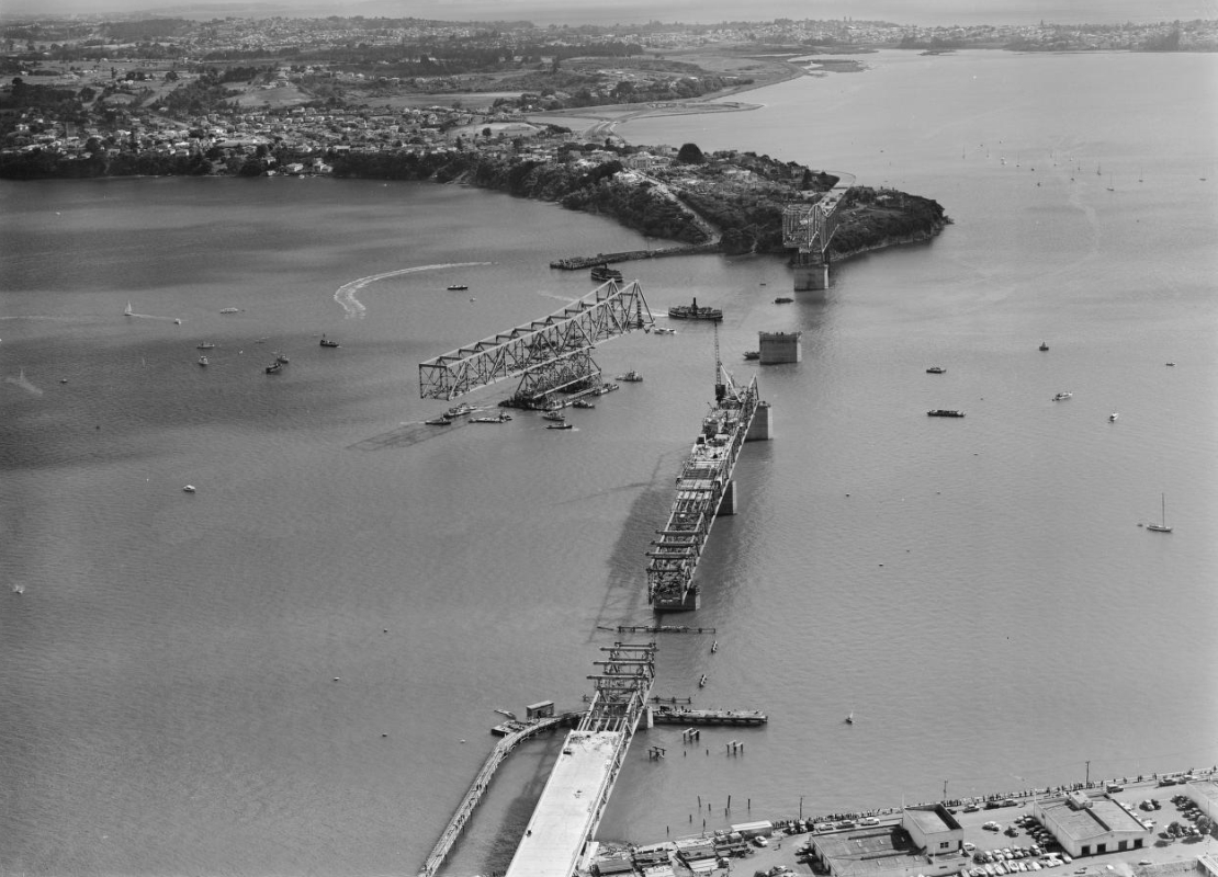
The Auckland Harbour Bridge is an eight-lane motorway bridge over Waitematā Harbour in Auckland, New Zealand. It joins Saint Marys Bay, New Zealand, St Marys Bay on the Auckland city side with Northcote, Auckland, Northcote on the North Shore, New Zealand, North Shore side. It is part of State Highway 1 (New Zealand), State Highway 1 and the Auckland Northern Motorway. The bridge is operated by the NZ Transport Agency Waka Kotahi (NZTA). It is the second-longest road bridge in New Zealand, and the longest in the North Island. The original inner four lanes, opened in 1959, are of truss, box truss construction. Two lanes were added to each side in 1968–1969 and are of orthotropic deck, orthotropic box structure construction extend as cantilevers from the original pier (architecture), piers. The bridge is 1,020 m (3,348 ft) long, with a main span of 243.8 metres (800 feet) rising 43.27 metres (142 feet) above high water, allowing ships access to the deepwater wharf at ... [...More Info...] [...Related Items...] OR: [Wikipedia] [Google] [Baidu] |
Auckland Art Gallery
Auckland Art Gallery Toi o Tāmaki is the principal public gallery in Auckland, New Zealand. It has the most extensive collection of national and international art in New Zealand and frequently hosts travelling international exhibitions. Set below the hilltop Albert Park, Auckland, Albert Park in the central-city area of Auckland, the gallery was established in 1888 as the first permanent art gallery in New Zealand. The building originally housed both the Auckland Art Gallery and the Auckland public library, and opened with collections donated by benefactors Governor Sir George Grey and James Tannock Mackelvie. This was the second public art gallery in New Zealand, after the Dunedin Public Art Gallery, which opened three years earlier in 1884. Wellington's New Zealand Academy of Fine Arts opened in 1892 and a Wellington Public Library in 1893. In 2009, it was announced that the museum received a donation from American businessman Julian Robertson, valued at over $100 milli ... [...More Info...] [...Related Items...] OR: [Wikipedia] [Google] [Baidu] |
Maungakiekie / One Tree Hill
Maungakiekie / One Tree Hill is a volcano, volcanic peak and Tūpuna Maunga o Tāmaki Makaurau, Tūpuna Maunga (ancestral mountain) in Auckland, New Zealand. It is an important place culturally and archeologically for both Māori people, Māori and . The suburb around the base of the hill is also called One Tree Hill, New Zealand, One Tree Hill. It is surrounded by the suburbs of Royal Oak, New Zealand, Royal Oak to the west, and clockwise, Epsom, New Zealand, Epsom, Greenlane, Oranga, and Onehunga. The summit provides views across the Auckland area, and allows visitors to see both of Auckland's harbours. The scoria volcanic cone, cones of the hill were erupted from three craters – one is intact and two have been breached by lava flows that rafted away part of the side of the scoria cone. Lava flows went in all directions, many towards Onehunga, covering an area of , making it the second largest (in area covered) of the Auckland volcanic field, behind Rangitoto Island. The v ... [...More Info...] [...Related Items...] OR: [Wikipedia] [Google] [Baidu] |
Auckland Region
Auckland () is one of the 16 regions of New Zealand, which takes its name from the eponymous urban areas of New Zealand, urban area. The region encompasses the Auckland, Auckland metropolitan area, smaller towns, rural areas, and the islands of the Hauraki Gulf. Containing percent of the nation's residents, it has by far the largest population and economy of any region of New Zealand, but the second-smallest land area. On 1 November 2010, the Auckland region became a unitary authority administered by the Auckland Council, replacing the previous regional council and seven local councils. In the process, an area in its southeastern corner was transferred to the neighbouring Waikato region. Since then, the Auckland Council has introduced a system of local boards to divide the region for local government. Geography On the mainland, the region extends from the mouth of the Kaipara Harbour in the north across the southern stretches of the Northland Peninsula, through the Waitā ... [...More Info...] [...Related Items...] OR: [Wikipedia] [Google] [Baidu] |
Auckland Town Hall
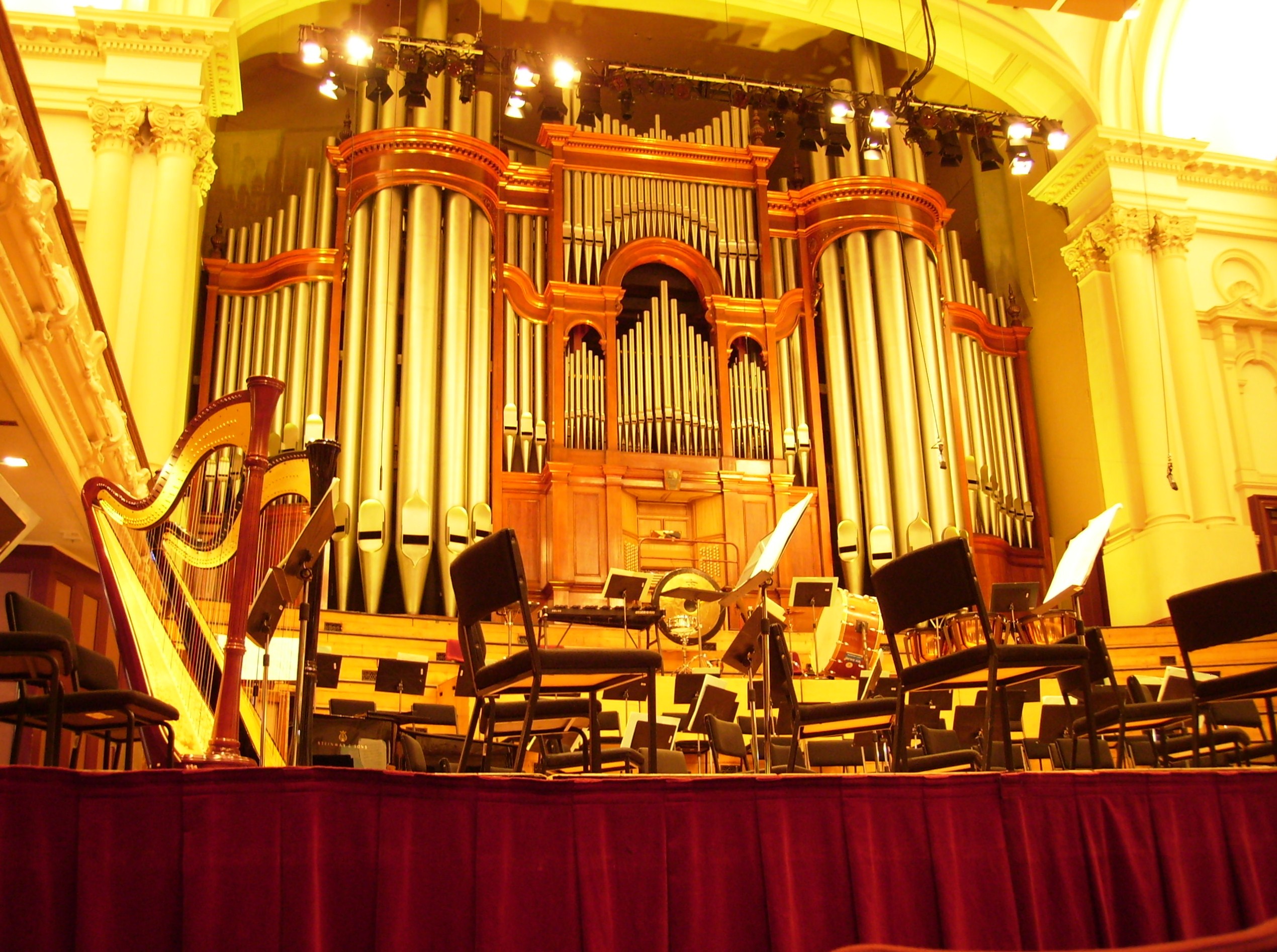
The Auckland Town Hall is an Edwardian architecture, Edwardian building on Queen Street, Auckland, Queen Street in the Auckland CBD, New Zealand, known both for its original and ongoing use for administrative functions (such as Local authority, Council meetings and hearings), as well as its famed Great Hall and separate Concert Chamber. Auckland Town Hall and its surrounding context is highly protected as a 'Category A' heritage site in the Auckland District Plan, registered by Heritage New Zealand as a List of category 1 historic places in Auckland, Category I Historic Place. History Building Since as early as 1872, there were plans to create a town hall for the city of Auckland. The corner of Greys Avenue and Queen Street was chosen as the location in 1880, and the corner was requisitioned by a formal act of parliament, the Auckland Reserves Exchange and Change of Trust Act 1881. The area proved to be too small, so the municipal government purchased the adjoining properties ... [...More Info...] [...Related Items...] OR: [Wikipedia] [Google] [Baidu] |
St Patrick's Cathedral, Auckland
The Cathedral of Saint Patrick and Saint Joseph (usually known as St Patrick's Cathedral) is a heritage-listed Catholic cathedral church in Auckland CBD, situated on the corner of Federal Street and Wyndham St. It is the mother church of the Roman Catholic Diocese of Auckland and the seat of the Bishop of Auckland. In 1841, the land was acquired by Bishop Jean-Baptiste Pompallier, the first Catholic bishop in New Zealand. A wooden chapel was constructed in 1843, replaced by a stone church in 1848, which was expanded in 1884, and finally replaced with the current cathedral in 1907. The church was designated as a cathedral in 1848, and consecrated in 1963. The cathedral was registered as a Category I historic place by Heritage New Zealand on 6 September 1984. Masses The normal Mass times are: * Sunday: 8am, 11am, 4.30pm & 7pm; * Monday to Friday: 7 am & 12.15 pm; * Public Holidays and Saturdays: 8.30am. Origins The church is located on the original site granted by the Cro ... [...More Info...] [...Related Items...] OR: [Wikipedia] [Google] [Baidu] |
George Eden, 1st Earl Of Auckland
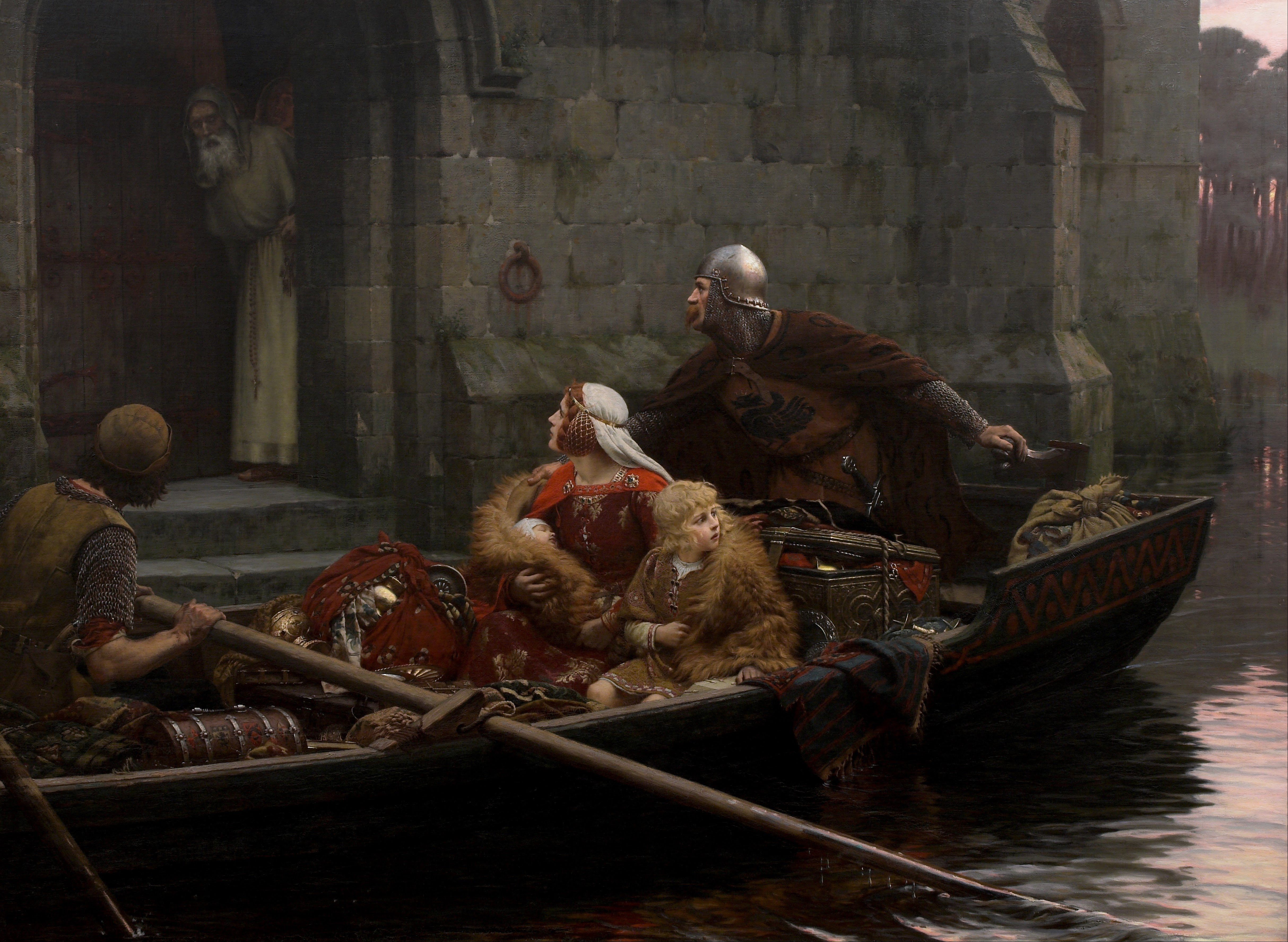
George Eden, 1st Earl of Auckland, (25 August 1784 – 1 January 1849) was an English people, English Whig (British political faction), Whig politician and colonial administrator. He was thrice First Lord of the Admiralty and also served as Governor-General of India between 1836 and 1842. The province of Auckland, which includes the present regions of Northland, Auckland, Waikato, Bay of Plenty and Gisborne along with the city of Auckland, in New Zealand, was named after him. Lord Auckland signed the Tripartite Treaty in June 1838 with Maharaja Ranjit Singh of the Sikh Empire and Shah Shujah Durrani, Shah Shuja of Afghanistan. Background and education Born in Beckenham, Kent, Auckland was the second son of William Eden, 1st Baron Auckland, and Eleanor, daughter of Sir Gilbert Elliot, 3rd Baronet, of Minto, Sir Gilbert Elliot, 3rd Baronet. His sister was the traveller and author Emily Eden, who accompanied her brother to India and wrote about her experiences there. He was e ... [...More Info...] [...Related Items...] OR: [Wikipedia] [Google] [Baidu] |
Waitematā Local Board
The Waitematā Local Board is one of the 21 local boards of the Auckland Council, and is one of the three boards overseen by the council's Waitematā and Gulf Ward councillor. The Waitematā board, named after the Waitematā Harbour which forms its northern boundary, covers the Auckland central business district, and the suburbs of Arch Hill, Eden Terrace, Freemans Bay, Grafton, Grey Lynn, Herne Bay, Mechanics Bay, Newmarket, Newton, Parnell, Ponsonby, Saint Marys Bay, Western Springs, and Westmere. The board is governed by seven board members elected at-large. Geography The western part of the suburb includes the suburbs of Western Springs, Herne Bay, Westmere, Grey Lynn, Arch Hill, St Mary's Bay, Ponsonby and Freemans Bay. In the north is Wynyard Quarter, Auckland Waterfront and Auckland Central. To the south is the suburbs of Newton, Eden Terrace and Grafton. In the east are the suburbs of Newmarket and Parnell. Demographics Waitematā Loca ... [...More Info...] [...Related Items...] OR: [Wikipedia] [Google] [Baidu] |
Albert-Eden Local Board
The Albert-Eden Local Board is one of the 21 local boards of the Auckland Council, and is one of the two boards overseen by the council's Albert-Eden-Puketāpapa ward councillors. The Albert-Eden board, named after the two volcanic cones in the board area: Mount Albert and Mount Eden, covers the suburbs of Balmoral, Epsom, Greenlane, Kingsland, Morningside, Mount Albert, Mount Eden, Owairaka, Point Chevalier, Sandringham, and Waterview. The board is governed by eight board members elected from two subdivisions: four from the Owairaka subdivision (western half of the board area), and four from the Maungawhau subdivision (eastern half). The first board members were elected with the nationwide local elections on Saturday 9 October 2010; the local board's second election closed on 12 October 2013. Geography The area include the suburbs of Greenlane, Epsom, Mt Eden, Balmoral, Sandringham, Kingsland, Morningside, Owairaka, Mount Albert, Waterview and Point ... [...More Info...] [...Related Items...] OR: [Wikipedia] [Google] [Baidu] |
Upper Harbour Local Board
The Upper Harbour Local Board is one of the 21 local boards of the Auckland Council, and is one of the two boards overseen by the council's Albany Ward councillors. The board is named for the upper reaches of Auckland's Waitematā Harbour. Its administrative area consists of the suburbs clustered around the upper reaches, and covers much of the north of Auckland's North Shore and part of West Auckland. The board is governed by six board members elected at-large. Area The local government area is centred around the Upper Waitematā Harbour, an estuarial arm of the Waitematā Harbour. The area includes the western suburbs of Whenuapai, Herald Island, West Harbour and Hobsonville, and Paremoremo, Albany, Fairview Heights, Greenhithe, Rosedale, Northcross, Unsworth Heights, Windsor Park, Sunnynook, and Pinehill in the east. Demographics Upper Harbour Local Board Area covers and had an estimated population of as of with a population density of people per km2 ... [...More Info...] [...Related Items...] OR: [Wikipedia] [Google] [Baidu] |

