|
Abergele
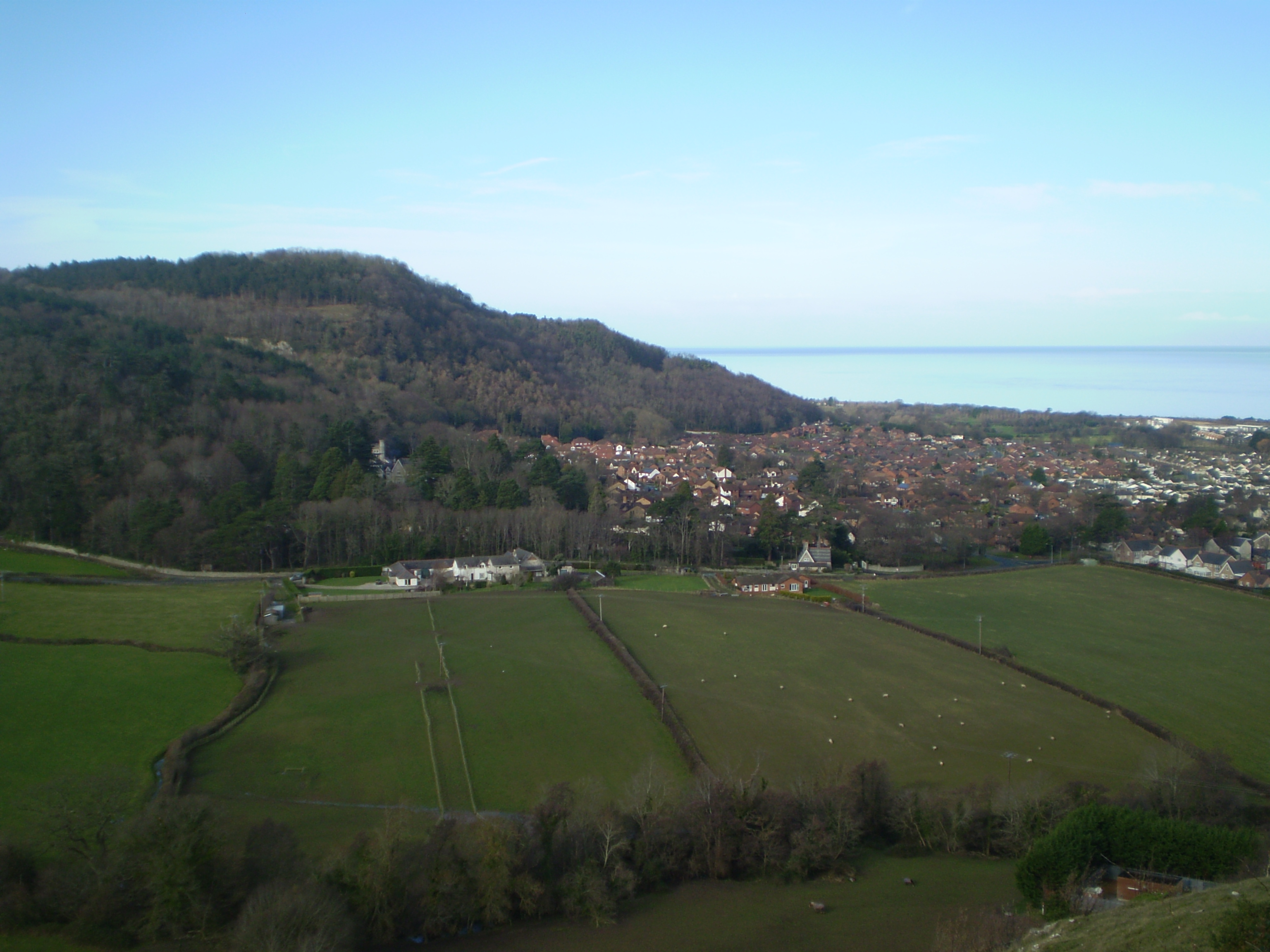
Abergele (; ) is a market town and community (Wales), community, situated on the north coast of Wales between the holiday resorts of Colwyn Bay and Rhyl, in Conwy County Borough. It lies within the historic counties of Wales, historic county boundaries of Denbighshire (historic), Denbighshire. Its northern suburb of Pensarn lies on the Irish Sea coast. The town is served by Abergele and Pensarn railway station, which is by the coast at Pensarn. Etymology The meaning of the name can be deduced by being the Welsh language, Welsh word for estuary, river mouth or confluence and the name of the river which flows through the town. is a dialectal form of , which means spear, describing the action or speed of the river cutting through the land. Geography The town itself lies on the A55 road and is known for Gwrych Castle. The highest hill is Moelfre Isaf (1040 ft) to the south of the town. There are views from Cefn-yr-Ogof (669 ft), Gallt-y-Felin-Wynt (Tower Hill) ... [...More Info...] [...Related Items...] OR: [Wikipedia] [Google] [Baidu] |
Abergele And Pensarn Railway Station
Abergele and Pensarn railway station is a station on the North Wales Coast Line, which serves both the town of Abergele and suburb of Pensarn in Conwy County Borough, Wales. History Opened as Abergele by the Chester and Holyhead Railway on 1 May 1848, the 'and Pensarn' suffix was believed to have been added when the station was substantially rebuilt in 1883. It became part of the London, Midland and Scottish Railway during the Railways Act 1921, Grouping of 1923. The line then passed on to the London Midland Region of British Railways on nationalisation in 1948. When British Rail brand names, Sectorisation was introduced, the station was served by Regional Railways although InterCity (British Rail), Intercity Sector trains passed through on their way from Euston railway station, London Euston to Holyhead railway station, Holyhead. The Privatisation of British Rail led to services being provided by Wales and Borders until 2003, Arriva Trains Wales until 2018, and in the presen ... [...More Info...] [...Related Items...] OR: [Wikipedia] [Google] [Baidu] |
Gwrych Castle
Gwrych Castle (; ) is a Listed building, Grade I listed country house near Abergele in Conwy County Borough, Wales. On an ancient site, the current building was created by Lloyd Hesketh Bamford-Hesketh and his descendants over much of the 19th and early 20th centuries. The castle and its 236-acre estate are now owned by a charity, the Gwrych Castle Preservation Trust. The family had owned land in the area of Abergele since at least the 16th century and claimed much older descent. In the very early 19th century Lloyd Hesketh Bamford-Hesketh determined to replace the existing house with a much larger building. Designs were prepared by Charles Busby (architect), Charles Busby and exhibited in 1815. Busby was subsequently sacked and Thomas Rickman engaged, while Bamford-Hesketh's ambitions grew from a Regency architecture, Regency style English country house, country house into an enormous Gothic Revival architecture, Gothic Revival castle. The foundation stone was laid in 1819. Ba ... [...More Info...] [...Related Items...] OR: [Wikipedia] [Google] [Baidu] |
Denbighshire (historic)
Denbighshire (), or the County of Denbigh, was Historic counties of Wales, one of the thirteen counties of Wales that existed from 1536 until their abolishment in 1974. Located in the North Wales, north of Wales, it was created by the Laws in Wales Acts 1535 and 1542, Laws in Wales Acts 1535, enacted in 1536, by combining several marcher lordships. Denbighshire was a maritime county, with a coast to the north onto the Irish Sea. It was named after its original county town of Denbigh. Other towns included Abergele, Colwyn Bay, Llangollen, Llanrwst, Ruthin and Wrexham. The central part of the county included much of the Vale of Clwyd. The neighbouring counties (clockwise from east) were Flintshire (historic), Flintshire, Cheshire, Shropshire, Montgomeryshire, Merionethshire, and Caernarfonshire. Under the Local Government Act 1972, the use of Denbighshire for Local government in the United Kingdom, local government and Lord Lieutenant, ceremonial purposes ended on 1 April 1974, wi ... [...More Info...] [...Related Items...] OR: [Wikipedia] [Google] [Baidu] |
Pensarn
Pensarn is a suburb of Abergele in Conwy County Borough, Wales. The name Pensarn means 'end of the causeway' in English. The crossing of Morfa Rhuddlan was facilitated by a causeway near the sea, located at this point. This causeway was later developed by holiday developments along the coast between Rhyl and Abergele. Pensarn is served by Abergele & Pensarn railway station, the A55 road and National Cycle Route 5 Route Reading to Stratford upon Avon Didcot , Abingdon-on-Thames , Radley , Oxford , Banbury , Stratford upon Avon Stratford upon Avon to Birmingham Stratford upon Avon , Redditch , Bromsgrove , Birmingham This stretch of the NCR5 g ... External links BBC Wales website Abergele Villages in Conwy County Borough {{Conwy-geo-stub ... [...More Info...] [...Related Items...] OR: [Wikipedia] [Google] [Baidu] |
A55 Road
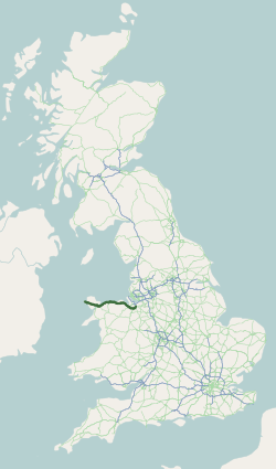
The A55, also known as the North Wales Expressway (), is a major road in Wales and England, connecting Cheshire and North Wales. The vast majority of its length from Chester to Holyhead is a dual carriageway primary route, with the exception of the Britannia Bridge over the Menai Strait and several short sections where there are gaps in between the two carriageways. All junctions are Grade separation, grade separated apart from a roundabout east of Penmaenmawr and another nearby in Llanfairfechan. Initially, the road ran from Chester to Bangor, Gwynedd, Bangor. In 2001, it was extended across Anglesey to the ferry port of Holyhead parallel to the A5 road (Great Britain), A5. The road improvements have been part funded with European money, under the Trans-European Networks programme, as the route is designated part of International E-road network, Euroroute European route E22, E22 (Holyhead – Leeds – Amsterdam – Hamburg – Malmö – Riga – Moscow – Perm, Russia, Perm ... [...More Info...] [...Related Items...] OR: [Wikipedia] [Google] [Baidu] |
River Gele
River Gele near Towyn. Looking east from the road bridge. The River Gele (''Welsh:'' Afon Gele) is a river in the North Wales and a tributary of the River Clwyd. The town of Abergele takes its name from the river. The spelling is a dialectal spelling of the Welsh word ' (spear or blade). The river gives its name to an electoral ward, called Gele, which includes the southern half of Abergele town. The river used to empty into the sea direct through the town of Abergele, but the Rhuddlan Marsh Embankment Act 1794 ( 34 Geo. 3. c. 110), diverted the river from the south of the town in an eastwards direction across the south of Rhuddlan Marsh and into the River Clwyd at Towyn. A short distance of the rivermouth is tidal. In 2010 and 2011 there were pollution scares on the river near its meeting point with the River Clwyd at Kinmel Bay Kinmel Bay () is a large seaside village in Conwy County Borough, north-east Wales. It is also an electoral ward to the county council and town ... [...More Info...] [...Related Items...] OR: [Wikipedia] [Google] [Baidu] |
Clwyd
Clwyd ( , ) is a preserved counties of Wales, preserved county of Wales, situated in the north-east corner of the country; it is named after the River Clwyd, which runs through the area. To the north lies the Irish Sea, with the English ceremonial counties of Cheshire to the east and Shropshire to the south-east. Powys and Gwynedd lie to the south and west respectively. Clwyd also shares a maritime boundary with Merseyside along the River Dee, Wales, River Dee. Between 1974 and 1996, a slightly different area had a county council, with local government functions shared with six district councils. In 1996, Clwyd was abolished, and the new Principal areas of Wales, principal areas of Conwy County Borough, Denbighshire, Flintshire and Wrexham County Borough were created; under this reorganisation, "Clwyd" became a preserved county, with the name being retained for certain ceremonial functions. This area of north-eastern Wales has been settled since prehistoric times; the Roman Em ... [...More Info...] [...Related Items...] OR: [Wikipedia] [Google] [Baidu] |
Rhyl
Rhyl (; , ) is a seaside town and community in Denbighshire in Wales. The town lies on the coast of North Wales, at the mouth of the River Clwyd. To the west is Kinmel Bay and Towyn, to the east Prestatyn, and to the south-east Rhuddlan and St Asaph. At the 2011 Census, Rhyl had a population of 25,149, with Rhyl–Kinmel Bay having 31,229. Rhyl forms a conurbation with Prestatyn and its two outlying villages, the Rhyl/Prestatyn Built-up area, whose 2011 population of 46,267 makes it North Wales's most populous non-city. Rhyl was once an elegant Victorian resort town, but suffered rapid decline around the 1990s and 2000s; attempts have been made to reverse this through county investment, equal to around £15 million from Denbighshire County, however, the outcomes have been perceived with varying levels of success. Prior to being in Denbighshire since 1996, it was in the Clwyd district of Rhuddlan, and before that the historic county of Flintshire. Etymology Early doc ... [...More Info...] [...Related Items...] OR: [Wikipedia] [Google] [Baidu] |
Tan-y-Gopa
Castell Cawr, or Tan-y-Gopa as it is known locally, is a heavily forested hill above the town of Abergele in Conwy county borough, Wales. On it is found the Iron Age hillfort of Castell Cawr, which overlooks the River Clwyd. Rare lesser horseshoe bats inhabit caves on the hill. The woods are owned by the Woodland Trust. The hill rises to 189 m (620 ft) above sea level, with extensive views to Snowdonia and the Clwydian Range. Thomas Pennant Thomas Pennant (16 December 1798) was a Welsh natural history, naturalist, traveller, writer and antiquarian. He was born and lived his whole life at his family estate, Downing Hall, near Whitford, Flintshire, in Wales. As a naturalist he had ... visited the area in the 18th century, and noted the existence of the hillfort. In 1860, James Halliwell-Phillipps wrote that the outline of the hillfort was obscured by vegetation, and identified the workings of a Roman lead mine on the hillside. The Welsh knew these excavations by th ... [...More Info...] [...Related Items...] OR: [Wikipedia] [Google] [Baidu] |
Clwyd North (UK Parliament Constituency)
Clwyd North () is a constituency of the House of Commons in the UK Parliament, first contested at the 2024 general election, following the 2023 review of Westminster constituencies The 2023 review of Westminster constituencies was the most recent cycle of the process to redraw the constituency map for the House of Commons of the United Kingdom. The new constituency boundaries were approved by the Privy Council on 15 Nov .... It is currently represented by Gill German of the Labour Party. Boundaries Under the 2023 review, the constituency was defined as being composed of the following, as they existed on 1 December 2020: * The County Borough of Conwy wards of: Abergele Pensarn, Colwyn, Eirias, Gele, Glyn, Kinmel Bay, Llanddulas, Llandrillo yn Rhos, Llysfaen, Mochdre, Pentre Mawr, Rhiw, and Towyn. * The County of Denbighshire wards: Bodelwyddan, Denbigh Central, Denbigh Lower, Denbigh Upper/ Henllan, Rhuddlan, Rhyl East, Rhyl South, Rhyl South East, Rhyl South West, ... [...More Info...] [...Related Items...] OR: [Wikipedia] [Google] [Baidu] |
Moelfre Isaf
Moelfre Isaf is a hill located to the south of the town of Abergele. There are views towards the Clwydian Range, Snowdonia, and the Isle of Man The Isle of Man ( , also ), or Mann ( ), is a self-governing British Crown Dependency in the Irish Sea, between Great Britain and Ireland. As head of state, Charles III holds the title Lord of Mann and is represented by a Lieutenant Govern ... and the Cumbrian Mountains can be seen on a clear day. Nearby is the small settlement of Moelfre, Conwy. Almost opposite is the higher hill of Moelfre Uchaf. External links www.geograph.co.uk : photos of Moelfre Isaf and surrounding area Mountains and hills of Conwy County Borough {{Conwy-geo-stub ... [...More Info...] [...Related Items...] OR: [Wikipedia] [Google] [Baidu] |
Castell Cawr
Castell Cawr, or Tan-y-Gopa as it is known locally, is a heavily forested hill above the town of Abergele in Conwy county borough, Wales. On it is found the Iron Age hillfort of Castell Cawr, which overlooks the River Clwyd. Rare lesser horseshoe bats inhabit caves on the hill. The woods are owned by the Woodland Trust. The hill rises to 189 m (620 ft) above sea level, with extensive views to Snowdonia and the Clwydian Range. Thomas Pennant visited the area in the 18th century, and noted the existence of the hillfort. In 1860, James Halliwell-Phillipps wrote that the outline of the hillfort was obscured by vegetation, and identified the workings of a Roman lead mine on the hillside. The Welsh knew these excavations by the name "Ffos-y-bleiddiaid" ("Ditch of the Wolves") See also *List of hillforts in Wales This is a list of hillforts in Wales. Anglesey * Din Sylwy (Bwrdd Arthur) (), contour fort * Caer Idris Hillfort (), promontory fort * Caer y Twr (), partia ... [...More Info...] [...Related Items...] OR: [Wikipedia] [Google] [Baidu] |


