|
A1 Road (Great Britain)
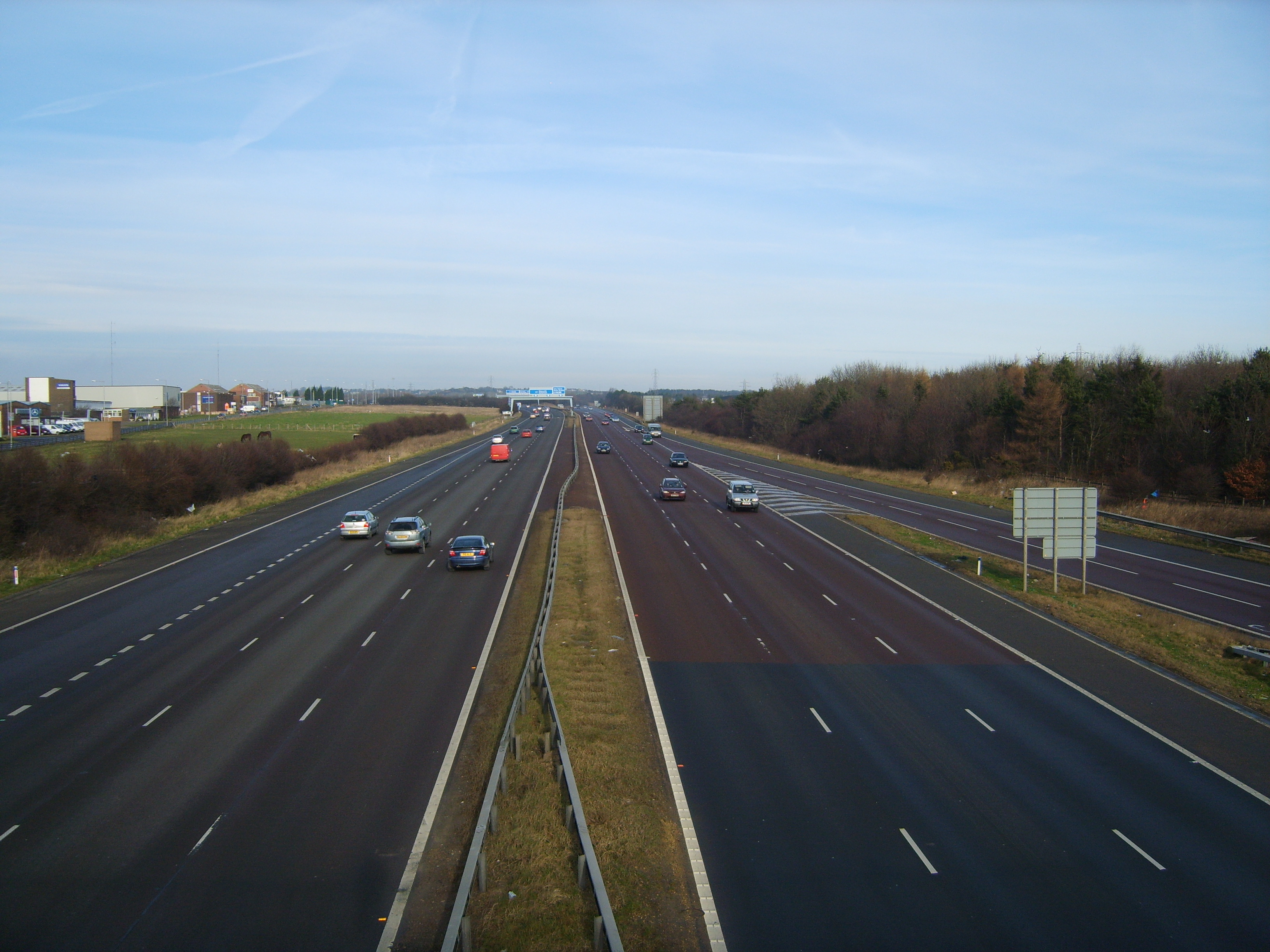
The A1, also known as the Great North Road, is the longest numbered road in the United Kingdom, at . It connects Greater London, London, the capital of England, with Edinburgh, the capital of Scotland. The numbering system for A-roads, devised in the early 1920s, was based around patterns of roads radiating from two hubs at London and Edinburgh. The first number in the system, A1, was given to the most important part of that system: the road from London to Edinburgh, joining the two central points of the system and linking two of the UK's mainland capital cities. It passes through or near north London, Hatfield, Hertfordshire, Hatfield, Stevenage, Baldock, Biggleswade, Peterborough, Stamford, Lincolnshire, Stamford, Grantham, Newark-on-Trent, Retford, Doncaster, Pontefract, York, Wetherby, Ripon, Darlington, Durham, England, Durham, Gateshead, Newcastle upon Tyne, Morpeth, Northumberland, Morpeth, Alnwick, Berwick-upon-Tweed, Dunbar, Haddington, East Lothian, Haddington, Muss ... [...More Info...] [...Related Items...] OR: [Wikipedia] [Google] [Baidu] |
A1(M) Motorway
A1(M) is the designation given to a series of four separate controlled-access highway, motorway sections in the UK. Each section is an upgrade to a section of the A1 road (Great Britain), A1, a major north–south road which connects Greater London, London, the capital of England, with Edinburgh, the capital of Scotland. The first section, the Doncaster Bypass, opened in 1961 and is one of the oldest sections of motorway in Britain. Construction of a new section of A1(M) between Leeming, North Yorkshire, Leeming and Barton, North Yorkshire, Barton was completed on 29 March 2018, a year later than the anticipated opening in 2017 due to extensive archaeological excavations. Its completion linked the Barton to Washington, Tyne and Wear, Washington section with the Darrington, West Yorkshire, Darrington to Leeming Bar section, forming the longest A1(M) section overall and reducing the number of sections from five to four. In 2015, a proposal was made by three local government org ... [...More Info...] [...Related Items...] OR: [Wikipedia] [Google] [Baidu] |
Durham, England
Durham ( , locally ) is a cathedral city and civil parish in the county of County Durham, Durham, England. It is the county town and contains the headquarters of Durham County Council, the unitary authority which governs the district of County Durham (district), County Durham. The built-up area had a population of 50,510 at the 2021 Census. The city was built on a meander of the River Wear, which surrounds the centre on three sides and creates a narrow neck on the fourth. The surrounding land is hilly, except along the Wear's floodplain to the north and southeast. Durham was founded in 995 by Anglo-Saxon monks seeking a place safe from Viking Age, Viking raids to house the relics of St Cuthbert. The church the monks built lasted only a century, as it was replaced by the present Durham Cathedral after the Norman Conquest; together with Durham Castle it is a UNESCO World Heritage Site. From the 1070s until 1836 the city was part of the County Palatine of Durham, a semi-independ ... [...More Info...] [...Related Items...] OR: [Wikipedia] [Google] [Baidu] |
Biggleswade
Biggleswade ( ) is a market town and civil parish in Central Bedfordshire in Bedfordshire, England. It lies on the River Ivel, 11 miles (18 km) south-east of Bedford. Its population was 16,551 in the 2011 United Kingdom census, This figure increased by 36% to 22,541 at the time of the 2021 United Kingdom census. Evidence of settlement in the area goes back to the Neolithic period, but it is likely that the town as such was founded by Anglo-Saxons. A gold Anglo-Saxon coin was found on a footpath beside the River Ivel in 2001. The British Museum bought the coin in February 2006 and at the time, it was the most expensive British coin purchased. A charter to hold a market was granted by John, King of England, King John in the 13th-century. In 1785 a great fire devastated the town. The Great North Road (Great Britain), Great North Road passed through until a bypass was completed in 1961. A railway station was opened in 1850. From the 1930s to the late 1990s, manufacturing prov ... [...More Info...] [...Related Items...] OR: [Wikipedia] [Google] [Baidu] |
Baldock
Baldock ( ) is a historic market town in the North Hertfordshire district of Hertfordshire, England. The River Ivel rises from springs in the town. It lies north of London and north northwest of the county town of Hertford. Nearby towns include Royston to the northeast, Letchworth and Hitchin to the southwest and Stevenage to the south. History and etymology Baldock has an exceptionally rich archaeological heritage.Moorhead, Sam. "A survey of Roman coin finds from Hertfordshire", in Lockyear, Kris (2015)''Archaeology in Hertfordshire: Recent Research'' University of Hertfordshire Press. Paleolithic, Neolithic and Bronze Age settlements show the site of Baldock has been continuously occupied since prehistoric times.Mawer, J. E. B., Stenton, Allen and Gover, F. M. (1938) ''The Place-Names Of Hertfordshire'' (English Place-Name Society Volume XV), Cambridge University Press, ASIN: B0019T1T10 iArchaeology Data Service archive – Baldock/ref> The earliest monument in the area ... [...More Info...] [...Related Items...] OR: [Wikipedia] [Google] [Baidu] |
Hatfield, Hertfordshire
Hatfield is a town and civil parish in Hertfordshire, England, in the borough of Welwyn Hatfield. It had a population of 29,616 in 2001, 39,201 at the 2011 census, and 41,265 at the 2021 census. The settlement is of Saxon origin. Hatfield House, home of the Marquess of Salisbury, forms the nucleus of the old town. From the 1930s when de Havilland opened a factory, until the 1990s when British Aerospace closed it, aircraft design and manufacture employed more people there than any other industry. Hatfield was one of the post-war New Towns Act 1946, New Towns built around London and has much International Style (architecture), modernist architecture from the period. The University of Hertfordshire is based there. Hatfield lies north of London beside the A1(M) motorway and has direct trains to London King's Cross railway station, London St Pancras railway station, Finsbury Park station, Finsbury Park and Moorgate station, Moorgate. There has been a strong increase in commuters who ... [...More Info...] [...Related Items...] OR: [Wikipedia] [Google] [Baidu] |
North London
North London is the northern part of London, England, north of the River Thames and the City of London. It extends from Clerkenwell and Finsbury, on the edge of the City of London financial district, to Greater London's boundary with Hertfordshire. The term is occasionally used in reference to all of London north of the River Thames. The term differentiates the area from South London, East London and West London. Some parts of North London are also part of Central London. Development The first northern suburb developed in the Soke of Cripplegate in the early part of the twelfth century, but London's growth beyond its Roman northern gates was slower than in other directions, partly because of the marshy ground north of the wall and also because the roads through those gates were less well-connected than elsewhere. The parishes that would become north London were almost entirely rural until the Victorian period. Many of these parishes were grouped into an area called the ... [...More Info...] [...Related Items...] OR: [Wikipedia] [Google] [Baidu] |
Greater London
Greater London is an administrative area in England, coterminous with the London region, containing most of the continuous urban area of London. It contains 33 local government districts: the 32 London boroughs, which form a Ceremonial counties of England, ceremonial county also called Greater London, and the City of London. The Greater London Authority is responsible for strategic local government across the region, and regular local government is the responsibility of the borough councils and the City of London Corporation. Greater London is bordered by the ceremonial counties of Hertfordshire to the north, Essex to the north-east, Kent to the south-east, Surrey to the south, and Berkshire and Buckinghamshire to the west. Greater London has a land area of and had an estimated population of in . The ceremonial county of Greater London is only slightly smaller, with an area of and a population of in . The area is almost entirely urbanised and contains the majority of the ... [...More Info...] [...Related Items...] OR: [Wikipedia] [Google] [Baidu] |
United Kingdom
The United Kingdom of Great Britain and Northern Ireland, commonly known as the United Kingdom (UK) or Britain, is a country in Northwestern Europe, off the coast of European mainland, the continental mainland. It comprises England, Scotland, Wales and Northern Ireland. The UK includes the island of Great Britain, the north-eastern part of the island of Ireland, and most of List of islands of the United Kingdom, the smaller islands within the British Isles, covering . Northern Ireland shares Republic of Ireland–United Kingdom border, a land border with the Republic of Ireland; otherwise, the UK is surrounded by the Atlantic Ocean, the North Sea, the English Channel, the Celtic Sea and the Irish Sea. It maintains sovereignty over the British Overseas Territories, which are located across various oceans and seas globally. The UK had an estimated population of over 68.2 million people in 2023. The capital and largest city of both England and the UK is London. The cities o ... [...More Info...] [...Related Items...] OR: [Wikipedia] [Google] [Baidu] |
European Route E15
The European route E15 is part of the United Nations international E-road network. It is a north–south "reference road", running from Inverness, Scotland south through England and France to Algeciras, Spain. 5 April 2002 Along most of its route between Paris and London, the road parallels the LGV Nord (as the French ) and (as the English |
WikiProject Highways
A WikiProject, or Wikiproject, is an affinity group for contributors with shared goals within the Wikimedia movement. WikiProjects are prevalent within the largest wiki, Wikipedia, and exist to varying degrees within sibling projects such as Wiktionary, Wikiquote, Wikidata, and Wikisource. They also exist in different languages, and translation of articles is a form of their collaboration. During the COVID-19 pandemic, CBS News noted the role of Wikipedia's WikiProject Medicine in maintaining the accuracy of articles related to the disease. Another WikiProject that has drawn attention is WikiProject Women Scientists, which was profiled by '' Smithsonian'' for its efforts to improve coverage of women scientists which the profile noted had "helped increase the number of female scientists on Wikipedia from around 1,600 to over 5,000". On Wikipedia Some Wikipedia WikiProjects are substantial enough to engage in cooperative activities with outside organizations relevant to the field ... [...More Info...] [...Related Items...] OR: [Wikipedia] [Google] [Baidu] |
Edinburgh
Edinburgh is the capital city of Scotland and one of its 32 Council areas of Scotland, council areas. The city is located in southeast Scotland and is bounded to the north by the Firth of Forth and to the south by the Pentland Hills. Edinburgh had a population of in , making it the List of towns and cities in Scotland by population, second-most populous city in Scotland and the List of cities in the United Kingdom, seventh-most populous in the United Kingdom. The Functional urban area, wider metropolitan area had a population of 912,490 in the same year. Recognised as the capital of Scotland since at least the 15th century, Edinburgh is the seat of the Scottish Government, the Scottish Parliament, the Courts of Scotland, highest courts in Scotland, and the Palace of Holyroodhouse, the official residence of the Monarchy of the United Kingdom, British monarch in Scotland. It is also the annual venue of the General Assembly of the Church of Scotland. The city has long been a cent ... [...More Info...] [...Related Items...] OR: [Wikipedia] [Google] [Baidu] |


