|
Bridgwater Tidal Barrier
Bridgwater tidal barrier will be a flood control gate located on the River Parrett in Bridgwater, Somerset, England. The River Parrett is tidal for some upstream of Bridgwater, and the combination of flooding on the Somerset Levels and high tides reaching up the Bristol Channel, have a detrimental effect on the whole area. In 2022, a tidal flood gate was approved to be installed at a cost of £249 million, which is expected to be operational by 2027. History Historically, flooding on the River Parrett has occurred when both excess rainwater and high tides in the Bristol Channel, backflow upstream on the river. In December 1929, serious flooding upstream at Lyng and Athelney was in danger of overwhelming those villages, and to prevent this, the locals suggested cutting the dykes, but this would release a "tidal wave" high, and combined with near incoming tide, it was feared mass flooding would occur in the Bridgwater area. However, by early 1930, the locals had abandone ... [...More Info...] [...Related Items...] OR: [Wikipedia] [Google] [Baidu] |
Bridgwater
Bridgwater is a historic market town and civil parish in Somerset, England. The town had a population of 41,276 at the 2021 census. Bridgwater is at the edge of the Somerset Levels, in level and well-wooded country. The town lies along both sides of the River Parrett; it has been a major inland port and trading centre since the industrial revolution. Most of its industrial bases still stand today. Its larger neighbour, Taunton, is linked to Bridgwater via a canal, the M5 motorway and the Great Western Railway, GWR railway line. Historically, the town had a politically radical tendency. The Battle of Sedgemoor, where the Monmouth Rebellion was finally crushed in 1685, was fought nearby. Notable buildings include the St Mary's Church, Bridgwater, Church of St Mary and Blake Museum, which is a largely restored house in Blake Street and was the birthplace of Robert Blake (admiral), Admiral Blake in 1598. The town has an arts centre and plays host to the annual West Country Carnival, ... [...More Info...] [...Related Items...] OR: [Wikipedia] [Google] [Baidu] |
Cofferdam
A cofferdam is an enclosure built within a body of water to allow the enclosed area to be pumped out or drained. This pumping creates a dry working environment so that the work can be carried out safely. Cofferdams are commonly used for construction or repair of permanent dams, oil platforms, bridge piers, etc., built within water. These cofferdams are usually welded steel structures, with components consisting of Larssen sheet piling, sheet piles, Wale (ship part), wales, and cross timber framing, braces. Such structures are usually dismantled after the construction work is completed. The origin of the word comes from ''coffer'' (originally from Latin meaning 'basket') and ''dam'' from Proto-Germanic meaning 'barrier across a stream of water to obstruct its flow and raise its level'). #Naval architecture, The term is also used in naval architecture, to refer to a space between two watertight bulkheads or decks within a ship. Uses For dam construction, two cofferdams ar ... [...More Info...] [...Related Items...] OR: [Wikipedia] [Google] [Baidu] |
Flood Barriers
A flood is an overflow of water ( or rarely other fluids) that submerges land that is usually dry. In the sense of "flowing water", the word may also be applied to the inflow of the tide. Floods are of significant concern in agriculture, civil engineering and public health. Human changes to the environment often increase the intensity and frequency of flooding. Examples for human changes are land use changes such as deforestation and removal of wetlands, changes in waterway course or flood controls such as with levees. Global environmental issues also influence causes of floods, namely climate change which causes an intensification of the water cycle and sea level rise. For example, climate change makes extreme weather events more frequent and stronger. This leads to more intense floods and increased flood risk. Natural types of floods include river flooding, groundwater flooding coastal flooding and urban flooding sometimes known as flash flooding. Tidal flooding may inclu ... [...More Info...] [...Related Items...] OR: [Wikipedia] [Google] [Baidu] |
Buildings And Structures In Somerset
A building or edifice is an enclosed structure with a roof, walls and windows, usually standing permanently in one place, such as a house or factory. Buildings come in a variety of sizes, shapes, and functions, and have been adapted throughout history for numerous factors, from building materials available, to weather conditions, land prices, ground conditions, specific uses, prestige, and aesthetic reasons. To better understand the concept, see ''Nonbuilding structure'' for contrast. Buildings serve several societal needs – occupancy, primarily as shelter from weather, security, living space, privacy, to store belongings, and to comfortably live and work. A building as a shelter represents a physical separation of the human habitat (a place of comfort and safety) from the ''outside'' (a place that may be harsh and harmful at times). buildings have been objects or canvasses of much artistic expression. In recent years, interest in sustainable planning and building practi ... [...More Info...] [...Related Items...] OR: [Wikipedia] [Google] [Baidu] |
Thames Barrier
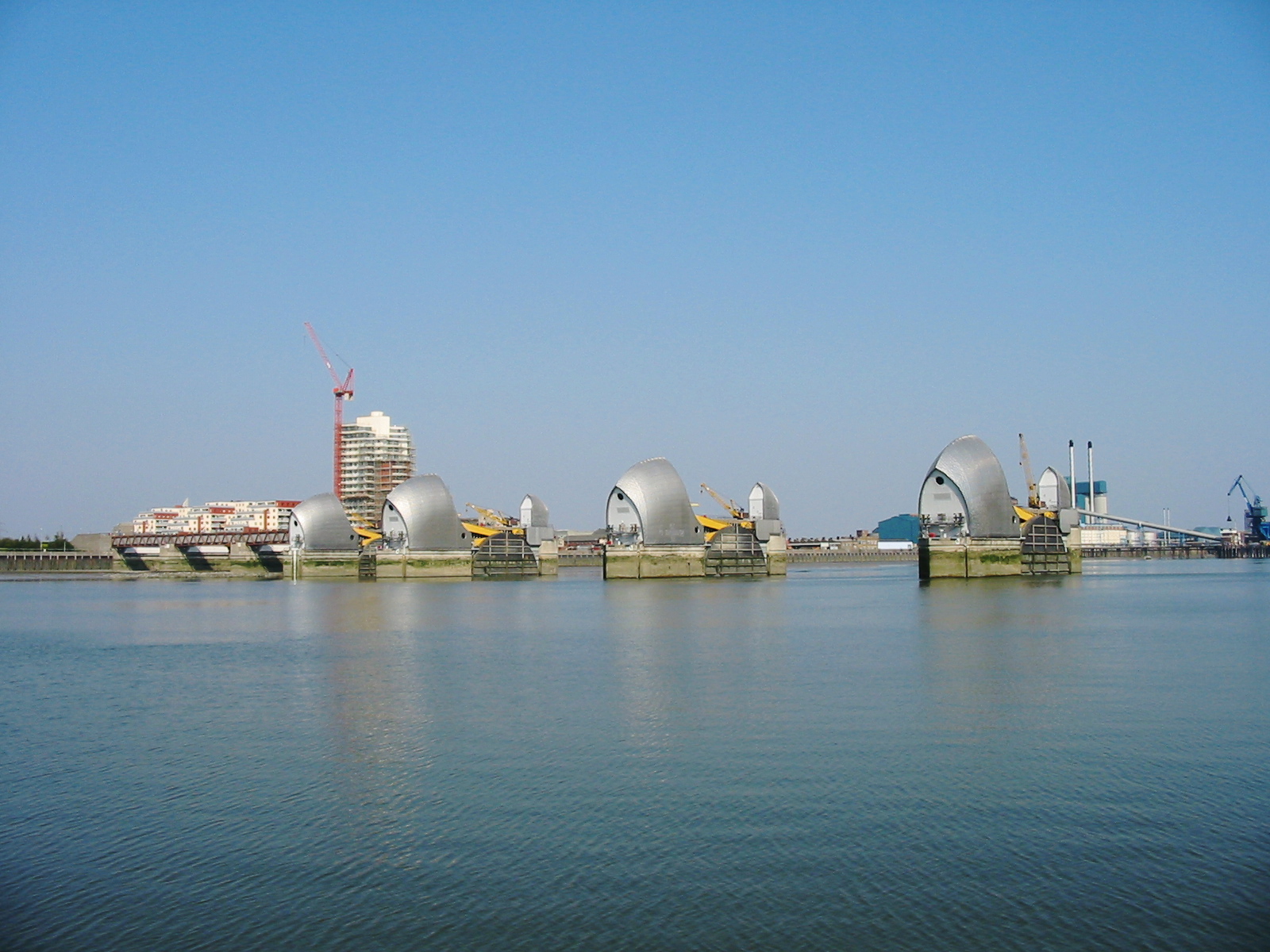
The Thames Barrier is a retractable barrier system built to protect the floodplain of most of Greater London from exceptionally high tides and storm surges moving up from the North Sea. It has been operational since 1982. When needed, it is closed (raised) during high tide; at low tide, it can be opened to restore the river's flow towards the sea. Built about east of the Isle of Dogs, its northern bank is in Silvertown in the London Borough of Newham and its southern bank is in the New Charlton area of the Royal Borough of Greenwich. History Background Flooding in London has been a problem since Roman times. In 1954, the Waverley Committee, established to investigate the serious North Sea flood of 1953 which affected parts of the Thames Estuary and parts of London, recommended that "as an alternative to raising the banks, the possibility and cost of erecting a structure across the Thames which could be closed in a surge should be urgently investigated". A number of designs ... [...More Info...] [...Related Items...] OR: [Wikipedia] [Google] [Baidu] |
River Hull Tidal Surge Barrier
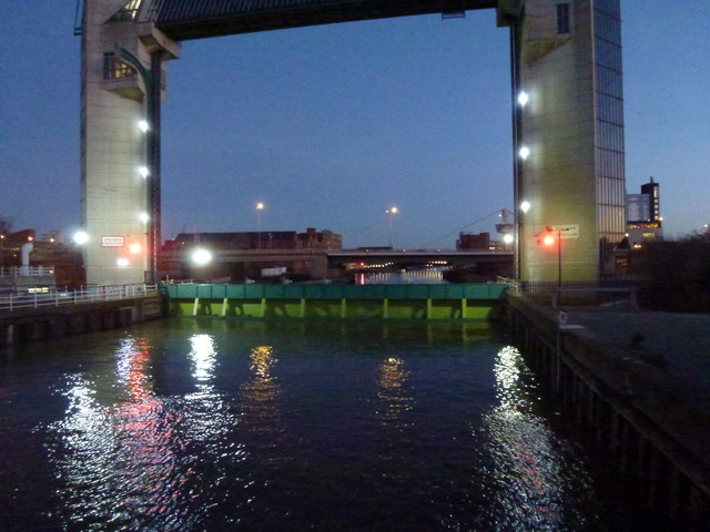
The River Hull tidal surge barrier is a flood control gate located on the River Hull in the city of Kingston upon Hull, in the East Riding of Yorkshire, England. The barrier impounds the river in times of tidal surges, preventing water moving upstream of the river from the Humber Estuary, and flooding the areas of the city which are near to the river, or susceptible to flooding. It is held horizontal when not in use, and turns 90 degrees before being lowered to the riverbed in the event of a tidal surge. It is the second largest flood barrier in the United Kingdom after the Thames Barrier in London. The barrier was opened in 1980, and since then, has closed over 30 times as a preventative measure during tidal surges. A proposed lagoon to control tidal flooding in the Humber Estuary would render the River Hull non-tidal. The barrier was grade II listed in 2017, with David Neave describing it as a prominent Hull landmark. History The need for the barrier arose after severe floodi ... [...More Info...] [...Related Items...] OR: [Wikipedia] [Google] [Baidu] |
River Foss Barrier
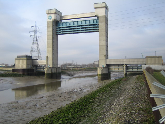
The Foss Barrier consists of a retractable floodgate and pumping station owned and managed by the Environment Agency. It straddles the River Foss in York, just above the confluence of the Foss with the River Ouse. The barrier’s purpose is to prevent water from the Ouse flowing upstream into the Foss, raising water levels and flooding properties along the River Foss. The pumps next to the flood gate move water around the barrier via a side culvert so that it can continue to drain into the Ouse. This prevents water levels on the Foss rising when the barrier is closed. The Ouse’s normal water level at York is approximately AOD (Above Ordnance Datum). When the river level reaches AOD, the barrier is lowered into the Foss, shutting it off from the Ouse. The electrically driven barrier takes less than five minutes to lower into position. The barrier operates as a ‘turn and lift’ gate (see below) so it opens and closes in a similar way to a garage door. The pump-house attac ... [...More Info...] [...Related Items...] OR: [Wikipedia] [Google] [Baidu] |
Barking Creek
Barking Creek joins the River Roding to the River Thames The River Thames ( ), known alternatively in parts as the The Isis, River Isis, is a river that flows through southern England including London. At , it is the longest river entirely in England and the Longest rivers of the United Kingdom, s .... It is fully tidal up to the Barking Barrage (a weir), which impounds a minimum water level through Barking. In the 1850s, the creek was home to England's largest fishing fleet and a Victorian icehouse – where the fish were landed and stored prior to being transferred to London's fish markets. Barking Creek contains a small number of house boats, and the former village of Creekmouth is nearby. The Barking Creek Barrier, a tidal flood barrier, was constructed in the 1980s as part of the Thames flood defence system, opening in 1983. Like all of the subsidiary gates, it is normally closed before, and opened after, the main Thames Barrier. The barrier is 38 metres wide, ... [...More Info...] [...Related Items...] OR: [Wikipedia] [Google] [Baidu] |
Oath Lock
Aller is a village and civil parish in Somerset, England, situated west of Somerton, Somerset, Somerton on the A372 road towards Bridgwater. The village has a population of 410. The parish includes the hamlet (place), hamlet of Beer (sometimes ''Bere'' or Bere Aller) and the deserted medieval village of Oath on the opposite bank of the River Parrett. History Aller was listed in the Domesday Book of 1086 as ''Alre'', meaning 'The alder tree' from the Old English ''alor''. The parish of Aller was part of the Hundred (county subdivision), hundred of Somerton (hundred), Somerton. Most of the valuable meadows had been enclosure, enclosed by 1577, but the surrounding fields were not enclosed until 1797. Between 1614 and 1616 there was a struggle between the lord, Sir John Davis, who had recently purchased the manor, and the tenants over the building of hedges and gates to increase the value of the remaining of common ground. The meadows remained open and Davis sold the manor to Joh ... [...More Info...] [...Related Items...] OR: [Wikipedia] [Google] [Baidu] |
Chilton Trinity
Chilton Trinity is a village and civil parish on the River Parrett, north of Bridgwater in Somerset, England. History Iron Age and Roman pottery have been found at Chilton village. The name Chilton implies a settlement for younger sons. At one time Chilton Trinity was part of the hundred of Andersfield, but in another era it was part of the hundred of Cannington. In 2023, work started at the eastern edge of the village on a tidal barrier over the River Parrett. Governance The parish council has responsibility for local issues, including setting an annual precept (local rate) to cover the council's operating costs and producing annual accounts for public scrutiny. The parish council evaluates local planning applications and works with the local police, district council officers, and neighbourhood watch groups on matters of crime, security, and traffic. The parish council's role also includes initiating projects for the maintenance and repair of parish facilities, as well ... [...More Info...] [...Related Items...] OR: [Wikipedia] [Google] [Baidu] |
Somerset
Somerset ( , ), Archaism, archaically Somersetshire ( , , ) is a Ceremonial counties of England, ceremonial county in South West England. It is bordered by the Bristol Channel, Gloucestershire, and Bristol to the north, Wiltshire to the east, Dorset to the south-east, and Devon to the south-west. The largest settlement is the city of Bath, Somerset, Bath, and the county town is Taunton. Somerset is a predominantly rural county, especially to the south and west, with an area of and a population of 965,424. After Bath (101,557), the largest settlements are Weston-super-Mare (82,418), Taunton (60,479), and Yeovil (49,698). Wells, Somerset, Wells (12,000) is a city, the second-smallest by population in England. For Local government in England, local government purposes the county comprises three Unitary authorities of England, unitary authority areas: Bath and North East Somerset, North Somerset, and Somerset Council, Somerset. Bath and North East Somerset Council is a member of ... [...More Info...] [...Related Items...] OR: [Wikipedia] [Google] [Baidu] |
Bridgwater Bay
Bridgwater Bay is on the Bristol Channel, north of Bridgwater in Somerset, England at the mouth of the River Parrett and the end of the River Parrett Trail. It stretches from Minehead at the southwestern end of the bay to Brean Down in the north. The area consists of large areas of mudflats, saltmarsh, sandflats and shingle ridges, some of which are vegetated. It has been designated as a Site of Special Scientific Interest (SSSI) covering an area of since 1989, and is designated as a wetland of international importance under the Ramsar Convention. The risks to wildlife are highlighted in the local Oil Spill Contingency Plan. Several rivers, including the Parrett, Brue and Washford, drain into the bay. Man-made drainage ditches from the Somerset Levels, including the River Huntspill, also run into the bay. The mud flats provide a habitat for a wide range of flora and fauna. These include some nationally rare plants, beetles and snails. It is particularly important for over ... [...More Info...] [...Related Items...] OR: [Wikipedia] [Google] [Baidu] |


