|
Bolpur Subdivision
Bolpur Subdivision is an administrative subdivision of Birbhum district in the state of West Bengal, India. Overview Bolpur subdivision is part of the Suri-Bolpur Plain, a sub-micro physiographic region. It covers the interfluves of the Mayurakshi and Ajay, in the south-eastern part of the district. This area exhibits somewhat upland topography sloping from north-west to south-east. Geography Subdivisions Birbhum district is divided into the following administrative subdivisions: Administrative units Bolpur subdivision has 4 police stations, 4 community development blocks, 4 panchayat samitis, 40 gram panchayats, 621 mouzas, 579 inhabited villages, 1 municipality and 4 census towns. The municipality is: Bolpur. The census towns are: Ilambazar, Surul, Parota and Labhpur. The subdivision has its headquarters at Bolpur. Police stations Police stations in Bolpur subdivision have the following features and jurisdiction: Blocks Community development blocks in Bolpur sub ... [...More Info...] [...Related Items...] OR: [Wikipedia] [Google] [Baidu] |
States And Territories Of India
India is a federal union comprising 28 states and 8 union territories, with a total of 36 entities. The states and union territories are further subdivided into districts and smaller administrative divisions. History Pre-independence The Indian subcontinent has been ruled by many different ethnic groups throughout its history, each instituting their own policies of administrative division in the region. The British Raj The British Raj (; from Hindi language, Hindi ''rāj'': kingdom, realm, state, or empire) was the rule of the British The Crown, Crown on the Indian subcontinent; * * it is also called Crown rule in India, * * * * or Direct rule in India, * Q ... mostly retained the administrative structure of the preceding Mughal Empire. India was divided into provinces (also called Presidencies), directly governed by the British, and princely states, which were nominally controlled by a local prince or raja loyal to the British Empire, which held ''de f ... [...More Info...] [...Related Items...] OR: [Wikipedia] [Google] [Baidu] |
Suri, Birbhum
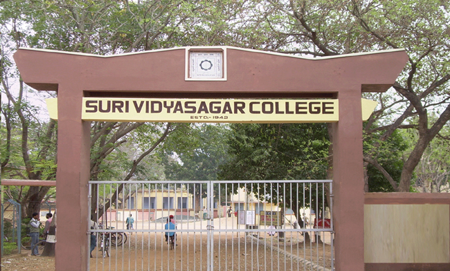
Suri () (also spelt as Siuri) is a city and a municipality in the Indian state of West Bengal. It is the headquarters of the Birbhum district. Geography Location Suri is located at . Suri is 220 km from State capital Kolkata (Calcutta), 90 km from Durgapur, 34 km from Bolpur– Santiniketan, 55 km from Andal and 19 km from Sainthia on the Andal–Sainthia branch line of Eastern Railway. It is on Panagarh–Morgram Highway.(known as N.H 60). It has an average elevation of 71 metres (233 feet).Suri Saharer Itihas by Sukumar Sinha, Ashadeep Publication It is situated on the extended part of Chota Nagpur Plateau. Tilpara barrage on Mayurakshi River is located 3 km north-west of Suri. As per the District Census Handbook 2011, Suri covered an area of 9.47 km2. History Prior to the advent of the British in India and their acquisition of the territory of Bengal, Suri was but merely a small village. Yet, the British colonists ... [...More Info...] [...Related Items...] OR: [Wikipedia] [Google] [Baidu] |
Labpur (community Development Block)
Labpur (also spelled Labhpur) is a community development block that forms an administrative division in Bolpur subdivision district of Birbhum district in the Indian state of West Bengal. Overview Birbhum district is physiographically a part of the ancient Rarh region. The western portion of the district is basically an extension of the Chota Nagpur Plateau. The area has mostly loose reddish lateritic low fertility soil. In the east, the flood plains of the major rivers, such as the Ajay, Bakreshwar, Mayurakshi and Brahmani, have soft alluvial soil. The forest cover is only 3.5% of the total district. Although coal is found in the district and Bakreshwar Thermal Power Station has a capacity of 2,010 MW, the economic condition of Birbhum is dominated by agriculture. From 1977 onwards major land reforms took place in West Bengal. Land in excess of land ceiling was acquired and distributed amongst the peasants. In Birbhum district, 19,968 hectares of vested agricultural land has be ... [...More Info...] [...Related Items...] OR: [Wikipedia] [Google] [Baidu] |
Santiniketan
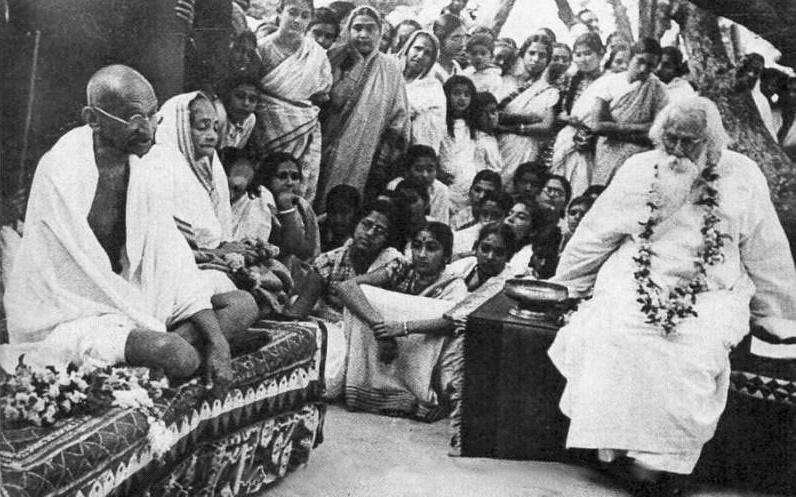
Santiniketan is a neighbourhood of Bolpur town in the Bolpur subdivision of Birbhum district in West Bengal, India, approximately 152 km north of Kolkata. It was established by Maharshi Devendranath Tagore, and later expanded by his son, Rabindranath Tagore whose vision became what is now a university town with the creation of Visva-Bharati.Pearson, WW.: ''Santiniketan Bolpur School of Rabindranath Tagore'', illustrations by Mukul Dey, The Macmillan Company, 1916 History In 1863, Debendranath Tagore took on permanent lease of land, with two (Alstonia scholaris) trees, at an annual payment of Rs. 5, from Bhuban Mohan Sinha, the talukdar of Raipur, Birbhum. He built a guest house there and named it ''Shantiniketan'' (the abode of peace). Gradually, the whole area came to be known as Shantiniketan.Basak, Tapan Kumar, ''Rabindranath-Santiniketan-Sriniketan (An Introduction)'', p. 2, B.B.Publication Binoy Ghosh says that Bolpur was a small place in the middle of the 19th c ... [...More Info...] [...Related Items...] OR: [Wikipedia] [Google] [Baidu] |
Women
A woman is an adult female human. Prior to adulthood, a female human is referred to as a girl (a female child or adolescent). The plural ''women'' is sometimes used in certain phrases such as "women's rights" to denote female humans regardless of age. Typically, women inherit a pair of X chromosomes, one from each parent, and are capable of pregnancy and giving birth from puberty until menopause. More generally, sex differentiation of the female fetus is governed by the lack of a present, or functioning, SRY-gene on either one of the respective sex chromosomes. Female anatomy is distinguished from male anatomy by the female reproductive system, which includes the ovaries, fallopian tubes, uterus, vagina, and vulva. A fully developed woman generally has a wider pelvis, broader hips, and larger breasts than an adult man. Women have significantly less facial and other body hair, have a higher body fat composition, and are on average shorter and less muscular than men. ... [...More Info...] [...Related Items...] OR: [Wikipedia] [Google] [Baidu] |
Bolpur Sriniketan (community Development Block)
Bolpur Sriniketan is a community development block that forms an administrative division in Bolpur subdivision of Birbhum district in the Indian state of West Bengal. Overview Birbhum district is physiographically a part of the ancient Rarh region. The western portion of the district is basically an extension of the Chota Nagpur Plateau. The area has mostly loose reddish lateritic low fertility soil. In the east, the flood plains of the major rivers, such as the Ajay, Bakreshwar, Mayurakshi and Brahmani, have soft alluvial soil. The forest cover is only 3.5% of the total district. Although coal is found in the district and Bakreshwar Thermal Power Station has a capacity of 2,010 MW, the economic condition of Birbhum is dominated by agriculture. From 1977 onwards major land reforms took place in West Bengal. Land in excess of land ceiling was acquired and distributed amongst the peasants. In Birbhum district, 19,968 hectares of vested agricultural land has been distributed amongs ... [...More Info...] [...Related Items...] OR: [Wikipedia] [Google] [Baidu] |
Labhpur
Labhpur is a census town in Labpur CD block in Bolpur subdivision of Birbhum district in the Indian state of West Bengal. It is known to the outside world as the native place of Tarashankar Bandopadhyay and one of the 51 Shakti Peethas. Geography Location Labhpur is located at . It has an average elevation of . Note: The map alongside presents some of the notable locations in the area. All places marked in the map are linked in the larger full screen map. It lies in the flood plains of Mayurakshi River and when water is released from Massanjore dam and Tilpara barrage in large quantities, flood waters wreak havoc in the area. In 2006, nearly 50,000 people were marooned in Labhpur and surrounding blocks of Birbhum district. Police station Labhpur police station has jurisdiction over Labhpur CD block. CD block HQ The headquarters of Labpur CD block are located at Labhpur. Panchayat 1. labpur 1 no gram panchayat 2. labpur 2 no gram panchayat Demographics As per th ... [...More Info...] [...Related Items...] OR: [Wikipedia] [Google] [Baidu] |
Parota, Birbhum
Parota is a census town in Nanoor CD block in Bolpur subdivision of Birbhum district. Geography Location Parota is located at . Note: The map alongside presents some of the notable locations in the area. All places marked in the map are linked in the larger full screen map. Parota is located in the south-eastern corner of the district which is an alluvial plain between Ajay River and Mayurakshi River Mayurakshi River (also called Mor River) is a major river in Jharkhand and West Bengal, India, with a long history of devastating floods. It has its source on Trikut Hills, about from Deoghar in Jharkhand state. It flows through Jharkhand and .... It has hot and dry summers, spread over March – May, followed by the monsoon from June to September. 78 per cent of the rainfall occurs during this period. Demographics As per the 2011 Census of India, Parota had a total population of 5,267 of which 2,960 (51%) were males and 2,577 (49%) were females. Population below 6 ye ... [...More Info...] [...Related Items...] OR: [Wikipedia] [Google] [Baidu] |
Surul
Surul is a census town in Bolpur Sriniketan (community development block), Bolpur Sriniketan Community development block in India, CD block in Bolpur subdivision of Birbhum district in the Indian States and territories of India, state of West Bengal. History Surul is a village adjacent to Visva-Bharati University, founded by Rabindranath Tagore. A major part of this central university, with the whole of its Sriniketan campus, stands within Surul Mouja. Surul consists of a large population of Bagdi (caste), Bagdis, Bauris, Haris (caste), Haris and Doms, as well as weavers. The Sarkar's of Surul Raj, who were Zamindars of this Birbhum District brought in Brahmins and other upper castes. The Sarkar family at Surul had contributed a vital role towards socio-economic development of the overall area and also towards establishment of Visva-Bharati, an Institution of National Importance.Ghosh, Binoy, ''Paschim Banger Sanskriti'', (in Bengali), part I, 1976 edition, pp. 304-308, Prakash B ... [...More Info...] [...Related Items...] OR: [Wikipedia] [Google] [Baidu] |
Ilambazar
Ilambazar is a census town, with a police station, in Ilambazar CD block in Bolpur subdivision of Birbhum district in the Indian state of West Bengal. A traditional weaving and trading centre it serves as a gateway to Birbhum district. History Ilambazar developed as a trade centre because of its location at the junction of thoroughfares and the river front. It also had the advantage of being near weaving centres. The British East India Company had a factory at Ilambazar. The French East India Company also made a foray in the Ilambazar area in the 1780s, which drove prices up to the benefit of the weavers. The English assumed direct administration of Birbhum district in 1786. Birbhum was badly impacted by the Great Bengal famine of 1770. Many villages were wiped out entirely, and even in large towns, over three quarters of households perished. During a peasants' insurrection in June 1789, Ilambazar was sacked, although it recovered and became a magnet for manufacturing and trade. ... [...More Info...] [...Related Items...] OR: [Wikipedia] [Google] [Baidu] |
Census Town
In India and some other countries, a census town is designated as a town that satisfies certain characteristics. India In India, a census town is one which is not statutorily notified and administered as a town, but nevertheless whose population has attained urban characteristics. They are characterized by the following: * Population exceeds 5,000 * At least 75% of main male working population is employed outside the agricultural sector * Minimum population density of 400 persons per km2 Examples of Indian census towns include Avinissery in Thrissur District of Kerala, Greater Noida and Chakeri in Uttar Pradesh, Indranagar in Tripura, Begampur, Chandpara, Nandigram, Chittaranjan and Beliatore in West Bengal, Chevella in Telangana, Amini in Lakshadweep, Deolali in Maharashtra, Ghatshila in Purbi Singhbhum District of Jharkhand, BGR Township ( Bongaigaon Refinery Township) in Bongaigaon Urban Agglomeration of Assam, Pileru in Andhra Pradesh, Chikhli in Gujarat an ... [...More Info...] [...Related Items...] OR: [Wikipedia] [Google] [Baidu] |
Municipality
A municipality is usually a single administrative division having municipal corporation, corporate status and powers of self-government or jurisdiction as granted by national and regional laws to which it is subordinate. The term ''municipality'' may also mean the governing body of a given municipality. A municipality is a general-purpose administrative subdivision, as opposed to a special district (United States), special-purpose district. The term is derived from French language, French and Latin language, Latin . The English language, English word ''municipality'' derives from the Latin social contract (derived from a word meaning "duty holders"), referring to the Latin communities that supplied Rome with troops in exchange for their own incorporation into the Roman state (granting Roman citizenship to the inhabitants) while permitting the communities to retain their own local governments (a limited autonomy). A municipality can be any political jurisdiction (area), jurisd ... [...More Info...] [...Related Items...] OR: [Wikipedia] [Google] [Baidu] |


.jpg)


