|
Black Diamond Mines Regional Preserve
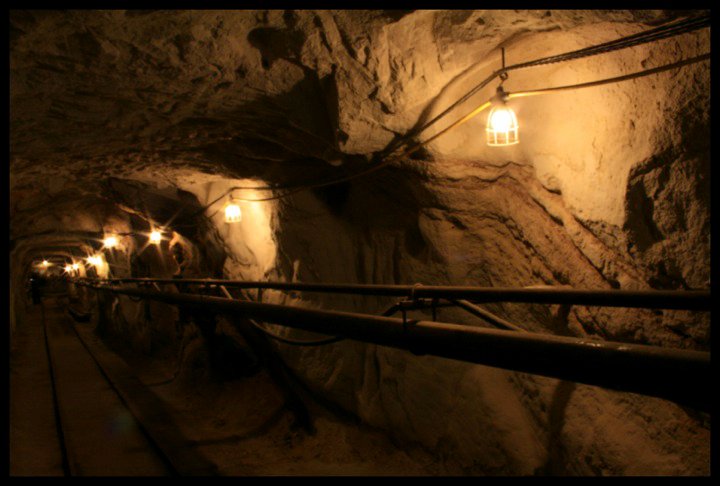
The Black Diamond Mines Regional Preserve is a park located north of Mount Diablo in Contra Costa County, California under the administration of the East Bay Regional Park District (EBRPD). The district acquired the property in 1973. The preserve contains relics of 3 mining towns, former coal and sand mines, and offers guided tours of a former sand mine. The of trails in the Preserve cross rolling foothill terrain covered with grassland, California oak woodland, California mixed evergreen forest, and chaparral. History Indigenous history Long before the widespread ranching and mining activity that took place in the area, indigenous people had a presence in the Bay Area for 13,000 years. Three Bay Miwok tribes, the Chupan, Chupcan, Ompin, and Volvon, lived in the areas surrounding the Black Diamond Mines Regional Preserve. The Chupcan occupied territory to the west of the preserve near Concord, California, Concord, the Volvon occupied the territory to the south including ... [...More Info...] [...Related Items...] OR: [Wikipedia] [Google] [Baidu] [Amazon] |
Antioch, California
Antioch is the third-most populous city in Contra Costa County, California, United States. The city is located in the East Bay region of the San Francisco Bay Area along the Sacramento–San Joaquin River Delta. The city's population was 115,291 at the 2020 United States census, 2020 census. The city has grown substantially more diverse since the 1970s. History Early history Antioch is one of the oldest towns in the region. The town has been variously named East Antioch, Smith's Landing, and Marsh's Landing, prior to its current name. In 1848, John Marsh (pioneer), John Marsh, owner of Rancho Los Méganos, one of the largest ranches in California, built a landing on the San Joaquin River in what is now Antioch. It became known as Marsh's Landing, and was the shipping point for the rancho. It included a pier extending well out into the river, enabling vessels drawing of water to tie up there in any season of the year. The landing also included a slaughterhouse, a smokehouse ... [...More Info...] [...Related Items...] OR: [Wikipedia] [Google] [Baidu] [Amazon] |
Coal
Coal is a combustible black or brownish-black sedimentary rock, formed as rock strata called coal seams. Coal is mostly carbon with variable amounts of other Chemical element, elements, chiefly hydrogen, sulfur, oxygen, and nitrogen. Coal is a type of fossil fuel, formed when dead plant matter decays into peat which is converted into coal by the heat and pressure of deep burial over millions of years. Vast deposits of coal originate in former wetlands called coal forests that covered much of the Earth's tropical land areas during the late Carboniferous (Pennsylvanian (geology), Pennsylvanian) and Permian times. Coal is used primarily as a fuel. While coal has been known and used for thousands of years, its usage was limited until the Industrial Revolution. With the invention of the steam engine, coal consumption increased. In 2020, coal supplied about a quarter of the world's primary energy and over a third of its Electricity generation, electricity. Some iron and steel-maki ... [...More Info...] [...Related Items...] OR: [Wikipedia] [Google] [Baidu] [Amazon] |
Typhoid Fever
Typhoid fever, also known simply as typhoid, is a disease caused by '' Salmonella enterica'' serotype Typhi bacteria, also called ''Salmonella'' Typhi. Symptoms vary from mild to severe, and usually begin six to 30 days after exposure. Often there is a gradual onset of a high fever over several days. This is commonly accompanied by weakness, abdominal pain, constipation, headaches, and mild vomiting. Some people develop a skin rash with rose colored spots. In severe cases, people may experience confusion. Without treatment, symptoms may last weeks or months. Diarrhea may be severe, but is uncommon. Other people may carry it without being affected, but are still contagious. Typhoid fever is a type of enteric fever, along with paratyphoid fever. ''Salmonella enterica'' Typhi is believed to infect and replicate only within humans. Typhoid is caused by the bacterium ''Salmonella enterica'' subsp. ''enterica'' serovar Typhi growing in the intestines, Peyer's patches, mesen ... [...More Info...] [...Related Items...] OR: [Wikipedia] [Google] [Baidu] [Amazon] |
Scarlet Fever
Scarlet fever, also known as scarlatina, is an infectious disease caused by ''Streptococcus pyogenes'', a Group A streptococcus (GAS). It most commonly affects children between five and 15 years of age. The signs and symptoms include a sore throat, fever, headache, cervical lymphadenopathy, swollen lymph nodes, and a characteristic rash. The face is flushed and the Exanthem, rash is Erythema, red and Blanch (medical), blanching. It typically feels like sandpaper and the tongue may be red and bumpy. The rash occurs as a result of capillary damage by exotoxins produced by ''S.pyogenes''. On darker-pigmented skin the rash may be hard to discern. Scarlet fever develops in a small number of people who have strep throat or streptococcal skin infections. The bacteria are usually spread by people coughing or sneezing. It can also be spread when a person touches an object that has the bacteria on it and then touches their mouth or nose. The diagnosis is typically confirmed by throat ... [...More Info...] [...Related Items...] OR: [Wikipedia] [Google] [Baidu] [Amazon] |
Rose Hill Cemetery, Antioch, California 01
A rose is either a woody perennial flowering plant of the genus ''Rosa'' (), in the family Rosaceae (), or the flower it bears. There are over three hundred species and tens of thousands of cultivars. They form a group of plants that can be erect shrubs, climbing, or trailing, with stems that are often armed with sharp prickles. Their flowers vary in size and shape and are usually large and showy, in colours ranging from white through pinks, reds, oranges and yellows. Most species are native to Asia, with smaller numbers native to Europe, North America, and Northwest Africa. Species, cultivars and hybrids are all widely grown for their beauty and often are fragrant. Roses have acquired cultural significance in many societies. Rose plants range in size from compact, miniature roses to climbers that can reach seven meters in height. Different species hybridize easily, and this has been used in the development of the wide range of garden roses. Etymology The name ''rose'' com ... [...More Info...] [...Related Items...] OR: [Wikipedia] [Google] [Baidu] [Amazon] |
Stockton, California
Stockton is a city in and the county seat of San Joaquin County, California, San Joaquin County in the Central Valley (California), Central Valley of the U.S. state of California. It is the most populous city in the county, the List of municipalities in California, 11th-most populous city in California and the List of United States cities by population, 60th-most populous city in the United States. Stockton's population in 2020 was 320,804. It was named an All-America City Award, All-America City in 1999, 2004, 2015, and again in 2017 and 2018. The city is located on the San Joaquin River in the northern San Joaquin Valley. It lies at the southeastern corner of a Sacramento–San Joaquin River Delta, large inland river delta that isolates it from other nearby cities such as Sacramento and those of the San Francisco Bay Area. Stockton was founded by Charles Maria Weber in 1849 after he acquired Rancho Campo de los Franceses. The city is named after Robert F. Stockton, and it was t ... [...More Info...] [...Related Items...] OR: [Wikipedia] [Google] [Baidu] [Amazon] |
Sacramento, California
Sacramento ( or ; ; ) is the List of capitals in the United States, capital city of the U.S. state of California and the county seat, seat of Sacramento County, California, Sacramento County. Located at the confluence of the Sacramento River, Sacramento and American Rivers in Northern California's Sacramento Valley, Sacramento's 2020 population of 524,943 makes it the fourth-most populous city in Northern California, List of largest California cities by population, the sixth-most populous in the state, the List of United States cities by population, ninth-most populous state capital, and the List of United States cities by population, 35th most populous city in the United States. Sacramento is the seat of the California Legislature and the governor of California. Sacramento is also the cultural and economic core of the Sacramento metropolitan area, Greater Sacramento area, which at the 2020 United States census, 2020 census had a population of 2,680,831, the fourth-largest S ... [...More Info...] [...Related Items...] OR: [Wikipedia] [Google] [Baidu] [Amazon] |
San Francisco Bay Area
The San Francisco Bay Area, commonly known as the Bay Area, is a List of regions of California, region of California surrounding and including San Francisco Bay, and anchored by the cities of Oakland, San Francisco, and San Jose, California, San Jose. The Association of Bay Area Governments defines the Bay Area as including the nine counties that border the estuary, estuaries of San Francisco Bay, San Pablo Bay, and Suisun Bay: Alameda County, California, Alameda, Contra Costa County, California, Contra Costa, Marin County, California, Marin, Napa County, California, Napa, San Mateo County, California, San Mateo, Santa Clara County, California, Santa Clara, Solano County, California, Solano, Sonoma County, California, Sonoma, and San Francisco County, California, San Francisco. Other definitions may be either smaller or larger, and may include neighboring counties which are not officially part of the San Francisco Bay Area, such as the Central Coast (California), Central Coast c ... [...More Info...] [...Related Items...] OR: [Wikipedia] [Google] [Baidu] [Amazon] |
Black Diamond Coal Mining Railroad
The Black Diamond Coal Mining Railroad was long and ran from Black Diamond Landing, California (now part of the city of Pittsburg, California) to Nortonville, California. It was owned and operated by the Black Diamond Coal Mining Company and therefore did not have its own official name. Over the years, it has been known by at least four different names. (A report prepared by the State in the 1880s referred to it as both the "Black Diamond Coal Mining Railroad Company" and the "Black Diamond Railroad." It has also been referred to as the "Black Diamond Coal Company Railroad" and the "Black Diamond Coal and Railroad Company."B. H. Ward, Mt. Diablo Coal Mine Railroads, The Western Railroader, Booklet 370-E.) The railroad was built by Gold Rush-era civil engineer and artist Sherman Day, and opened for service in 1868 primarily to serve the Black Diamond Coal Mine at Nortonville. At the town of Cornwall, California the railroad crossed the tracks of the Southern Pacific Railroad ... [...More Info...] [...Related Items...] OR: [Wikipedia] [Google] [Baidu] [Amazon] |
San Joaquin River
The San Joaquin River ( ; ) is the longest river of Central California. The long river starts in the high Sierra Nevada and flows through the rich agricultural region of the northern San Joaquin Valley before reaching Suisun Bay, San Francisco Bay, and the Pacific Ocean. An important source of irrigation water as well as a wildlife corridor, the San Joaquin is among the most heavily dammed and diverted of California's rivers. People have inhabited the San Joaquin Valley for more than 8,000 years, and it was one of the major population centers of pre-Columbian California. Starting in the late 18th century, successive waves of explorers then settlers, mainly Spanish and American, emigrated to the San Joaquin basin. When Spain colonized the area, they sent soldiers from Mexico, who were usually of mixed native Mexican and Spanish birth, led by Spanish officers. Franciscan missionaries from Spain came with expeditions to evangelize the natives by teaching them about the Catholi ... [...More Info...] [...Related Items...] OR: [Wikipedia] [Google] [Baidu] [Amazon] |
Judsonville, California
Judsonville was a city in eastern Contra Costa County, California Contra Costa County (; ''Contra Costa'', Spanish for 'Opposite Coast') is a county located in the U.S. state of California, in the East Bay of the San Francisco Bay Area. As of the 2020 United States census, the population was 1,165,927. Th .... It was located northeast of Stewartville. It was a mining town for the nearby coal mines. retrieved September 17, 2007 A post office operated at Judsonville from 1878 to 1883, with a closure in 1879. The name is in honor of Egbert Judson, part owner of a mine. Notes Ghost towns in California[...More Info...] [...Related Items...] OR: [Wikipedia] [Google] [Baidu] [Amazon] |
West Hartley, California
West Hartley was an unincorporated community in eastern Contra Costa County, California. It was located northeast of Mount Diablo Mount Diablo is a mountain of the Diablo Range, in Contra Costa County, California, Contra Costa County of the eastern San Francisco Bay Area in Northern California. It is south of Clayton, California, Clayton and northeast of Danville, Califo ..., at an elevation of 440 feet (134 m). It is now a ghost town. It was a mining town for the nearby coal mines. retrieved September 17, 2007 It was founded in the late 1880s and named for England's West Hartley coal mine. References * Former settlements in Contra Costa County, California ...[...More Info...] [...Related Items...] OR: [Wikipedia] [Google] [Baidu] [Amazon] |


