|
Auricularia Nigricans
''Auricularia nigricans'' is a species of fungus in the family Auriculariaceae. Basidiocarps (fruitbodies} are gelatinous, ear-like, and grow on dead wood of broadleaf trees. It is found in southern and eastern Asia, North America, South America and the Caribbean. The name ''Auricularia polytricha'', when used by authors from the Americas, is a synonym of ''A. nigricans''. When used by Asian authors, it likely refers instead to ''Auricularia cornea''. Taxonomy The species was first described in 1788 as ''Peziza nigrescens'' by the Swedish botanist Olof Swartz, based on a collection he made from Jamaica. In a later publication he changed the name to ''Peziza nigricans'', which was accepted by the Swedish mycologist Elias Magnus Fries. For abstruse nomenclatural reasons, Fries's sanctioned name takes priority over Swartz's original name. In his monograph of '' Auricularia'' species, American mycologist Bernard Lowy rejected the name as being "doubtful" due to the habitat descri ... [...More Info...] [...Related Items...] OR: [Wikipedia] [Google] [Baidu] |
Elias Magnus Fries
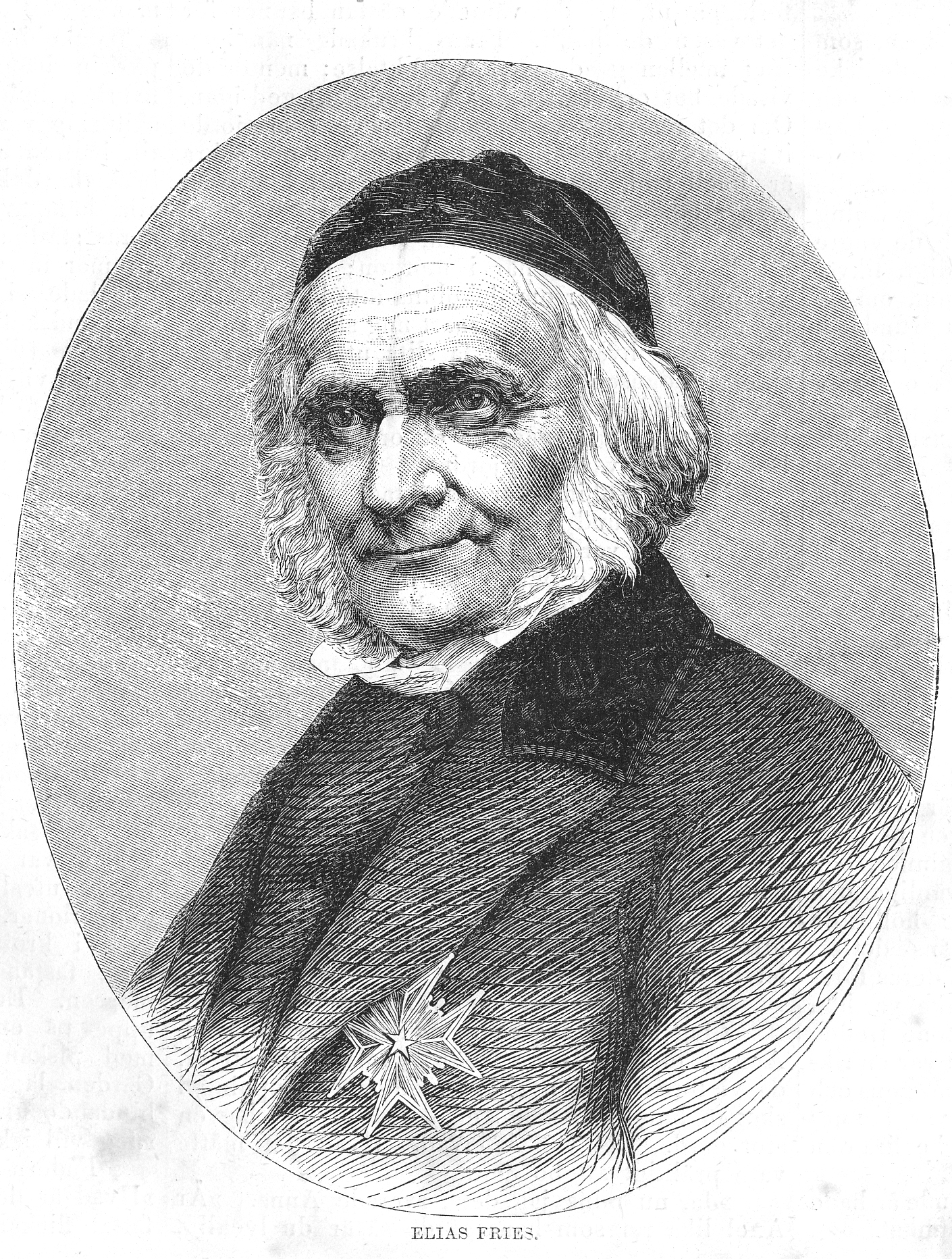
Elias Magnus Fries (15 August 1794 – 8 February 1878) was a Swedish mycologist and botanist. He is sometimes called the Mycology, "Linnaeus of Mycology". In his works he described and assigned botanical names to hundreds of fungus and lichen species, many of which remain authoritative today. Career Fries was born at Femsjö (Hylte Municipality), Småland, the son of the pastor there. He attended school in Växjö. He acquired an extensive knowledge of flowering plants from his father. In 1811 Fries entered Lund University where he studied under Carl Adolph Agardh and Anders Jahan Retzius. He obtained his doctorate in 1814. In the same year he was appointed an associate professorship in botany. Fries edited several exsiccata series, the first starting in 1818 under the title ''Lichenes Sveciae exsiccati, curante Elia Fries'' and the last together with Franz Joseph Lagger under the title ''Hieracia europaea exsiccata''. He was elected a member of the Royal Swedish Academ ... [...More Info...] [...Related Items...] OR: [Wikipedia] [Google] [Baidu] |
Cladistic
Cladistics ( ; from Ancient Greek 'branch') is an approach to biological classification in which organisms are categorized in groups ("clades") based on hypotheses of most recent common ancestry. The evidence for hypothesized relationships is typically shared derived characteristics ( synapomorphies) that are not present in more distant groups and ancestors. However, from an empirical perspective, common ancestors are inferences based on a cladistic hypothesis of relationships of taxa whose character states can be observed. Theoretically, a last common ancestor and all its descendants constitute a (minimal) clade. Importantly, all descendants stay in their overarching ancestral clade. For example, if the terms ''worms'' or ''fishes'' were used within a ''strict'' cladistic framework, these terms would include humans. Many of these terms are normally used paraphyletically, outside of cladistics, e.g. as a ' grade', which are fruitless to precisely delineate, especially when ... [...More Info...] [...Related Items...] OR: [Wikipedia] [Google] [Baidu] |
Hokianga
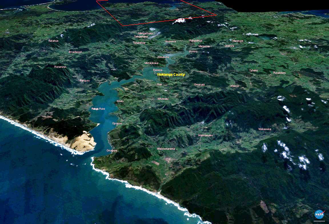
The Hokianga is an area surrounding the Hokianga Harbour, also known as the Hokianga River, a long Estuary, estuarine drowned valley on the west coast in the north of the North Island of New Zealand. The original name, still used by local Māori people, Māori, is ''Te Kohanga o Te Tai Tokerau'' ("the nest of the northern people") or ''Te Puna o Te Ao Marama'' ("the wellspring in the world of light"). The full name of the harbour is Te Hokianga-nui-a-Kupe — "the place of Kupe's great return". Geography The Hokianga is in the Far North (district), New Zealand, Far North District, which is in the Northland Region. The area is northwest of Whangārei City—and west of Kaikohe—by road. The estuary extends inland for from the Tasman Sea. It is navigable for small craft for much of its length, although there is a bar across the mouth. In its upper reaches the Rangiora Narrows separate the mouths of the Waihou and Mangamuka Rivers from the lower parts of the harbour ... [...More Info...] [...Related Items...] OR: [Wikipedia] [Google] [Baidu] |
Westland, New Zealand
Westland District is a territorial authority district on the West Coast of New Zealand's South Island. It is administered by the Westland District Council. The district's population is History Westland was originally a part of Canterbury Province, administered from Christchurch, on the east coast. The booming population as a result of the gold rush, together with the difficulty of travel and communication across the Southern Alps, led first to the creation of a special Westland County, then the formal separation of Westland from Canterbury to form the short-lived Westland Province (1873–1876). Westland Province also included what is now the southern portion of Grey District, with the provincial boundary at the Grey and Arnold rivers. Greymouth proper was in Westland Province, Cobden, on the north bank of the Grey River, was in Nelson Province. After the abolition of the provinces in 1876, a new Westland County was created with roughly the same borders as the province. A ... [...More Info...] [...Related Items...] OR: [Wikipedia] [Google] [Baidu] |
Coromandel Peninsula
The Coromandel Peninsula () on the North Island of New Zealand extends north from the western end of the Bay of Plenty, forming a natural barrier protecting the Hauraki Gulf and the Firth of Thames in the west from the Pacific Ocean to the east. It is wide at its broadest point. Almost its entire population lives on the narrow coastal strips fronting the Hauraki Gulf and the Bay of Plenty. In clear weather the peninsula is clearly visible from Auckland, the country's biggest city, which lies on the far shore of the Hauraki Gulf, to the west. The peninsula is part of the Thames-Coromandel District and the Waikato Region. Names The Māori name for the peninsula is ''Te Tara-o-te-Ika-a-Māui'', meaning "the barb of Māui's fish". This comes from the legend of Māui and the Fish, in which the demigod uses his hook to catch a great fish (Te Ika-a-Māui or the North Island) from the depths of the Pacific Ocean. In Hauraki Māori tradition, the fish is likened to a sti ... [...More Info...] [...Related Items...] OR: [Wikipedia] [Google] [Baidu] |
Waitaki
Waitaki District is a territorial authority district that is located in the Canterbury and Otago regions of the South Island of New Zealand. It straddles the traditional border between the two regions, the Waitaki River, and its seat is Oamaru. History Waitaki District is made up of the former Waitaki County, Waihemo County and Oamaru Borough, which were amalgamated in 1989. It is governed by the Waitaki District Council. Name During the colonial period, the area was also known as ''Molesworth''. However, the Māori name ''Waitaki'' eventually prevailed. Geography It has a land area of , of which or 59.02% is in the Canterbury Region and or 40.98% in the Otago Region. It is the only district in the South Island that lies in two regions. A major reason for this split was the governance of the Waitaki River, which forms a political boundary between Canterbury and Otago. With major hydro schemes on this river, it was decided to place the entire catchment in one administrative ... [...More Info...] [...Related Items...] OR: [Wikipedia] [Google] [Baidu] |
Waima
Waima is a suburb of West Auckland, New Zealand. It is under the local governance of the Auckland Council. The majority of the modest population is clustered around the comparatively prominent Waima superette, situated just off the main arterial road Woodlands Park Road, on such streets as Waima Crescent, Hollywood Avenue, Boylan Road and Rimutaka Place. The central "hub" could be considered Waima reserve, which consists of various public amenities such as a playground, basketball court, toilets and a sport field. To the northwest, Waima is bordered by popular walking track and Lower Nihotipu Reservoir pipeline route "Exhibition Drive". Two water treatment stations and holding tanks service Auckland city's water supply from locations on Woodlands Park Road. Waima extends East to Tainui Road and the Auckland Centennial Memorial Park and the cul de sac of Rimutaka place represents Waima's Southernmost point. History In the early 20th century, the area was a part of McEldowne ... [...More Info...] [...Related Items...] OR: [Wikipedia] [Google] [Baidu] |
East Indies
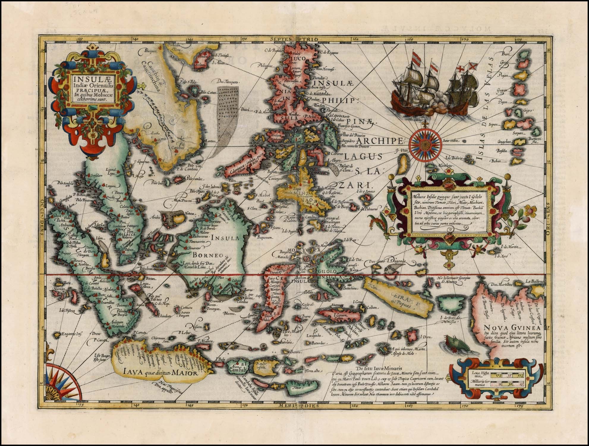
The East Indies (or simply the Indies) is a term used in historical narratives of the Age of Discovery. The ''Indies'' broadly referred to various lands in Eastern world, the East or the Eastern Hemisphere, particularly the islands and mainlands found in and around the Indian Ocean by Portuguese explorers, soon after the Cape Route was discovered. In a narrow sense, the term was used to refer to the Malay Archipelago, which today comprises the list of islands of the Philippines, Philippine Archipelago, Indonesian Archipelago, Borneo, and New Guinea. Historically, the term was used in the Age of Discovery to refer to the coasts of the landmasses comprising the Indian subcontinent and the Mainland Southeast Asia, Indochinese Peninsula along with the Malay Archipelago. Overview During the era of History of colonialism, European colonization, territories of the Spanish Empire in Asia were known as the Spanish East Indies for 333 years before the Treaty of Paris (1898), American ... [...More Info...] [...Related Items...] OR: [Wikipedia] [Google] [Baidu] |
Presque-isle
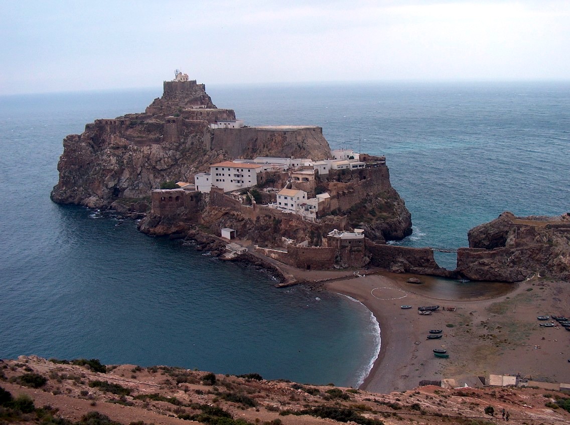
Presque-isle (from the French ''presqu'île'', meaning ''almost island'') is a geographical term denoting a piece of land which is closer to being an island than most peninsulas because of its being joined to the mainland by an extremely narrow neck of land. List of presque-isles * Peñón de Vélez de la Gomera in Spain * Monte Argentario in Italy * Quiberon in Brittany, France *Saint-Malo in Brittany, France * Mahia Peninsula in the Hawke's Bay Region of New Zealand *Isle of Portland in Dorset, England * Northmavine in Shetland, Scotland *Novastoshnah, in St. Paul, Alaska * Presqu'ile Provincial Park in Ontario, Canada * Presque Isle State Park in Erie, Pennsylvania, United States * Presque Isle Township in Presque Isle County, Michigan * Catawba Island Township, Ottawa County, Ohio * Presque Isle Park, Marquette, Michigan * Presque Isle in Maine, United States * Presqu'île of Lyon, the central part of the city of Lyon, France * Vũng Tàu City, Bà Rịa–Vũng Tàu pr ... [...More Info...] [...Related Items...] OR: [Wikipedia] [Google] [Baidu] |


