|
Augsburg-Haunstetten
Augsburg-Haunstetten, also known as Haunstetten-Siebenbrunn is one of the seventeen '' Planungsräume'' (English: Planning district, singular: Planungsraum) of Augsburg, Bavaria, Germany. It is the largest of the seventeen Planungsräume with an area of 32.59 km² (12.58 mi²). It is one of the most heavily populated subdivisions of Augsburg, with over 25,000 inhabitants. The town of Siebenbrunn was its own entity until 1910 when it was annexed to Augsburg, and Haunstetten was its own city from 1952 until 1972, when Bavaria underwent extensive reform of its political subdivisions and Haunstetten was also annexed to Augsburg. The population stood at 26,291 as of December 31, 2010. Geography Haunstetten is the southernmost subdivision of Augsburg and lies between the rivers Lech, Wertach and Singold, on a river terrace. The Planungsraum comprises five ''Stadtbezirke,'' (English: Ward, singular: Stadtbezirk) the 12th, 33rd, 34th, 35th, and 36th Stadtbezirke, which are n ... [...More Info...] [...Related Items...] OR: [Wikipedia] [Google] [Baidu] |
Augsburg-Universitätsviertel
Augsburg-Universitätsviertel (English: University Quarter) is one of the 17 Planungsräume (English: Planning district, singular ''Planungsraum'') of Augsburg, Bavaria, Germany. It consists of one ''Stadtbezirk,'' (English: Ward) out of the 41 that make up the city, the 32nd, with which its planning district is coterminous. The Universitätsviertel houses the main campus of the University of Augsburg, which was founded in 1970. The planning district also houses the old Augsburg Airport as well as the ''Volkssiedlung,'' (English: Public settlement or People's settlement) a public housing development. The district, with many university students, has a lower percentage of foreign-born residents than other areas of Augsburg, with only 13.1% compared to the citywide average of 16.7%. The Universitätsviertel has an area of 3.96 km2 (1.53 mi2), and as of January 1, 2007, a population of 10,824. It is bordered on the south by Inningen, the south and east by Haunstetten, on the ... [...More Info...] [...Related Items...] OR: [Wikipedia] [Google] [Baidu] |
List Of Civic Divisions Of Augsburg
This is a list of civic divisions of Augsburg, Bavaria, Germany. Augsburg is divided into two tiers of such divisions. The highest level division is called a ''Planungsraum,'' (Plural: ''Planungsräume,'' English: planning district) while the lower tier are called ''Stadtbezirke'' (Singular: ''Stadtbezirk,'' English: wards). Some ''Planungsräume'' contain only one ''Stadtbezirk,'' with which such a planning district is coterminous; other districts consist of multiple ''Stadtbezirke.'' Currently, Augsburg contains 17 ''Planungsräume'' and 42 ''Stadtbezirke''. Population statistics are current as of January 1, 2006. External links Interactive map of Augsburg civic divisions, with detailed census figures {{AugsburgCityDivisions Districts of Augsburg, ... [...More Info...] [...Related Items...] OR: [Wikipedia] [Google] [Baidu] |
Augsburg-Inningen
Inningen is one of the 17 Planungsräume (English: Planning District) of Augsburg, Bavaria, Germany. It consists solely of the 41st Stadtbezirk (English: Ward or City Ward), with which it shares a name and is coterminous. As of January 1, 2006, Inningen was reported to have a population 4,735, and an area of 13.42 km2 (5.18 km2). Its population density is . It was previously its own municipality before being annexed to Augsburg in 1972. History Although supposedly founded by the Allemanni tribes in the year 506, the town was first mentioned in a historical context in 1071. At that time the town had already been settled by local inhabitants and a Roman road. connecting Augsburg with Kempten im Allgäu, ran through the town. The town also has a large millstone also dating from Roman times. The largest landmark in the area, the Church of Saints Peter and Paul was built in 1713. Up until the Second World War, Inningen was a small farming community on the outskirts of Augsb ... [...More Info...] [...Related Items...] OR: [Wikipedia] [Google] [Baidu] |
Bolzano
Bolzano ( ; ; or ) is the capital city of South Tyrol (officially the province of Bolzano), Northern Italy. With a population of 108,245, Bolzano is also by far the largest city in South Tyrol and the third largest in historical Tyrol. The greater metro area has about 250,000 inhabitants and is one of the urban centres within the Alps. Bolzano is the seat of the Free University of Bozen-Bolzano, where lectures and seminars are held in English, German, and Italian. The city is also home to the Italian Army's Alpini High Command ( COMALP) and some of its combat and support units. In the 2020 version of the annual ranking of quality of life in Italian cities, Bolzano was ranked jointly first for quality of life alongside Bologna. Along with other Alpine towns in South Tyrol, Bolzano engages in the Alpine Town of the Year Association for the implementation of the Alpine Convention. The Convention aims to promote and achieve sustainable development in the Alpine Arc. Conseque ... [...More Info...] [...Related Items...] OR: [Wikipedia] [Google] [Baidu] |
Urnfield Culture
The Urnfield culture () was a late Bronze Age Europe, Bronze Age culture of Central Europe, often divided into several local cultures within a broader Urnfield tradition. The name comes from the custom of cremation, cremating the dead and placing their ashes in urns, which were then buried in fields. The first usage of the name occurred in publications over grave sites in southern Germany in the late 19th century. Over much of Europe, the Urnfield culture followed the Tumulus culture and was succeeded by the Hallstatt culture. Some linguists and archaeologists have associated this culture with a Celtic languages, pre-Celtic language or Proto-Celtic language family.Peter Schrijver, 2016, "Sound Change, the Italo-Celtic Linguistic Unity, and the Italian Homeland of Celtic", in John T. Koch & Barry Cunniffe, ''Celtic From the West 3: Atlantic Europe in the Metal Ages: questions of shared language''. Oxford, England; Oxbow Books, pp. 9, 489–502. By the end of the 2nd millennium BC, ... [...More Info...] [...Related Items...] OR: [Wikipedia] [Google] [Baidu] |
Roman Empire
The Roman Empire ruled the Mediterranean and much of Europe, Western Asia and North Africa. The Roman people, Romans conquered most of this during the Roman Republic, Republic, and it was ruled by emperors following Octavian's assumption of effective sole rule in 27 BC. The Western Roman Empire, western empire collapsed in 476 AD, but the Byzantine Empire, eastern empire lasted until the fall of Constantinople in 1453. By 100 BC, the city of Rome had expanded its rule from the Italian peninsula to most of the Mediterranean Sea, Mediterranean and beyond. However, it was severely destabilised by List of Roman civil wars and revolts, civil wars and political conflicts, which culminated in the Wars of Augustus, victory of Octavian over Mark Antony and Cleopatra at the Battle of Actium in 31 BC, and the subsequent conquest of the Ptolemaic Kingdom in Egypt. In 27 BC, the Roman Senate granted Octavian overarching military power () and the new title of ''Augustus (title), Augustus'' ... [...More Info...] [...Related Items...] OR: [Wikipedia] [Google] [Baidu] |
Trade Route
A trade route is a logistical network identified as a series of pathways and stoppages used for the commercial transport of cargo. The term can also be used to refer to trade over land or water. Allowing goods to reach distant markets, a single trade route contains long-distance arteries, which may further be connected to smaller networks of commercial and noncommercial transportation routes. Among notable trade routes was the Amber Road, which served as a dependable network for long-distance trade. Maritime trade along the Spice Route became prominent during the Middle Ages, when nations resorted to military means for control of this influential route. During the Middle Ages, organizations such as the Hanseatic League, aimed at protecting interests of the merchants and trade became increasingly prominent. In modern times, commercial activity shifted from the major trade routes of the Old World to newer routes between modern nation-states. This activity was sometimes car ... [...More Info...] [...Related Items...] OR: [Wikipedia] [Google] [Baidu] |
Füssen
Füssen () is a Town#Germany, town in Bavaria, Germany, in the district of Ostallgäu, situated one kilometre from the Austrian border. The town is known for violin manufacturing and as the closest transportation hub for the Neuschwanstein and Schloss Hohenschwangau, Hohenschwangau castles. As of , the town has a population of . History Füssen was settled in Roman times, on the Via Claudia Augusta, a road that leads southwards to northern Italy and northwards to Augusta Vindelicum (today's Augsburg), the former regional capital of the Ancient Rome, Roman province Raetia. The original name of Füssen was "Foetes", or "Foetibus" (inflected), which derives from Latin "Fauces", meaning "gorge", probably referring to the Lech (river), Lech gorge. In Late Antiquity Füssen was the home of a part of the Legio III Italica, which was stationed there to guard the important trade route over the Alps. Füssen later became the site of the "Hohes Schloss" (High Castle), the former summer res ... [...More Info...] [...Related Items...] OR: [Wikipedia] [Google] [Baidu] |
Bronze Age
The Bronze Age () was a historical period characterised principally by the use of bronze tools and the development of complex urban societies, as well as the adoption of writing in some areas. The Bronze Age is the middle principal period of the three-age system, following the Stone Age and preceding the Iron Age. Conceived as a global era, the Bronze Age follows the Neolithic, with a transition period between the two known as the Chalcolithic. The final decades of the Bronze Age in the Mediterranean basin are often characterised as a period of widespread societal collapse known as the Late Bronze Age collapse (), although its severity and scope are debated among scholars. An ancient civilisation is deemed to be part of the Bronze Age if it either produced bronze by smelting its own copper and alloying it with tin, arsenic, or other metals, or traded other items for bronze from producing areas elsewhere. Bronze Age cultures were the first to History of writing, develop writin ... [...More Info...] [...Related Items...] OR: [Wikipedia] [Google] [Baidu] |
Augustus
Gaius Julius Caesar Augustus (born Gaius Octavius; 23 September 63 BC – 19 August AD 14), also known as Octavian (), was the founder of the Roman Empire, who reigned as the first Roman emperor from 27 BC until his death in AD 14. The reign of Augustus initiated an Roman imperial cult, imperial cult and an era of regional hegemony, imperial peace (the or ) in which the Roman world was largely free of armed conflict. The Principate system of government was established during his reign and lasted until the Crisis of the Third Century. Octavian was born into an equites, equestrian branch of the plebeian Octavia gens, Octavia. Following his maternal great-uncle Julius Caesar's assassination of Julius Caesar, assassination in 44 BC, Octavian was named in Caesar's will as his Adoption in ancient Rome, adopted son and heir, and inherited Caesar's name, estate, and the loyalty of his legions. He, Mark Antony, and Marcus Lepidus formed the Second Triumvirat ... [...More Info...] [...Related Items...] OR: [Wikipedia] [Google] [Baidu] |
Via Claudia Augusta
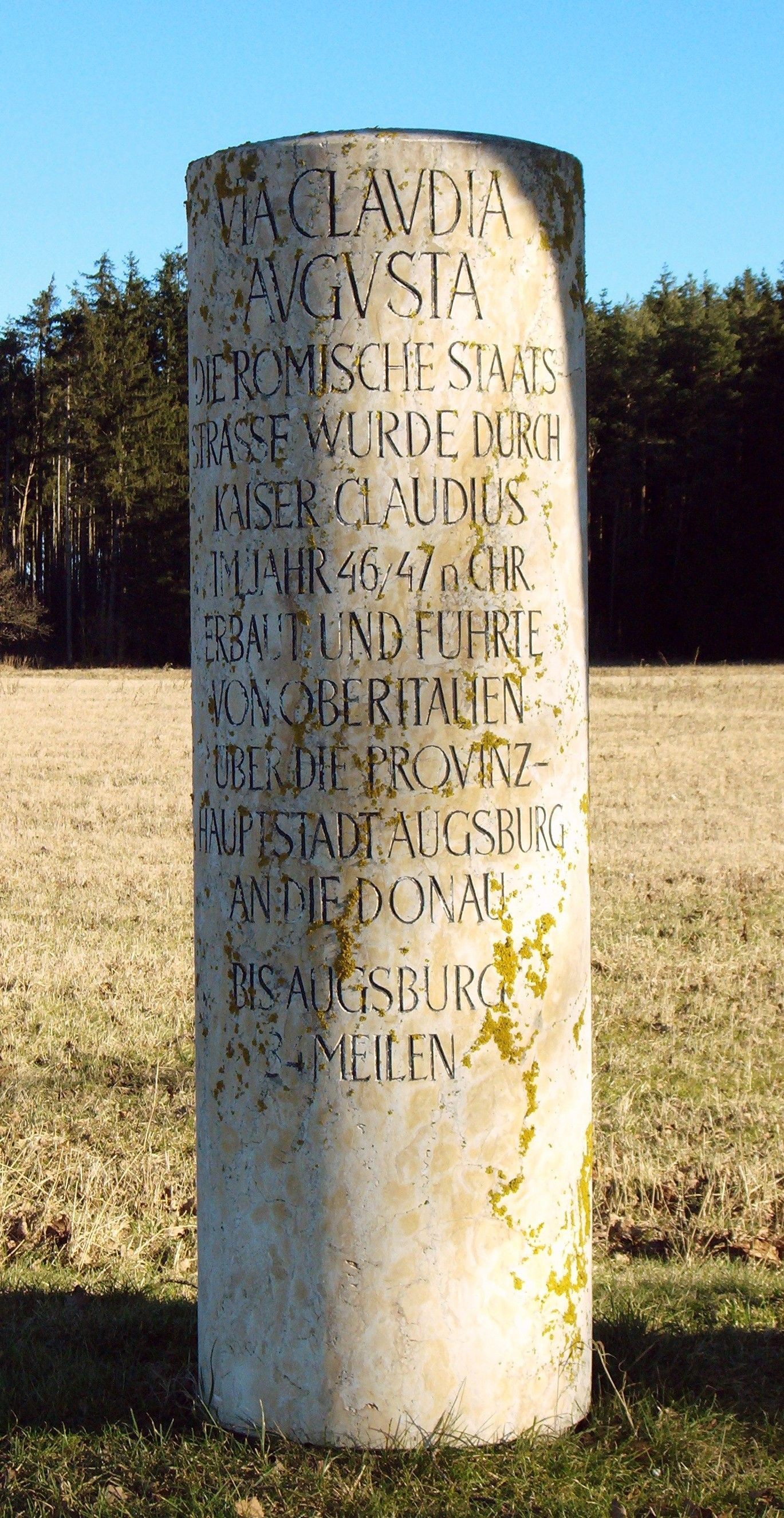
The Via Claudia Augusta is an ancient Roman road, which linked the valley of the Po River with Rhaetia (encompassing parts of modern Eastern Switzerland, Northern Italy, Western Austria, Southern Germany and all of Liechtenstein) across the Alps. The route still exists, and since the 1990s increased interest in long-distance hiking and cycling have made the German and Austrian stretches of the Via Claudia Augusta popular among tourists, with the result that modern signage (''illustration'') identifies the revitalised track. Since 2007, the ''Giontech Archeological Site'', in Mezzocorona/Kronmetz (Italy) serves as the Via Claudia Augusta International Research Center with the support of the ''Foundation Piana Rotaliana'' and the Government of the City of Mezzocorona/Kronmetz. History In 15 BC, the Roman general Nero Claudius Drusus, the stepson of Augustus, got orders from his stepfather to improve the passage through the Alps for military purposes and to increase Roman control ... [...More Info...] [...Related Items...] OR: [Wikipedia] [Google] [Baidu] |


