|
Aldgate
Aldgate () was a gate in the former defensive wall around the City of London. The gate gave its name to ''Aldgate High Street'', the first stretch of the A11 road, that takes that name as it passes through the ancient, extramural Portsoken Ward of the City of London. There is an ancient ''Aldgate Ward'' inside the line of the former gate and wall, and a similarly ancient Portsoken Ward that lies just outside of it. However the use of the Aldgate and Portsoken Wards as everyday place names is very limited. Consequently, the use of Aldgate as a place name is informal, and typically applies to the Portsoken Ward, especially the central area around Aldgate High Street. Aldgate High Street is 2.3 miles (3.7 km) east of Charing Cross. Etymology The etymology of the name "Aldgate" is uncertain. It is first recorded in 1052 as ''Æst geat'' ("east gate") but had become ''Alegate'' by 1108. Writing in the 16th century, John Stow derived the name from "Old Gate" (Aeld Gat ... [...More Info...] [...Related Items...] OR: [Wikipedia] [Google] [Baidu] |
Aldgate East Tube Station
Aldgate East () is a London Underground station on Whitechapel High Street in Whitechapel, in London, England. It takes its name from the City of London ward of Aldgate, the station lying to the east of the ward (and the City). The station is served by the District and Hammersmith & City lines, and is located in Travelcard Zone 1. On the District line, the station is between Tower Hill and Whitechapel stations. On the Hammersmith & City line, it is between Liverpool Street and Whitechapel stations. History Original station The original Aldgate East station opened on 6 October 1884 as part of an eastern extension to the District Railway (now the District line). It was to the west of the current station, close to the Metropolitan Railway's Aldgate station. The curved link to the Metropolitan Railway had to be particularly sharp owing to the location of Aldgate East station. Resited station As part of the London Passenger Transport Board's 1935–1940 New Works Programm ... [...More Info...] [...Related Items...] OR: [Wikipedia] [Google] [Baidu] |
Aldgate Pump
Aldgate Pump is a historic former water pump located at the junction where Aldgate High Street meets Fenchurch Street and Leadenhall Street in the City of London. The pump is considered to be the symbolic start point of the East End of London. The pump is also notable for its long and sometimes dark history, along with its significant cultural references. Design Aldgate Pump is a Grade II listed structure. The metal wolf head on the pump's spout is supposed to signify the last wolf shot in the City of London. Historic photographs show that the pump was surmounted by an ornate wrought iron lantern. During the 20th century this was removed, but was recreated by the Bottega Prata workshop in Bologna, Italy, during its restoration by the Heritage of London Trust, unveiled in September 2019. The pump can no longer be used to draw water, but a drainage grating is still in place. History As a well, it was mentioned during the reign of King John in the early 13th century. [...More Info...] [...Related Items...] OR: [Wikipedia] [Google] [Baidu] |
St Botolph's Aldgate
St Botolph's Aldgate is a Church of England parish church in the City of London and also, as it lies outside the line of the city's former eastern walls, a part of the East End of London. The church served the ancient parish of St Botolph without Aldgate which included the extramural Portsoken Ward of the City of London, as well as East Smithfield which is outside the City. The full name of the church is St Botolph without Aldgate and Holy Trinity Minories and it is sometimes known simply as Aldgate Church. The ecclesiastical parish was united with that of the Church of Holy Trinity, Minories, in 1899. The current 18th-century church building is made of brick with stone quoins and window casings. The tower is square with an obelisk spire. Position and dedication The church stands at the junction of Houndsditch and Aldgate High Street and is approximately 30 yards outside the former position of Aldgate, a defensive barbican on the London Wall, laying in the East End of L ... [...More Info...] [...Related Items...] OR: [Wikipedia] [Google] [Baidu] |
Whitechapel High Street
Whitechapel High Street is a street in the London Borough of Tower Hamlets, Borough of Tower Hamlets in the East End of London. It is about 0.2 miles (350 m) long, making it "one of the shortest high streets in London". It links Aldgate, Aldgate High Street to the south-west with Whitechapel Road to the north-east, and includes junctions with Commercial Street, London, Commercial Street to the north and Commercial Road to the east. For motorists, it is the start of the A11 road (England), A11 from London to Norwich. For cyclists, it is the start of List of cycle routes in London, Cycleway 2 from Aldgate to Stratford, London, Stratford. For pedestrians, it is a route from Aldgate tube station to Brick Lane. "Whitechapel High Street provides a transition between the commercial development pressures from the City and the historic east end communities." The street has many narrow plots with 3–5 storey buildings, rebuilt and enlarged at different times in different styles. It was ... [...More Info...] [...Related Items...] OR: [Wikipedia] [Google] [Baidu] |
London Wall
The London Wall is a defensive wall first built by the Ancient Rome, Romans around the strategically important port town of Londinium in AD 200, as well as the name of a #modern, modern street in the City of London, England. Roman London was, from around 120–150, protected by a large fort, with a large garrison, that stood to its north-western side. The fort, now referred to as the ''Cripplegate Fort'', was later incorporated into a comprehensive city-wide defence, with its strengthened northern and western sides becoming part of the Wall which was built around 200. The incorporation of the fort's walls gave the walled area its distinctive shape in the north-west part of the city. The end of Roman rule in Britain, around 410, led to the wall falling into disrepair. It was restored in the late Anglo-Saxon period, a process generally thought to have begun under Alfred the Great after 886. Repairs and enhancements continued throughout the medieval period. The wall largely defi ... [...More Info...] [...Related Items...] OR: [Wikipedia] [Google] [Baidu] |
Whitechapel
Whitechapel () is an area in London, England, and is located in the London Borough of Tower Hamlets. It is in east London and part of the East End of London, East End. It is the location of Tower Hamlets Town Hall and therefore the borough town centre. Whitechapel is located east of Charing Cross. The district is primarily built around Whitechapel High Street and Whitechapel Road, which extend from the City of London boundary to just east of Whitechapel station. These two streets together form a section of the originally Roman Road from the Aldgate to Colchester, a route that later became known as the ''Great Essex Road''. Population growth resulting from ribbon development along this route, led to the creation of the parish of Whitechapel, a daughter parish of Stepney#Manor and Ancient Parish, Stepney, from which it was separated, in the 14th century. Whitechapel has a long history of having a high proportion of immigrants within the community. From the late 19th century unt ... [...More Info...] [...Related Items...] OR: [Wikipedia] [Google] [Baidu] |
City Of London
The City of London, also known as ''the City'', is a Ceremonial counties of England, ceremonial county and Districts of England, local government district with City status in the United Kingdom, city status in England. It is the Old town, historic centre of London, though it forms only a small part of the larger Greater London metropolis. The City of London had a population of 8,583 at the 2021 United Kingdom census, 2021 census, however over 500,000 people were employed in the area as of 2019. It has an area of , the source of the nickname ''the Square Mile''. The City is a unique local authority area governed by the City of London Corporation, which is led by the Lord Mayor of London, Lord Mayor of the City of London. Together with Canary Wharf and the West End of London, West End, the City of London forms the primary central business district of London, which is one of the leading financial centres of the world. The Bank of England and the London Stock Exchange are both ba ... [...More Info...] [...Related Items...] OR: [Wikipedia] [Google] [Baidu] |
A11 Road (England)
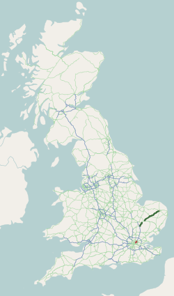
The A11 is a major trunk road in England. It originally ran roughly north east from London to Norwich, Norfolk. It now consists of a short section in Inner London and a much longer section in Cambridgeshire, Suffolk and Norfolk. The lengthy section between these was renumbered as a result of the opening of the M11 in the 1970s and then the A12 extension in 1999. It also multiplexes/overlaps with the A14 on the Newmarket bypass. Route City of London All this part has been declassified and is now a minor road. Thus the A11 now starts at Aldgate, just inside the eastern boundary of the City of London. The first stretch is Whitechapel High Street, east of the junction with Mansell Street. In a complex reworking of the roads since the days of the Aldgate gyratory system, it is two-way, but the east-bound section is part of the ring-road that retained a one-way system south of this junction, but the westbound section is for local access and motorists have to U-turn to avoid e ... [...More Info...] [...Related Items...] OR: [Wikipedia] [Google] [Baidu] |
Portsoken
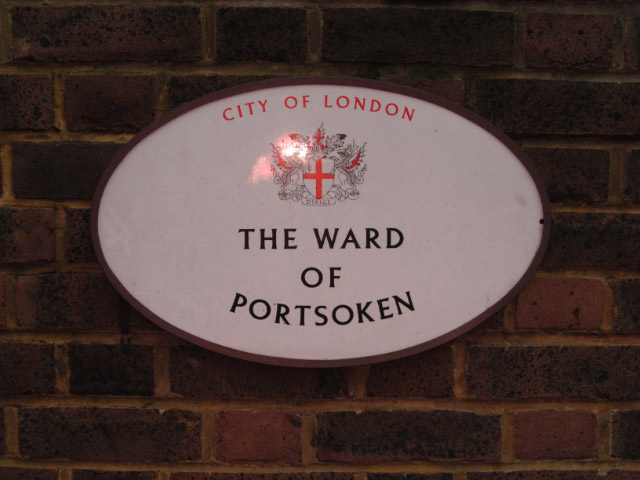
Portsoken, traditionally referred to with the definite article as the Portsoken, is one of the City of London, England's 25 ancient wards, which are still used for local elections. Historically an extra-mural ward, lying east of the former London Wall, the area is sometimes considered to be part of the East End of London. The ward is about 5 hectares in area, and is mainly oriented north-south, with the central part informally known as ''Aldgate'' while to its north as ''Bishopsgate''. History John Stow's ''Survey of London'' records that the " soke" – in this context the right to extract fines as a source of income – (later "liberty") was granted in the time of Saxon king Edgar the Peaceful, east of Aldgate to a guild of knights, the '' Cnichtengild'', in exchange, essentially, for regular jousting. Norman kings confirmed these rights but later the land was voluntarily transferred to the Priory of the Holy Trinity by the descendants of the guild. In 1120 or 1121 (the e ... [...More Info...] [...Related Items...] OR: [Wikipedia] [Google] [Baidu] |
Peasants' Revolt
The Peasants' Revolt, also named Wat Tyler's Rebellion or the Great Rising, was a major uprising across large parts of England in 1381. The revolt had various causes, including the socio-economic and political tensions generated by the Black Death in the 1340s, the high taxes resulting from the conflict with France during the Hundred Years' War, and instability within the local leadership of London. The revolt heavily influenced the course of the Hundred Years' War by deterring later Parliaments from raising additional taxes to pay for military campaigns in France. Interpretations of the revolt by academics have shifted over the years. It was once seen as a defining moment in English history, in particular causing a promise by King Richard II to abolish serfdom, and a suspicion of Lollardy, but modern academics are less certain of its impact on subsequent social and economic history. The revolt has been widely used in socialist literature, including by the author William ... [...More Info...] [...Related Items...] OR: [Wikipedia] [Google] [Baidu] |
London Borough Of Tower Hamlets
The London Borough of Tower Hamlets is a London boroughs, borough in London, England. Situated on the north bank of the River Thames and immediately east of the City of London, the borough spans much of the traditional East End of London and includes much of the regenerated London Docklands area. The 2019 mid-year population for the borough is estimated at 324,745. The borough was formed in 1965 by merger of the former Metropolitan boroughs of the County of London, metropolitan boroughs of Metropolitan Borough of Stepney, Stepney, Metropolitan Borough of Poplar, Poplar, and Metropolitan Borough of Bethnal Green, Bethnal Green. 'Tower Hamlets' was originally an alternative name for the historic Tower division, Tower Division; the area of south-east Middlesex, focused on (but not limited to) the area of the modern borough, which owed military service to the Tower of London. The Tower of London itself is located in the borough, adjacent to its western boundary with the City of L ... [...More Info...] [...Related Items...] OR: [Wikipedia] [Google] [Baidu] |


