|
Adamstown (other)
Adamstown may refer to: Locations Australia * Adamstown, New South Wales, a suburb in New South Wales Ireland * Adamstown, Castletownkindalen, a townland in Castletownkindalen civil parish, barony of Moycashel, County Westmeath * Adamstown, Conry, a townland in Conry civil parish, barony of Rathconrath, County Westmeath * Adamstown, a townland in County Louth * Adamstown, a townland in County Meath County Meath ( ; or simply , ) is a Counties of Ireland, county in the Eastern and Midland Region of Republic of Ireland, Ireland, within the Provinces of Ireland, province of Leinster. It is bordered by County Dublin to the southeast, County ... * Adamstown, County Wexford, a village in County Wexford * Adamstown, Dublin, a suburb of Dublin Pitcairn Island * Adamstown, Pitcairn Islands, the capital and only city of the Pitcairn Islands United States * Adamstown, alternate name for Neals Diggins, California * Adamstown, Maryland, a town in Frederick County, Maryland * ... [...More Info...] [...Related Items...] OR: [Wikipedia] [Google] [Baidu] |
Adamstown, New South Wales
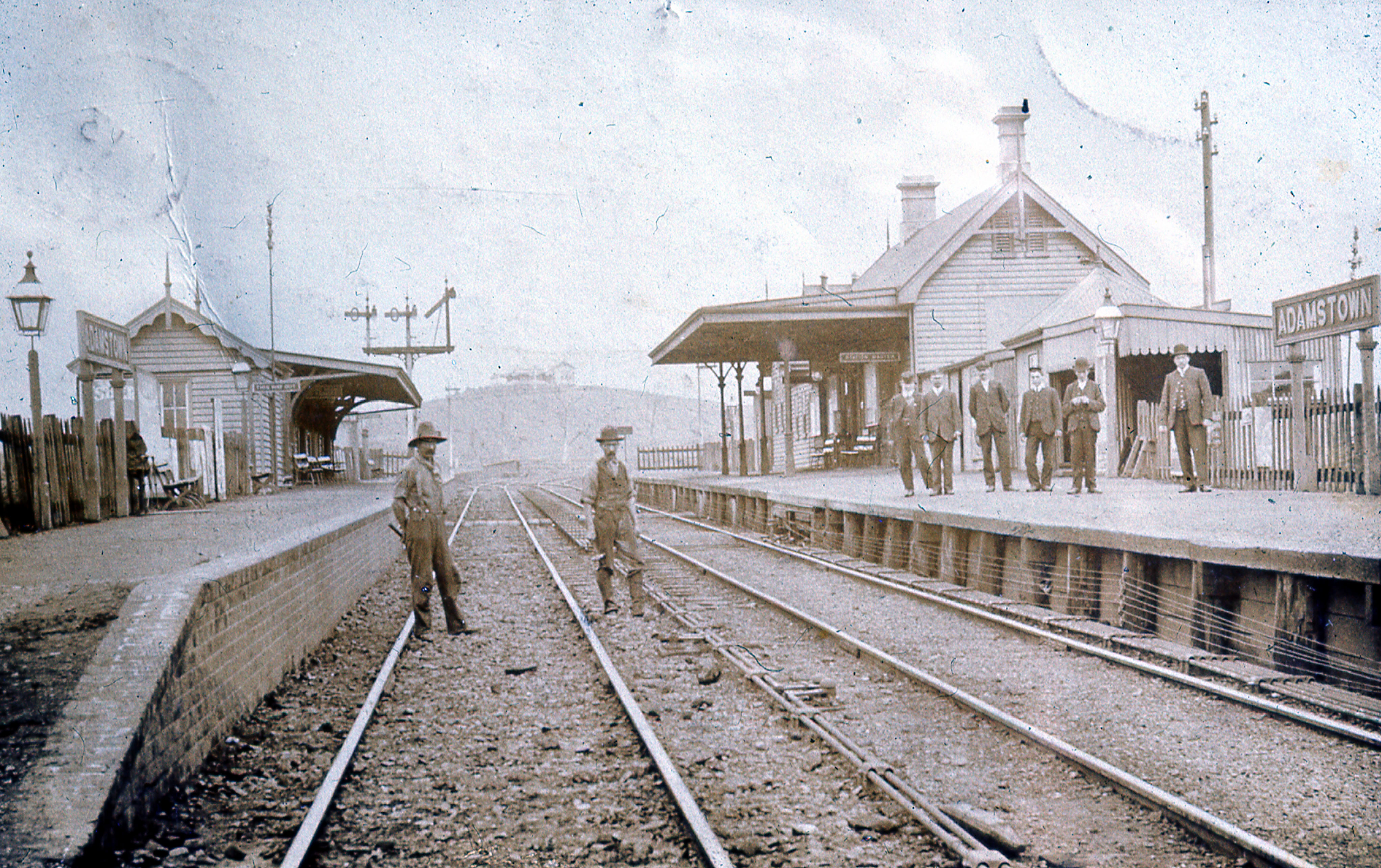
Adamstown is a List of suburbs in Greater Newcastle, New South Wales, suburb of Newcastle, New South Wales, Newcastle, New South Wales, Australia, located from Newcastle's central business district. It is split between the City of Newcastle and City of Lake Macquarie Local government areas of New South Wales, local government areas. History The suburb takes its name from Thomas Adams, who purchased a land grant of 54 acres of Crown land. Adamstown officially became a suburb in 1885 and the first council was elected in 1886 with the council chambers being completed in 1892. In 1938 Adamstown merged into other local council areas to become the areas of Greater Newcastle. The Adamstown railway station, New South Wales, Adamstown railway station opened in 1887 with the Newcastle–Gosford, New South Wales, Gosford section of the Main North railway line, New South Wales, Main North line. The now closed branch line to Belmont, New South Wales, Belmont formerly left the main line ... [...More Info...] [...Related Items...] OR: [Wikipedia] [Google] [Baidu] |
Castletownkindalen
Castletownkindalen () is a civil parish in County Westmeath, Ireland. It is located about south–west of Mullingar. Castletownkindalen is one of 8 civil parishes in the barony of Moycashel in the province of Leinster Leinster ( ; or ) is one of the four provinces of Ireland, in the southeast of Ireland. The modern province comprises the ancient Kingdoms of Meath, Leinster and Osraige, which existed during Gaelic Ireland. Following the 12th-century .... The civil parish covers . Castletownkindalen civil parish comprises the village of Castletown Geoghegan and 41 townlands: Adamstown, Ballybrennan, Ballybrown, Ballyhast, Ballykilroe, Ballynacoska, Ballynagore, Balrath, Bredagh, Castletown, Clonsingle, Cloonagh, Conranstown, Dooraheen, Dromore, Garhy, Glengorm, Gneevebeg, Gneevebrack, Keelbeg, Kilbalraherd, Kilhugh, Killalea, Killeen, Killinlahan, Kippinduff, Knockacurra, Lissakilly, Lurrig, Mabrista, Rathdrishoge, Rathnugent, Shurock, Sraduff, Sraneeg, Teernacre ... [...More Info...] [...Related Items...] OR: [Wikipedia] [Google] [Baidu] |
Conry (civil Parish)
Conry () Conry civil parish ''The Placenames Database of Ireland'' Retrieved on 1 August 2015. is a in , Ireland. It is located about west–south–west of . Conry is one of 9 civil parishes in the of [...More Info...] [...Related Items...] OR: [Wikipedia] [Google] [Baidu] |
County Louth
County Louth ( ; ) is a coastal Counties of Ireland, county in the Eastern and Midland Region of Republic of Ireland, Ireland, within the Provinces of Ireland, province of Leinster. Louth is bordered by the counties of County Meath, Meath to the south, County Monaghan, Monaghan to the west, County Armagh, Armagh to the north and County Down, Down to the north-east, across Carlingford Lough. It is the List of Irish counties by area, smallest county in Ireland by land area and the List of Irish counties by population, 17th most populous, with just over 139,100 residents 2022 census of Ireland, as of 2022. The county is named after the village of Louth, County Louth, Louth. Louth County Council is the Local government in the Republic of Ireland, local authority for the county. History County Louth is named after the Louth, County Louth, village of Louth, which in turn is named after Lugh, a god of the ancient Irish. Historically, the placename has had various spellings; , , and ( ... [...More Info...] [...Related Items...] OR: [Wikipedia] [Google] [Baidu] |
County Meath
County Meath ( ; or simply , ) is a Counties of Ireland, county in the Eastern and Midland Region of Republic of Ireland, Ireland, within the Provinces of Ireland, province of Leinster. It is bordered by County Dublin to the southeast, County Louth, Louth to the northeast, County Kildare, Kildare to the south, Offaly to the southwest, Westmeath to the west, County Cavan, Cavan to the northwest, and County Monaghan, Monaghan to the north. To the east, Meath also borders the Irish Sea along a narrow strip between the rivers River Boyne, Boyne and Delvin River, Delvin, giving it the List of Irish counties by coastline, second shortest coastline of any county. Meath County Council is the Local government in the Republic of Ireland, local authority for the county. Meath is the List of Irish counties by area, 14th-largest of Ireland's 32 traditional counties by land area, and the List of Irish counties by population, 8th-most populous, with a total population of 220,826 according to ... [...More Info...] [...Related Items...] OR: [Wikipedia] [Google] [Baidu] |
Adamstown, County Wexford
Adamstown () is a village in County Wexford, Ireland. It is about north-west of Wexford, east of New Ross, and south-west of Enniscorthy. The village is in a townland and civil parish of the same name. History A monastery called Magheranoidhe was built in the area c. 600 AD by a Saint Abban different from Abbán moccu Corbmaic. Following the Norman conquest of Ireland, the monastery became property of the Marshall family. The de Heddon and later Devereux families were granted control of it and the surrounding lands. A castle was built in the area by Adam Devereux, for who the village is named, in 1418. This castle was rebuilt in 1556 by Nicholas Devereux. The Adamstown estate later passed to the Earl of Albemarle, and later the Downes family by the 1800s. A church dedicated to St. Abban was built in Adamstown in 1835. Amenities The village contains a primary school, a secondary school, a GAA pitch and soccer pitch, a community centre, two pubs, a shop, an R.C. church and ... [...More Info...] [...Related Items...] OR: [Wikipedia] [Google] [Baidu] |
Adamstown, Dublin
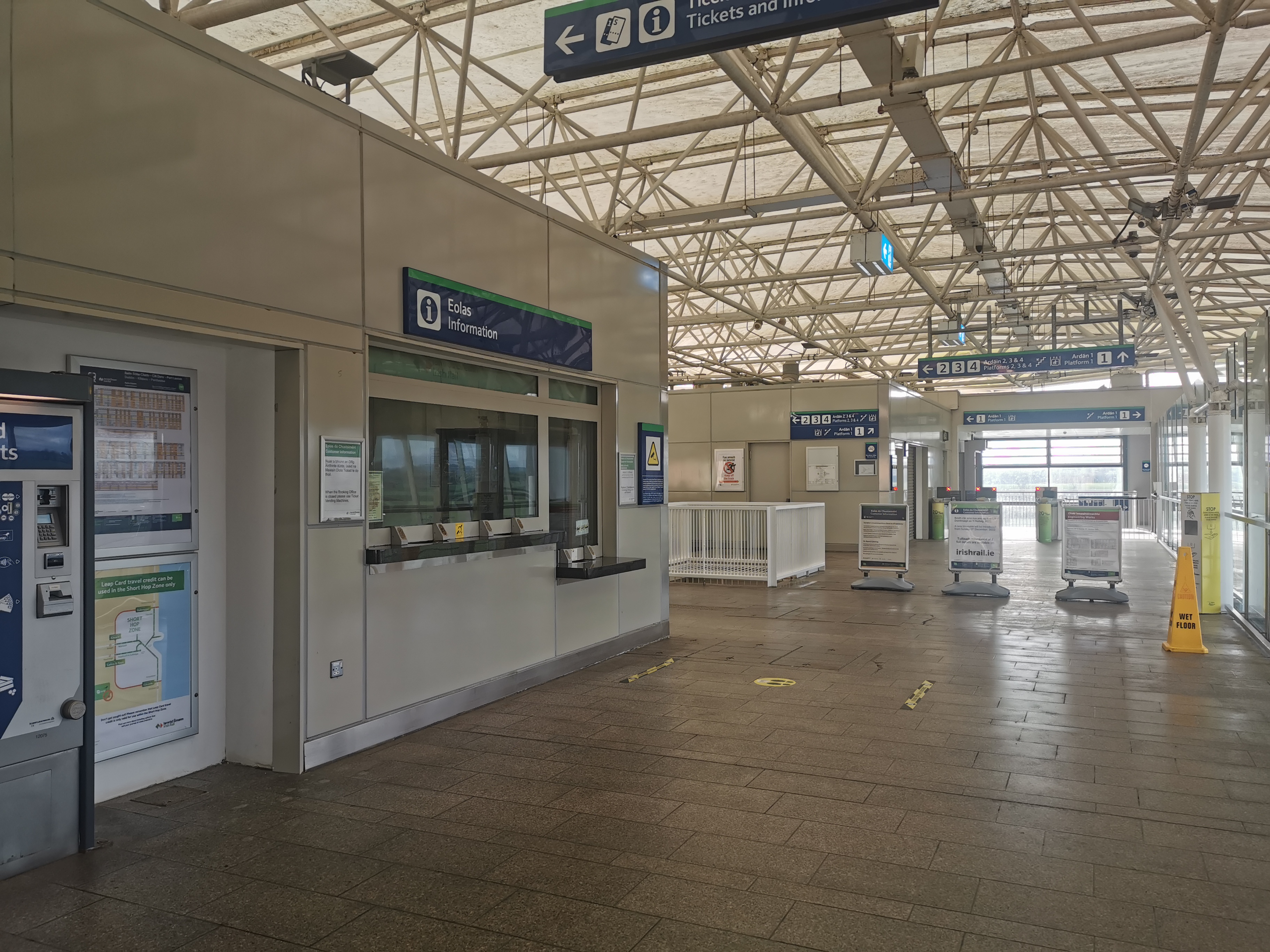
Adamstown () is a planned town and suburban development in County Dublin, Ireland. Located approximately 16 km from Dublin city centre, it is in the jurisdiction of South Dublin County Council. The first planned town to be developed in Ireland since Shannon Town in the 1980s, the development-in-progress is based on a 220 hectare site which is a designated Strategic Development Zone. This site lies south of the N4 road and Lucan, west of a River Liffey tributary, the Griffeen River, and north of the Grand Canal. While no date has been set for the official granting of any long-term official status (as of 2022 the local authority described it as an "emerging new town"), development has been underway since 2005. As of 2015, perhaps 4,500 of a planned population of 25,000 were resident and by 2022 had reached approximately 10,000. As of 2020, the planned scale of development was approximately 9,000 dwellings, with supporting infrastructure including public transport links. Geog ... [...More Info...] [...Related Items...] OR: [Wikipedia] [Google] [Baidu] |
Adamstown, Pitcairn Islands
Adamstown is the capital and only settlement of the Pitcairn Islands, the only British Overseas Territory that is located in the southern Pacific Ocean. As of 2023, Adamstown has a population of 35, which is the entire population of the Pitcairn Islands. All the other islands in the group are uninhabited. Adamstown is where all residents live, while they grow food in other areas of the island. Adamstown is the third-smallest capital in the world by population. It has access to television, satellite Internet and a telephone; however, the main means of communication remains ham radio. The "Hill of Difficulty" connects the island's jetty to the town. History The history of the Pitcairn Islands begins with the settlement of the islands by Polynesians in the 11th century. The Polynesians established a culture that flourished for four centuries and then vanished. Pitcairn was settled again in 1790 by a group of British mutineers on HMS ''Bounty'' and Tahitians. Adamstown is ... [...More Info...] [...Related Items...] OR: [Wikipedia] [Google] [Baidu] |
Neals Diggins, California
Neals Diggins (also, Neals Diggings; later, Adamstown, Adamsville, and Adams Bar) is a former settlement and mining camp in Butte County, California, United States The United States of America (USA), also known as the United States (U.S.) or America, is a country primarily located in North America. It is a federal republic of 50 U.S. state, states and a federal capital district, Washington, D.C. The 48 .... It was located on the Feather River upstream of Oroville, on the opposite bank from Long's Bar. It was founded by Sam Neal, a local rancher, in 1848. Later that year, George Adams re-established the place and named it for himself. References Former settlements in Butte County, California Former populated places in California Populated places established in 1848 {{ButteCountyCA-geo-stub ... [...More Info...] [...Related Items...] OR: [Wikipedia] [Google] [Baidu] |
Adamstown, Maryland
Adamstown is an unincorporated community and census-designated place (CDP) in Frederick County, Maryland, United States. It is named for Adam Kohlenberg (March 11, 1819 – January 1, 1868), a station agent and first town merchant who owned much of present-day Adamstown. As of the 2010 census, the Adamstown CDP had a population of 2,372. History Adamstown lies in the fertile valley between Sugarloaf and Catoctin Mountain on the former Carrollton Manor, a estate originally owned by Charles Carroll of Carrollton. Until 2000, it was a little-altered representative of mid-19th century linear town planning. It is significant in architecture for its variety of structures, including residential, commercial, industrial, educational, agricultural, and religious buildings. The late 18th century road from Jefferson to Greenfield Mills on the Monocacy River, originally called the Bridal Road, followed the route of the present-day Mountville Road. The 1832 arrival of the railroad to t ... [...More Info...] [...Related Items...] OR: [Wikipedia] [Google] [Baidu] |


