|
A180 Road (England)
The A180 is a primary route in northern England, that runs from the M180 motorway to Cleethorpes. The road is a continuation of the M180, but built to lower specifications: it is mainly dual two-lane without hard shoulders. The road is (mostly grade separation, grade separated) dual carriageway for from the M180 to Grimsby, and is a single carriageway road for between Grimsby and Cleethorpes beach. Route The A180 begins at junction 5 of the M180 in North Lincolnshire, where it picks up traffic from the motorway and the A15 road (Great Britain), A15 road heading towards the ports of Grimsby and Immingham. The road crosses the border into North East Lincolnshire and has a junction with the A160 road to Immingham Dock. It bypass route, bypasses the town of Immingham and Habrough before meeting the A1173 road (linking to the A46 road to Lincoln, Lincolnshire, Lincoln). The road then has a junction with the A1136 road prior to having two roundabout junctions with local roads. In ce ... [...More Info...] [...Related Items...] OR: [Wikipedia] [Google] [Baidu] |
Barnetby-le-Wold
Barnetby le Wold is a village and Civil parishes in England, civil parish in North Lincolnshire, Lincolnshire, England, located between Brigg and Immingham. The village is also near Barton-upon-Humber. Barnetby railway station serves the village and Humberside Airport. History Evidence of early settlement is indicated by the finding of a cast copper broach in the village, which was based on a late Roman age coin. The village was named in the ''Domesday Book'' of 1086, where it is called "Bernodebi" which is derived from the Scandinavian name "Beornnoth", a potential Dane who settled and gave his name to the area. As such, the village was historically part of the Danelaw area of England but by 1086 was recorded as in the lordship of William de Percy. The "le Wold" denotes that the village is part of the greater Lincolnshire Wolds geographic area. The historical animal husbandry method of tethering cattle was carried out in the village and there is a place called teatherings ... [...More Info...] [...Related Items...] OR: [Wikipedia] [Google] [Baidu] |
Habrough
__NOTOC__ Habrough ( ) is a village and civil parish in North East Lincolnshire, England, north-west of Grimsby and inland from the Humber estuary at the southern edge of the A180 road, just west of Immingham and south of South Killingholme. Humberside Airport is to the south-west. The parish has an area of . History Habrough is listed in the 1086 ''Domesday Book'', with 28 households, a mill and a saltern. There was a manor house here, of which only earthworks remain south east from the church. It belonged during the 13th and 14th centuries to the de Saltfletby family, and later the Skipwith family. The manor was reputedly abandoned when the Skipwith line died out. Today the village has land owned by the Earl of Yarborough and is situated less than away from the Brocklesby House Estate of the Earl of Yarborough. The name Habrough is found in old records as "Haburgh". Community The Anglican parish church is dedicated to St Margaret. The church tower was res ... [...More Info...] [...Related Items...] OR: [Wikipedia] [Google] [Baidu] |
Borough Of North Lincolnshire
A borough is an administrative division in various English-speaking countries. In principle, the term ''borough'' designates a self-governing walled town, although in practice, official use of the term varies widely. History In the Middle Ages, boroughs were settlements in England that were granted some self-government; burghs were the Scottish equivalent. In medieval England, boroughs were also entitled to elect members of parliament. The use of the word ''borough'' probably derives from the burghal system of Alfred the Great. Alfred set up a system of defensive strong points (Burhs); in order to maintain these particular settlements, he granted them a degree of autonomy. After the Norman Conquest, when certain towns were granted self-governance, the concept of the burh/borough seems to have been reused to mean a self-governing settlement. The concept of the borough has been used repeatedly (and often differently) throughout the world. Often, a borough is a single town with i ... [...More Info...] [...Related Items...] OR: [Wikipedia] [Google] [Baidu] |
Kenneth Marks
Kenneth Marks (15 June 1920 – 13 January 1988) was a Labour Party politician in the United Kingdom. Marks was Member of Parliament (MP) for Manchester Gorton from a 1967 by-election to 1983. From 1975 to 1979, he was a junior Environment minister. He was educated at the Central High School, Manchester and Manchester Academy (secondary school). In 1955 he unsuccessfully contested Manchester Moss Side at the general election. Before his by-election success, Marks served as a Labour councillor on the Denton Urban District Council, representing Denton West. Prior to entering parliament he was a secondary school head teacher.Hansard, House of Commons, Vol. 796, Col. 1464, 26 February 1970. He was also a member of the National Union of Teachers and served on its advisory committee for secondary schools. In parliament he was chairman of the Labour Party's social security group and vice chairman of its education group, as well as serving on the Select committee on Education ... [...More Info...] [...Related Items...] OR: [Wikipedia] [Google] [Baidu] |
A1098 Road
This is a list of A roads in zone 1 in Great Britain beginning north of the River Thames The River Thames ( ), known alternatively in parts as the The Isis, River Isis, is a river that flows through southern England including London. At , it is the longest river entirely in England and the Longest rivers of the United Kingdom, s ..., east of the A1 (roads beginning with 1). Single- and double-digit roads Triple-digit roads Four-digit roads 1000s 1100s 1200s and higher References {{DEFAULTSORT:A Roads in Zone 1 of the Great Britain Numbering Scheme 1 1 1 ... [...More Info...] [...Related Items...] OR: [Wikipedia] [Google] [Baidu] |
Boston, Lincolnshire
Boston is a market town and inland port in the borough of the same name in the county of Lincolnshire, England. It lies to the south-east of Lincoln, east of Nottingham and north-east of Peterborough. The town had a population of 45,339 at the 2021 census, while the borough had an estimated population of 66,900 at the ONS mid-2015 estimates. The Haven in Boston flows about 5 miles away to the Lincolnshire coast at The Wash, a bay between Lincolnshire and Norfolk. Boston's most notable landmark is St Botolph's Church, colloquially referred to as 'The Stump', the largest parish church in England, which is visible from miles away across the flat lands of Lincolnshire. Residents of Boston are known as Bostonians. Emigrants from Boston named several other settlements around the world after the town—most notably Boston, Massachusetts, then a British colony and now part of the United States. Etymology The name ''Boston'' is said to be a contraction of " Saint Botolph's to ... [...More Info...] [...Related Items...] OR: [Wikipedia] [Google] [Baidu] |
Louth, Lincolnshire
Louth () is a market town and Civil parishes in England, civil parish in the East Lindsey district of Lincolnshire, England.OS Explorer map 283:Louth and Mablethorpe: (1:25 000): Louth serves as an important town for a large rural area of eastern Lincolnshire. Visitor attractions include St James' Church, Louth, St James' Church, Hubbard's Hills, the market, many independent retailers, and Lincolnshire's last remaining cattle market. Geography Louth is at the foot of the Lincolnshire Wolds where they meet the Lincolnshire Marsh. It developed where the ancient trackway along the Wolds, known as the Barton Street, crossed the River Lud. The town is east of a gorge carved into the Wolds that forms the Hubbard's Hills. This area was formed from a glacial overspill channel in the last glacial period. The River Lud meanders through the gorge before entering the town. Directly to the southeast of Louth is the village of Legbourne, to the northeast is the village of Keddington, ... [...More Info...] [...Related Items...] OR: [Wikipedia] [Google] [Baidu] |
A16 Road (Great Britain)
A16, A 16, A.16 or A-16 may refer to: *A16 road, in several countries * ATC code A16, ''Other alimentary tract and metabolism products'', a subgroup of the Anatomical Therapeutic Chemical Classification System * British NVC community A16 (Callitriche stagnalis community), a British Isles plant community It may also refer to: * A16, a restaurant in the San Francisco Bay Area * Subfamily A16, a rhodopsin-like receptors subfamily * One of the Encyclopaedia of Chess Openings codes for the English Opening in chess * Washington A16, 2000 Protests in Washington, D.C. against the International Monetary Fund and the World Bank on April 16 of 2000 and 2005, both known as "A16" Technology * Apple A16 Bionic, a system on a chip mobile processor designed by Apple * Samsung Galaxy A16, an Android device developed by Samsung Electronics Transportation * Aviadesign A-16 Sport Falcon, an American light-sport aircraft * Focke-Wulf A.16, a 1926 German three-four passenger light transport monoplane ... [...More Info...] [...Related Items...] OR: [Wikipedia] [Google] [Baidu] |
Roundabout
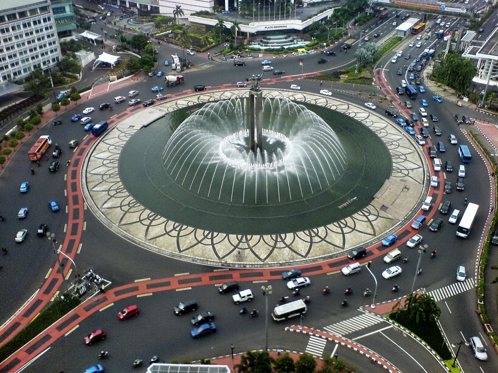
A roundabout, a rotary and a traffic circle are types of circular intersection or junction in which road traffic is permitted to flow in one direction around a central island, and priority is typically given to traffic already in the junction.''The New Shorter Oxford English Dictionary,'' Volume 2, Clarendon Press, Oxford (1993), page 2632 In the United States, engineers use the term modern roundabout to refer to junctions installed after 1960 that incorporate design rules to increase safety. Compared to stop signs, traffic signals, and earlier forms of roundabouts, modern roundabouts reduce the likelihood and severity of collisions greatly by reducing traffic speeds through horizontal deflection and minimising T-bone and head-on collisions. Variations on the basic concept include integration with tram or train lines, two-way flow, higher speeds and many others. For pedestrians, traffic exiting the roundabout comes from one direction, instead of three, simplifying the p ... [...More Info...] [...Related Items...] OR: [Wikipedia] [Google] [Baidu] |
A1136 Road
This is a list of A roads in zone 1 in Great Britain beginning north of the River Thames The River Thames ( ), known alternatively in parts as the The Isis, River Isis, is a river that flows through southern England including London. At , it is the longest river entirely in England and the Longest rivers of the United Kingdom, s ..., east of the A1 (roads beginning with 1). Single- and double-digit roads Triple-digit roads Four-digit roads 1000s 1100s 1200s and higher References {{DEFAULTSORT:A Roads in Zone 1 of the Great Britain Numbering Scheme 1 1 1 ... [...More Info...] [...Related Items...] OR: [Wikipedia] [Google] [Baidu] |
Lincoln, Lincolnshire
Lincoln () is a cathedral city and district in Lincolnshire, England, of which it is the county town. In the 2021 Census, the city's district had a population of 103,813. The 2021 census gave the urban area of Lincoln, including Bracebridge Heath, North Hykeham, South Hykeham and Waddington, a recorded population of 127,540. Roman '' Lindum Colonia'' developed from an Iron Age settlement of Britons on the River Witham, near the Fosse Way road. Over time its name was shortened to Lincoln, after successive settlements, including by Anglo-Saxons and Danes. Landmarks include Lincoln Cathedral ( English Gothic architecture; for over 200 years the world's tallest building) and the 11th-century Norman Lincoln Castle. The city hosts the University of Lincoln, Bishop Grosseteste University, Lincoln City F.C. and Lincoln United F.C. Lincoln is the largest settlement in Lincolnshire, with the towns of Grimsby second largest and Scunthorpe third. Etymology The name Lincol ... [...More Info...] [...Related Items...] OR: [Wikipedia] [Google] [Baidu] |


