|
A121 Highway (Nigeria)
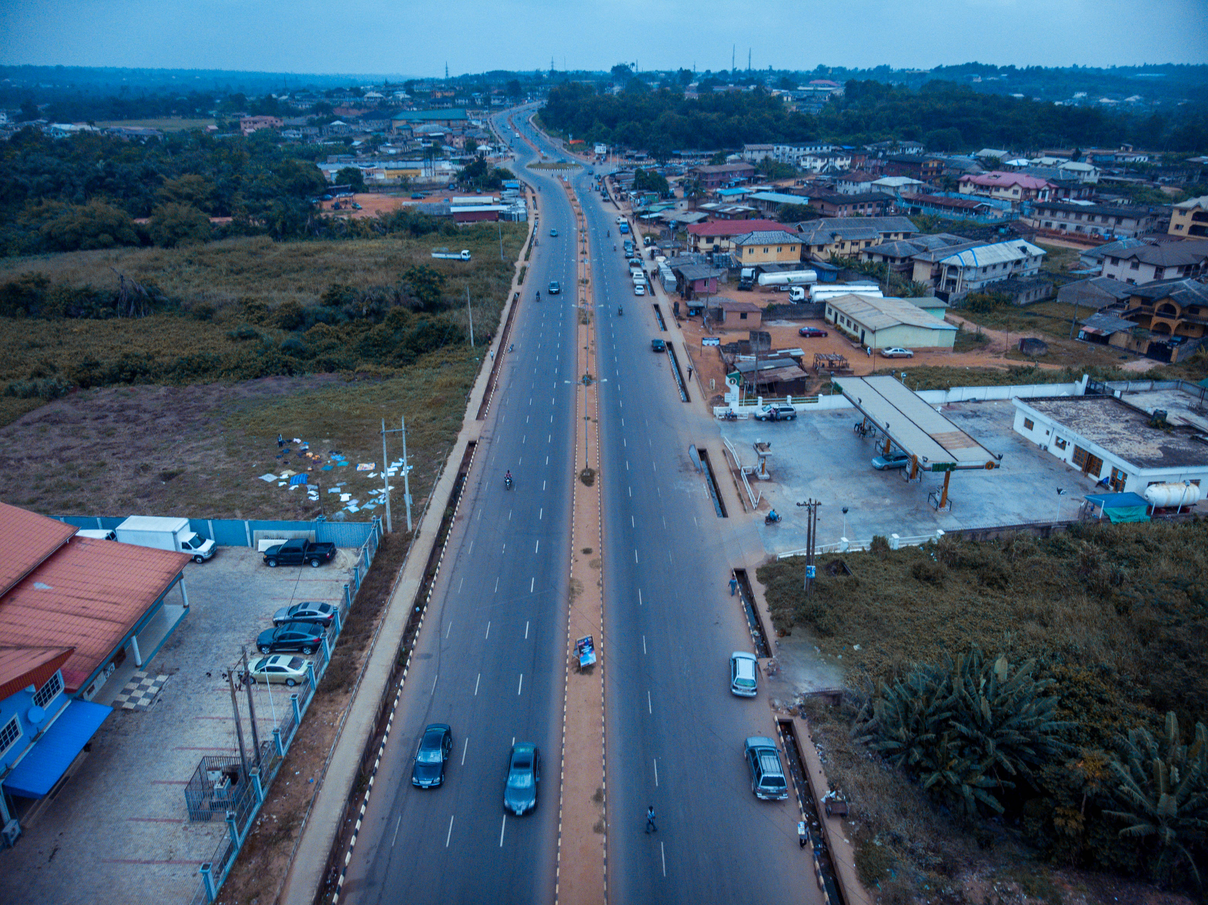
The A121 highway is located in Nigeria. It is one of the ''east-west'' roads linking the main ''south-north'' roads. It is named from the two highways it links. The A1 highway at Shagamu, in Ogun State connects to the A2 highway at Benin City, Edo State. The town of Ijebu Ode Ijebu-Ode is a town in Ogun State, South Western geopolitical zone in Nigeria, close to the A121 highway. The city is located 110 km by road Northeast of Lagos; it is within of the Atlantic Ocean in the eastern part of Ogun State and po ... is on this road. References Highways in Nigeria {{Nigeria-road-stub ... [...More Info...] [...Related Items...] OR: [Wikipedia] [Google] [Baidu] |
Nigeria
Nigeria, officially the Federal Republic of Nigeria, is a country in West Africa. It is situated between the Sahel to the north and the Gulf of Guinea in the Atlantic Ocean to the south. It covers an area of . With Demographics of Nigeria, a population of more than 230 million, it is the List of African countries by population, most populous country in Africa, and the List of countries and dependencies by population, world's sixth-most populous country. Nigeria borders Niger in Niger–Nigeria border, the north, Chad in Chad–Nigeria border, the northeast, Cameroon in Cameroon–Nigeria border, the east, and Benin in Benin–Nigeria border, the west. Nigeria is a Federation, federal republic comprising 36 States of Nigeria, states and the Federal Capital Territory, Nigeria, Federal Capital Territory, where its capital, Abuja, is located. The List of Nigerian cities by population, largest city in Nigeria by population is Lagos, one of the largest List of largest cities, metr ... [...More Info...] [...Related Items...] OR: [Wikipedia] [Google] [Baidu] |
A1 Highway (Nigeria)
The A1 highway is a major road in Nigeria, connecting Lagos in the south to the border with Niger Niger, officially the Republic of the Niger, is a landlocked country in West Africa. It is a unitary state Geography of Niger#Political geography, bordered by Libya to the Libya–Niger border, north-east, Chad to the Chad–Niger border, east ... in the north at Birnin Konni. Route description The A1 highway, also known as Route 1, spans a significant distance across Nigeria, passing through major cities including Lagos, Ibadan, Minna, and Birnin Konni at the border with Niger.The Trans-Saharan Road Liaison Committee TRLC. (2009). ''Study of Identification of Potential Trade between the Member Countries of the Trans-Saharan Road Liaison Committee'' https://www.badea.org/Portal/Document_Repository/96/1_english_rep.pdf''.'' clrt-afrique.com. Connectivity The A1 highway facilitates trade, travel, and connectivity between Algeria's capital, Algiers, and the Republic of Niger. ... [...More Info...] [...Related Items...] OR: [Wikipedia] [Google] [Baidu] |
Shagamu
Sagamu or Ishagamu is an agglomeration of thirteen towns in southwestern Nigeria. It is located in Ogun State along the Ibu River and Eruwuru Stream between Lagos and Ibadan. It was founded in the mid 19th century by members of the Remo branch of the Yoruba people. The 13 towns are: Makun, Offin, Sonyindo, Epe, Ibido, Igbepa, Ado, Oko, Ipoji, Batoro, Ijoku, Ijagba and Latawa. It is the capital of Remo Kingdom, and the paramount ruler of the kingdom, the ''Akarigbo'' of Remo, has his palace is in the town of Offin. The Sagamu region is underlain by major deposits of limestone, which is used in the city's major industry, the production of cement. Agricultural products of the region include cocoa and kola nuts. Sagamu is the largest kola nut collecting center in the country. The kola nut industry supports several secondary industries such as basket and rope manufacturing, which are used to store the kola nuts. The city was founded in the mid-19th century when several small ... [...More Info...] [...Related Items...] OR: [Wikipedia] [Google] [Baidu] |
Ogun State
Ogun State is a state in southwestern Nigeria. It is bordered to the south by Lagos State and the Bight of Benin, to the east by Ondo State, and to the north by Oyo and Osun states while its western border forms part of the national border with the Republic of Benin. The capital and largest city is Abeokuta, and the state is divided into 20 local government areas. Of the 36 states, Ogun is the 24th largest in area but among the top fifteen most populous, with an estimated population of about 6.4 million as of 2020. Geographically, the state lies primarily in the tropical Nigerian lowland forests ecoregion, although parts of the state's north transition into the Guinean forest–savanna mosaic and some of the coastal south reach the Central African mangrove ecoregion. The Ogun and Yewa rivers are the state’s major waterways while the Omo Forest Reserve in the southeastern part of the state is one of the most important conservation areas in the country — home t ... [...More Info...] [...Related Items...] OR: [Wikipedia] [Google] [Baidu] |
A2 Highway (Nigeria)
The A2 highway is a federal highway in Nigeria that spans . It serves as a vital transportation route, connecting the country's southern and northern regions. Route description The A2 begins in the bustling city of Port Harcourt, located in Rivers State, and heads westward, passing through Elele in the same state. It then proceeds to the city of Warri in Delta State before reaching Benin City in Edo State. From Benin City, the A2 turns northward, leading to Ekpoma, another town in Edo State, and further on to Okene, situated in Kogi State. Continuing north, the highway enters the Federal Capital Territory, connecting Nigeria's capital city, Abuja. The A2 then heads northward, passing through Kaduna and Zaria in Kaduna State. Further north, it reaches the metropolis of Kano, providing a transportation link for the region. Beyond Kano, the A2 continues its journey northward, reaching Kazaure in Jigawa State before culminating at Daura in Katsina State. Finally, the highway ... [...More Info...] [...Related Items...] OR: [Wikipedia] [Google] [Baidu] |
Benin City
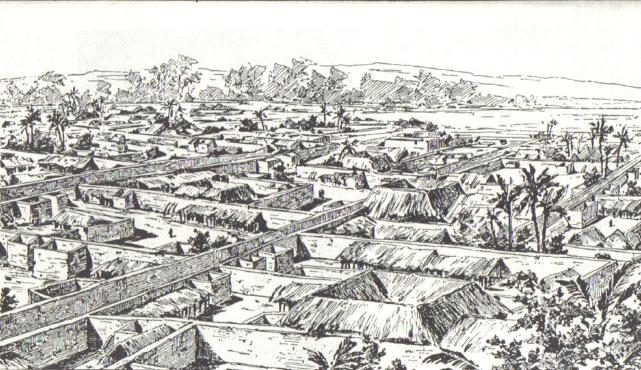
Benin City serves as the Capital city, capital and largest Metropolitan area, metropolitan centre of Edo State, situated in Nigeria, southern Nigeria. It ranks as the List of Nigerian cities by population, fourth-most populous city in Nigeria, according to the Census in Nigeria, 2006 national census, preceded by Lagos, Kano (city), Kano, and Ibadan. Geography Benin City is located in close proximity to the Benin River, situated approximately to the north, whilst its eastern perimeter lies from Lagos via the arterial road network. The city's municipal boundaries converge with those of several prominent neighbouring towns in Nigeria, southern Nigeria, notably Agbor, Oghara, and Ekpoma. Agriculture Benin City boasts an exceptionally fertile agricultural landscape and serves as the epicentre of Nigeria's thriving Natural rubber, rubber industry. Additionally, the production of palm oil constitutes a substantial sector, further underscoring the city's prominence in Nigeria ... [...More Info...] [...Related Items...] OR: [Wikipedia] [Google] [Baidu] |
Edo State
Edo State, Edo, officially known as Edo State, is a States of Nigeria, state in the South South, South-South Geopolitical zones of Nigeria, geopolitical zone of the Federal Republic of Nigeria. As of 2024, the state was ranked as the List of Nigerian states by population, 20th most populous state (5,250,000) in Nigeria. The estimated state population is around 4,777,000 in 2021. Edo State is the List of Nigerian states by area, 21st largest state by landmass in Nigeria. The state's capital and largest city, Benin City, is the List of Nigerian cities by population, fourth largest city in Nigeria and the centre of the country's rubber industry. Created in 1991 from the former Bendel State, it is also known as the heartbeat of the nation. Edo State borders Kogi State to the north for 133 km and across the Niger River for 81 km to the northeast, Anambra State to the east for about four km across the Niger River, Delta State to the southeast and south for 350 km (218 mi ... [...More Info...] [...Related Items...] OR: [Wikipedia] [Google] [Baidu] |
Ijebu Ode
Ijebu-Ode is a town in Ogun State, South Western geopolitical zone in Nigeria, close to the A121 highway. The city is located 110 km by road Northeast of Lagos; it is within of the Atlantic Ocean in the eastern part of Ogun State and possesses a warm tropical climate. According to the '' Britannica'', by the 16th century, it was established as the chief town, and since pre-colonial times it has been the capital of the Ijebu kingdom. There are around 2,119,221 Ijebus around south-west Nigeria, in Lagos and Ogun states.It has an estimated population of 394,246(2024). It is home to Sungbo's Eredo one of the largest ramparts in West Africa. As with most Ijebus, people from Ijebu Ode have a nationwide reputation of being natural entrepreneurs, The primary cultural food is "Ikokore". History The largest city inhabited by the Ijebus, a sub-group of the Yoruba ethnic group who speak the Ijebu dialect of Yoruba, it is historically and culturally the headquarters of Ijebul ... [...More Info...] [...Related Items...] OR: [Wikipedia] [Google] [Baidu] |


