|
2010 Baja California Earthquake
The 2010 Baja California earthquake (also known as 2010 Easter earthquake, 2010 Sierra El Mayor earthquake, or 2010 El Mayor – Cucapah earthquake) occurred on April 4 (Easter Sunday) with a moment magnitude of 7.2 and a maximum Mercalli intensity of VII (''Very strong''). The shock originated at (3:40:41 PM PDT) south of Guadalupe Victoria, Baja California, Mexico. The 89-second quake was widely felt throughout northwest Mexico and southern California. It was also the strongest to rock southern California in at least 18 years (since the M 7.3 1992 Landers earthquake), if not longer: the next most recent comparable earthquake—the 1952 Kern County earthquake (M 7.3)—was 58 years earlier. Each of these earthquakes had a similar magnitude, and was also felt across a large swath of North America. Most of the damage occurred in the twin cities of Mexicali and Calexico on the Mexico–United States border. Geology The quake originally was believed to have occurred on the Lagun ... [...More Info...] [...Related Items...] OR: [Wikipedia] [Google] [Baidu] |
Fault (geology)
In geology, a fault is a planar fracture or discontinuity in a volume of rock across which there has been significant displacement as a result of rock-mass movements. Large faults within Earth's crust result from the action of plate tectonic forces, with the largest forming the boundaries between the plates, such as the megathrust faults of subduction zones or transform faults. Energy release associated with rapid movement on active faults is the cause of most earthquakes. Faults may also displace slowly, by aseismic creep. A ''fault plane'' is the plane that represents the fracture surface of a fault. A '' fault trace'' or ''fault line'' is a place where the fault can be seen or mapped on the surface. A fault trace is also the line commonly plotted on geologic maps to represent a fault. A ''fault zone'' is a cluster of parallel faults. However, the term is also used for the zone of crushed rock along a single fault. Prolonged motion along closely spaced faults can blur ... [...More Info...] [...Related Items...] OR: [Wikipedia] [Google] [Baidu] |
Seismic Zone
In seismology, a seismic zone or seismic belt is an area of seismicity potentially sharing a common cause. It may also be a region on a map for which a common areal rate of seismicity is assumed for the purpose of calculating probabilistic ground motions. An obsolete definition is a region on a map in which a common level of seismic design is required. A type of seismic zone is a Wadati–Benioff zone which corresponds with the down-going slab in a subduction zone. Examples * Charlevoix Seismic Zone (Quebec, Canada) *New Madrid Seismic Zone (Midwestern United States) *South West Seismic Zone (Western Australia Western Australia (commonly abbreviated as WA) is a state of Australia occupying the western percent of the land area of Australia excluding external territories. It is bounded by the Indian Ocean to the north and west, the Southern Ocean to t ...) See also * List of fault zones References {{seismology-stub ... [...More Info...] [...Related Items...] OR: [Wikipedia] [Google] [Baidu] |
Laguna Salada Fault - USGS Map
Laguna (Italian and Spanish for lagoon) may refer to: People * Abe Laguna (born 1992), American DJ known as Ookay * Andrés Laguna (1499–1559), Spanish physician, pharmacologist, and botanist * Ana Laguna (born 1955), Spanish-Swedish ballet dancer, court dancer and professor * Benjamín Máximo Laguna y Villanueva (1822–1902), Spanish forester * Frederica de Laguna (1906–2004), American anthropologist * Fábio Laguna (born 1977), Brazilian keyboardist * Grace de Laguna (1878–1978), American philosopher * Ieva Lagūna (born 1990), Latvian model * Jorge Laguna (born 1993), Mexican footballer * José Dapena Laguna (1912–1991), Puerto Rican politician - mayor of Ponce, Puerto Rico * José Durand Laguna (1889–1958), Argentine football manager * Justo Oscar Laguna (1929–2011), Argentinian bishop * Kenny Laguna (born 1948), American songwriter and record producer * Ricardo Laguna (born 1982), Mexican-American professional BMX rider and television personality * Theod ... [...More Info...] [...Related Items...] OR: [Wikipedia] [Google] [Baidu] |
United States Geological Survey
The United States Geological Survey (USGS), formerly simply known as the Geological Survey, is a scientific agency of the United States government. The scientists of the USGS study the landscape of the United States, its natural resources, and the natural hazards that threaten it. The organization's work spans the disciplines of biology, geography, geology, and hydrology. The USGS is a fact-finding research organization with no regulatory responsibility. The agency was founded on March 3, 1879. The USGS is a bureau of the United States Department of the Interior; it is that department's sole scientific agency. The USGS employs approximately 8,670 people and is headquartered in Reston, Virginia. The USGS also has major offices near Lakewood, Colorado, at the Denver Federal Center, and Menlo Park, California. The current motto of the USGS, in use since August 1997, is "science for a changing world". The agency's previous slogan, adopted on the occasion of its hundredt ... [...More Info...] [...Related Items...] OR: [Wikipedia] [Google] [Baidu] |
Holtville, California
Holtville (formerly, Holton) is a city in Imperial County, California. Holtville is located east of El Centro. The population was 5,939 at the 2010 census, up from 5,612 in 2000. History The city was founded in the 1880s by Swiss-German settlers, many of whom entered from Mexico. The construction of railroads in the 1890s, the All-American Canal in the late 1940s, and U.S. Route 80 in the 1920s (later converted to Interstate 8 in the 1970s) and the North American Free Trade Agreement (NAFTA) economic boom in the 1990s brought more people to Holtville and the Imperial Valley. The city of Holtville, which was originally called ''Holton'', was founded in 1903 by W.F. Holt, and incorporated on June 20, 1908. The name was changed to Holtville due to a request by the U. S. Postal Service because the name Holton sounded too much like Colton (in San Bernardino County), the regional headquarters of the Southern Pacific Railroad at the time. The name honors W.F. Holt, founder of the ... [...More Info...] [...Related Items...] OR: [Wikipedia] [Google] [Baidu] |
Brawley, California
Brawley (formerly, Braly) is a city in the Imperial Valley and within Imperial County, southern California, United States. The population was 24,953 at the 2010 census, up from 22,052 in 2000. The town has a significant cattle and feed industry, and hosts the annual Cattle Call Rodeo. Year-round agriculture is an important economic activity in Brawley. Summer daytime temperatures often exceed . History The Imperial Land Company laid out the town in 1902 and named it Braly in honor of J.H. Braly, who owned the land. After Braly refused to permit the use of his name, the name was changed to Brawley. The first post office at Brawley opened in 1903. Incorporated in 1908, it was a "tent city" of only 100 persons involved in railroads and the earliest introduction of agriculture. It had a population of 11,922 in 1950, but population growth was slow from the 1960s to the early 1990s. Geography Brawley is located in the Colorado Desert and Lower Colorado River Valley regions. The c ... [...More Info...] [...Related Items...] OR: [Wikipedia] [Google] [Baidu] |
Calipatria, California
Calipatria (portmanteau of ''California'' and ''Patria'', Spanish for "homeland") is a city in Imperial County, California. Calipatria is located north of El Centro. It is part of the El Centro Metropolitan Area. The population was 6,515 at the 2020 census, down from 7,710 at the 2010 census, up from 7,289 at the 2000 census, including 4000 inmates at Calipatria State Prison. The community is located along State Route 111. Geography Calipatria is located at . At an elevation of below sea level, Calipatria is the lowest elevation city in the western hemisphere. The city currently claims to have the "tallest flagpole (184 feet) where the flag flies at sea level" at , so their American flag will always fly above sea level. According to the Guinness Book of World Records, the Jeddah Flagpole holds the title of world's tallest, but it is entirely above sea level. According to the United States Census Bureau, the city has a total area of , all land. Climate This area ... [...More Info...] [...Related Items...] OR: [Wikipedia] [Google] [Baidu] |
Ocotillo, California
Ocotillo (; Spanish for " Vine cactus") is a census-designated place (CDP) in Imperial County, California. Ocotillo is located west of El Centro, The population was 215 at the 2020 census, down from 266 at the 2010 census and 296 at the 2000 census. It is part of the El Centro, California Metropolitan Statistical Area. Ocotillo was devastated by floods from Hurricane Kathleen in 1976; 3 people died. There is a cafe, a church, a small park, a community center, a small market, two bars, OHV rentals and a gas station. There is a Desert Museum with displays about the desert terrain, flora, etc. and artifacts from the Kumeyaay culture that inhabited the area which is located on the north side of Interstate 8. Geography According to the United States Census Bureau, the CDP has a total area of , all of it land. History Ocotillo is located on a site that originally sat on the edge of ancient Lake Cahuilla and is the traditional territory of the Kumeyaay. The town originated a ... [...More Info...] [...Related Items...] OR: [Wikipedia] [Google] [Baidu] |
Heber, California
Heber is a census-designated place (CDP) in Imperial County, California. Heber is located north-northwest of Calexico. The population was 4,275 at the 2010 census, up from 2,566 in 2000. Geography According to the United States Census Bureau, the CDP has a total area of , all land. History Heber was founded in 1903 by the Imperial Land Company. The first post office at Heber opened in 1904, having been established first as Bradtmoore a half mile north. The name honors A.H. Heber, president of the California Development Company. Demographics 2010 The 2010 United States Census reported that Heber had a population of 4,275. The population density was . The racial makeup of Heber was 2,174 (50.9%) White, 5 (0.1%) African American, 33 (0.8%) Native American, 15 (0.4%) Asian, 0 (0.0%) Pacific Islander, 1,758 (41.1%) from other races, and 290 (6.8%) from two or more races. Hispanic or Latino of any race were 4,197 persons (98.2%). The Census reported that 4,275 people (100% o ... [...More Info...] [...Related Items...] OR: [Wikipedia] [Google] [Baidu] |
El Centro, California
El Centro ( Spanish for "The Center") is a city and county seat of Imperial County, California, United States. El Centro is the largest city in the Imperial Valley, the east anchor of the Southern California Border Region, and the core urban area and principal city of the El Centro metropolitan area which encompasses all of Imperial County. El Centro is also the largest U.S. city to lie entirely below sea level (). The city, located in southeastern California, is from San Diego and less than from the Mexican city of Mexicali. The city was founded in 1906 by W. F. Holt and C.A. Barker, who purchased the land on which El Centro was eventually built for about and invested $100,000 ($ in dollars) in improvements. The modern city is home to retail, transportation, wholesale, and agricultural industries. There are also two international border crossings nearby for commercial and noncommercial vehicles. El Centro's census population as of 2020 was 44,322, up from 42,598 at the 20 ... [...More Info...] [...Related Items...] OR: [Wikipedia] [Google] [Baidu] |
Imperial, California
Imperial is a city in Imperial County, California, north of El Centro. As of the 2010 census, the city had a population of 14,758. It is part of the El Centro metropolitan area. In 2016, Imperial was the fourth fastest-growing city in the state, gaining 4.1 percent more residents from January 1, 2015, to January 1, 2016. It compares to Imperial County's growth of 1.3 percent and Brawley's growth of 1.2 percent. History Imperial was created by the Imperial Land Company and was named by George Chaffey. Imperial's first post office opened in 1901. Imperial incorporated in 1904. The first mayor of Imperial was Allison Peck. The town-site of Imperial was plotted in 1902 for home and commercial businesses. Its first buildings included a printing press, drug store, grocery store, brick building, and church. The city can also boast of having the first school in the valley and the first Chamber of Commerce. The City of Imperial was incorporated July 12, 1904 thus being the first ... [...More Info...] [...Related Items...] OR: [Wikipedia] [Google] [Baidu] |
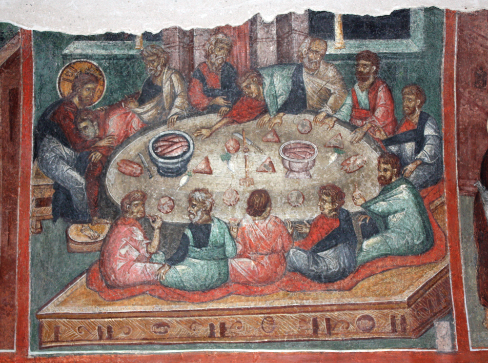
Easter Sunday
Easter,Traditional names for the feast in English are "Easter Day", as in the ''Book of Common Prayer''; "Easter Sunday", used by James Ussher''The Whole Works of the Most Rev. James Ussher, Volume 4'') and Samuel Pepys''The Diary of Samuel Pepys, Volume 2'') as well as the single word "Easter" in books printed i157515841586 also called Pascha ( Aramaic, Greek, Latin) or Resurrection Sunday, is a Christian festival and cultural holiday commemorating the resurrection of Jesus from the dead, described in the New Testament as having occurred on the third day of his burial following his crucifixion by the Romans at Calvary . It is the culmination of the Passion of Jesus Christ, preceded by Lent (or Great Lent), a 40-day period of fasting, prayer, and penance. Easter-observing Christians commonly refer to the week before Easter as Holy Week, which in Western Christianity begins on Palm Sunday (marking the entrance of Jesus in Jerusalem), includes Spy Wednesday (on which the betr ... [...More Info...] [...Related Items...] OR: [Wikipedia] [Google] [Baidu] |


.jpg)

