|
2010 Tarlac Local Elections
Local elections were held in the province of Tarlac on May 10, 2010, as part of the 2010 general election. Voters elected candidates for all local positions: four members of the Sangguniang Panlalawigan, vice governor, governor, and representatives for the three districts of Tarlac. Provincial elections The candidates for governor and vice governor with the highest number of votes won the seat; they were voted separately, and therefore, may be from different parties when elected. Parties are as stated in their certificate of candidacies. Gubernatorial election Vice-gubernatorial election Marcelino Aganon Jr. (Lakas Kampi CMD) was the incumbent but ineligible for reelection. Instead, he ran for governor (and lost). Congressional elections Each of Tarlac's three legislative districts elected a representative to the House of Representatives. The candidate with the highest number of votes won the seat. 1st District Incumbent Monica Prieto-Teodoro ... [...More Info...] [...Related Items...] OR: [Wikipedia] [Google] [Baidu] |
Tarlac
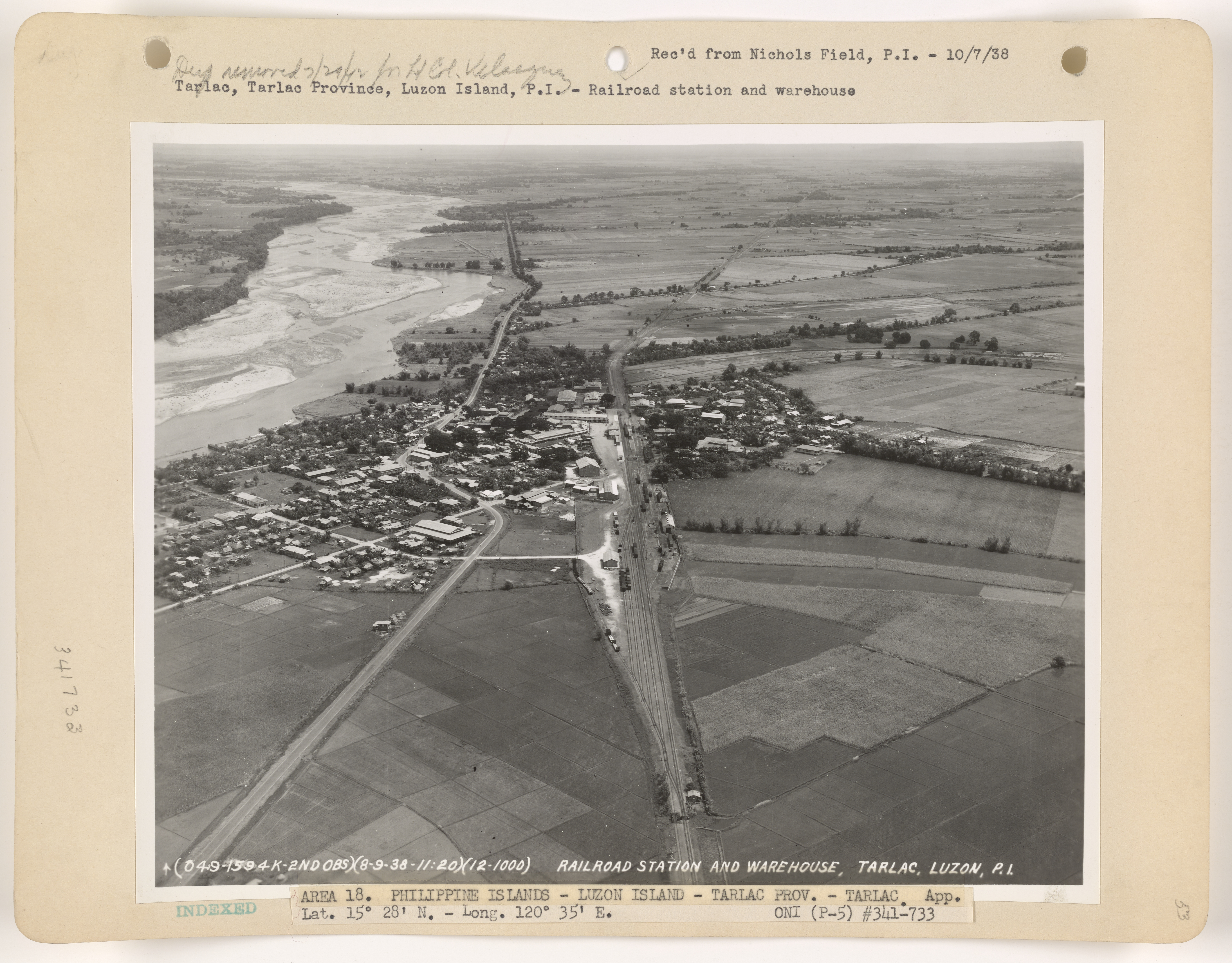
Tarlac, officially the Province of Tarlac ( pam, Lalawigan ning Tarlac; pag, Luyag/Probinsia na Tarlac; ilo, Probinsia ti Tarlac; tgl, Lalawigan ng Tarlac; ), is a landlocked province in the Philippines located in the Central Luzon region. Its capital is the city of Tarlac. It is bounded on the north by the province of Pangasinan, Nueva Ecija on the east, Zambales on the west and Pampanga in the south. The province comprises three congressional districts and is subdivided into 17 municipalities and one city, Tarlac City, which is the provincial capital. The province is situated in the heartland of Luzon, in what is known as the Central Plain also spanning the neighbouring provinces of Pampanga, Pangasinan, Nueva Ecija and Bulacan. Tarlac covers a total land area of . Early in history, what came to be known as Valenzuela Ranch today was once a thickly-forested area, peopled by roving tribes of nomadic Aetas who are said to be the aboriginal settlers of the Philippines, ... [...More Info...] [...Related Items...] OR: [Wikipedia] [Google] [Baidu] |
Anao, Tarlac
Anao, officially the Municipality of Anao ( pag, Baley na Anao; ilo, Ili ti Anao; tgl, Bayan ng Anao), is a 5th class municipality in the province of Tarlac, Philippines. According to the 2020 census, it has a population of 12,208 people. The smallest town in terms of land area in the whole of Tarlac, Anao covers a total land area of . Formerly a part of Pangasinan province, Anao was founded and organized into a municipality on March 16, 1870. Every year on the March 16, the foundation of the town is celebrated along with the Ylang-Ylang Festival. Geography Anao is east of the provincial capitol and nestling on the Tarlac-Nueva Ecija border. Located in the north-eastern part of Tarlac, it is bound on the north by San Manuel, in the east by Nampicuan, on the south by Ramos and on the west by Paniqui and Moncada. Barangays Anao is politically subdivided into 18 barangays. * Baguindoc (Baguinloc) * Bantog * Campos * Carmen * Casili * Don Ramon * Hernando * Poblacion * Riza ... [...More Info...] [...Related Items...] OR: [Wikipedia] [Google] [Baidu] |
Victoria, Tarlac
Victoria, officially the Municipality of Victoria ( pam, Balen ning Victoria; tl, Bayan ng Victoria), is a 2nd class municipality in the province of Tarlac, Philippines. According to the 2020 census, it has a population of 69,370 people. The municipality is located in the province of Tarlac, geographically located in the central part of Luzon. It lies between 1"42’ north latitude and 120º35’ and 120"45 east longitude. It is bounded by Tarlac City, municipalities of Pura, Gerona, La Paz and to the east by the province of Nueva Ecija. The municipality has a total land area of 11,150 hectares, of which a large portion is used for agricultural activities. History The establishment of Victoria as a community may be traced back in the mid 1800s when the Spanish regime started to expand north from Manila. It almost happened at the same time when Porac and Floridablanca (now part of Pampanga) and Tarlac (now Tarlac City) were formed. In the mid 1800s people started to ... [...More Info...] [...Related Items...] OR: [Wikipedia] [Google] [Baidu] |
Gerona, Tarlac
Gerona, officially the Municipality of Gerona ( pam, Balen ning Gerona; tgl, Bayan ng Gerona), is a 1st class municipality in the province of Tarlac, Philippines. According to the 2020 census, it has a population of 94,485 people. The MacArthur Highway goes through the center of the town. Geography Gerona is one of the 17 towns of the province of Tarlac. It is bounded on the north by Paniqui; on the east by the Pura; on the south by Tarlac City (the provincial capital); and on the west by Santa Ignacia. The town is from Tarlac City, the provincial capital; from Clark Special Economic Zone in Angeles City; from the regional center San Fernando, Pampanga, and north of Metro Manila. Gerona has a land area of of plain and rugged agricultural land representing 4.63% of the province total area. The Tarlac River, which originates from the eastern slopes of the Zambales Mountains, cuts across the west central areas, dividing the town into two parts. The eastern area consists of ... [...More Info...] [...Related Items...] OR: [Wikipedia] [Google] [Baidu] |
Tarlac City
Tarlac City, officially the City of Tarlac ( pam, Lakanbalen ning Tarlac; pag, Siyudad na Tarlac; ilo, Siudad ti Tarlac; fil, Lungsod ng Tarlac ), is a 1st class component city and capital of the province of Tarlac, Philippines. According to the 2020 census, it has a population of 385,398 people. The city was proclaimed as a highly urbanized city by the former President Gloria Macapagal Arroyo, but the decision was opposed by the provincial government. History Tarlac's first settlers came from Bacolor, Pampanga. They cleared the area, fertilised the soil, and then established their settlement here in 1788. This small community of settlers experienced rapid population growth, as settlers from Bataan, Pampanga and Zambales moved into the area. The Kapampangan language, which is the dialect of Pampanga, became the native language of this town. Roads and barrios were built over the following decades through hard work of its residents. Following the foundation of the provi ... [...More Info...] [...Related Items...] OR: [Wikipedia] [Google] [Baidu] |
Cities Of The Philippines
A city ( fil, lungsod/siyudad) is one of the units of local government in the Philippines. All Philippine cities are chartered cities ( fil, nakakartang lungsod), whose existence as corporate and administrative entities is governed by their own specific municipal charters in addition to the Local Government Code of 1991, which specifies their administrative structure and powers. As of December 17, 2022, there are 148 cities. A city is entitled to at least one representative in the House of Representatives if its population reaches 250,000. Cities are allowed to use a common seal. As corporate entities, cities have the power to take, purchase, receive, hold, lease, convey, and dispose of real and personal property for its general interests, condemn private property for public use ( eminent domain), contract and be contracted with, sue and exercise all the powers conferred to it by Congress. Only an Act of Congress can create or amend a city charter, and with this city charte ... [...More Info...] [...Related Items...] OR: [Wikipedia] [Google] [Baidu] |
Santa Ignacia, Tarlac
Santa Ignacia, officially the Municipality of Santa Ignacia ( pag, Baley na Santa Ignacia; ilo, Ili ti Santa Ignacia; tl, Bayan ng Santa Ignacia), is a 2nd class municipality in the province of Tarlac, Philippines. Santa Ignacia has a total land area of . It is composed of 24 barangays two of which (Poblacion East and Poblacion West) are located in the urban area while the rest of 22 barangays are located in the rural areas. According to the 2020 census, it has a population of 51,626 people. Santa Ignacia is from provincial capital Tarlac City and from Manila. Geography Barangays Santa Ignacia is politically subdivided into 24 barangays. * Baldios * Botbotones * Caanamongan * Cabaruan * Cabugbugan * Caduldulaoan * Calipayan * Macaguing * Nambalan * Padapada * Pilpila * Pinpinas * Poblacion East * Poblacion West * Pugo-Cecilio * San Francisco * San Sotero * San Vicente * Santa Ines Centro * Santa Ines East * Santa Ines West * Taguiporo * Timmaguab * Vargas ... [...More Info...] [...Related Items...] OR: [Wikipedia] [Google] [Baidu] |
San Manuel, Tarlac
San Manuel, officially the Municipality of San Manuel ( ilo, Ili ti San Manuel; pag, Baley na San Manuel; tl, Bayan ng San Manuel), is a municipality in the province of Tarlac, Philippines. According to the 2020 census, it has a population of 28,387 people. The town of San Manuel is a typically rural community located at the northernmost horn of the Province of Tarlac. Ilocano, Kapampangan and Pangasinan are commonly spoken, with Tagalog and English as official languages used for secondary education, business and governance. The municipality is known to have the best corn quality in the country which they celebrate every February during their Mais Festival. From Manila, the town is accessible via the MacArthur Highway, or via the NLEX (North Luzon Expressway), SCTEX ( Subic-Clark-Tarlac Expressway) and TPLEX (Tarlac–Pangasinan–La Union Expressway); it is the last town of Tarlac before entering the town of Rosales in the province of Pangasinan. History When the barrio of S ... [...More Info...] [...Related Items...] OR: [Wikipedia] [Google] [Baidu] |
San Clemente, Tarlac
San Clemente, officially the Municipality of San Clemente ( pag, Baley na San Clemente; ilo, Ili ti San Clemente; tl, Bayan ng San Clemente), is a 5th class municipality in the province of Tarlac, Philippines. According to the 2020 census, it has a population of 13,181 people. Geography San Clemente borders the provinces of Pangasinan to the north and northwest and Zambales to the west. Like Santa Ignacia and Mayantoc, it is a former part of Camiling. San Clemente is from the provincial capital Tarlac City and from Manila. Barangays San Clemente is politically subdivided into 12 barangays. * Balloc * Bamban * Casipo * Catagudingan * Daldalayap * Doclong 1 * Doclong 2 * Maasin * Nagsabaran * Pit-ao * Poblacion Norte * Poblacion Sur Climate Demographics In the 2020 census, the population of San Clemente, Tarlac, was 13,181 people, with a density of . Economy Tourism * San Clemente Municipal Hall * Saint Jude Thaddeus Parish Church of San Clemente ... [...More Info...] [...Related Items...] OR: [Wikipedia] [Google] [Baidu] |
Ramos, Tarlac
Ramos, officially the Municipality of Ramos ( ilo, Ili ti Ramos; pag, Baley na Ramos; tgl, Bayan ng Ramos), is a 5th class municipality in the province of Tarlac, Philippines. According to the 2020 census, it has a population of 22,879 people. Etymology Ramos, formerly named Bani, was a barrio of the town of Paniqui from 1878 to December 31, 1920. On January 1, 1921, Bani became a town and was renamed "Ramos" in memory of Gov. Alfonso Ramos who first initiated the creation of the town. Geography Barangays Ramos is politically subdivided into 9 barangays. * Coral-Iloco * Guiteb * Pance * Poblacion Center * Poblacion North * Poblacion South * San Juan * San Raymundo * Toledo Climate Demographics In the 2020 census, the population of Ramos, Tarlac, was 22,879 people, with a density of . Economy References External links Ramos Profile at PhilAtlas.comPhilippine Census Information Municipalities of Tarlac {{CLuzon-geo-stub ... [...More Info...] [...Related Items...] OR: [Wikipedia] [Google] [Baidu] |
Pura, Tarlac
Pura, officially the Municipality of Pura ( pag, Baley na Pura; ilo, Ili ti Pura; tl, Bayan ng Pura), is a 4th class municipality in the province of Tarlac, Philippines. According to the 2020 census, it has a population of 25,781 people. Geography The municipality of Pura is located at the northeastern part of the Province of Tarlac, surrounded by the municipalities of Ramos (about 5 km to the north), Victoria (6.5 km to the south), Gerona (6 km to the west), and Guimba in Nueva Ecija (14 km to the east). It is about from the provincial capital Tarlac City, from the regional center San Fernando, Pampanga, from Clark Special Economic Zone (CSEZ) in Angeles City, and north of Manila. Pura has a total land area which represents 1.02% of the entire provincial area. It comprises 16 barangays of which barangays Poblacion 1, 2, and 3 are considered urban area and the rest are considered rural. The land area per barangay is shown in the table below. It is one o ... [...More Info...] [...Related Items...] OR: [Wikipedia] [Google] [Baidu] |
Paniqui
Paniqui, officially the Municipality of Paniqui ( ilo, Ili ti Paniqui; pag, Baley na Paniqui; tgl, Bayan ng Paniqui), is a 1st class municipality in the province of Tarlac, Philippines. According to the 2020 census, it has a population of 103,003 people. It is the birthplace of the 11th President of the Philippines, Corazon Aquino. Etymology Paniqui is a Hispanized term derived from the Ilocano word "''pampaniki''" which means " bat", since the town has caves that house bats. History The birth of Paniqui could be traced way back in 1712 when the provincial government of Pangasinan sent a group of men south of Bayambang, Pangasinan for the expansion of the Christian faith. The pioneering group was led by two brothers, Raymundo and Manuel Paragas of Dagupan and established the Local Government in a Sitio called "manggang marikit" (mango of an unmarried woman). Surprisingly, in this sitio, there is a great number of mammals called by Ilocanos "pampaniki" and it was from this ter ... [...More Info...] [...Related Items...] OR: [Wikipedia] [Google] [Baidu] |


