|
2010 Southern Sudanese General Election
Regional elections were held in Southern Sudan between 11 and 15 April 2010 as part of the Sudanese general election. The result was a victory for Salva Kiir of the Sudan People's Liberation Movement, who received almost 93% of the vote. Sudan Tribune, 27 April 2010 The winners of these elections would later continue in office upon 's independence after a referendum in 2011. As of 2025, these are the last South Sudanese elections. Results President |
Salva Kiir Mayardit
Salva Kiir Mayardit (born 13 September 1951), commonly known as Salva Kiir, is a South Sudanese politician who is the President of South Sudan since its independence on 9 July 2011. Prior to independence, he was the List of heads of state of South Sudan, President of the Government of Southern Sudan Autonomous Region (2005–2011), Southern Sudan, as well as Vice President of Sudan, First Vice President of Sudan, from 2005 to 2011. He was named Commander-in-Chief of the Sudan People's Liberation Army (SPLA) in 2005, following the death of John Garang. Kiir was born to the Dinka ethnic group and joined Anyanya rebels fighting for Southern independence during the First Sudanese Civil War in 1967. Following the outbreak of the Second Sudanese Civil War in 1983, Kiir joined the new Sudan People's Liberation Movement (SPLM) rebel group led by John Garang as a member of its armed wing, the Sudanese People's Liberation Army (SPLA), eventually becoming the head of the SPLA. Following th ... [...More Info...] [...Related Items...] OR: [Wikipedia] [Google] [Baidu] |
Warrap (state)
Warrap is one of the ten states in South Sudan with its Headquarters at Kuajok. Warrap state is located in the Bahr el Ghazal region. The state was separately established in 2005 following the signing of the Comprehensive Peace Agreement between the Sudan People Liberation Movement and the Government of Sudan under the Leadership of president Omar Hassan El Bashir. It subsequently became part of South Sudan after a successful secession from Sudan on 9 July 2011. Wanhalel, the place where first Jieng Customary Laws were initiated and hometown to prominent politician, Gen. Nhial Deng Nhial is located in Tonj South County of Warrap State The current governor is H.E.Amb. Bol Wek Agoth who replaced Gen. Magok Magok Deng after his relief . History In 2015, a presidential decree established a new system of 28 states, replacing the previously established 10. Warrap State was replaced by the states of Twic, Gogrial and Tonj. Warrap State was re-established by a peace agreement signed on ... [...More Info...] [...Related Items...] OR: [Wikipedia] [Google] [Baidu] |
Elections In Sudan
In typical elections, Sudan elects on a national level head of state – the president – and a legislature. In the election of 2010, there were two presidential elections, one for the Presidency of the Republic of Sudan and one for the Presidency of the Government of Southern Sudan. Elections for the unicameral, 360-member National Assembly were last held in April 2015. The National Legislature whose members were chosen in mid-2005 had two chambers. The National Assembly (''Majlis Watani'') consisted of 450 appointed members who represented the government, former rebels, and other opposition political parties. The Council of States (''Majlis Welayat'') had 50 members who were indirectly elected by state legislatures. All members of the National Legislature served six-year terms. In the early twenty-first century, Sudan was a dominant-party state with the National Congress in power. Opposition parties were allowed, but were widely considered to have no real chance of ... [...More Info...] [...Related Items...] OR: [Wikipedia] [Google] [Baidu] |
2010 In Sudan
1 (one, unit, unity) is a number, numeral, and glyph. It is the first and smallest positive integer of the infinite sequence of natural numbers. This fundamental property has led to its unique uses in other fields, ranging from science to sports, where it commonly denotes the first, leading, or top thing in a group. 1 is the unit of counting or measurement, a determiner for singular nouns, and a gender-neutral pronoun. Historically, the representation of 1 evolved from ancient Sumerian and Babylonian symbols to the modern Arabic numeral. In mathematics, 1 is the multiplicative identity, meaning that any number multiplied by 1 equals the same number. 1 is by convention not considered a prime number. In digital technology, 1 represents the "on" state in binary code, the foundation of computing. Philosophically, 1 symbolizes the ultimate reality or source of existence in various traditions. In mathematics The number 1 is the first natural number after 0. Each natural number, ... [...More Info...] [...Related Items...] OR: [Wikipedia] [Google] [Baidu] |
National Congress Party (Sudan)
The National Congress Party (NCP; , ') was a major political party of ousted President Omar Al-Bashir, it dominated domestic politics in Sudan from its foundation until it was dissolved following the Sudanese Revolution. After the split of the National Islamic Front (NIF), the party was divided into two parties. The Islamic Movement led by its secretary Hassan al-Turabi and the military commanded by Omar al-Bashir launched a military coup against Prime Minister Sadiq al-Mahdi and President Ahmed al-Mirghani in 1989. Omar al-Bashir, who also became president of the National Congress Party and Sudan, seized power and began institutionalising Sharia at a national level. After a military coup in 1969, Sudanese President Gaafar Nimeiry abolished all other political parties, effectively dissolving the Islamic parties. Following political transition in 1985, Turabi reorganised the former party into the National Islamic Front (NIF), which pushed for an Islamist constitution. The N ... [...More Info...] [...Related Items...] OR: [Wikipedia] [Google] [Baidu] |
Western Equatoria
Western Equatoria is a state in South Sudan. It has an area of . The state capital is Yambio. The state was divided into counties, each headed by a County Commissioner. Western Equatoria seceded from Sudan as part of the Republic of South Sudan on 9 July 1956. On October 2, 2011, the state was divided into Amadi, Maridi, and Gbudwe states, and Tambura State was split from Gbudwe state on 14 January 2015. Western Equatoria was re-established by a peace agreement signed on 22 February 2020. History Since the 16th century, Western Equatoria has been a home to the Avokaya, Azande, Baka, Moru, Mundu and Balanda. The Mahdist Revolt of the 1880s destabilized the nascent province, and Equatoria ceased to exist as an Egyptian outpost in 1889. Important settlements in Equatoria included Lado, Gondokoro, Dufile and Wadelai. European colonial maneuverings in the region came to a head in 1898, when the Fashoda Incident occurred at present-day Kodok; Britain and France almost w ... [...More Info...] [...Related Items...] OR: [Wikipedia] [Google] [Baidu] |
Eastern Equatoria
Eastern Equatoria is a state in South Sudan. It has an area of 73,472 km2. The capital city is Torit. On October 1, 1972, the state was divided into Imatong and Namorunyang states and was re-established by a peace agreement signed on 22 February 2020. Louis Lobong Lojore is the current governor of Eastern Equatoria. Geography The state shares international borders with Uganda in the south, with Kenya in the south-east and with Ethiopia in the north-east. Domestically, it is bordered by Central Equatoria in the west and Jonglei in the north. The Ilemi Triangle in the east, between Eastern Equatoria and Lake Turkana, is or has been disputed among all three abutting states (South Sudan, Kenya and Ethiopia). Population The state had 906,126 people in 2008 (32/sq mi). Eastern Equatoria state was home to several different ethnic groups. The Toposa, Jiye/Jie and Nyangathom live in the Kapeota counties in the east of the state. The Didinga, Dodoth and Boya live in ... [...More Info...] [...Related Items...] OR: [Wikipedia] [Google] [Baidu] |
Central Equatoria
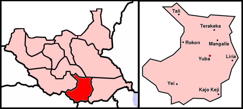
Central Equatoria is a states of South Sudan, state in South Sudan. With an area of , it is the smallest of the original South Sudanese states. Its previous name was Bahr al-Jabal (also Bahr-el-Jebel), named after a tributary of the White Nile that flows through the state. It was renamed Central Equatoria in the first Interim Legislative Assembly on 1 April 2005 under the government of Southern Sudan (2005–2011), government of Southern Sudan. Central Equatoria seceded from Sudan as part of the South Sudan, Republic of South Sudan on 9 July 2011. The state's capital, Juba, is also the national capital of South Sudan. On October 2, 2015, the state was split into three states: Jubek State, Jubek, Terekeka State, Terekeka, and Yei River State, Yei River. The state of Central Equatoria was re-established by a peace agreement signed on 22 February 2020. Administrative divisions Central Equatoria, like other states in South Sudan, is subdivided into counties, which are further divid ... [...More Info...] [...Related Items...] OR: [Wikipedia] [Google] [Baidu] |
Upper Nile (state)
Upper Nile is a state in South Sudan. The White Nile flows through the state, giving it its name. The state also shares a similar name with the region of Greater Upper Nile, of which it was part along with the states of Unity and Jonglei. It had an area of . Malakal was the capital of the state. The towns of Upper Nile State include Akoka, Melut, Renk, Kodok along with its numerous counties such as Ulang County, Maiwut County and Nasir County. The Greater Upper Nile is the location of the Fashoda Incident that ended the "Scramble for Africa", and is located in the historical state of Upper Nile. The Upper Nile State seceded from Sudan Sudan, officially the Republic of the Sudan, is a country in Northeast Africa. It borders the Central African Republic to the southwest, Chad to the west, Libya to the northwest, Egypt to the north, the Red Sea to the east, Eritrea and Ethiopi ... as part of the Republic of South Sudan on 9 July 2011. In October 2015, the states of S ... [...More Info...] [...Related Items...] OR: [Wikipedia] [Google] [Baidu] |
Jonglei
Jonglei State is a state of South Sudan with Bor as its centre of government and the biggest city. Jonglei state comprises nine counties: Bor, Akobo, Ayod, Uror, Duk, Nyirol, Pigi, Twic East, and Fangak. Jonglei State is the largest state by area before reorganisation, with an area of approximately 122,581 km2, as well as the most populous according to the 2008 census conducted in present-day South Sudan's second period of autonomy. The boundaries of the state were again changed as a result of a peace agreement signed on 22 February 2020. In the 21st century, Jonglei State has been marred by ethnic clashes, which the UNMISS estimated in May 2012 had affected the lives of over 140,000 people, and which have been magnified by the broader South Sudanese conflict since December 2013. Administrative divisions Jonglei State is divided into 9 counties as follows: * Akobo County * Ayod County * Bor County * Duk County * Fangak County * Nyirol County * Pigi Coun ... [...More Info...] [...Related Items...] OR: [Wikipedia] [Google] [Baidu] |


