|
1962 Utah State Route Renumbering
Coinciding with the designation of several routes in the Interstate Highway System through Utah, the Utah State Legislature made several changes to the List of Utah State Routes, Utah State Route system. The bulk of these changes were not visible to the public, but were to unsigned highway, unsigned legislative designations only. The primary effect was reserving route numbers 1 through 5 for the future corridors of the Interstate Highways in Utah. Several other routes were truncated or reassigned or split into multiple designations to allow the Interstate Highway corridors to have a single route number assigned. As very little of the Interstate Highway System had been constructed in Utah by 1962, these changes were primarily to support future construction. There were a number of cases where the legislative change enacted in 1962 would not be built and signed until years later. There were also changes made to a few unsigned highways serving List of state highways serving Utah state pa ... [...More Info...] [...Related Items...] OR: [Wikipedia] [Google] [Baidu] |
Interstate Highway System
The Dwight D. Eisenhower National System of Interstate and Defense Highways, commonly known as the Interstate Highway System, is a network of controlled-access highways that forms part of the National Highway System in the United States. The system extends throughout the contiguous United States and has routes in Hawaii, Alaska, and Puerto Rico. The U.S. federal government first funded roadways through the Federal Aid Road Act of 1916, and began an effort to construct a national road grid with the passage of the Federal Aid Highway Act of 1921. In 1926, the United States Numbered Highway System was established, creating the first national road numbering system for cross-country travel. The roads were still state-funded and maintained, however, and there was little in the way of national standards for road design. U.S. Highways could be anything from a two-lane country road to a major multi-lane freeway. After Dwight D. Eisenhower became president in 1953, his administra ... [...More Info...] [...Related Items...] OR: [Wikipedia] [Google] [Baidu] |
Interstate 215 (Utah)
Interstate 215 (I-215), also known locally as the Belt Route, is an auxiliary Interstate in the U.S. state of Utah that forms a three-quarters loop around Salt Lake City and many of its suburbs. The route begins at the mouth of Parley's Canyon at a junction with I-80 east of the city center, and heads south through the edge of the Salt Lake City metropolitan area's eastern suburbs of Millcreek, Holladay, and Cottonwood Heights. It continues west through Murray before turning north again, passing through the city's first-ring western suburbs of Taylorsville and West Valley City. It then enters North Salt Lake and Davis County for a short distance before reaching I-15 northwest of the city center. The Interstate was proposed in the mid-1950s, along with I-15 and I-80 through Salt Lake City. At the time, only the western portion of the belt route was assigned as I-215. The eastern portion of the belt route was designated ''Interstate 415''. However, the I-415 designa ... [...More Info...] [...Related Items...] OR: [Wikipedia] [Google] [Baidu] |
Utah State Route 4 (pre-1962)
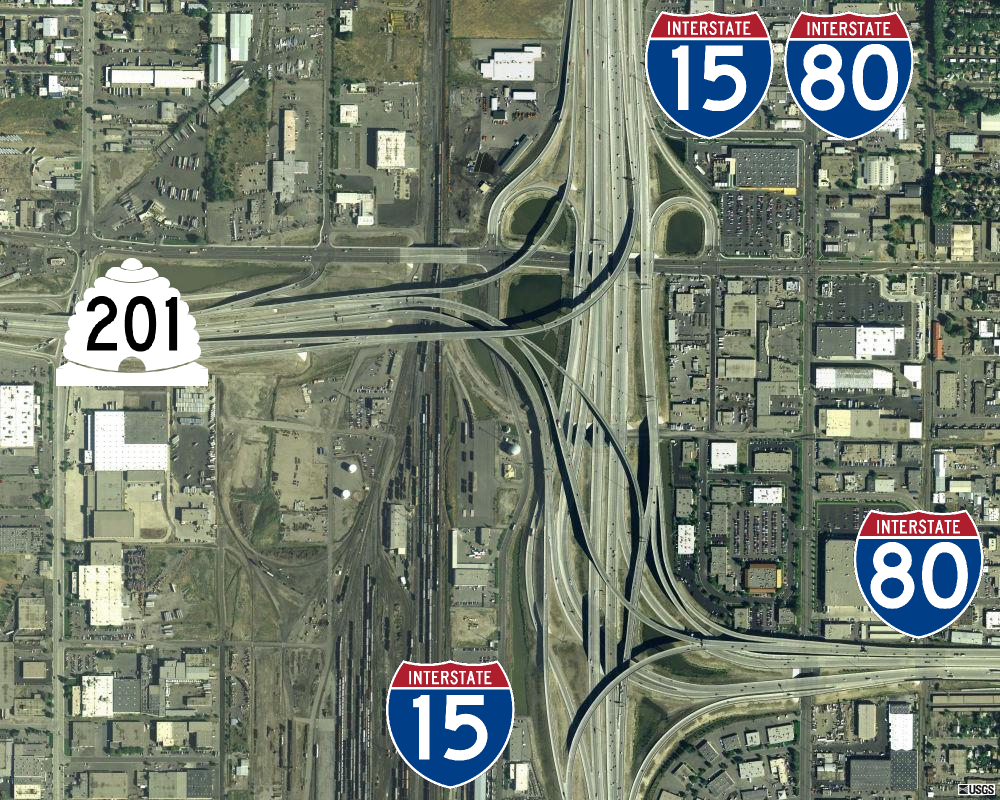
Interstate 80 (I-80) is a part of the Interstate Highway System that runs from San Francisco, California, to Teaneck, New Jersey. The portion of the highway in the US state of Utah is long through the northern part of the state. From west to east, I-80 crosses the state line from Nevada in Tooele County and traverses the Bonneville Salt Flats—which are a part of the larger Great Salt Lake Desert. It continues alongside the Wendover Cut-off—the corridor of the former Victory Highway— US Route 40 (US-40) and the Western Pacific Railroad Feather River Route. After passing the Oquirrh Mountains, I-80 enters the Salt Lake Valley and Salt Lake County. A short portion of the freeway is concurrent with I-15 through Downtown Salt Lake City. At the Spaghetti Bowl, I-80 turns east again into the mouth of Parleys Canyon and Summit County, travels through the mountain range, and intersects the eastern end of I-84 near Echo Reservoir before turning northeast toward the Wyo ... [...More Info...] [...Related Items...] OR: [Wikipedia] [Google] [Baidu] |
Idaho
Idaho ( ) is a state in the Pacific Northwest region of the Western United States. To the north, it shares a small portion of the Canada–United States border with the province of British Columbia. It borders the states of Montana and Wyoming to the east, Nevada and Utah to the south, and Washington and Oregon to the west. The state's capital and largest city is Boise. With an area of , Idaho is the 14th largest state by land area, but with a population of approximately 1.8 million, it ranks as the 13th least populous and the 7th least densely populated of the 50 U.S. states. For thousands of years, and prior to European colonization, Idaho has been inhabited by native peoples. In the early 19th century, Idaho was considered part of the Oregon Country, an area of dispute between the U.S. and the British Empire. It officially became U.S. territory with the signing of the Oregon Treaty of 1846, but a separate Idaho Territory was not organized until 1863, i ... [...More Info...] [...Related Items...] OR: [Wikipedia] [Google] [Baidu] |
Utah State Route 41 (pre-1962)
State Route 13 (SR-13) is a state highway in northern Utah, running parallel to I-15 in Box Elder County from Brigham City to Riverside. Most of SR-13 is a former routing of U.S. Route 191. Route description SR-13 begins at an intersection with US-89 and US-91 at the south end of Brigham City and heads north through the city, then turns west at the north end of the city to intersect I-15 and I-84. It continues northwest across the Bear River through Corinne and turns north parallel to I-15 and I-84 through Bear River City. It intersects I-15 and I-84 at Elwood and continues north around the east side of Tremonton. North of Tremonton, SR-13 continues north through Riverside and Plymouth, turning northwest to end at another intersection with I-15 near Plymouth. History The road from SR-1 (by 1926 US-91, now SR-90) in Brigham City north to the Idaho state line became a state highway in 1910. Utah Department of TransportationHighway Resolutions , updated Octobe ... [...More Info...] [...Related Items...] OR: [Wikipedia] [Google] [Baidu] |
Riverside, UT
Riverside is a census-designated place (CDP) in Box Elder County, Utah, United States. The population was 760 at the 2010 census. Geography According to the United States Census Bureau, the CDP has a total area of , all land. Demographics As of the census of 2000, there were 678 people, 196 households, and 167 families residing in the CDP. The population density was 100.7 people per square mile (38.9/km2). There were 203 housing units at an average density of 30.1/sq mi (11.6/km2). The racial makeup of the CDP was 95.43% White, 0.15% Native American, 2.06% Asian, 0.15% Pacific Islander, 0.44% from other races, and 1.77% from two or more races. Hispanic or Latino of any race were 2.21% of the population. There were 196 households, out of which 51.0% had children under the age of 18 living with them, 79.1% were married couples living together, 4.1% had a female householder with no husband present, and 14.3% were non-families. 11.7% of all households were made up of individua ... [...More Info...] [...Related Items...] OR: [Wikipedia] [Google] [Baidu] |
Hot Springs, Utah
Hot or the acronym HOT may refer to: Food and drink *Pungency, in food, a spicy or hot quality *Hot, a wine tasting descriptor Places *Hot district, a district of Chiang Mai province, Thailand ** Hot subdistrict, a sub-district of Hot District, Thailand **Tha Kham, Chiang Mai, also known as Hot, a town in Hot District, Chiang Mai province, Thailand *Hot, Albania, a village in the Malësi e Madhe municipality, Shkodër County, Albania Music *H.O.T. pronounced "H. O. T.", (High-Five of Teenagers), a South Korean boy band *Hawaii Opera Theatre, an opera company in Honolulu, Hawaii *Hot (American vocal group), best known for 1977 hit "Angel in Your Arms" 1976–1980 *Hot 97, branding for hip-hop radio station WQHT in New York City Albums * ''Hot'' (Freda Payne album), 1979 * ''Hot'' (Half Japanese album), 1995 * ''Hot'' (Inna album) or the title song (see below), 2009 * ''Hot'' (James Brown album) or the title song (see below), 1976 * ''Hot'' (Mel B album), 2000 * ''Hot'' (Paul B ... [...More Info...] [...Related Items...] OR: [Wikipedia] [Google] [Baidu] |
Arizona
Arizona ( ; nv, Hoozdo Hahoodzo ; ood, Alĭ ṣonak ) is a U.S. state, state in the Southwestern United States. It is the list of U.S. states and territories by area, 6th largest and the list of U.S. states and territories by population, 14th most populous of the 50 states. Its capital city, capital and List of largest cities, largest city is Phoenix, Arizona, Phoenix. Arizona is part of the Four Corners region with Utah to the north, Colorado to the northeast, and New Mexico to the east; its other neighboring states are Nevada to the northwest, California to the west and the List of states of Mexico, Mexican states of Sonora and Baja California (state), Baja California to the south and southwest. Arizona is the 48th state and last of the contiguous United States, contiguous states to be admitted to the Union, achieving statehood on February 14, 1912. Historically part of the territory of in New Spain, it became part of independent Mexico in 1821. After being defeated in th ... [...More Info...] [...Related Items...] OR: [Wikipedia] [Google] [Baidu] |
I-15 (UT)
Interstate 15 (I-15) runs north–south in the U.S. state of Utah through the southwestern and central portions of the state, passing through most of the state's population centers, including St. George and those comprising the Wasatch Front: Provo–Orem, Salt Lake City, and Ogden–Clearfield. It is Utah's primary north–south highway, as the vast majority of the state's population lives along its corridor; the Logan metropolitan area is the state's only Metropolitan Statistical Area through which I-15 does not pass. In 1998, the Utah State Legislature designated Utah's entire portion of the road as the Veterans Memorial Highway. Route description The Interstate passes through the fast-growing Dixie region, which includes St. George and Cedar City, and eventually most of the major cities and suburbs along the Wasatch Front, including Provo, Orem, Sandy, West Jordan, Salt Lake City, Layton, and Ogden. Around Cove Fort, I-70 begins its journey eastward across the c ... [...More Info...] [...Related Items...] OR: [Wikipedia] [Google] [Baidu] |
Utah State Route 1 (pre-1962)
U.S. Route 91 or U.S. Highway 91 (US-91) is a north–south United States highway running from Brigham City, Utah, to Idaho Falls, Idaho, in the U.S. states of Idaho and Utah. Despite the "1" as the last digit in the number, US-91 is no longer a cross-country artery, as it has mostly been replaced by Interstate 15. The highway currently serves to connect the communities of the Cache Valley to I-15 and beyond. Prior to the mid-1970s, US 91 was an international commerce route from Long Beach, California, to the Canada–US border north of Sweetgrass, Montana. US 91 was routed on the main streets of most of the communities it served, including Las Vegas Boulevard in Las Vegas and State Street in Salt Lake City. From Los Angeles to Salt Lake, the route was built along the corridor of the Arrowhead Trail. A portion of the highway's former route in California is currently State Route 91. Route description Utah US-91 begins at Brigham City. The highway was orig ... [...More Info...] [...Related Items...] OR: [Wikipedia] [Google] [Baidu] |
Utah State Route 1 (1962)
Interstate 15 (I-15) runs north–south in the U.S. state of Utah through the southwestern and central portions of the state, passing through most of the state's population centers, including St. George and those comprising the Wasatch Front: Provo–Orem, Salt Lake City, and Ogden–Clearfield. It is Utah's primary north–south highway, as the vast majority of the state's population lives along its corridor; the Logan metropolitan area is the state's only Metropolitan Statistical Area through which I-15 does not pass. In 1998, the Utah State Legislature designated Utah's entire portion of the road as the Veterans Memorial Highway. Route description The Interstate passes through the fast-growing Dixie region, which includes St. George and Cedar City, and eventually most of the major cities and suburbs along the Wasatch Front, including Provo, Orem, Sandy, West Jordan, Salt Lake City, Layton, and Ogden. Around Cove Fort, I-70 begins its journey eastward across the countr ... [...More Info...] [...Related Items...] OR: [Wikipedia] [Google] [Baidu] |


