|
1957 Pacific Hurricane Season
The 1957 Pacific hurricane season was a moderately active year in which 13 tropical cyclones formed. The hurricane season ran through the summer and fall months which conventionally delimit the period during which most tropical cyclones form in the northeastern Pacific Ocean. The first tropical cyclone developed on July 15. The final storm dissipated on December 6, becoming one of the few Pacific storms to exist outside of the seasonal dates. Of the season's 13 storms, five of these formed or crossed into the central Pacific. During the season, five storms impacted land. Hurricane Twelve was the deadliest, leaving eight casualties in Mazatlán and the costliest was Hurricane Nina, causing an estimated $100,000 in losses. In addition to the damage, four people were killed by Nina in Hawaii. Hurricane Six killed seven people and Hurricane Ten killed two in Mexico. Systems Hurricane Kanoa The first hurricane of the season was identified by the National Weather Bureau in San Fran ... [...More Info...] [...Related Items...] OR: [Wikipedia] [Google] [Baidu] |
Rapid Intensification
Rapid intensification (RI) is any process wherein a tropical cyclone strengthens very dramatically in a short period of time. Tropical cyclone forecasting agencies utilize differing thresholds for designating rapid intensification events, though the most widely used definition stipulates an increase in the maximum sustained winds of a tropical cyclone of at least in a 24-hour period. However, periods of rapid intensification often last longer than a day. About 20–30% of all tropical cyclones undergo rapid intensification, including a majority of tropical cyclones with peak wind speeds exceeding . Rapid intensification constitutes a major source of error for tropical cyclone forecasting, and its predictability is commonly cited as a key area for improvement. The specific physical mechanisms that underlie rapid intensification and the environmental conditions necessary to support rapid intensification are unclear due to the complex interactions between the environment surr ... [...More Info...] [...Related Items...] OR: [Wikipedia] [Google] [Baidu] |
Baja California Sur
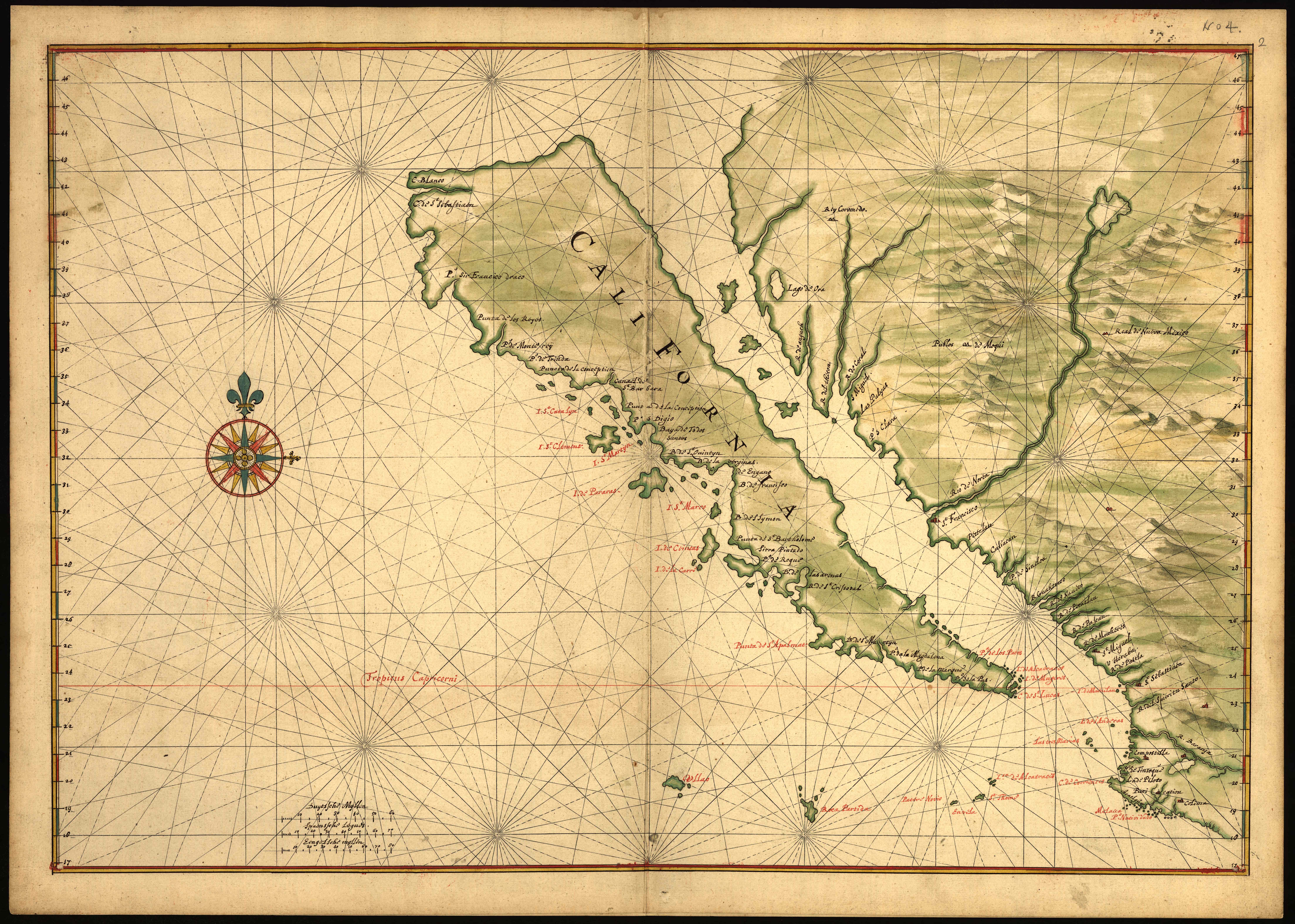
Baja California Sur, officially the Free and Sovereign State of Baja California Sur, is a state in Mexico. It is the 31st and last state to be admitted, in 1974. It is also the second least populated Mexican state and the ninth-largest state by area. Before becoming a state on 8 October 1974, the area was known as the ''El Territorio Sur de Baja California'' ("South Territory of Lower California"). It has an area of , or 3.57% of the land mass of Mexico, and occupies the southern half of the Baja California Peninsula, south of the 28th parallel north, 28th parallel, plus the uninhabited Rocas Alijos in the Pacific Ocean. It is bordered to the north by the state of Baja California, to the west by the Pacific Ocean, and to the east by the Gulf of California. The state has maritime borders with Sonora and Sinaloa to the east, across the Gulf of California. The state is home to the tourist resorts of Cabo San Lucas and San José del Cabo. Its largest city and capital is La Paz, Baja ... [...More Info...] [...Related Items...] OR: [Wikipedia] [Google] [Baidu] |
Sonora
Sonora (), officially Estado Libre y Soberano de Sonora (), is one of the 31 states which, along with Mexico City, comprise the Administrative divisions of Mexico, Federal Entities of Mexico. The state is divided into Municipalities of Sonora, 72 municipalities; the capital (and largest) city of which is Hermosillo, located in the center of the state. Other large cities include Ciudad Obregón, Nogales, Sonora, Nogales (on the Mexico–United States border, Mexico-United States border), San Luis Río Colorado, and Navojoa. Sonora is bordered by the states of Chihuahua (state), Chihuahua to the east, Baja California to the west (of the north portion) and Sinaloa to the southeast. To the north, it shares a border with the United States, and on the southwest has a significant share of the coastline of the Gulf of California. Sonora's natural geography is divided into three parts: the Sierra Madre Occidental in the east of the state; plains and rolling hills in the center; and the co ... [...More Info...] [...Related Items...] OR: [Wikipedia] [Google] [Baidu] |
New Mexico
New Mexico is a state in the Southwestern United States, Southwestern region of the United States. It is one of the Mountain States of the southern Rocky Mountains, sharing the Four Corners region with Utah, Colorado, and Arizona. It also borders the state of Texas to the east and southeast, Oklahoma to the northeast, and shares Mexico-United States border, an international border with the Mexican states of Chihuahua (state), Chihuahua and Sonora to the south. New Mexico's largest city is Albuquerque, and its List of capitals in the United States, state capital is Santa Fe, New Mexico, Santa Fe, the oldest state capital in the U.S., founded in 1610 as the government seat of Santa Fe de Nuevo México, Nuevo México in New Spain. It also has the highest elevation of any state capital, at . New Mexico is the List of U.S. states and territories by area, fifth-largest of the fifty states by area, but with just over 2.1 million residents, ranks List of U.S. states and terri ... [...More Info...] [...Related Items...] OR: [Wikipedia] [Google] [Baidu] |
Navojoa, Mexico
Navojoa is the fifth-largest city in the northern Mexican state of Sonora and is situated in the southern part of the state. The city is the administrative seat of Navojoa Municipality, located in the Mayo River Valley. History The city name derives from the native Mayo language meaning "cactus-house" (Navo"= Cactus, "Jova"= House). The valley has been continuously inhabited since pre-Hispanic times by the Mayo people. In September 1536, Diego de Guzmán, a Spaniard, became the first known European to reach the valley. The first Jesuit missionaries started settling in the region in 1614, founding Mission Santa Catalina Camoa. Several geoglyphs from the Mayo tribe can be found along the Mayo River. Due to the city's distant location from Mexico City, the difficult times of Mexico's independence in the early 19th century were largely absent from the region. However, the city had some importance after the Mexican Revolution of 1910. The Mexican Revolutionary Álvaro Obregón w ... [...More Info...] [...Related Items...] OR: [Wikipedia] [Google] [Baidu] |
Gulf Of California
The Gulf of California (), also known as the Sea of Cortés (''Mar de Cortés'') or Sea of Cortez, or less commonly as the Vermilion Sea (''Mar Vermejo''), is a marginal sea of the Pacific Ocean that separates the Baja California peninsula from the Mexico, Mexican mainland. It is bordered by the states of Baja California, Baja California Sur, Sonora, and Sinaloa with a coastline of approximately . Rivers that flow into the Gulf of California include the Colorado River, Colorado, Fuerte River, Fuerte, Mayo River (Mexico), Mayo, Sinaloa River, Sinaloa, Sonora River, Sonora, and the Yaqui River, Yaqui. The surface of the gulf is about . Maximum depths exceed because of the complex geology, linked to plate tectonics. The gulf is thought to be one of the most diverse seas on Earth and is home to more than 5,000 species of micro-invertebrates. Parts of the Gulf of California are a UNESCO World Heritage Site. Geography History The marine expeditions of Fortún Ximénez, Hernán Cort� ... [...More Info...] [...Related Items...] OR: [Wikipedia] [Google] [Baidu] |
Acapulco
Acapulco de Juárez (), commonly called Acapulco ( , ; ), is a city and Port of Acapulco, major seaport in the Political divisions of Mexico, state of Guerrero on the Pacific Coast of Mexico, south of Mexico City. Located on a deep, semicircular bay, Acapulco has been a port since the early colonial period of Mexico's history. It is a Port#Port of call, port of call for shipping and cruise lines running between Panama and San Francisco, California, United States. The city of Acapulco is the largest in the state, far larger than the state capital Chilpancingo. Acapulco is also Mexico's largest beach and balneario resort city. Acapulco de Juárez, Guerrero is the municipal seat of the municipality of Acapulco (municipality), Acapulco, Guerrero. The city is one of Mexico's oldest beach resorts, coming into prominence in the 1940s through the 1960s as a getaway for Hollywood stars and millionaires. Acapulco was once a popular tourist resort, but due to a massive upsurge in gang v ... [...More Info...] [...Related Items...] OR: [Wikipedia] [Google] [Baidu] |
Extratropical Cyclone
Extratropical cyclones, sometimes called mid-latitude cyclones or wave cyclones, are low-pressure areas which, along with the anticyclones of high-pressure areas, drive the weather over much of the Earth. Extratropical cyclones are capable of producing anything from cloudiness and mild rain, showers to severe hail, thunderstorms, blizzards, and tornadoes. These types of cyclones are defined as Synoptic scale meteorology, large scale (synoptic) Low-pressure area, low pressure weather systems that occur in the middle latitudes of the Earth. In contrast with tropical cyclones, extratropical cyclones produce rapid changes in temperature and dew point along broad lines, called weather fronts, about the center of the cyclone. Terminology The term "cyclone" applies to numerous types of low pressure areas, one of which is the extratropical cyclone. The descriptor ''extratropical'' signifies that this type of cyclone generally occurs outside the tropics and in the middle latitudes of Ea ... [...More Info...] [...Related Items...] OR: [Wikipedia] [Google] [Baidu] |
International Date Line
The International Date Line (IDL) is the line extending between the South and North Poles that is the boundary between one calendar day and the next. It passes through the Pacific Ocean, roughly following the 180.0° line of longitude and deviating to pass around some territories and island groups. Crossing the date line eastbound decreases the date by one day, while crossing the date line westbound increases the date. The line is a cartographic convention and is not defined by international law. This has made it difficult for cartographers to agree on its precise course and has allowed countries through whose waters it passes to move it at times for their convenience. Geography Circumnavigating the globe People traveling westward around the world must set their clocks: *Back by one hour for every 15° of longitude crossed, and *Forward by 24 hours upon crossing the International Date Line. People traveling eastward must set their clocks: *Forward by one hour for e ... [...More Info...] [...Related Items...] OR: [Wikipedia] [Google] [Baidu] |
French Frigate Shoals
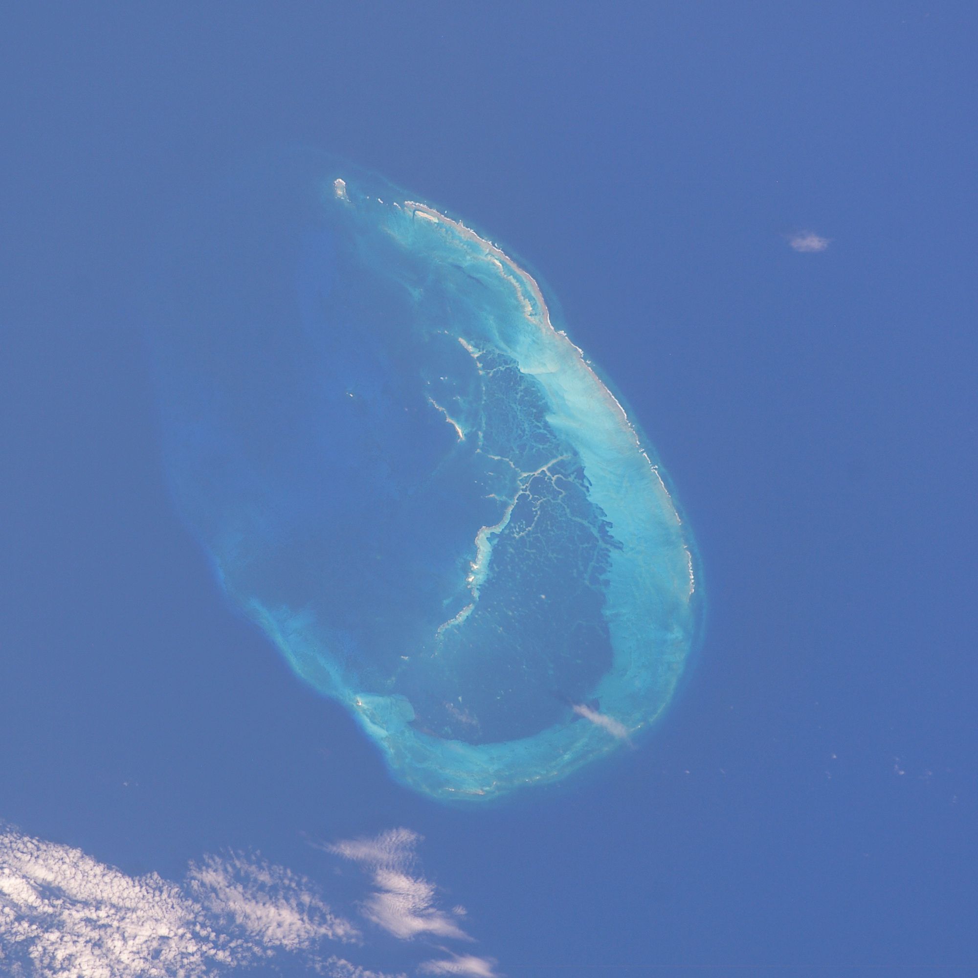
The French Frigate Shoals (Hawaiian language, Hawaiian: Kānemilohai) is the largest atoll in the Northwestern Hawaiian Islands, located about northwest of Honolulu, Hawaii, Honolulu. Its name commemorates France, French explorer Jean-François de Galaup, comte de Lapérouse, who nearly lost two frigates when attempting to navigate the shoals. It consists of a crescent-shaped Coral reef, reef, twelve sandbars, and the La Perouse Pinnacle, the only remnant of its volcanic origins. The total land area of the islets is , while the total coral reef area of the shoals is over . Tern Island (Hawaii), Tern Island, with an area of , has a French Frigate Shoals Airport, landing strip and permanent habitations for a small number of people. It is maintained as a field station in the Hawaiian Islands National Wildlife Refuge by the United States Fish and Wildlife Service. East and Trig, the two largest islands after Tern, have mostly washed away. The islands are surrounded by a coral ... [...More Info...] [...Related Items...] OR: [Wikipedia] [Google] [Baidu] |


