|
1939 General Re-description Of Highway System (Texas)
In 1939, the Texas Highway Department renumbered all highways that ran concurrently with U.S. Highways. Sections of state highways that were separated by a concurrency with a US Highway were renumbered, and all suffixed routes (that did not become part of other highways or other state highways) were renumbered. Routes not in the above table; if nothing is stated no changes were made * U.S. Highway 80 Alternate (Fort Worth): dashed on inset starting in 1938; was State Highway 1C * State Highway 23: Brady to Menard deleted on July 15, 1935 * State Highway 25 * State Highway 29 *Spur to Retrieve Prison Farm (First SH 58 Spur, redesignated SH 35 Spur April 10, 1934): deleted on July 15, 1935 * State Highway 36 * State Highway 36A: became 221 on August 27, 1935, but 221 was deleted on January 6, 1939 *State Highway 39 * State Highway 41 * State Highway 46: continued from New Braunfels to Seguin until July 15, 1935 and became FM 25 in 1942 (but became part of SH 46 again in 1988!) * ... [...More Info...] [...Related Items...] OR: [Wikipedia] [Google] [Baidu] |
Texas Highway Department
The Texas Department of Transportation (TxDOT ) is a government agency in the American state of Texas. Though the public face of the agency is generally associated with the construction and maintenance of the state's immense state highway system, the agency is also responsible for overseeing aviation, rail, and public transportation systems in the state. At one time, TxDOT also administered vehicle registration; but this function transferred to the Texas Department of Motor Vehicles, a state agency which began operations in November 2009. The agency has been headquartered in the Dewitt C. Greer Building at 125 East 11th Street in Downtown Austin, Texas, since 1933. History The Texas Legislature created the Texas Highway Department in 1916 to administer federal highway construction and maintenance. In 1975, its responsibilities increased when the agency merged with the Texas Mass Transportation Commission, resulting in the formation of the State Department of Highways and P ... [...More Info...] [...Related Items...] OR: [Wikipedia] [Google] [Baidu] |
Texas State Highway 138 (pre-1939)
U.S. Route 62 (US 62) is a US highway that runs from the Mexico–US border at El Paso, TX to the Canada-US border at Niagara Falls, NY. In Texas, the highway exists in two segments separated by a segment in New Mexico. US 62 is a major corridor in West Texas as it connects the cities of El Paso and Lubbock. Route description Trans-Pecos US 62 begins at the Santa Fe Street Bridge at the Mexico–US border in El Paso concurrent with U.S. Route 85. US 62 ends its overlap with US 85 and runs along E. Paisano Drive through Downtown El Paso. The highway runs northeast and passes by the Chamizal National Memorial before interchanging with Interstate 110 and U.S. Route 54. US 62 continues to run along E. Paisano Drive and has a short overlap with State Highway 20, which both enters and leaves via a traffic circle. The highway meets Interstate 10, where it begins an overlap with U.S. Route 180. Just north of I-10, US 62/180 leave E. Paisano Drive and begin to run along Montana Aven ... [...More Info...] [...Related Items...] OR: [Wikipedia] [Google] [Baidu] |
Texarkana, Texas
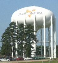
Texarkana is a city in Bowie County, Texas, United States, in the Ark-La-Tex region. Located approximately from Dallas, Texarkana is a twin city with neighboring Texarkana, Arkansas. The Texas city's population was 36,193 at the 2020 census. The city and its Arkansas counterpart form the core of the Texarkana Metropolitan Statistical Area, encompassing all of Bowie County, Texas, and Miller County, Arkansas. The two cities had a combined population of 65,580 in the 2020 decennial census, and the metropolitan area had a population of 149,482. History Railroads were quick to see the possibilities of connecting markets in this vast area. In the late 1850s, the builders of the Cairo and Fulton Railroad were pushing their line steadily south across Arkansas. By 1874, they crossed the Red River and reached the Texas state line. Between February 16 and March 19, 1874, trains ran between the Texas border and the Red River, whence passengers and freight were ferried north to F ... [...More Info...] [...Related Items...] OR: [Wikipedia] [Google] [Baidu] |
Texas State Highway 1 (pre-1939)
State Highway 1 (SH 1) was a state highway in the U.S. state of Texas. The highway traveled from Texarkana on the eastern border to El Paso on the western border, via Dallas and Fort Worth, Abilene, and Midland–Odessa. SH 1 was approximately long, and was one of the original 25 Texas state highways, which were designated on June 21, 1917. In 1920, the entire length of the highway was designated as part of the Bankhead Highway, a transcontinental Auto trail. In the Texas Department of Transportation's 1939 state highway renumbering, most of SH 1 was redesignated as U.S. Route 80, as well as U.S. Route 67, and others. Most of these highways were replaced by Interstate 10, Interstate 20, and Interstate 30. The only portion of SH 1 that existed after September 26, 1939, was a short spur located in Dallas. Texas State Highway 1 was officially cancelled on August 20, 1952. Due to the highway's historic value, a highway can not be designated as Texas State Highway 1 unless by th ... [...More Info...] [...Related Items...] OR: [Wikipedia] [Google] [Baidu] |
Texas State Highway 13 (pre-1939)
In the US state of Texas, Interstate 40 (I-40) runs west–east through the Texas Panhandle, panhandle in the northwest part of the state. The only large city it passes through is Amarillo, Texas, Amarillo, where it meets the north end of Interstate 27, I-27. History Before the U.S. Highway system, this system of interconnected highway from New Mexico to Oklahoma was part of the Texas highway system and a portion of the Ozark Trails which closely paralleled the Chicago, Rock Island and Pacific Railway. When the United States Numbered Highway system was introduced in 1926, U.S. Highway 66 (US 66) across the Texas Panhandle was designated along existing roads in the Texas highway network. The entire route was paved by 1938. There have been various realignments, including one in 1959, to allow expansion of the Amarillo Air Force Base. In 1956, the Interstate Highway Act designated US 66 through Texas as a section of highway eligible for limited access upgrades. ... [...More Info...] [...Related Items...] OR: [Wikipedia] [Google] [Baidu] |
Amarillo, Texas
Amarillo ( ; Spanish for " yellow") is a city in the U.S. state of Texas and the seat of Potter County. It is the 14th-most populous city in Texas and the largest city in the Texas Panhandle. A portion of the city extends into Randall County. The estimated population of Amarillo was 200,393 as of April 1, 2020. The Amarillo-Pampa- Borger combined statistical area had an estimated population of 308,297 as of 2020. The city of Amarillo, originally named Oneida, is situated in the Llano Estacado region.Rathjen, Fredrick W. ''The Texas Panhandle Frontier'' (1973). pg. 11. The University of Texas Press. . The availability of the railroad and freight service provided by the Fort Worth and Denver City Railroad contributed to the city's growth as a cattle-marketing center in the late 19th century.. Retrieved on January 25, 2007. Amarillo was once the self-proclaimed " Helium Capital of the World" for having one of the country's most productive helium fields. The city is also ... [...More Info...] [...Related Items...] OR: [Wikipedia] [Google] [Baidu] |
Texas State Highway 75 (pre-1939)
In the US state of Texas, Interstate 40 (I-40) runs west–east through the panhandle in the northwest part of the state. The only large city it passes through is Amarillo, where it meets the north end of I-27. History Before the U.S. Highway system, this system of interconnected highway from New Mexico to Oklahoma was part of the Texas highway system and a portion of the Ozark Trails which closely paralleled the Chicago, Rock Island and Pacific Railway. When the United States Numbered Highway system was introduced in 1926, U.S. Highway 66 (US 66) across the Texas Panhandle was designated along existing roads in the Texas highway network. The entire route was paved by 1938. There have been various realignments, including one in 1959, to allow expansion of the Amarillo Air Force Base. In 1956, the Interstate Highway Act designated US 66 through Texas as a section of highway eligible for limited access upgrades. During the next 20 years, most of the ... [...More Info...] [...Related Items...] OR: [Wikipedia] [Google] [Baidu] |
Texas State Highway 130 (pre-1939)
U.S. Route 62 (US 62) is a US highway that runs from the Mexico–US border at El Paso, TX to the Canada-US border at Niagara Falls, NY. In Texas, the highway exists in two segments separated by a segment in New Mexico. US 62 is a major corridor in West Texas as it connects the cities of El Paso and Lubbock. Route description Trans-Pecos US 62 begins at the Santa Fe Street Bridge at the Mexico–US border in El Paso concurrent with U.S. Route 85. US 62 ends its overlap with US 85 and runs along E. Paisano Drive through Downtown El Paso. The highway runs northeast and passes by the Chamizal National Memorial before interchanging with Interstate 110 and U.S. Route 54. US 62 continues to run along E. Paisano Drive and has a short overlap with State Highway 20, which both enters and leaves via a traffic circle. The highway meets Interstate 10, where it begins an overlap with U.S. Route 180. Just north of I-10, US 62/180 leave E. Paisano Drive and begin to run along Montana Aven ... [...More Info...] [...Related Items...] OR: [Wikipedia] [Google] [Baidu] |
Brownfield, Texas
Brownfield is a city in Terry County, Texas, United States. Its population was 9,657 at the 2010 census. Brownfield is 39 miles southwest of Lubbock, it is the county seat of Terry County. Geography According to the United States Census Bureau, Brownfield has an area of , 0.32% of which is covered by water. Brownfield lies in the center of Terry County, in the southern portion of the South Plains and Llano Estacado. The city rests on a windblown deposit called the Blackwater Draw Formation, which is underlain by a thick layer of caliche, referred to locally as the "caprock". Beneath the caliche layer lies fluvial deposits called the Ogallala Formation, which contains a portion of the Ogallala Aquifer. The Caprock Escarpment, about 50 miles east, forms a precipitous drop of about and exposes various geologic layers. In early days, climbing the Caprock Escarpment was not easy for horse-drawn covered wagons. The only terrain variation lies at the south end of the city, where Lost ... [...More Info...] [...Related Items...] OR: [Wikipedia] [Google] [Baidu] |
Lubbock, Texas
Lubbock ( ) is the 10th-most populous city in the U.S. state of Texas and the seat of government of Lubbock County. With a population of 260,993 in 2021, the city is also the 85th-most populous in the United States. The city is in the northwestern part of the state, a region known historically and geographically as the Llano Estacado, and ecologically is part of the southern end of the High Plains, lying at the economic center of the Lubbock metropolitan area, which has an estimated population of 325,245 in 2021. Lubbock's nickname, "Hub City," derives from it being the economic, educational, and health-care hub of the multicounty region, north of the Permian Basin and south of the Texas Panhandle, commonly called the South Plains. The area is the largest contiguous cotton-growing region in the world and is heavily dependent on water from the Ogallala Aquifer for irrigation. Lubbock is home to Texas Tech University, the sixth-largest college by enrollment in the state. ... [...More Info...] [...Related Items...] OR: [Wikipedia] [Google] [Baidu] |
Texas State Highway 137 (pre-1939)
U.S. Route 385 (US 385) is a spur of U.S. Route 85 that runs for 1,206 miles (1,941 km) from Deadwood, South Dakota to Big Bend National Park in Texas. Route description , - , TX , 545 , 877 , - , OK , 36 , 58 , - , CO , 317 , 510 , - , NE , 181 , 290 , - , SD , 122 , 196 , - , Total , 1206 , 1941 Texas US 385 is designated as a part of the La Entrada al Pacifico trade corridor from Interstate 10 in Fort Stockton to Interstate 20 in Odessa. The section from Fort Stockton to McCamey runs concurrently with US 67. From McCamey, the route proceeds to Crane in Crane County. From Crane to Odessa, US 385 intersects with U.S. Highway 62 in Seminole and continues northward to Brownfield, where US 385 continues northward towards Levelland and crosses by Texas State Highway 86 in Dimmitt, as well as U.S. Highway 84 in Littlefield. From Littlefield, US 385 continues northward until it crosses Interstate 40 and then goes in a half circle to Hartley, where US ... [...More Info...] [...Related Items...] OR: [Wikipedia] [Google] [Baidu] |
Dickens, Texas
Dickens is a city in and the county seat of Dickens County, Texas, United States. The population was 286 at the 2010 census, down from 332 at the 2000 census. Charles Weldon Cannon (1915–1997), a Dickens County native, made his famous boots and saddles in Dickens. Geography Dickens is located west of the center of Dickens County at (33.621341, –100.834987), with the Croton Breaks to the east and Mackenzie Peak to the north. U.S. Route 82 passes through Dickens, leading east to Guthrie and west to Lubbock. Texas State Highway 70 crosses the west side of town, leading north to Matador and southeast to Jayton. According to the United States Census Bureau, the city of Dickens has a total area of , all of it land. Demographics 2020 census As of the 2020 United States census, there were 219 people, 126 households, and 62 families residing in the city. 2000 census As of the census of 2000, there were 332 people, 133 households, and 88 families living in the ... [...More Info...] [...Related Items...] OR: [Wikipedia] [Google] [Baidu] |

.jpg)


